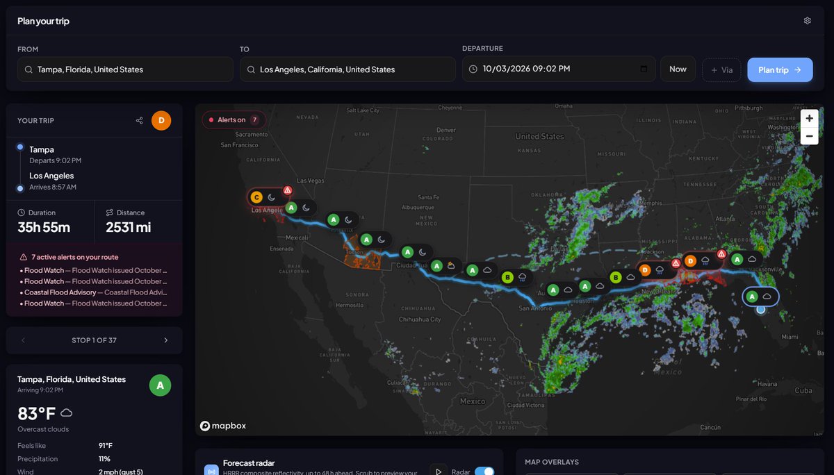
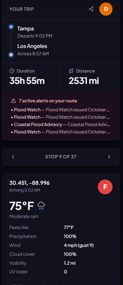
(1/3) Ever wondered what the weather is going to be like during your road trip? Here's an updated version of my route planner app that I released a couple years back (modernized with Claude!).
https://t.co/447laBmA8t
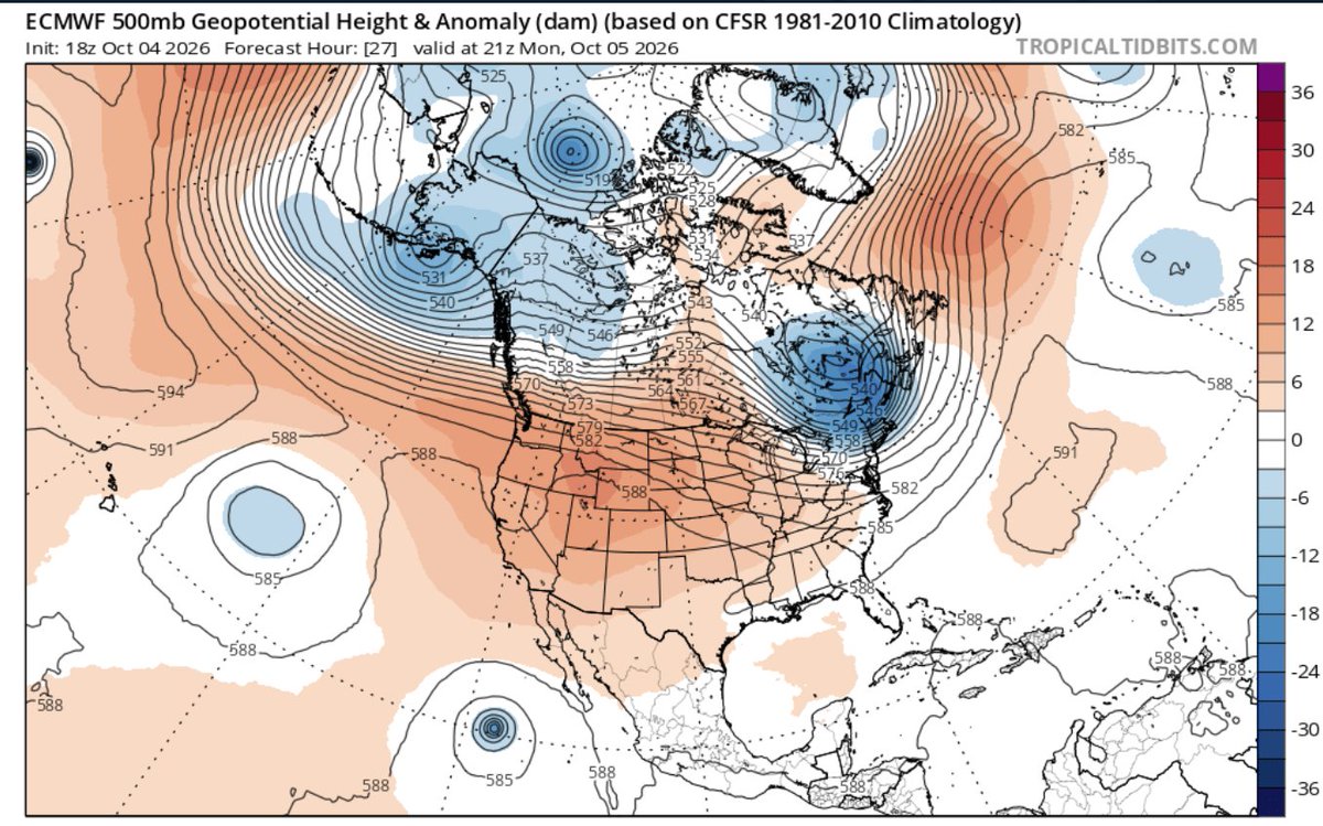
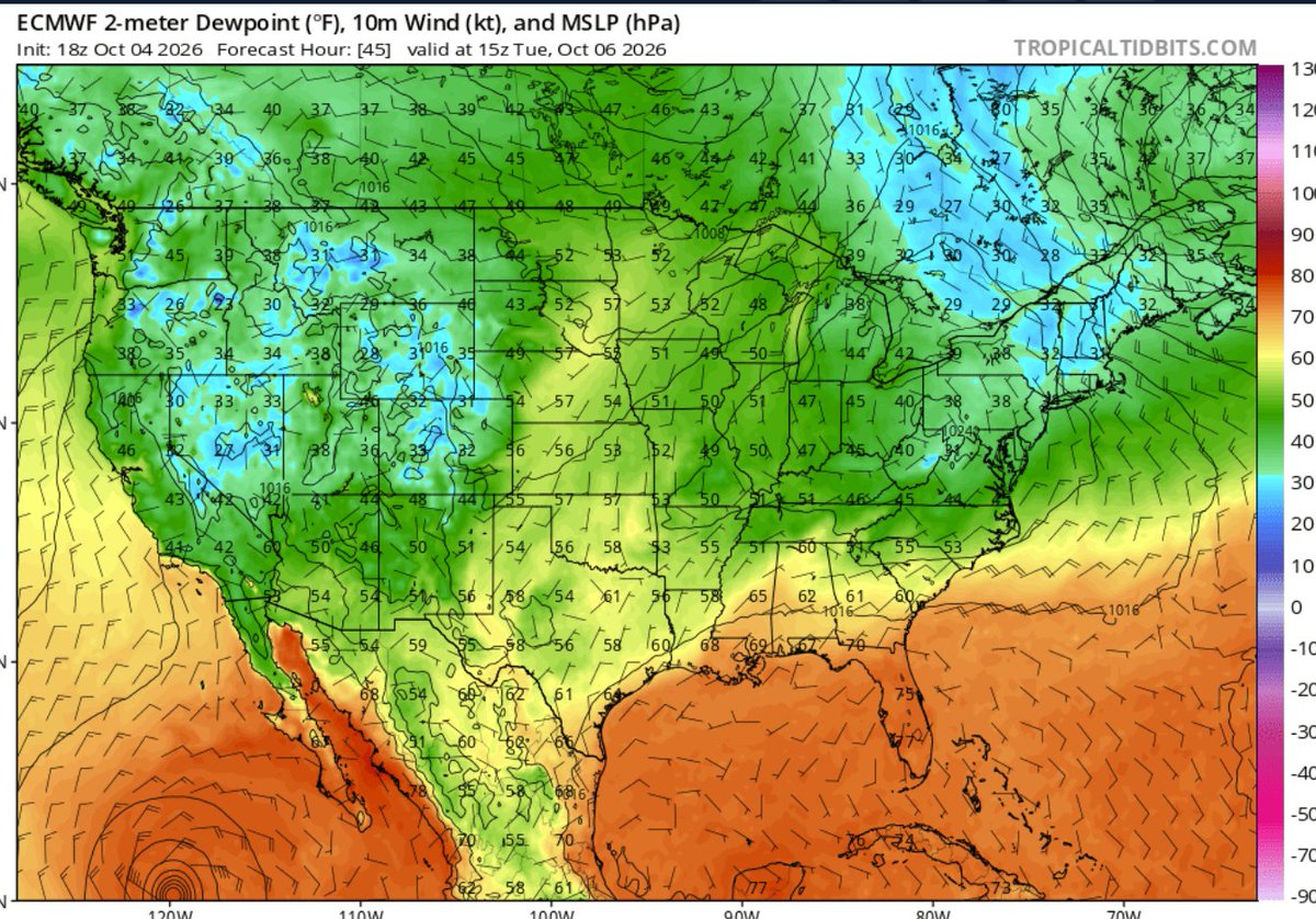
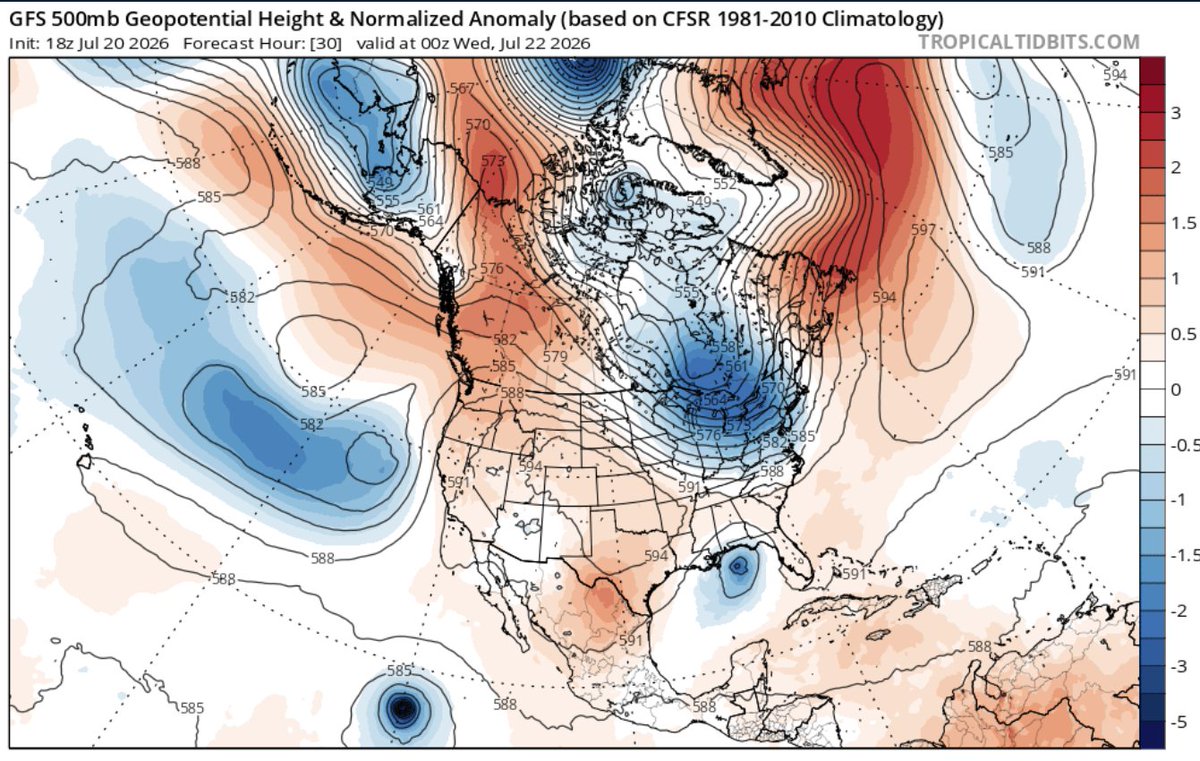
Beautiful weather in store for the Mid-Atlantic the next week as a trough dives down from Canada, bringing lower dewpoints and cool overnight lows with it. Great weather for fall foliage acceleration!
(3/3) Clicking on a specific location marker allows you to see the weather for that location and the assigned grade. Finally, you also have the option to see overlays like SPC severe weather outlooks, excessive rainfall, and WPC outlooks.
(1/3) Ever wondered what the weather is going to be like during your road trip? Here's an updated version of my route planner app that I released a couple years back (modernized with Claude!).
https://t.co/447laBmA8t
(2/3) The web page allows you to select your departure time and then see the weather every hour based on your selected departure time. HRRR model forecasts are overlaid as well.
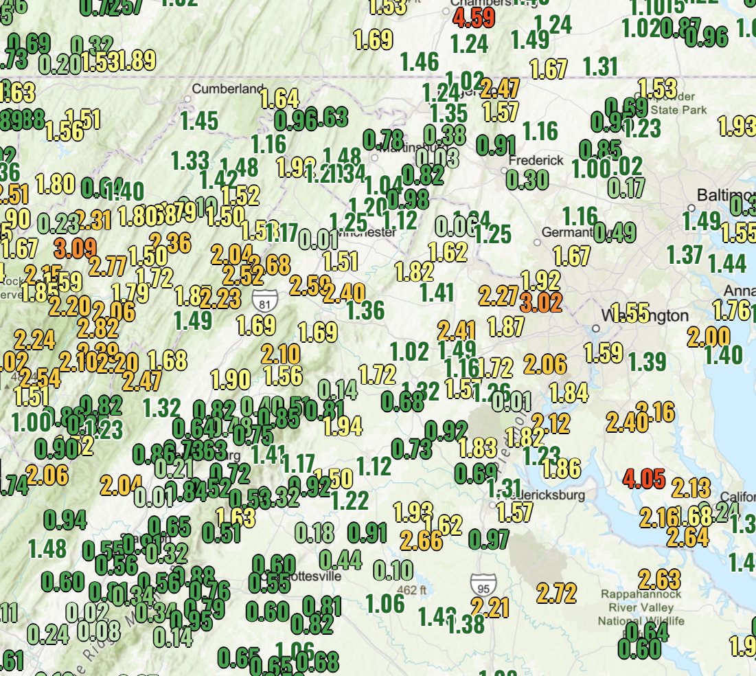
The Mid-Atlantic has abruptly entered fall after a warm start to September. Courtesy of a strong high in Canada, and a low off the coast, northeasterly winds have advected a cool maritime airmass and wet weather for much of the region. Many areas have seen 1-2 inches of rain!
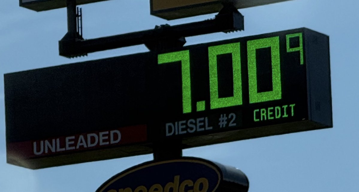
speechless. at this point, we're talking $7/gal diesel becoming a possibility in the days ahead in more places, specifically Great Lakes- MI, IN, OH, IL (less so WI- lower taxes)
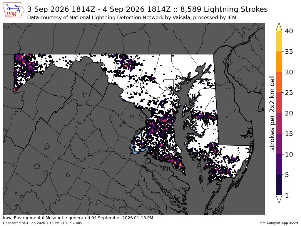
In case anyone's keeping score, we had about 12,000 cloud-to-ground lightning strikes in the Maryland/DC/VA/Delmarva vicinity last night. (And that doesn't include the ~70-80% of flashes that don't strike the ground.)
This is just positively absurd...
The acceleration in global warming that will inevitably result from this el nino event is concerning, not to mention for very volatile weather for the upcoming months.
This is all courtesy of a rather deep trough for this time of year, which will act as the trigger. Potential limiting factor is widespread cloud cover in the morning keeping a lid on instability.
With highs in the upper 80's to low 90's tomorrow, impressive CVA, and more than enough shear, we have the potential for 1-2 rounds of storms Tuesday into early Wednesday morning. SPC has a level 3/5 risk, with primary threat being damaging winds.