When water levels rise, seconds count. Refresh your knowledge on standard flood safety protocols to ensure you can act fast: https://t.co/YLtTy1tCzc #WeatherReadyWednesday
https://t.co/i8SAokQciR
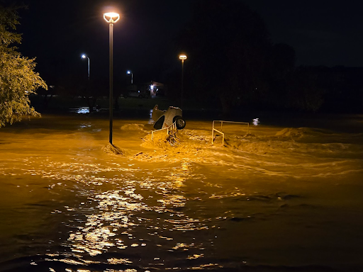
Car submerged in the floodwaters in Indian Bend Wash (Tyler Heard on X)
We are transforming water prediction. Previously, flood information was limited to specific points on a river. Our new Flood Inundation Mapping services provide a visual representation of flood extent and depth, helping communities see the potential impact across the landscape.
Areas of very heavy rain the next few days will bring potential flash flooding along the western and central Gulf coast and into the deep south. Remember: more than 50% of all flood fatalities are vehicle-related. You never know how deep the water is or if the road has been washed away or compromised beneath the water. Don’t risk driving into floodwaters. Turn Around, Don’t Drown!
https://t.co/oC2NEoWc33
The National Water Center has issued Key Messages for the Flash Flooding threat this week in Texas and the Lower Mississippi Valley. More info: https://t.co/UZ3ekqUUkq #flooding#txwx#mswx#lawx
We don't just tell you how high the river will get - we show you where the water will actually go. Our Flood Inundation Maps provide a visual look at the expected flooding in your area. You can find FIM maps for 60% of the US population at https://t.co/UZ3ekqUUkq
The work of hydrologists in our Operations Division is vital to translate complex data into life-saving information. These scientists and technicians at the National Water Center and 13 River Forecast Centers help keep our nation #WeatherReady.
#OnThisDay in 1921, the Pueblo, CO flood devastated the Arkansas River Valley. Today, @NWSABRFC & NWC provide specific forecasts, and use the National Water Model, to provide more lead time for events. Learn more about the 1921 flood: https://t.co/Ofqe58jePO
NEVER drive or walk into floodwaters. It is impossible to know how deep the water is just by looking at it. Turn Around Don’t Drown! Learn more: https://t.co/8mGNbeWJQj #WeatherReady
The Alaska-Pacific RFC (@NWSAPRFC) serves one of the most geographically diverse and hydrologically complex regions in the nation. APRFC forecasters are focused on unique challenges from glacial melt to coastal flooding and are a vital part of our #WeatherReadyNation.
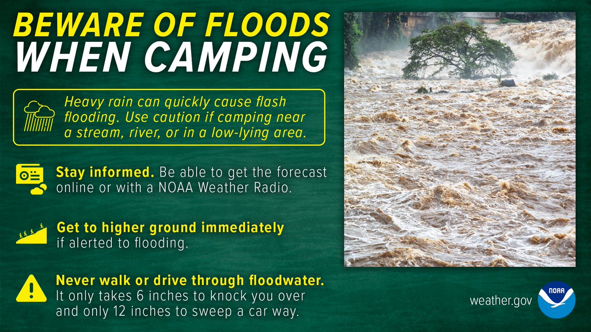
Are you planning to camp or hike near a stream or river? Remember that it doesn’t have to rain directly over you for there to be flooding. If you notice even a slight rise in water level, seek higher ground immediately! https://t.co/YLtTy1t4JE #WeatherReady
Looking for a one-stop shop for water data? The National Water Prediction Service (NWPS) is officially operational, replacing legacy systems with a mobile-friendly interface for observations and forecasts. Check out https://t.co/UZ3ekqUmuS today!
From Alaska to the West Gulf, our 13 River Forecast Centers provide critical regional nuances to our national forecasts. Learn more about your RFC at https://t.co/7BpStmrVzy
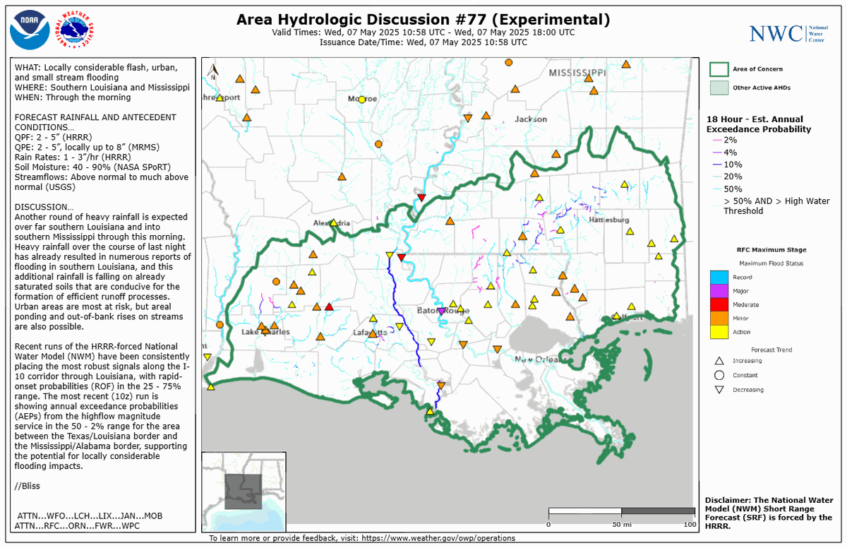
The National Water Center has issued an Area Hydrologic Discussion for southern Louisiana and Mississippi through this morning. https://t.co/Pz6VN3C6Uw