3:30 PM 7/27 Slow-moving downpours and storms into early this evening with isolated poor drainage issues. Showers will be more numerous/widespread later Tuesday into Wednesday. A Flood Watch is in effect for much of the state Tuesday 2 PM - Wednesday 8 PM. #fox61
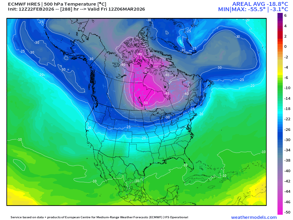
Interesting scenario that near record cold "Polar Vortex" anomaly near Greenland eventually ends up traveling west to Alaska, and then southward perilously close to U.S. border in 12-days. I suspect nat gas traders' eyeballs are widening.
⭐️❄️ 1ST CALL SNOW MAP ❄️⭐️
I’m comfortable enough now to put real numbers on a forecast map — not raw model output, but a forecast built from actual meteorological reasoning.
This forecast is based on:
• Snow ratios
• Lower DGZ placement
• Front-end focused snowfall
• Dry dew points early
• Mixing potential near 800 mb (~6,000 ft) as coastal redevelopment occurs
🩶 ZONE 1: 4–6"
Lower Manhattan • Long Island • NJ Coast • Philadelphia
The front end of this storm should deliver 4–6" of snow, with locally higher amounts, before a transition to sleet and possibly freezing rain.
⚠️ I do NOT see this turning into “just rain.”
Ground temperatures will be in the upper teens to lower 20s — meaning freezing rain is a legitimate concern and should not be ignored.
🟦 ZONE 2: 6–10"
Interior North/Central NJ • North Shore LI • Upper Boroughs • Lower Westchester • Lower Fairfield CT
Soundings support some sleet here, but also a longer-duration front-end snowfall.
This is a challenging transition zone — and there is still a realistic scenario where no meaningful changeover occurs due to strong dynamics.
➡️ Higher-end totals are very much on the table.
🟪 ZONE 3: 10–15"
NW NJ • Poconos • Lower Hudson Valley • Central CT
This area benefits from very high snow ratios for nearly 90% of the storm before eventually shifting to wetter snow.
I am very confident that areas in purple do not switch to sleet or freezing rain.
This is the jackpot zone.
📌 SIDE THOUGHTS
This is my First Call.
Adjustments will be made.
Forecasting for more than 7+ million homes is never perfect — especially in a setup with this many microclimates and boundary-layer challenges.
But this is the best possible forecast with the data we have right now.
More updates coming.
Stay tuned ON tv UNTIL 10AM @PIX11News ❄️📺
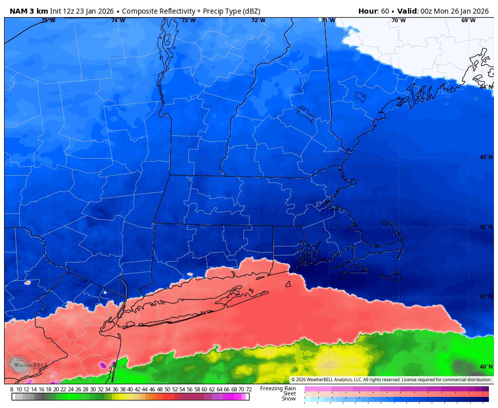
AI models score another one today.
Global NWP models are often biased too weak and under-amplified with developing baroclinic waves in the equatorward entrance quadrant of an anticyclonically curved jet, and while some AI model runs were overdone, they definitively outpaced the GFS & ECMWF which showed nothing for many regions currently experiencing moderate snow until the very short range.
How about them 6's?
Cat 5 Blizzard: January 6 to 8, 1996
Cat 3 Blizzard: February 11, 2006
Cat 4 Blizzard: Jan 22-23, 2016
2026 ???
https://t.co/Bulu9ObHsm
https://t.co/VKERTHHKTJ
https://t.co/F4KY1KXLIs
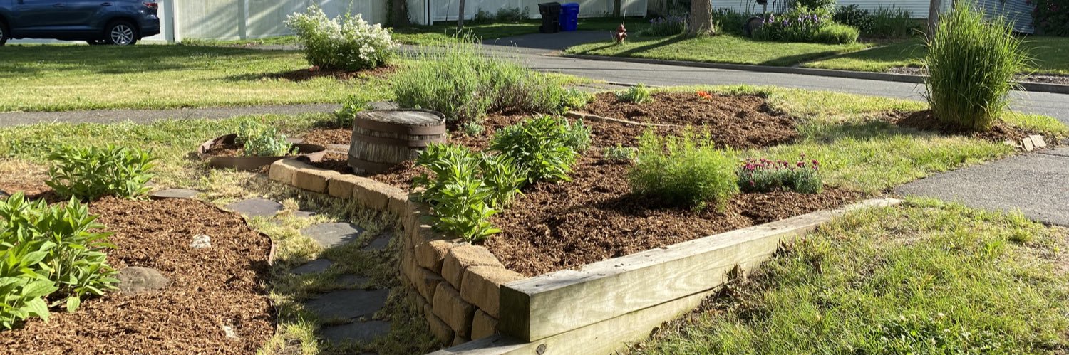
Get ready for a landscape upgrade! We’re about to turn this humble mulch bed into an eye-catching stone feature. You won’t want to miss the final result! #foothills#lawncare#stonedesign#outdoorliving#stoneheart
https://t.co/364jGEDIQl
Wow, we’ve hit 1k followers! 🎉 In TikTok Platform. Thank you all so much for your incredible support! We couldn’t have made it here without each of you. Stay tuned for more awesome content, and let’s keep growing together! 🙌 #Grateful#1KStrong