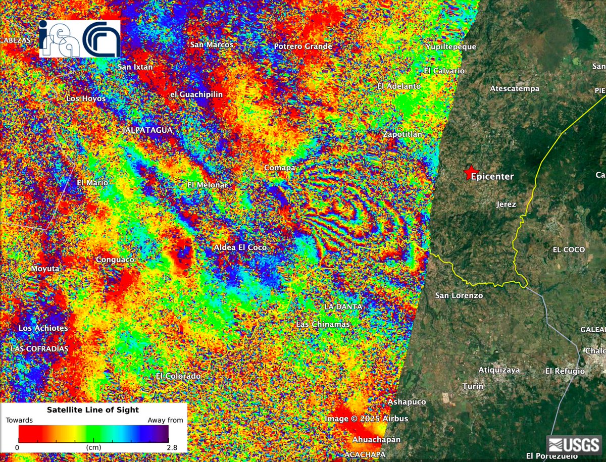
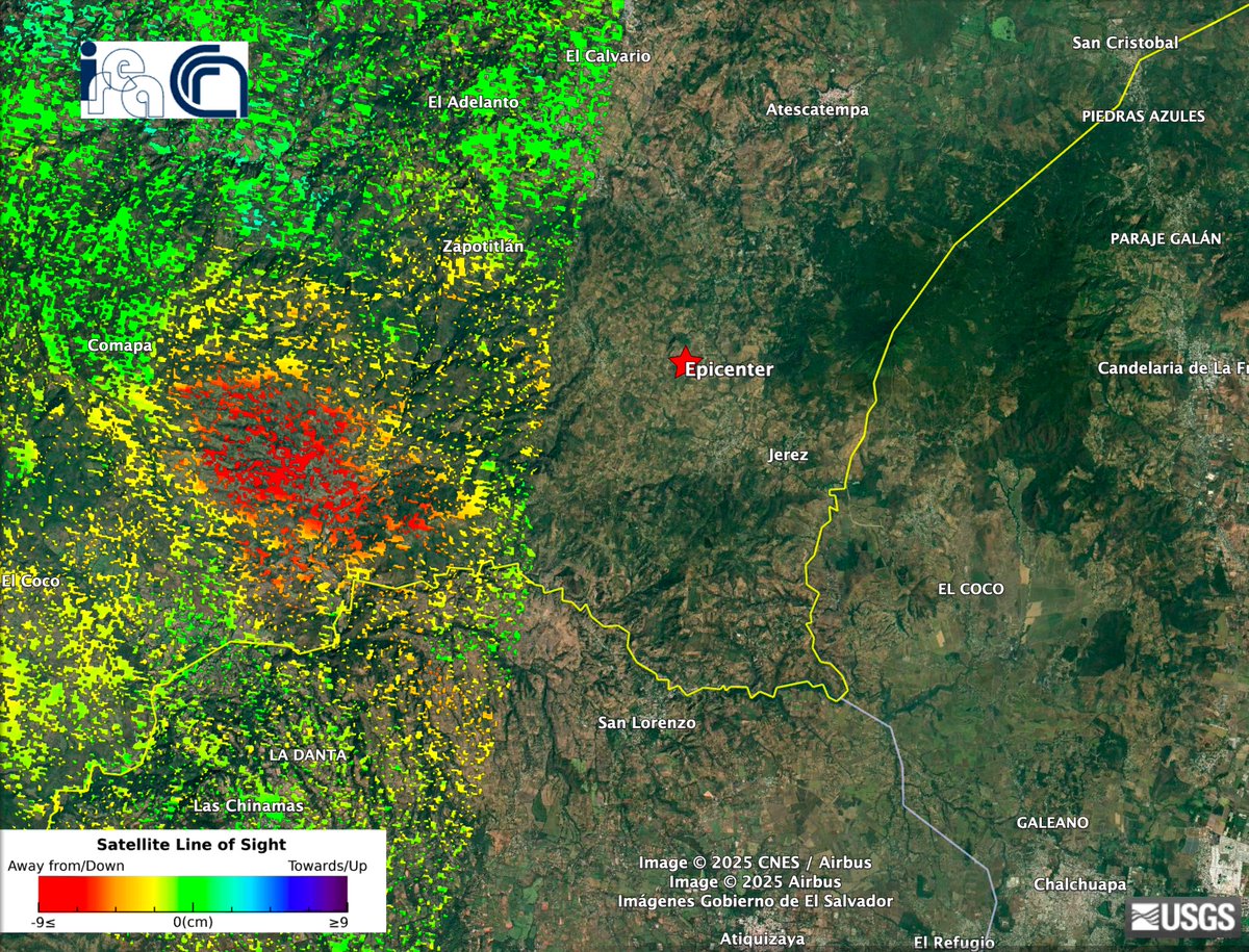
the Automatic Sentinel-1 #DInSAR co-seismic interferogram and LOS Displacement (Des Orbit /Track 26) for the earthquake of Mw 5.7 close to Jerez, Guatemala 🇬🇹 occurred at end of July. are available on @EPOSeu geoportal https://t.co/lgQhixHHuh @CnrIrea@FraxInSAR@SimoneAtzori73
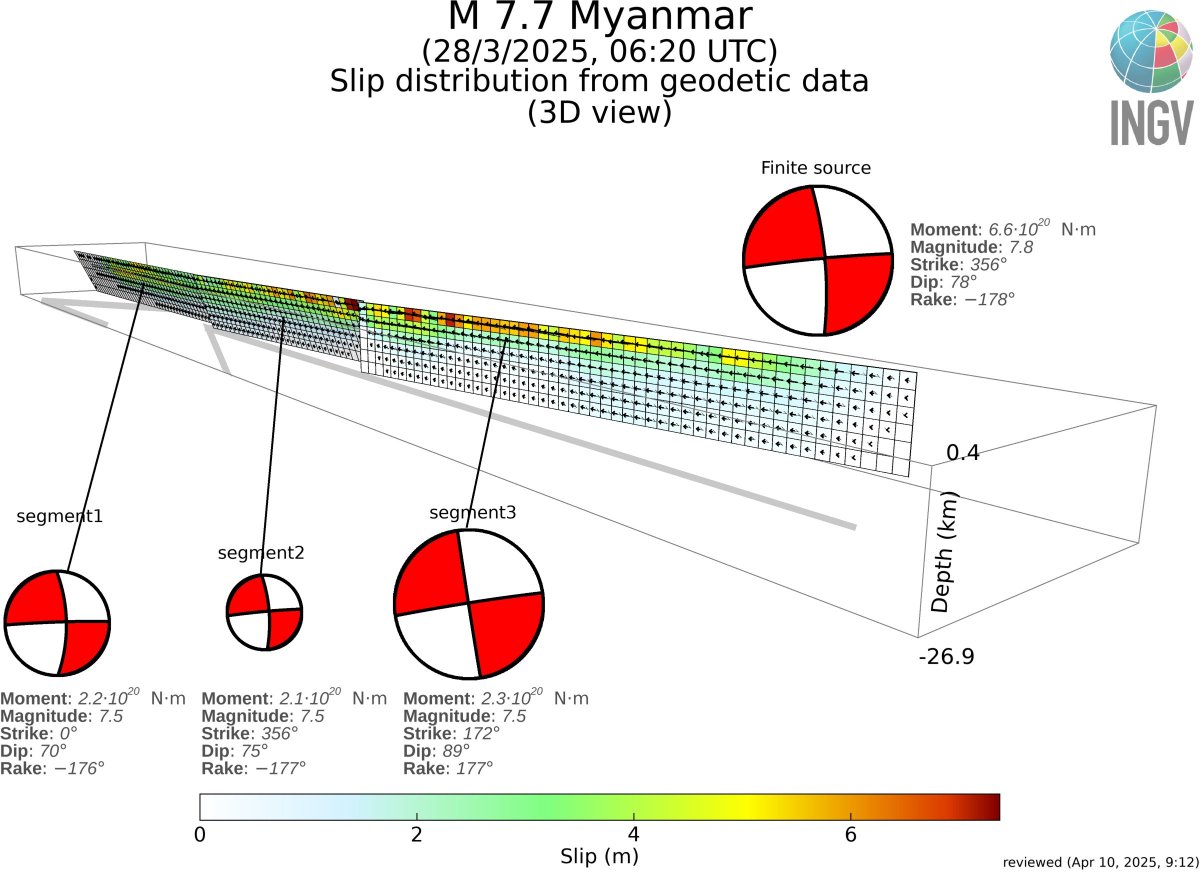
The ~500 km long fault of the M 7.7 #Myanmar#earthquake completely inferred from geodetic (#InSAR and pixel offset) is available at:
https://t.co/OWQ0A7AUhJ
Refinements are expected in the next days.
Thanks to @CnrIrea, @INGVterremoti GeoSAR Lab, @maferp_13, @FraxInSAR
#CampiFlegrei: sciami sismici “burst-like” spiegano la dinamica dell’area
Su @NatureComms, lo studio di @CnrIrea e @INGV_press che svela segnali sismici peculiari ai Campi Flegrei: una chiave per comprendere l'attuale dinamica
Scopri di più👇
https://t.co/QKYAgomCLM
@MC_Carro
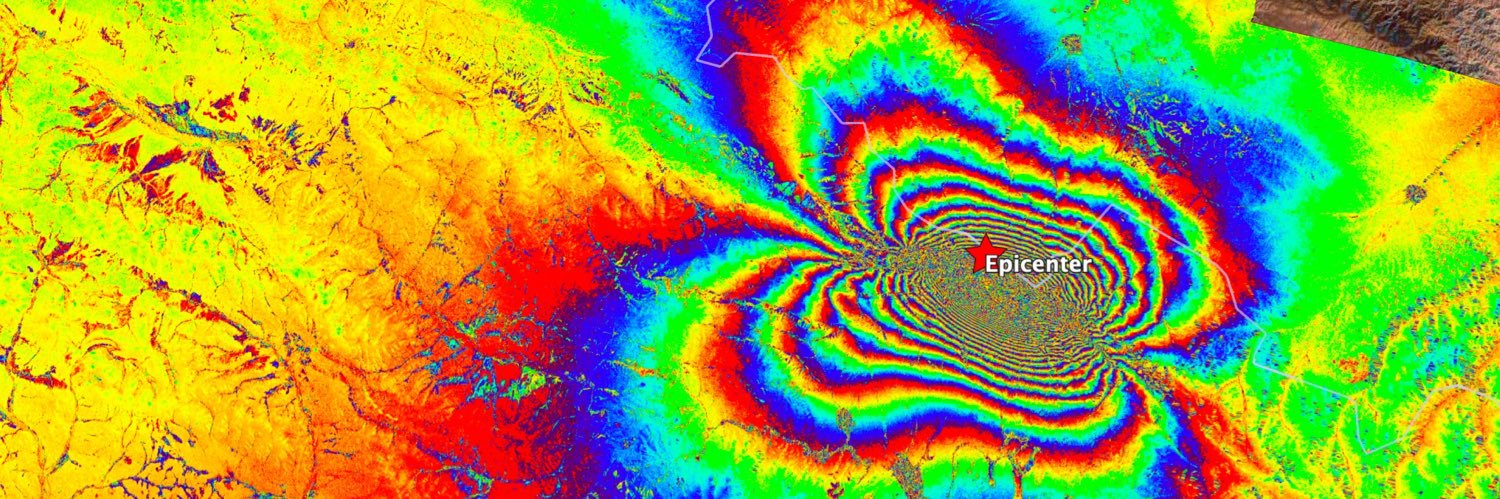
A preliminary model of the Jan 7, M 7.1 #TibetEarthquake from #InSAR. Today a new #Sentinel image will provide, hopefully, new insights. Current data and model available at
https://t.co/9FadKnaKyd
@antandre71@maferp_13
the Automatic #Sentinel-1 #DInSAR
coseismic Interferograms for the recent vulcano tectonic crisis in #Awash, #Ethiopia 20241217-20250110, 20241229-20250110 (Descending Pass, Track_79), all available in @EPOSeu@FraxInSAR@CnrIrea
🆕Abstract submission deadline has been extended!
The new deadline for submitting abstracts is 📅 15th October
For more info visit https://t.co/m7nAHYyawe
7th LAKES Workshop / 20-21-22 November / Milan
Interested in #lakes, #modelling and #remotesensing? Registrations and abstract submissions are officially OPEN! Don't miss the chance to be part of this event!
Info👉 https://t.co/eCz5WmKn5d
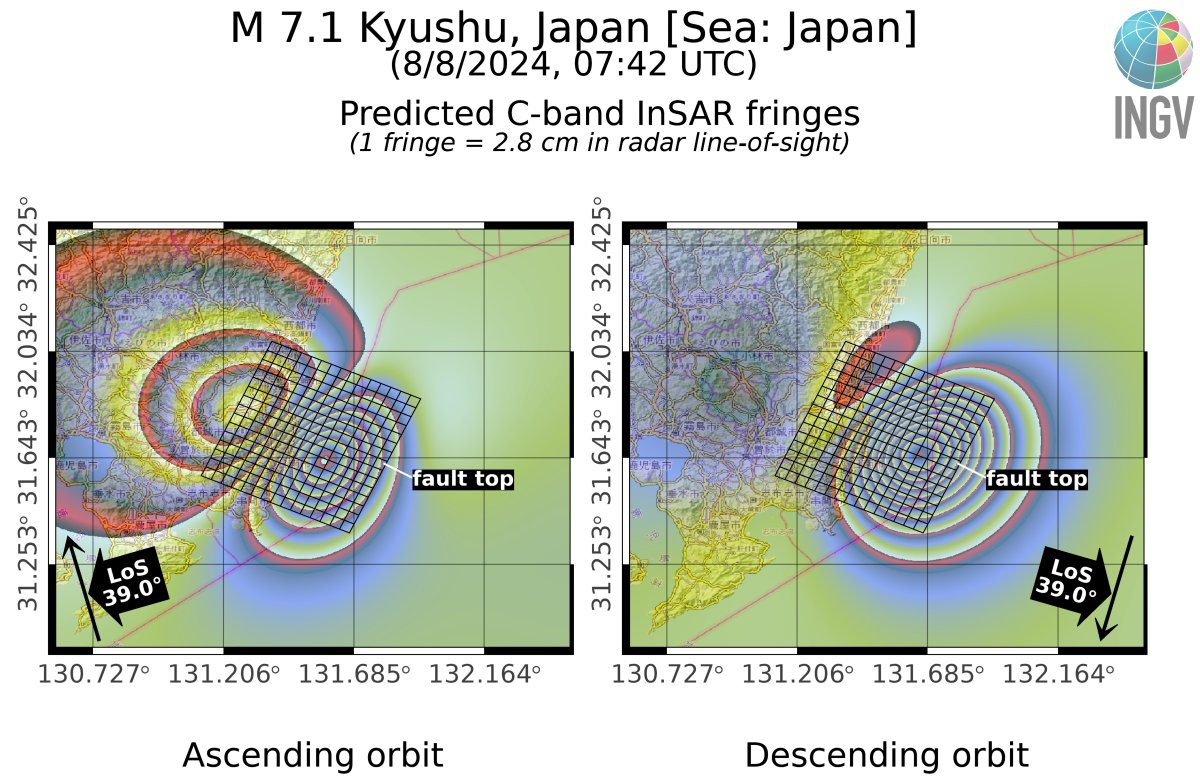
Due to the radar line-of-sight properties, the best geometry to detect InSAR fringes for the M 7.1 #japanearthquake would be ascending (check the scenario, based on the USGS slip distribution), but only descending is planned with #Sentinel1.
Bad luck or insufficient coverage?
A new X-Band #SAR constellation is coming. The Italian NIMBUS #IRIDE mission will be launched in 2026. Mid-inclination orbits can improve #InSAR performance and allow generation of dense 3D displacement maps.
Here is the first study https://t.co/I6kGZ4YnV7
@CnrIrea@ManuBonano
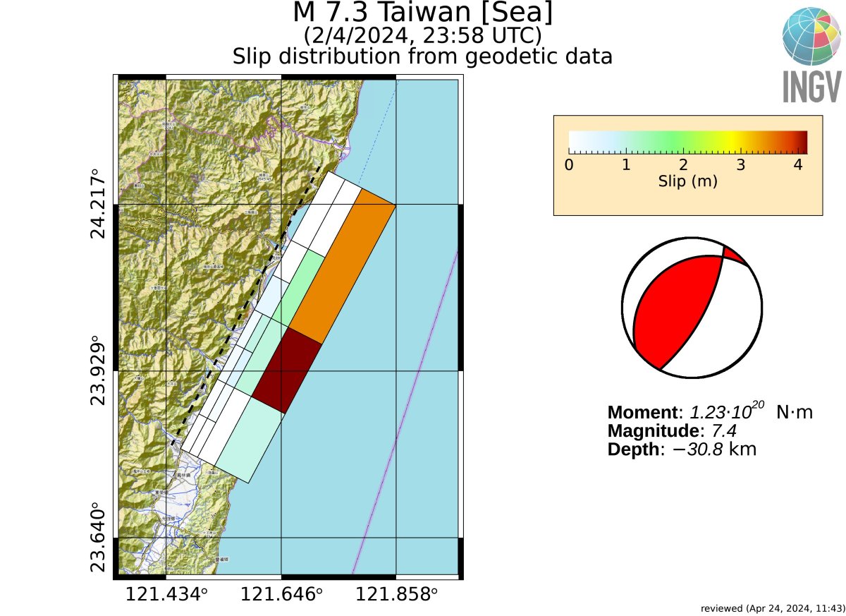
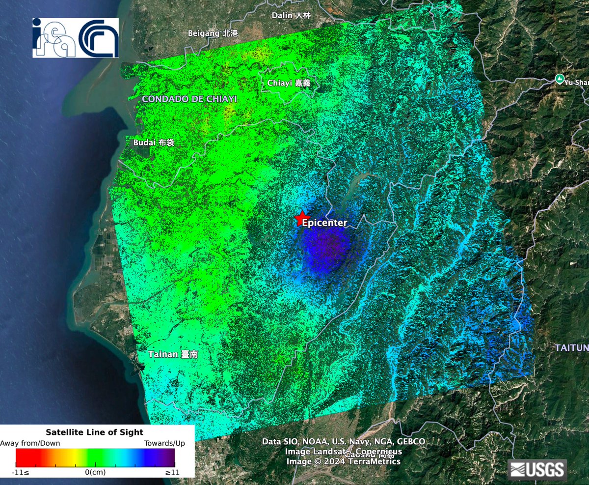
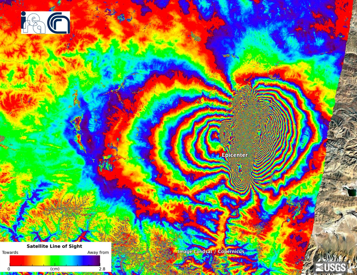
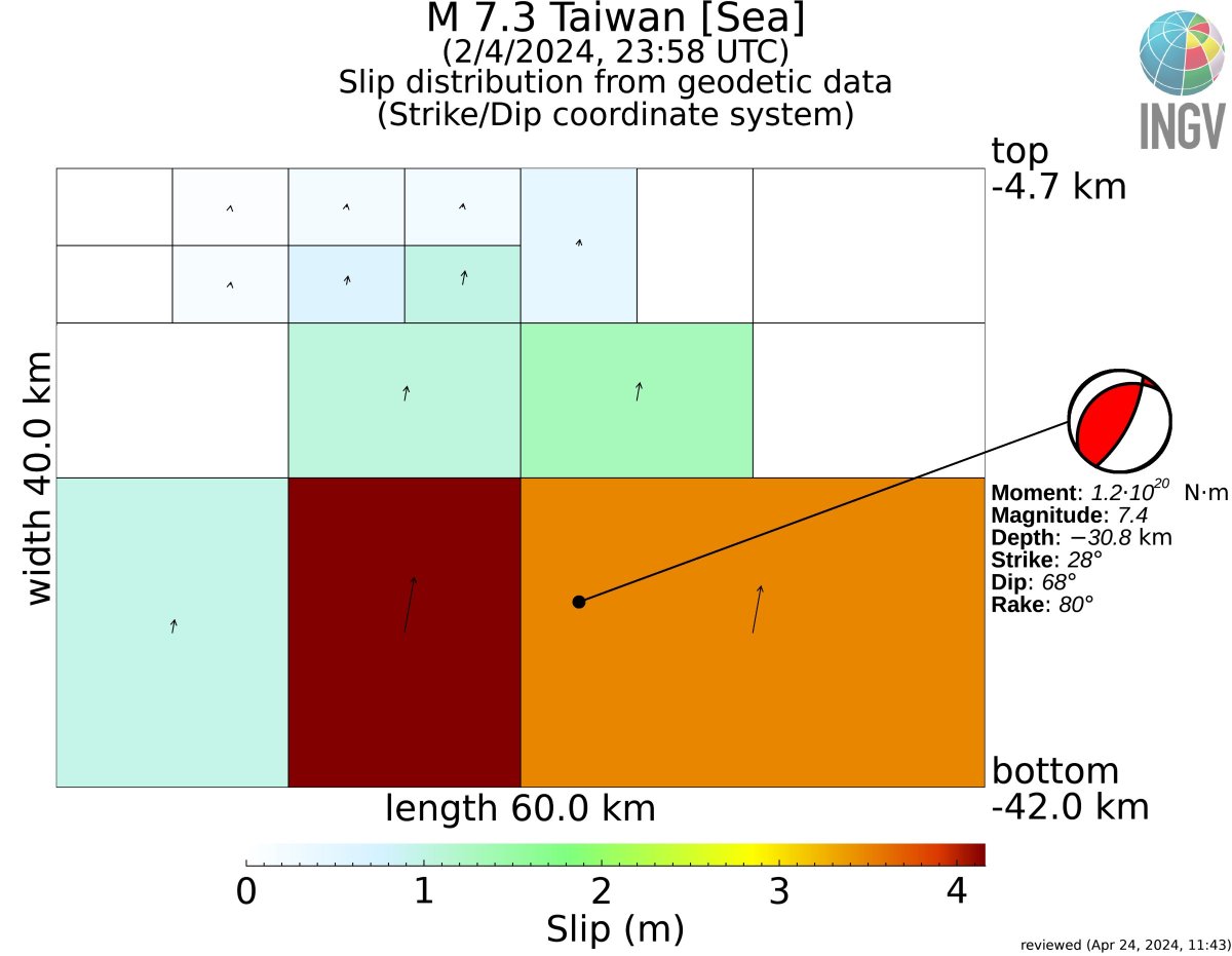
Slip distribution of the April 2nd, M 7.3, #Taiwan#earthquake after including ALOS-2 (Jaxa) with #Sentinel1 (@CopernicusEU) data.
Here data and model for download: https://t.co/wONukZQMCQ
Two words of comment in the 🧵⬇️
🛰️Are you a researcher who works with satellite data? Do you want to delve into the world of #DInSAR and the P-SBAS algorithm?
On 04/18 at 14h don't miss the training course at @EuroGeosciences 24 on-demand P- SBAS/EarthConsole® service!
More info here: https://t.co/Xh4R6LQw53