#BREAKING: Two new tornadoes confirmed from Hurricane #Milton last week. Fort Myers EF-2 with winds of 116 mph and 500 yards wide. That is the strongest tornado in Lee County in 2 years. Also an EF-1 twister in Matlacha, you saw live on @WINKNews pass by. Was only on the ground for a mile, but damaged several homes in the process.
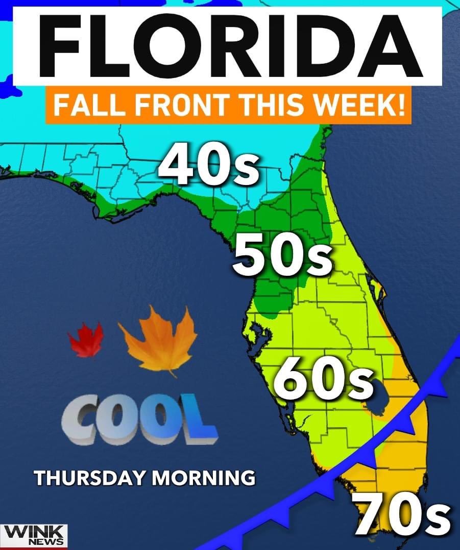
FLORIDA FALL FRONT! 🍁 The first of the season will drop temps and humidity levels across *most* of the state. Even mornings in the 40s for northern Florida! Only a small difference in Southwest Florida, but hey, we'll take it! @WINKNews
The Town of Fort Myers Beach has issued a Mandatory Evacuation for the entire Island.
We encourage residents and business owners to make a plan, to be evacuated by 3:00pm, on Monday, October 7, 2024.
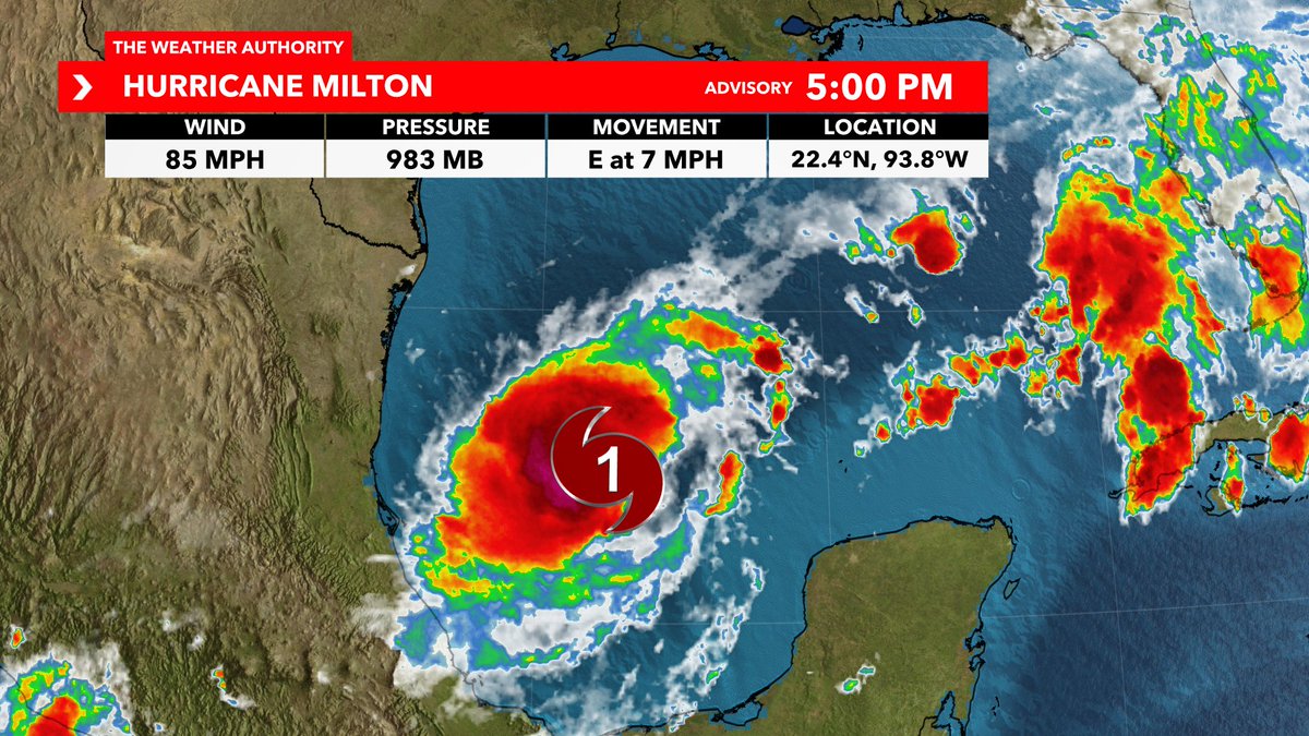
NEW ADVISORY: 5 PM update is in for Hurricane #Milton. Notable change is peak intensity increased to 145 mph, Category 4. Little movement in the cone. Stick with @WINKNews for the latest.
#BREAKING: Milton is now a hurricane as it continues to strengthen in the Gulf. It is expected to become a Major Hurricane in the next day or two. Southwest Florida, take this storm seriously! I will have more updates ahead with the brand new come at 5 PM today. #Milton
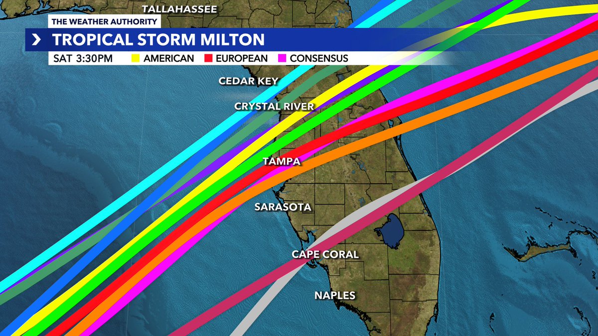
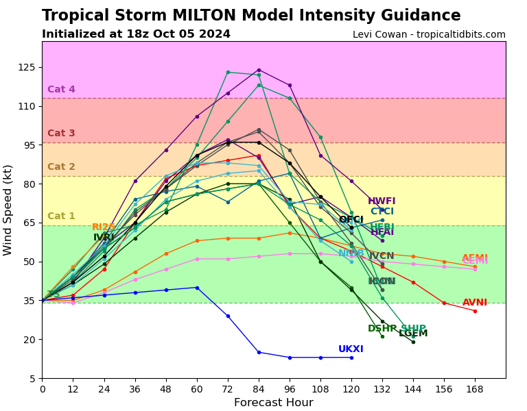
NEW: Latest models just came out for #Milton. A bump north overall near or above Tampa Bay. Important: It's still early and these are not set in stone. Expect more adjustments north or south. The southern half of the storm will have the surge. Peak intensity of Cat 3+ certainly attainable with this storm. @WINKNews
Current highest probability for landfall is between Hernando Beach to Everglades City, which includes potential tracks through Tampa Bay or Southwest Florida.
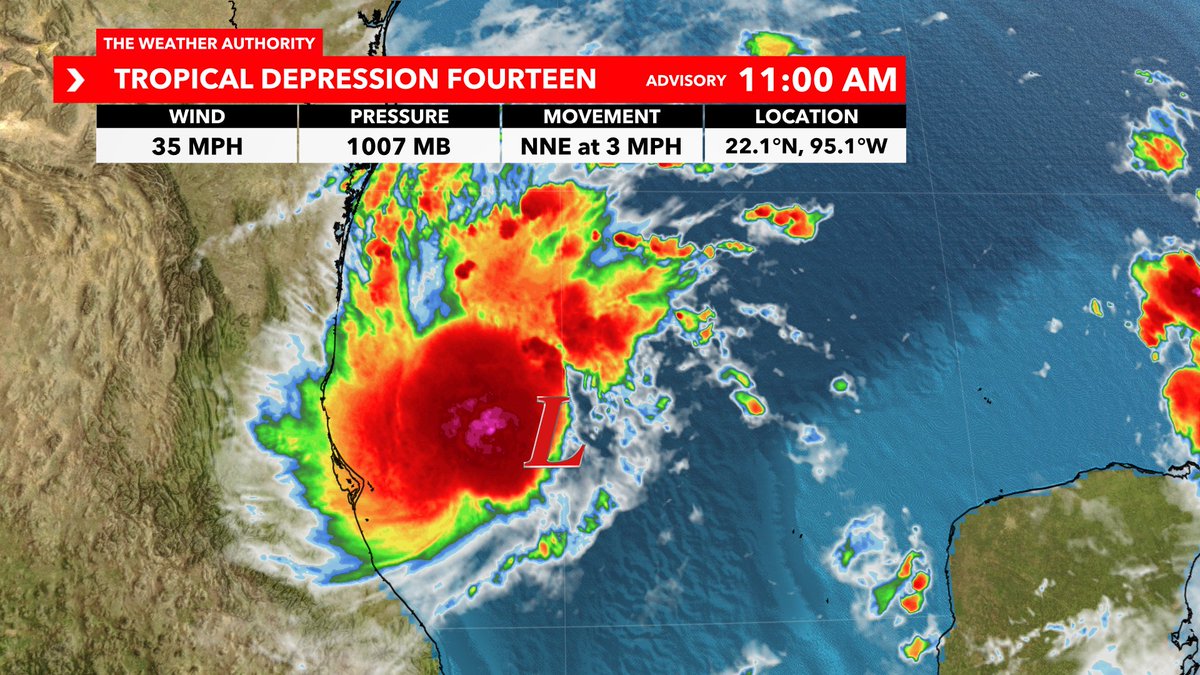
#BREAKING: First cone is out with a Florida hurricane expected Tuesday into Wednesday across the state. Initial landfall intensity from the NHC is upper Cat 2 and near Cat 3. Next name is #Milton. Here are my thoughts as of Saturday:
1. This system is unfortunately already organizing at a quick pace over warmer than average water temps in the Gulf Mexico for October.
2. For that reason, I do agree that this will intensify into a hurricane in the days ahead. Can't rule out a Major Hurricane at peak intensity *IF* favorable ingredients come together.
3. Current highest probability for landfall is between Hernando Beach to Everglades City, which includes potential tracks through Tampa Bay or Southwest Florida. Although model changes are always possible, they will start to tighten up with greater accuracy over the next day or two. When that gradually occurs soon, we will be able to give you more specifics on local surge, wind, etc. Reminder that every storm is different in the impacts they bring and those impacts will be felt outside of the cone too.
4. IMPORTANT: Surge will again be a problem for a portion of our western Florida coastline. This is a unique and rare angle of approach from the southwest. That means that if you're on the southern side of the storm you will be getting surge to a certain degree. *CLOSEST TO THE SOUTHERN HALF OF THE EYEWALL WILL GET THE HIGHEST SURGE.* That's why landfall location is important with this storm. Every mile makes a difference! If you're north of the center, your wind will be coming in from a different direction and from the land...more likely to suck the water out at landfall. Some surge is still possible north after the storm exists, but not to the level compared to those south of the center.
5. Remain calm. Now is the time this weekend to review your hurricane plan with your family or friends. Grab necessities, but don't overstock! Remember about our neighbors and others in the community. If you are told to evacuate, please do so!
You're in good hands here at WINK. I will guide you through the entire storm 24/7 from start to finish, without the hype and with information you need. Make sure to tune into WINK News for the latest all week.
SHE SAID YES! Our CBS19 anchor @ShardaeLaRae is engaged! Congratulations to her and her fiancé! 💍
Click the link to watch the beautiful moment: https://t.co/3EsZjzIZDx
More than 13,000 people have cast ballots on Election Day at 35 polling locations in Smith County. Polls are open until 7. For polling locations, sample ballots or more information about today’s Election, visit: https://t.co/QJ5tnSr3w7 and click on the red banner.
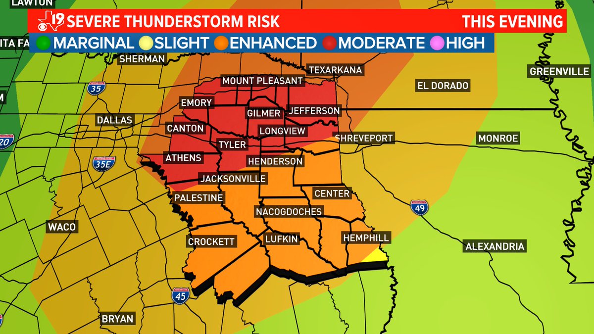
Parts of East Texas have been upgraded to a Level 4 of 5 Moderate risk for severe weather.
Damaging wind gusts and tornadoes are the main concerns for this event. One or two of these tornadoes have the potential to be strong (EF2+). #TXwx#ETXwx@kytxcbs19