The next AI revolution is not just happening on screens. It is happening in the physical world.
Robots, drones, autonomous vehicles, and smart machines all need one thing before they can operate safely: Precise location.
Traditional GPS can be off by several meters. For humans, that may be fine. For autonomous machines, it can be dangerous.
GEODNET is building the spatial intelligence layer for Physical AI, using RTK positioning to improve accuracy from meters to within one centimeter.
Over 20,000 base stations.
170+ countries.
11,000+ cities.
130+ enterprise customers.
Physical AI needs real-world infrastructure.
That infrastructure is being built now.
Paris, France: already covered. 🇫🇷
Paris, Illinois: now covered too. 🗼
Two Parises. One network.
New stations went live across the U.S. this week, adding more centimeter-level RTK coverage to the world's largest RTK network.
22K+ stations. 175 countries.
$GEOD just lit up Gainesville.
Normal GPS is a few metres. This gets you to a centimetre. Seven cities this week.
GEODNET just lit up Gainesville, Florida, and that’s one of seven new cities the network added this week.
Normal GPS gets you within a few metres. GEODNET’s RTK network gets you to within a centimetre. Regular people stick small base stations on their roofs and earn $GEOD tokens for the coverage. It’s already the biggest network of its kind.
Gainesville’s a smart place to switch on. It’s home to the University of Florida’s engineering and agriculture research, and centimetre precision is exactly what autonomous tractors and precision farming need.
The network grows because Physical AI demands it. A delivery robot, a farming drone, a self-driving car, they can’t work safely if their location is only accurate to a few metres. A few metres is the difference between staying in your lane and hitting the kerb.
So seven cities in a week is pretty impressive. It’s the positioning layer robots actually need, being built city by city.
"The Roomba is not going to die." 🤖🧹
Specialized robots are already in your home, your warehouse, your field and they're just getting started.
A debate about what the future of robotics really looks like. Humanoids vs. the machines already winning.
Full debate → link in first comment
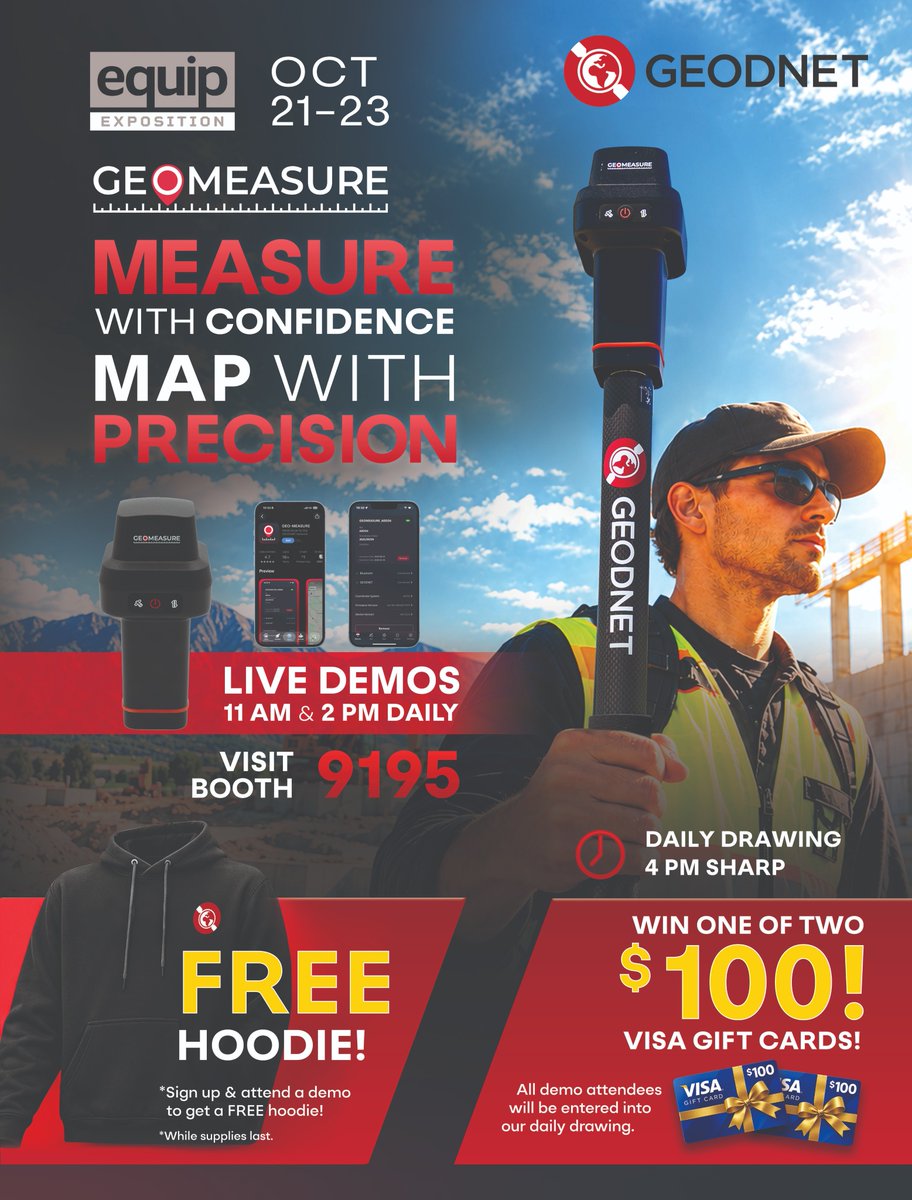
Great to have the Kubota Tractor team stop by Booth #9195 at @equipexposition 🚜
@GEODNET Project Creator @mikeahorton with our friends from Kubota on Day 1!
Next live demo: 2 PM ET.
Free hoodie + $100 gift card drawing at 4 PM ET.
Come say hi! @equipexposition
@AbdulbaqiI48145@equipexposition Sign up and attend a demo at Booth #9195 in Louisville!
The free hoodie and the daily 4 PM drawing are for in-person demo attendees.
Hope to see you there! 📍
We're live at Booth #9195 in Louisville!
Come find us. First demo at 11 AM.
Free hoodie 👕 + $100 gift card drawing at 4 PM 💸
If you're here, let's meet. 📍
Louisville KY | Oct 21-23 | @equipexposition
Always fun listening to Mike Horton, founder of @GEODNET .
Interesting take on humanoids versus specialized machines here and I agree. imho we'll see a mix, with specialized machines paying back first.
Whatever form they take, they all need to know exactly where they are and regular GPS is not good enough outdoors, since it can be off by a few meters.
GEODNET runs the world's largest RTK network, with centimeter-level precision, 22K+ base stations in 175 countries.
That is what the rails for physical AI look like🦾
Mike talks unglamorous physical AI and what comes after.
Don't miss this interview with GEODNET Project Creator @mikeahorton, dropping Thursday at 2pm UTC.
Tune in: @DePINConnection 👇
Police Drones Cost Pennies. Helicopters Cost Over $10,000.
Mike Horton (@mikeahorton) of @GEODNET on why the unglamorous physical AI use cases come first, and why he expects the consumer robot wave to hockey stick the network.
Catch the full interview Thursday at 2pm UTC 👇
https://t.co/7cXPVjuqG3
Billions of robots, drones, and autonomous vehicles are coming.
They all need to know exactly where they are — down to the centimeter.
That's what GEODNET was built for. The rails for physical AI. 🤖📡
Full debate → link in first comment
AI can think. But can it navigate the real world?
GEODNET builds precision positioning for drones, robots and autonomous machines.
I investigated $GEOD's commercial traction, token burns, dilution—and the key question: who captures the value? https://t.co/SDAoo8lLkl
We're at @equipexposition in Louisville, KY! 🌎🔴
Stop by Booth #9195 to see the GEO-MEASURE in action — 8mm accuracy, triple-band GNSS, and live RTK corrections from the world's largest precision network.
From robotic mowers to survey-grade mapping, precision positioning is changing what's possible in the field.
📍 Booth #9195 | Oct 21–23, Louisville KY
🎯 Live demos: 11 AM & 2 PM daily
🎁 Free hoodie with every demo
🎰 Daily $100 Visa gift card drawing at 4 PM
Traditional surveying equipment: $5,000–$15,000+.
Traditional RTK subscriptions: hundreds to thousands per month.
GEO-MEASURE: $695. Includes 1 year of free RTK corrections on the world’s largest network.
Centimeter-level precision. Built for professionals. Priced for everyone.