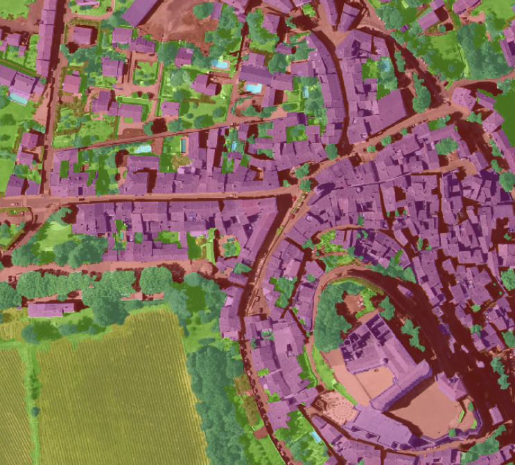
The FLAIR dataset 🛩️🛰️ is also available on Hugging Face :
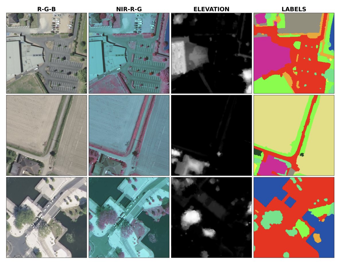
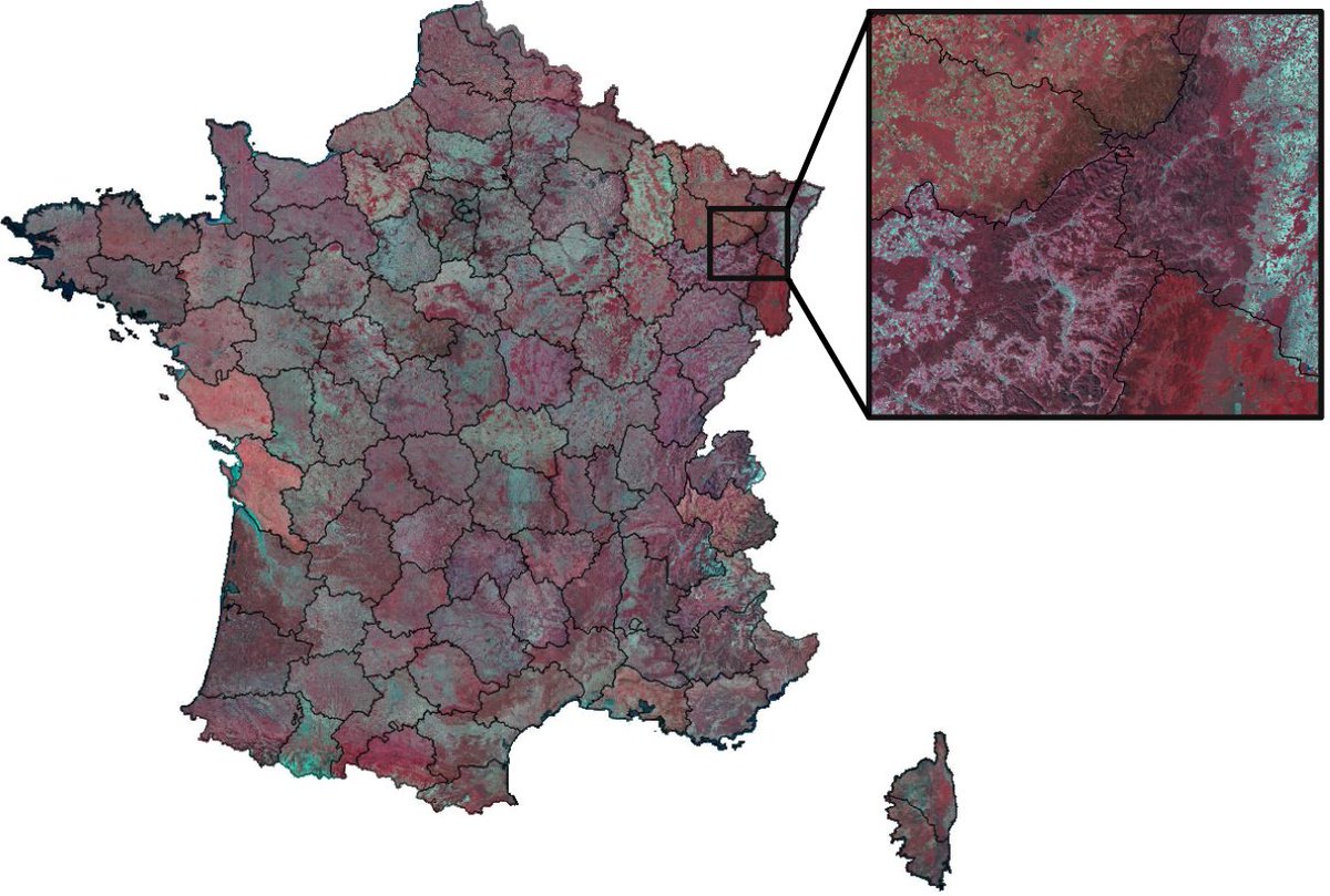
- over 20 billion annotated pixels of very high resolution aerial imagery at 0.2 m spatial resolution
- along with Sentinel-2 satellite 1-year time series with 10 spectral band at 10m
https://t.co/z4nStqC4U6
🚨The FLAIR dataset has been accepted at NeurIPS2023 in the Benchmark & Dataset track. It contains high-resolution aerial imagery with a ground sample distance of 20 cm and over 20 billion individually labeled pixels for precise land-cover classification.
https://t.co/bGDULl1tHx
[📣 Webinaire] On vous présente le projet #CoSIA, (Couverture du Sol par Intelligence Artificielle), ses données, ainsi que ses premiers cas d’usages.
📅 RDV le 10/10 à 14h
⚠️ Sur inscription 👉 https://t.co/HkKrptDDsk
🦾 L’#IGN mise sur l’#IA pour produire des données et entraîner des modèles qui détectent automatiquement la couverture de notre sol (🌿 🌳 🏘️ 💧).
Complémentaires de l’#OCSGE, les données CoSIA permettent de cartographier finement le territoire, pour répondre à de problématiques précises au service de la gestion des sols, de l’urbanisme et de l’environnement :
💡 Imperméabilité du sol
💡 Nature en ville
💡 Haies en milieu rural
On vous dit tout sur CoSIA et ses potentiels usages lors de notre première conférence en ligne, avec les témoignages de premiers “expérimentateurs de la donnée”.
Testez sans attendre la donnée CoSIA 👉 https://t.co/GqH2zEcY63
#Digitalcommons | It's up to you!
After a first challenge, #Flair is now available as #Opensource on #Github
This geospatial dataset describes the diversity of the territory to map land cover. An essential resource to train #IA model 🤖🗺️
ℹ️ https://t.co/CWBgdY1xSD
#CommunNumérique | A vous de jouer !
Après un 1er défi, #Flair est maintenant disponible en #Opensource sur #Github
Ce jeu de données géospatiales décrit la diversité du territoire pour cartographier l’occupation du sol. Un #dataset incontournable pour entraîner des modèles #IA
Dataset discovery: The FLAIR-one semantic segmentation dataset consists of 77,412 high resolution patches (512x512 at 0.2 m spatial resolution) with 19 semantic classes
https://t.co/8HhwMomfA5
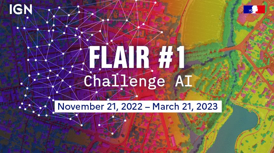
🚨Only 20 days left to participate in the challenge #IGN#AI land cover challenge: #FLAIR-one. Use our FLAIR dataset (French Land cover from Aerospace ImageRy), train #IA models and report your results. Almost 250 registered and more than 800 submissions 🙌https://t.co/D8MOijAhnj
Launch of #IGN 1st #IA land cover challenge: #FLAIR-one on https://t.co/oVv6Fke3Sy. Sign up to use our FLAIR dataset (French Land cover from Aerial ImageRy), train #IA models and report your results during the next 4 months. Can you beat the benchmark!? Sign up now!
The month of May was somewhat hectic but rich in emotions.
..successfully defended my PhD ! 🤘🎓🌎🛰️@ademe@CNES@IGNFrance@CesbioLab
..attended the amazing @esa Living Planet Symposium (#LPS22) !
..got a new job at @IGNFrance!
Now, for the lucky ones, see you in Nice @isprs🎊!
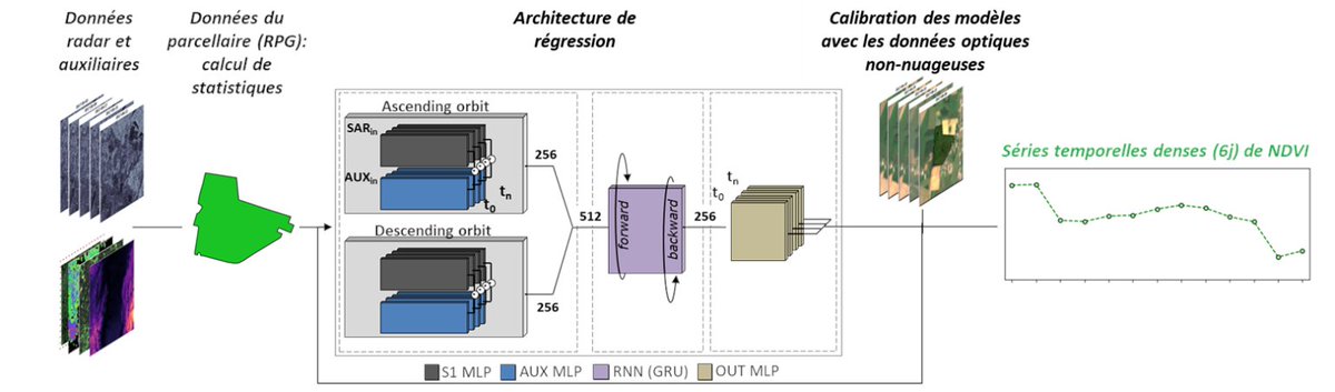
SenRVM : série temporelle de NDVI sans lacunes par régression multimodale pour le suivi de la végétation https://t.co/VbISrGGIt5
"Recurrent-based regression of Sentinel time series for continuous vegetation monitoring" Remote Sensing of Environment https://t.co/jbjxmXNj3v










![IGNFrance's tweet photo. [📣 Webinaire] On vous présente le projet #CoSIA, (Couverture du Sol par Intelligence Artificielle), ses données, ainsi que ses premiers cas d’usages.
📅 RDV le 10/10 à 14h
⚠️ Sur inscription 👉 https://t.co/HkKrptDDsk
🦾 L’#IGN mise sur l’#IA pour produire des données et entraîner des modèles qui détectent automatiquement la couverture de notre sol (🌿 🌳 🏘️ 💧).
Complémentaires de l’#OCSGE, les données CoSIA permettent de cartographier finement le territoire, pour répondre à de problématiques précises au service de la gestion des sols, de l’urbanisme et de l’environnement :
💡 Imperméabilité du sol
💡 Nature en ville
💡 Haies en milieu rural
On vous dit tout sur CoSIA et ses potentiels usages lors de notre première conférence en ligne, avec les témoignages de premiers “expérimentateurs de la donnée”.
Testez sans attendre la donnée CoSIA 👉 https://t.co/GqH2zEcY63](https://pbs.twimg.com/media/F7HJUn0XkAAJids.jpg)
![IGNFrance's tweet photo. [#ChallengeIA] Relevez le défi #FLAIR 2 ! Avec @ConnectbyCNES et l’@ENSG
🔬+🛰️+🛩️+🤖 = 🗺️
Avec ce nouveau challenge #IA sur l’occupation des sols #OCSGE, le #Dataset s’enrichit de l’imagerie satellitaire du programme @CopernicusEU #FPCUP
Pour participer ⬇️](https://pbs.twimg.com/media/Fw-uQqwaUAAy8In.jpg)


![IGNFrance's tweet photo. [#AIChallenge] Join the #FLAIR 2 challenge! With @ConnectbyCNES and @ENSG_IGN
🔬+🛰️+🛩️+🤖 = 🗺️
With this new #AI challenge on land cover, the #dataset is enriched with #satelliteimagery from the @CopernicusEU program #FPCUP
Check out ⬇️](https://pbs.twimg.com/media/Fw-4y0WacAIFs53.jpg)