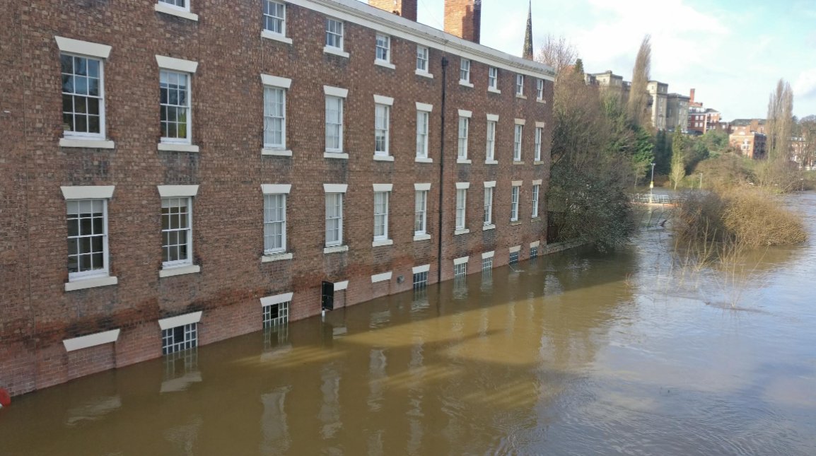
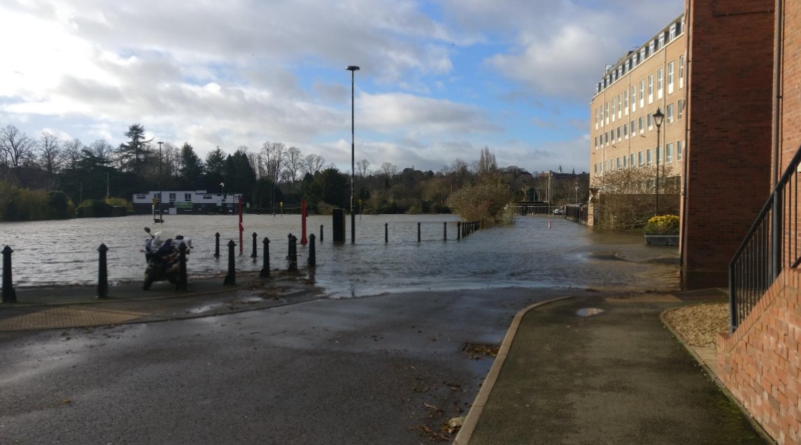
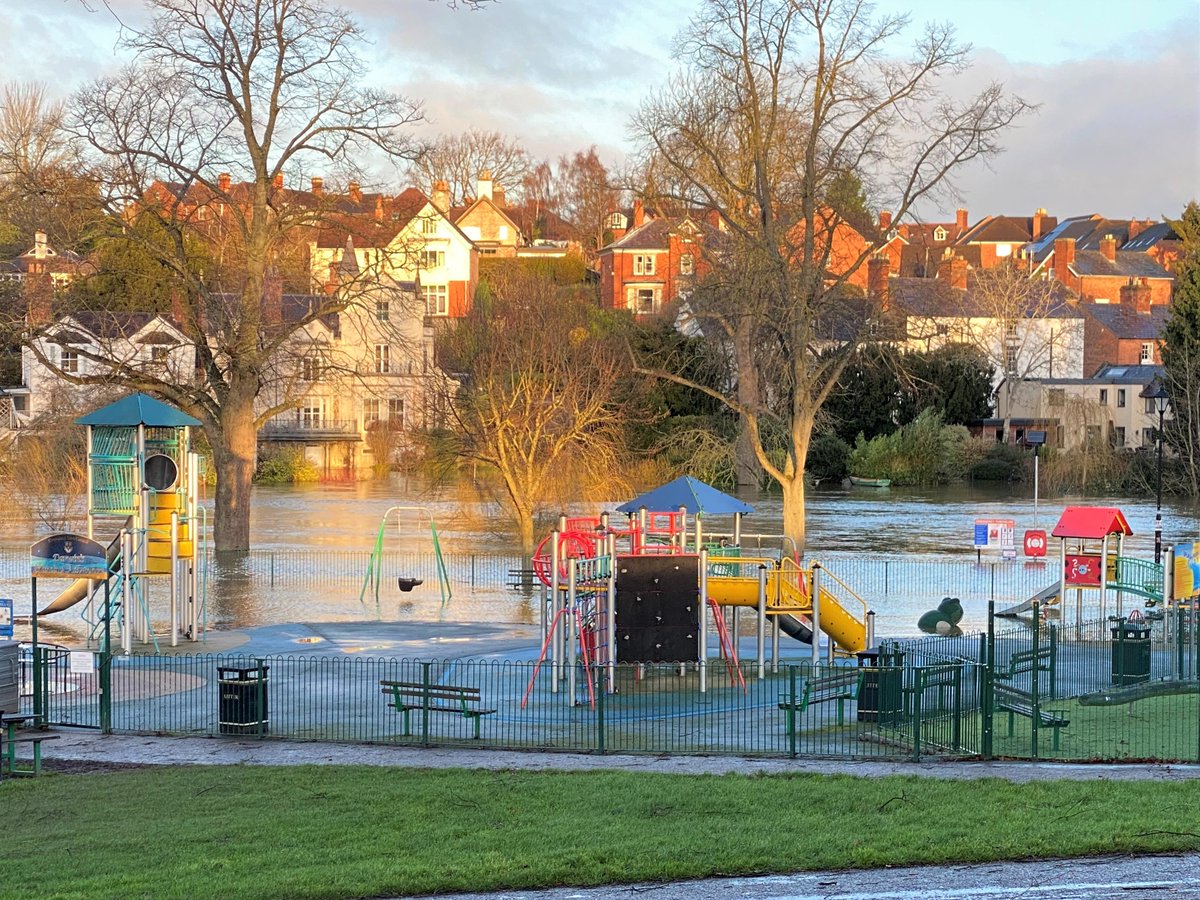
In our local town of Shrewsbury, car parks have become lakes and lakes have become oceans! How have you been impacted by the weather this week?
#Flooding#Floods#UK
The team at Shoothill are devastated to hear about the passing of Queen Elizabeth II. We thought we'd share this again, a project that conveys itself much differently now.
One million images of The Queen, celebrating her life and service: https://t.co/KCNswPBeRG
We're aware of an issue where river levels are failing to update. This is due to an issue with the Environment Agency's API. We're awaiting updates. Thank you for your patience.
ICYMI: Shoothill released a ONE MILLION image digital mosaic of Her Majesty The Queen, titled 'A Life In Pictures' in time for the jubilee celebrations this weekend.
Take a look at it here: https://t.co/n3XkemVoFw
#ALifeInPictures#Jubilee
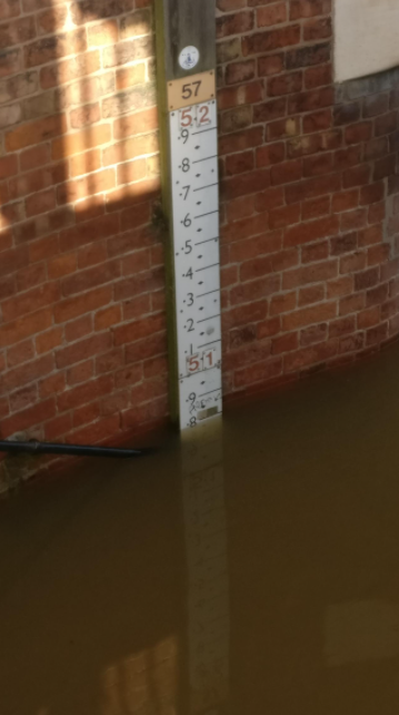
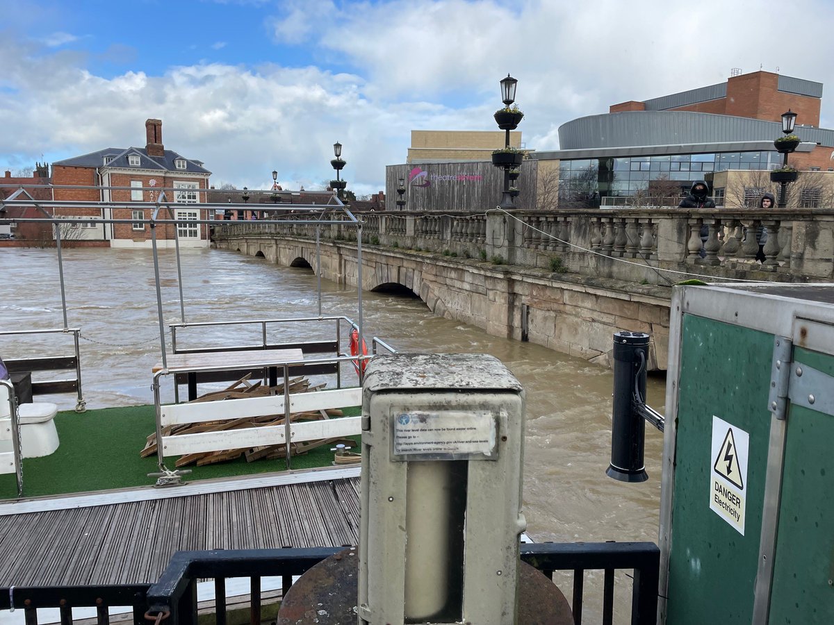
The latest situation in central Shrewsbury...
The metal box is a river gauge - these are what the Environment Agency use to collect data relating to river levels. We display this information on @GaugeMap.
#StormFranklin
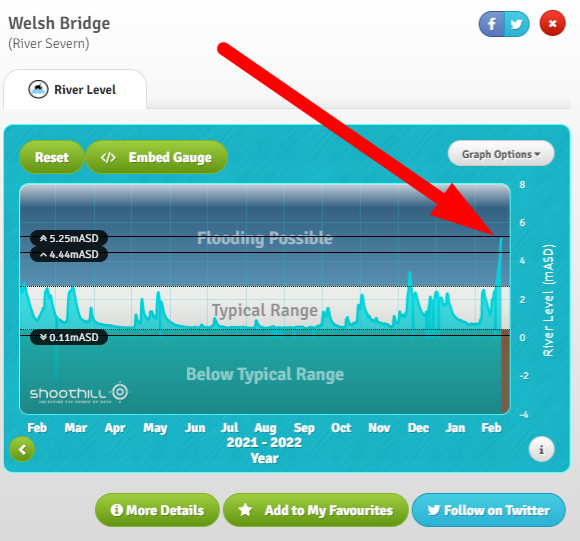
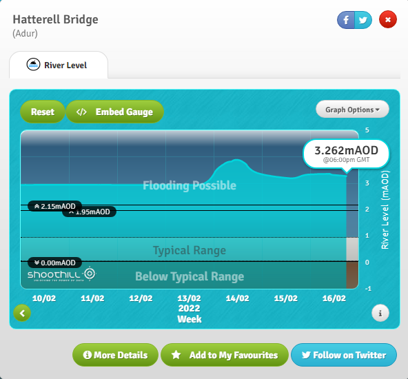
Crikey! @Shoothill@GaugeMap showing very nearly the highest the Welsh Bridge gauge in #Shrewsbury (our home town) has ever been since records began : https://t.co/t1ttLLlA7H
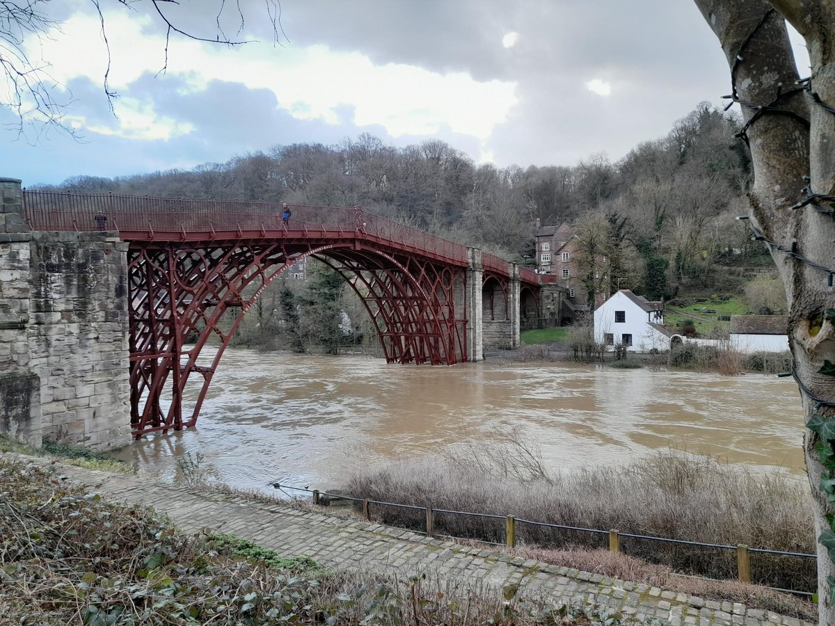
Wharfage closed at Ironbridge - The river has now reached 6.2 m and it’s no longer safe to go behind the flood barriers. The Wharfage is now closed to vehicles and pedestrians. Please stay away from the area and stay safe everyone. More here > https://t.co/ZqfOz1kEqr
It is not very often the map at https://t.co/bTs5tnVDPH looks like this. Stay safe everyone, and keep yourself up to date on local river revels with @GaugeMap (https://t.co/OMYbbQb8uT).
#StormFranklin
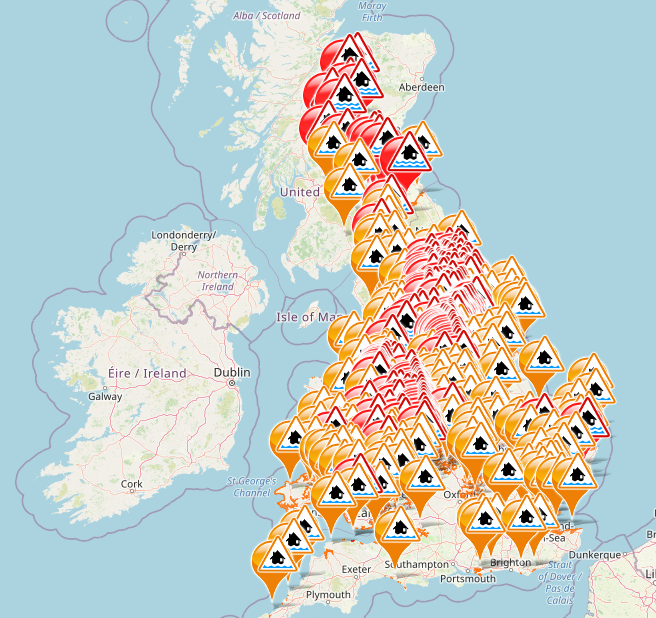
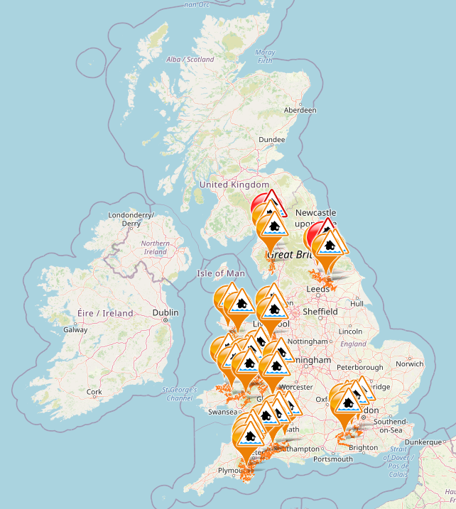
All the gauges marked 'flooding possible' as of 21st February in the UK.
If you are concerned about river levels near you, GaugeMap can help.
Take a look at the gauges closest to you here: https://t.co/O93DFOOSyB
#StormFranklin
Large parts of Shropshire are under water as days of successive storms take their toll, and it looks set to get worse before it gets better - the Severn is forecast to reach its highest level ever recorded in Shrewsbury this week.
https://t.co/YCWH2Nuxnf
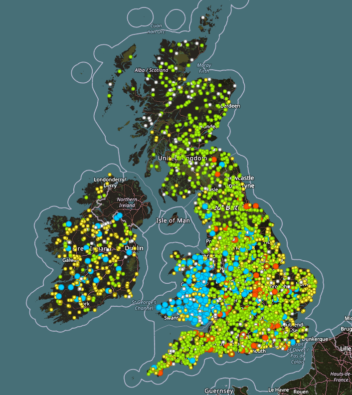
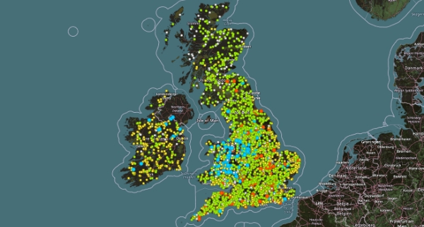
GaugeMap gives updates on over 3000 river and tide gauges - helping keep you up to date on all things #StormEunice as it hits the south coast tomorrow morning. Keep an eye on levels local to you here: https://t.co/LZx6KNhXFg
FloodAlerts covers the whole of mainland UK and is the only place to do so. #StormEunice is coming, starting in the south-west on Friday morning, heading north-east throughout the day. Keep updated on flood warnings here: https://t.co/y3Ml2Y0bCS
#StormEunice#StormDudley
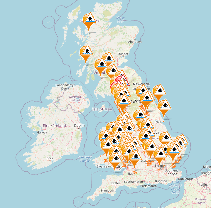
The bad weather over the weekend has impacted river levels across the UK. 2 flood warnings have been issued, one in Boroughbridge and another in the Lake District. There are 28 other flood alerts.
Check here: https://t.co/ueaxxWzWWI
#Flood#LakeDistrict#Boroughbridge
It's a wet and windy December and there are flood warnings dotted all over the UK, particularly in the West Midlands and Wales. Monitor your local river levels here: https://t.co/LZx6KNhXFg
This summer, GaugeMap turned 7 years old.
7 years later, and the site still receives tens of thousands of hits a month in summer alone.
Do you still use it? 🙋♂️
https://t.co/B324nUBiWk
#Innovation#DataVisualisation#Flooding#FlashbackFriday