Some amazing footage of some playful Sea Lions in the Falkland Islands, taken from a Gladius Mini ROV that our sales brand 'Alphageouk' (https://t.co/3w95kAK4ic) provided to Alejandra Mora-Soto at Oxford University for her research project.
@UniofOxford#rov#gladiusmini
In collaboration with Aplitop, Geo-4D's sales brand AlphaGeo are pleased to provide an open webinar invite where we will demonstrate the use of TcpMDT and it's point Cloud Module.
To register for this free Webinar, follow the following link: https://t.co/hgcfrfpGDo
This Friday our sales branch (AlphaGeo UK) are co-hosting a free webinar on the use of Aplitop's TcpMDT survey software, for which we are a sales point in the UK and Ireland.
Please follow the link below to register for the webinar.
https://t.co/EZpu2476s3
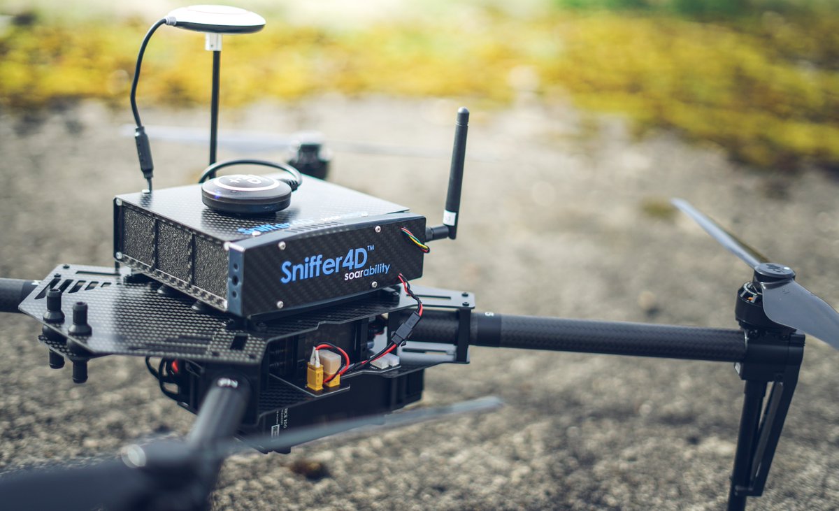
Our pollutant mapping system is now up and running. Using a DJI M100, Zenmuse X3 and Sniffer-4D, we can provide rapid real-time assessment of various pollutants. Get in touch at [email protected] to find out more more. P.S. That's me (Dave Harrison) using it in the video
We have now received our M100-mounted Sniffer-4D air pollutant monitoring system. In collaboration with Soarability, we are now providing demos. Get in touch if you would like to know more or would like us to provide a demo.
FREE WEBINAR INVITATION. Tomorrow at 11:00 GMT AlphaGeo UK will be collaborating with Aplitop to host a free webinar focusing on the use of Aplitop’s TcpMDT surveying and civil engineering software package. Register here: https://t.co/6ZDnKxMZcO
Need to map air pollutants? Geo-4D now operate the AirSense-100 sniffer drone, capable of precision measurements of VOCs, CH4, NO2, O3, CO, SO2, PM1.0, PM2.5 and PM10
https://t.co/EoxxnZcps3