Only managed 9/30 for the #30DayMapChallenge this year in the end - but had a lot of fun trying out different cartographic styles and exploring the wealth of #London geospatial data freely available 😍 next year... at least 15/30 🎯
#Day15 of the #30mapchallenge: The Geography of Central London toilets!
The theme for today is #OpenStreetMap and I wanted to map something that is really hard to find in the data world, to highlight why OSM is so important to the #geospatial industry.
#QGIS#CARTO#maps
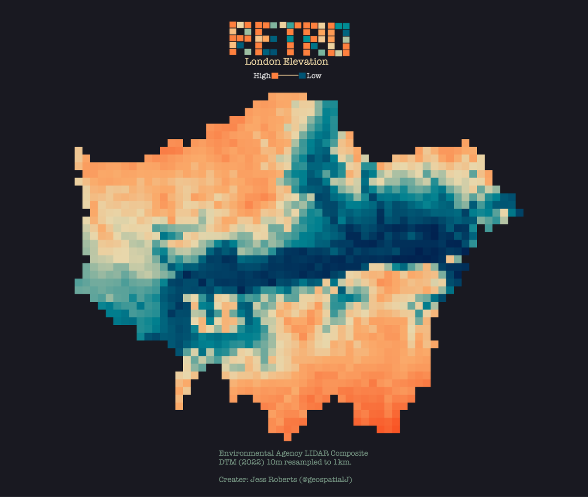
#30DayMapChallenge Day11 – Retro.
Most common Tube seat pattern (aka moquette) by borough (= largest number of stops on a line in a borough). Some lines share the same patterns.
Which one is your favourite?
After some more facts? 👇
https://t.co/25mglPSG3g
Forests hold mountains of carbon— the Congo Rainforest is one of the world’s most carbon-rich forests.
#30DayMapChallenge Day 8: Africa
(🗺️ : @g_fiske )
Day 6 of #30DayMapChallenge - Asia. Going to be quite hard to stay on theme this year while sticking to #London data... A selection of Asian country embassies in London 🇨🇳🇮🇳🇯🇵🇳🇵🇮🇶🇰🇷
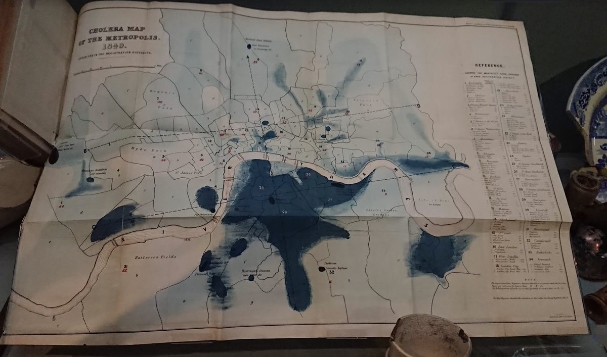
#30DayMapChallenge Day 5: Analog map. Not made a map for today but instead posting something I saw at a Museum of London exhibition a few years back - the Cholera Map of the Metropolis from 1849. Some vintage #healthGIS.
@Julian_H0ffmann Yeah that's a neat idea. I've got an elevation dot map planned for Day 27 using exactly that so watch this space 🤩 for this I just used good ole QGIS
Day 5 of #30DayMapChallenge - analog! My laziest one... Some interesting bits of history around #London. I got distracted looking at all the cool info and forgot about the map! Favourite learning was the Necropolis Railway 💀 check out https://t.co/URdQcJlFGG for great material.
#30DayMapChallenge, Day 3: Polygons. River Basins of the Iberian Peninsula. No neon this time; feels good to be back in daylight. Faster rendering times too.
#rayshader adventures, an #rstats tale