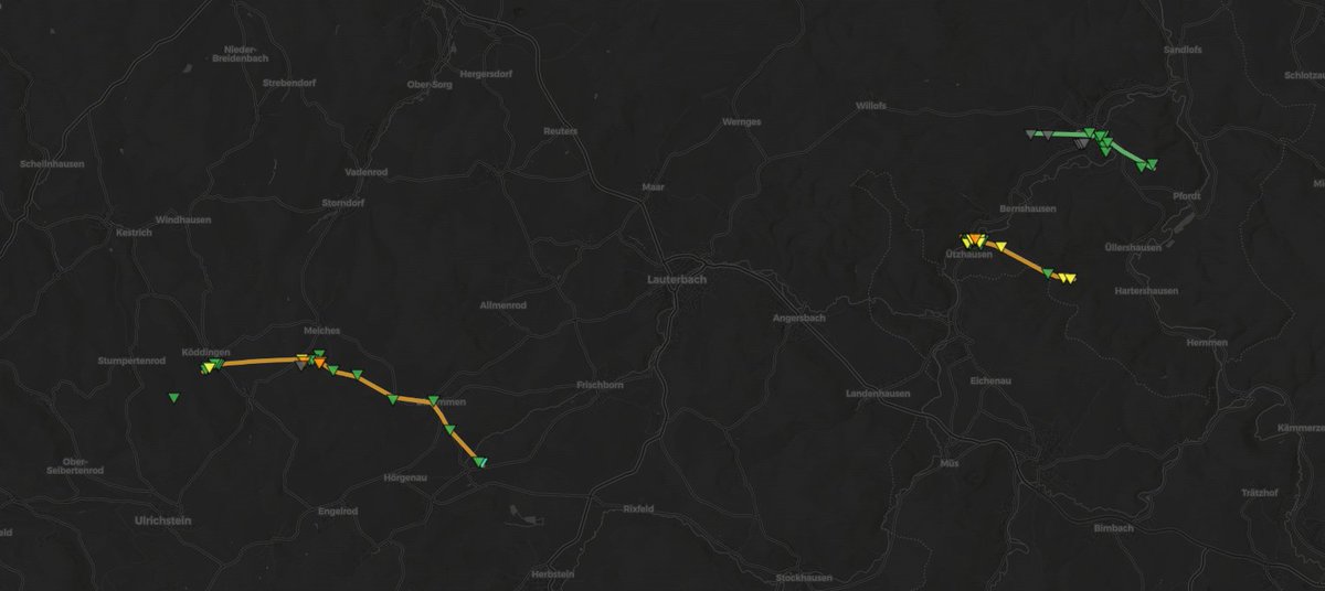
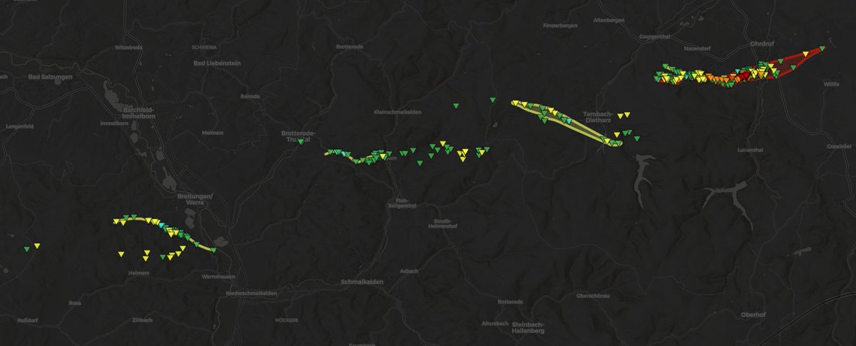
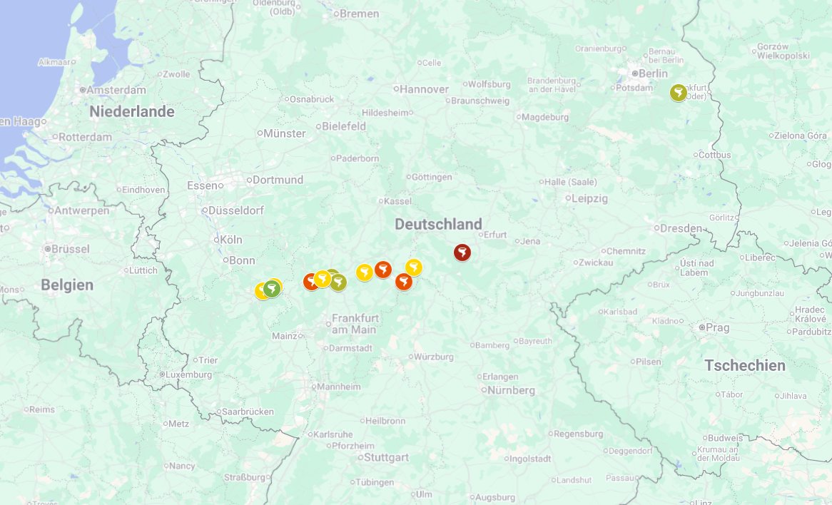
Introducing: the TorKUD Data Viewer. This outstanding work by @wxhendr is now publicly accessible and presents track data and survey results from @TorKUDde for tornadoes examined since 2015.
➡️ https://t.co/lkMSAqdGwt
It's been a month since a historic severe weather outbreak impacted central Germany. Our dataviewer has proven to be very useful in surveying the complex damage patterns. Many tornadoes were fast moving, accompanied by damaging winds, or occured in close proximity to each other.
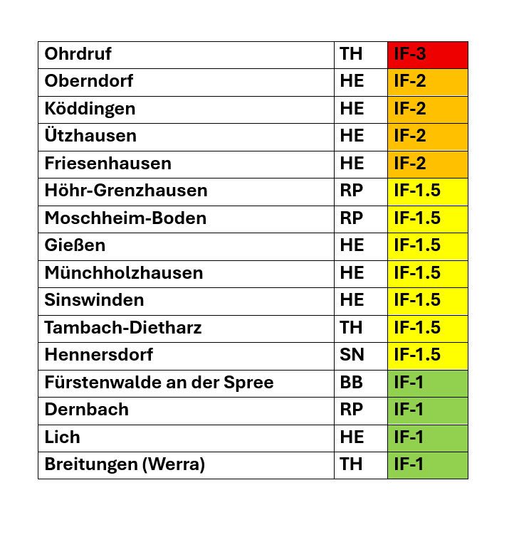
An updated list on one of the most extensive survey projects in Germany in recent history. Fall directions of 5,000+ trees have been analyzed to map the windfield of the powerful Ohrdruf tornado alone. This also uncovered a possible satellite tornado near the start of its path.
Hier ein kleiner Blick hinter die Kulissen 😉 Ich habe fast jeden umgestürzten Baum (über 5.500) entlang der fotografierten Tornado-Bahn erfasst (unser Data-Viewer zeigt nur etwa jeden fünften oder sechsten davon an)!
@225MPH_EF4 I‘d suggest not sharing your body with any „person“ who uses normal weather apps instead of looking at Pivotal weather for 18 hours a day (as sane people would do)
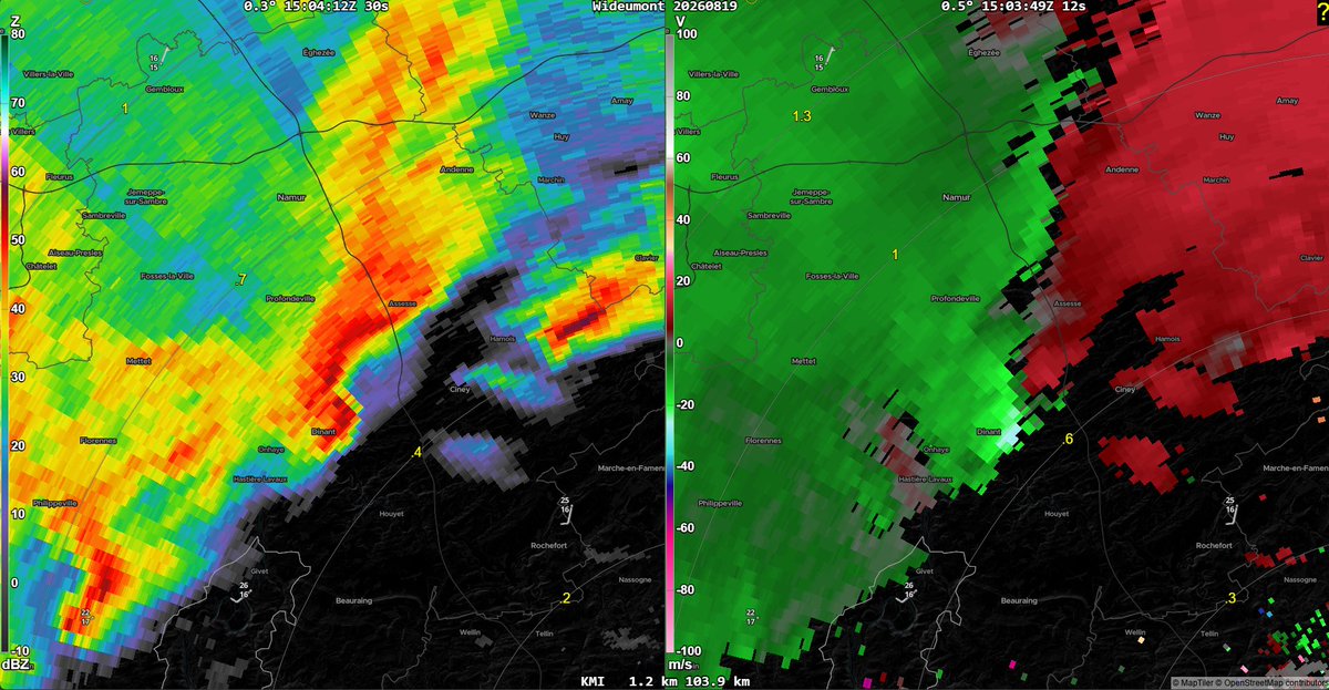
The tornado outbreak on August 19th was largely set off by a supercell which developed over N France. It eventually merged with a trailing line of storms in Germany, and gradually opened up into a broader bookend vortex. In the process, the storm became a serial tornado producer.
Westlich von Hamburg hat sich eine Lücke in der Schauer-Linie gebildet, wo sich Rotation aufbaut. Hier gibt es auf jeden Fall wieder ein gewisses #Tornado-Potenzial!
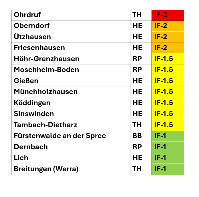
After further review together with ESSL and DWD, it's been concluded that IF3 level damage to vegetation occured just southwest of Ohrdruf (TH). The tornado from August 19th has subsequently been upgraded. 15 tornadoes have been confirmed from the outbreak in total.
The ever growing list from the August 19th outbreak is now counting 13 tornadoes, including the strongest German tornado in at least four years. Ground surveys for additional possible cases are still being carried out today.
Today is the planned final day of operation for the NAM weather model. What a good 21 year run, it was nice knowing you. You served us well, be it the insanely aggressive hurricane forecasts, the squall of death, or something else.
Every once in a while, Germany's dense network of wind turbines aids tornado research, such as in 2023, when one was struck by the Lashorst tornado. On August 19th, it happened again: a suspected tornado passed a wind turbine near Meiches (HE), which recorded winds of 185 kph.
🟢 Mindestens zehn #Tornados vom 19.08. gelten inzwischen als gesichert. Die Untersuchungen zu weiteren Verdachtsfällen dauern noch an. Der aktuelle Kartierungsstand kann in unserem Data Viewer abgerufen werden (Angaben vorläufig).
➡️ https://t.co/8cLJMmIlpq
Starting to get a sense of the scale of the August 19th tornado outbreak. Ten cases have been confirmed. The QLCS started spamming (strong) tornadoes as it entered central Germany. Rarely do we ever see such a density of tornadoes with one event. And there's more. Impressive!