Conversational GIS is not a concept anymore.
Our CEO explains how it gets built — Wednesday 3 June, 15:30, GEO Business 2026.
Stand G185, ExCeL London. Come find us.
Our CEO and CTO spent two weeks at Berkeley Haas going from VC fundamentals to final pitches at Plug and Play in Sunnyvale.
The programme is done. The work it opened up is not.
Week one at UC Berkeley Haas done.
Barry Katz on Silicon Valley as infrastructure. Gauthier Vasseur on AI data strategy. A farm visit in the Central Valley.
More ground covered than most programmes do in two weeks.
#BerkeleyHaas#GeospatialAI#AgriTech
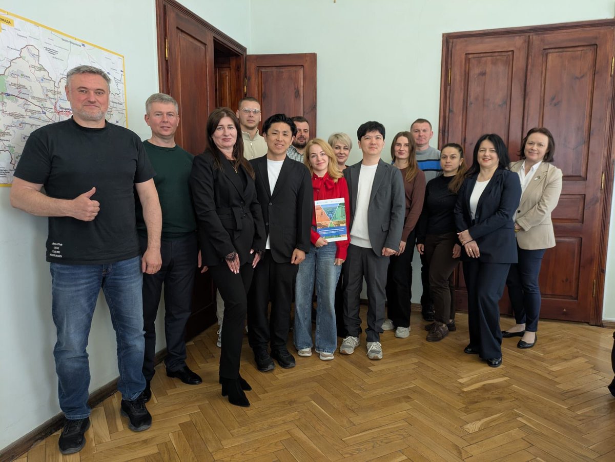
3 days. 3 levels of dialogue. Western Ukraine 🇺🇦🇯🇵
With Eukarya Inc., GIS-Point delivered a working program across community, region & university-showcasing a live 3D digital twin of Horodok city.
Not a concept. A functioning municipal model.
#GISpoint#DigitalTwin#3DModelling
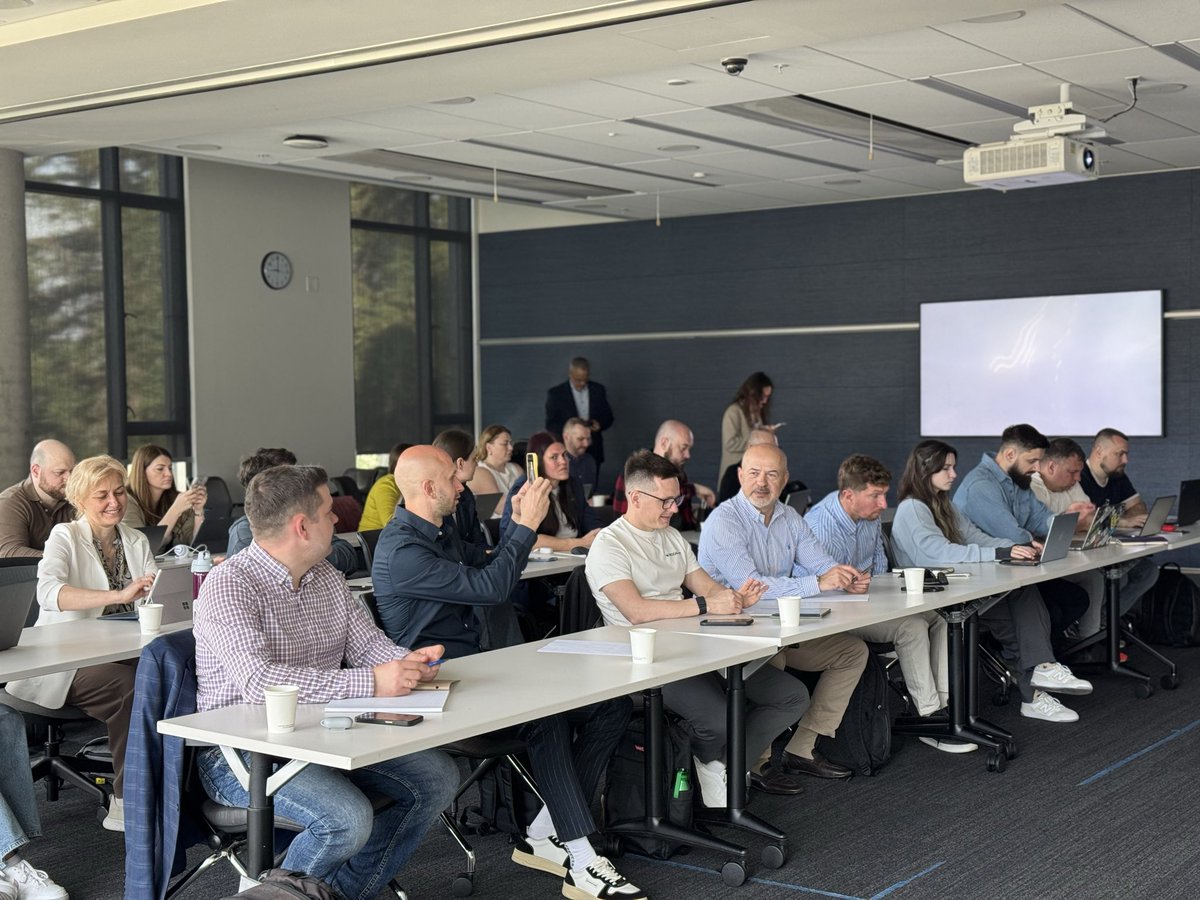
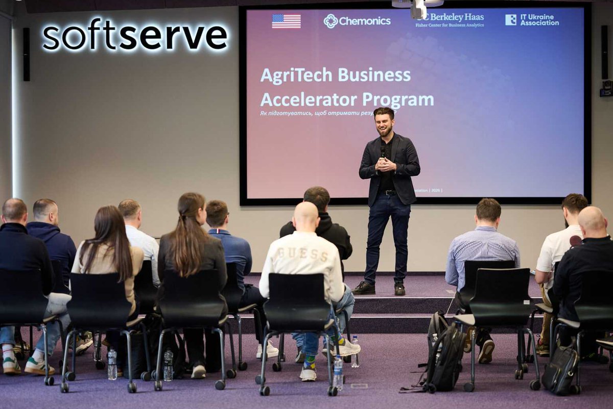
We've joined Stage 2 of the AgriTech Business Accelerator 🌱🇺🇦
UC Berkeley lectures, pitching workshops & Silicon Valley networking - all to scale Ukrainian agri-tech globally.
Excited for what's ahead. 🚀
#AgriTech#GIS#SiliconValley#StartupEcosystem
Most GIS dev projects lose 3 months to onboarding. Developers learning what CRS means on the client’s budget.
Our engineers hold geospatial degrees and worked in the field before writing pipelines.
They don’t need it explained.
16 companies. 3 weeks online. UC Berkeley faculty.
GIS-Point completed Phase 1 of the AgriTech Business Accelerator.
Next: 10 days in California. Lectures, pitching workshops, Silicon Valley networking.
Eukarya built Re:Earth and drove Japan’s PLATEAU programme 3D models of hundreds of municipalities nationwide.
On May 14 they bring that experience to Lviv.
GIS-Point is a partner - we’ve been piloting 3D city modelling in Horodok for over a year.
https://t.co/fJyQ8XV03l
On May 14, Lviv Polytechnic hosts a hands-on event on 3D city modelling and digital twins.
Organizers: Eukarya Inc. - developers of Re:Earth and Japan’s PLATEAU project.
We’re partners. Details in comments.
Laser scanning data: processed, structured, and ready for GIS and engineering workflows.
Spatial analysis. Data organization. High-accuracy output.
If you have similar data challenges 👇let’s talk.
Most LiDAR workflows end with a file transfer.
Download. Install. Struggle.
We built the alternative - billions of points, real-time interaction, browser only.
Link in comments.
Your farm data already knows where the risks are.
It just can’t tell you yet.
Natural language queries. Instant map answers. Crop stress, drought, fertilizer efficiency in seconds.
What if your GIS data could just… answer you?
“Where are we losing money in logistics?”
Ask in plain language. Get a map, analytics, and clear actions. Instantly.
That’s what we build at GIS-Point.
Before: field surveys, fragmented spreadsheets, weeks per decision.
After: one GeoAnalytics platform, mobility data + density grids + competitor mapping.
Minutes per site.
Case study in comments.
How much engineering data in your company still lives on paper?
We digitized a full bridge dataset - damage annotations and all in 35 hours.
BIM/GIS-ready output. No extra personnel.
Breakdown in comments.
Your fleet generates massive spatial data. How much of it actually drives decisions?
We built an AI that answers logistics questions in plain language - routes, delays, fuel - visualized on the map.