Join the Esri DC Open House on May 20, 4–6 PM in Vienna, VA. Discover new ArcGIS features, Geospatial AI, Digital Twins, and connect with Esri experts. Space is limited—save your spot today 🌎 Register: https://t.co/UJP56rXjPa
How can a carefully constructed map strengthen your story? 🗺️
See how configured popups, simple legends, and symbols transform sample stories - then apply those techniques to your own projects. https://t.co/ayAZkSNnxx
#StoryMaps#GIS
Meteorologists and forecasters are keeping a close eye on the Pacific, as signs of an upcoming El Niño are taking shape.
We've just launched 90-day sea surface temperature and anomaly animations. Both are updated daily.
https://t.co/aw9uHAIGJe
Looking for a little weekend reading?
Explore the 2025 ArcGIS #StoryMaps Competition Finalists gallery—and vote for your favorite to win the Community Choice Award: https://t.co/eBVGtCV2SA
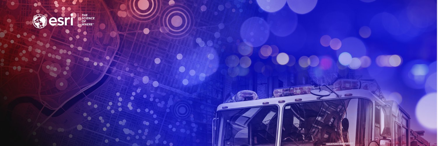
"We put risk on the map so Chiefs can put resources where they matter most." Leveraging Data for Community Risk Reduction with NERIS @Esri@GISPublicSafety@usfire@fireengineering https://t.co/WaoAgupL69
Yesterday, the Division of Fire said good-bye to an individual who had a lasting impact to so many in the fire service: Retired Assistant Chief Herman “Rocky” Hudson.
His public safety career spanned nearly four decades.
From good intentions to good data—see how GIS is transforming fire & EMS decision-making!
Read the latest @Esri blog for practical tips and success stories:
https://t.co/BAP20XS8B7
#GIS#FireService#PublicSafety#Esri
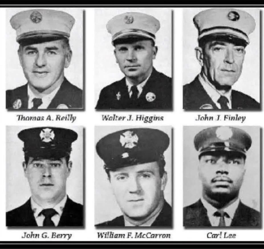
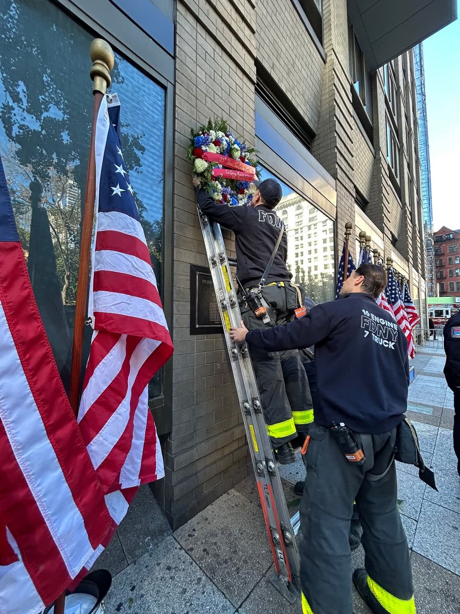
Today, the UFA joined in honoring the 12 FDNY Firefighters who made the ultimate sacrifice at the 23rd Street Fire on this day in 1966.
This remains the 2nd largest loss of FDNY members after 9/11.
Their courage and sacrifice will never be forgotten.
We Will Never Forget.
What is the first thing you should consider for preventing fires?
Battalion Chief Doug Reynolds advises the top safety tip is to install at least one smoke detector on each floor of a home, and to check them regularly to ensure that they are working.
Esri CMO Mariana Kantor chats with Josephine Young, Director of Infrastructure Information Management at San Francisco International airport, on how location data and geospatial technology helped SFO become a world class airport ready for the future. https://t.co/sYud2AJbJa
Heavy rain and strong winds are expected to affect Puerto Rico & the U.S. Virgin Islands this week due to multiple storms moving north in the Atlantic. These storms have the potential to grow into larger hazards, so pay close attention to any alerts issued by local officials.
🚨 Big news for #Fire, #Rescue & #EMS mobile app users!
The biggest ArcGIS Field Maps release yet is here.
✅ Smarter data collection
✅ Enhanced offline use
✅ Real-time crew tracking
Boost safety & efficiency in the field.
👉 Learn more: https://t.co/PyFiRtFPJy
#PublicSafety #GIS #ArcGISFieldMaps
#JoinOurTeam as a Media Specialist!
#SBCoFD is seeking a creative and experienced communicator to join our Public Affairs team. This full-time position helps promote fire district services, supports media operations during emergencies, and creates engaging public content across video, photography, writing, and social media.
Apply By: 9/19/25 at 5:00 PM
Apply Now: https://t.co/NoL2NkN0TZ