Less rainfall expected across Kenya this week.
Kenya Met expects rain in fewer areas, while ICPAC forecasts below-usual rainfall across most of the country.
Rain and thunderstorms are still expected, especially in western Kenya.
13–20 October 2026.
Heavy rains, strong winds and a storm uprooted a large tree along Mumias Road in Kakamega town, as the October–December rains begin.
Photo by Benjamin Sakwa
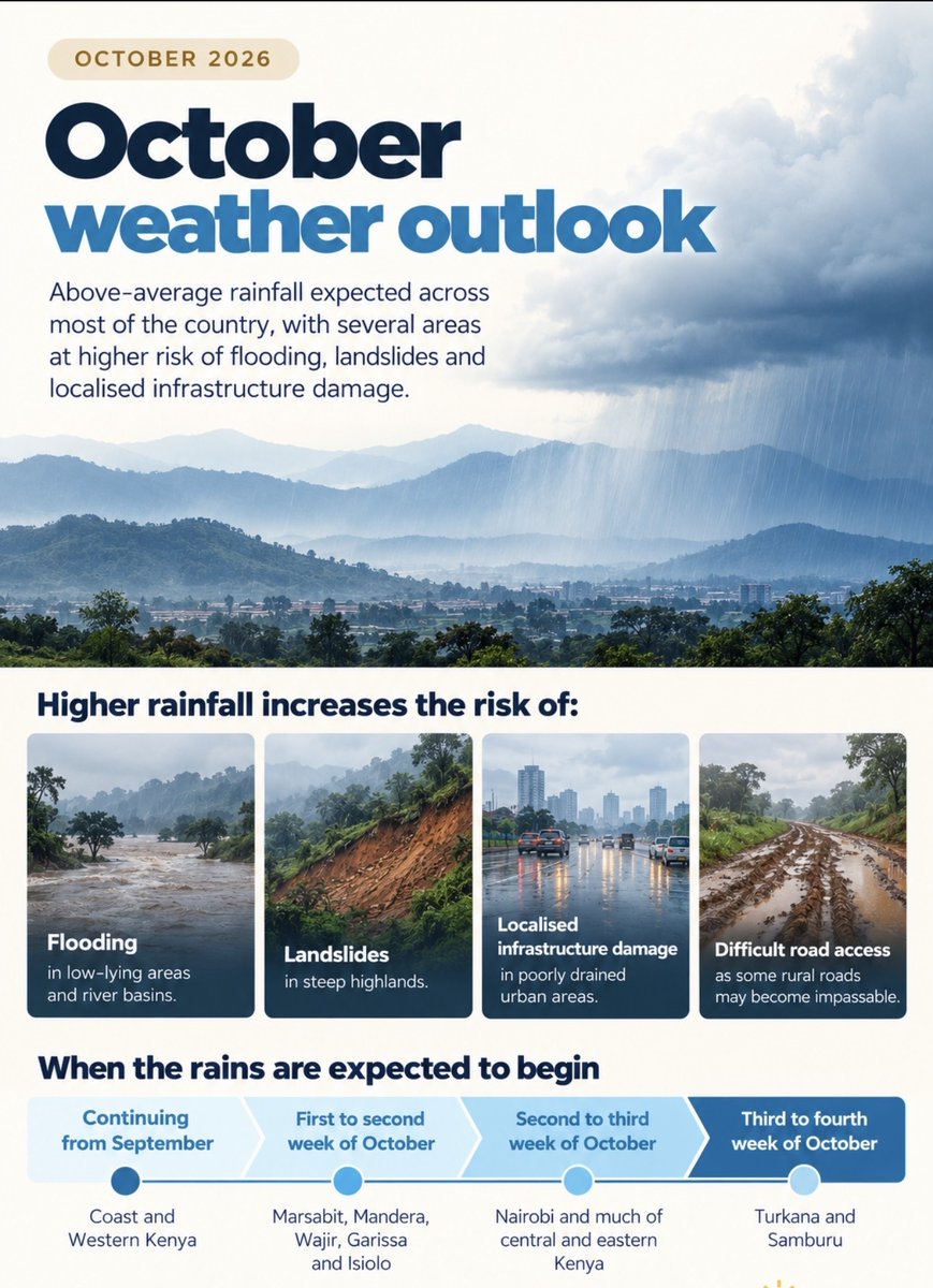
Already continuing: Coast and western Kenya
1st–2nd week of October: Marsabit, Mandera, Wajir, Garissa and Isiolo
2nd–3rd week: Nairobi and much of central and eastern Kenya
3rd–4th week: Turkana and Samburu
Source: @MeteoKenya
Kenya’s October weather outlook is in.
Above-average rainfall is expected across most of the country, with an increased risk of flooding, landslides and localised infrastructure damage in some areas.
With the enhanced rainfall, there is an increased risk of:
• Flash and riverine flooding in low-lying areas and river basins
• Landslides in steep highland areas
• Urban flooding where drainage is poor
• Some rural roads becoming difficult or impassable
Heading to the Coast?
Strong winds, rough seas, high waves, heavy rainfall, and reduced visibility are expected along parts of Kenya’s Coast.
Be careful if you’re planning any offshore activities.
Source: KMA / Kenya Met
Where are strong winds expected?
Turkana, Marsabit, Isiolo, Garissa, Mandera, Wajir, Tana River, Taita Taveta, Kwale, Kilifi, Lamu and Kitui.
Winds could exceed 25 knots (46 km/h) this week.
22–28 September.
Source: Kenya Met
Rain continues this week across western, central and coastal Kenya, the Rift Valley and North East.
Strong winds are also expected in northern, eastern and coastal areas.
Here’s the breakdown:
Where is heavier rainfall expected?
Mombasa, Kilifi and Lamu could receive more than 50 mm of rain this week.
Nyahururu and surrounding areas could also receive more than 50 mm.
22–28 September.
It’s official, the 2026 El Niño has broken a record for the highest ocean anomaly in 170+ years… Incredibly reaching that threshold a full 2 months ahead of 2015’s record of +3.02C set on Nov 18th.
See that red line? That’s 2026.
Every other bold line are the strongest El Niño’s on record.
2026 is in a league of its own.
#elnino #elniño
We have two months left for this El Niño to continue to intensify. And it will.
Strong winds exceeding 25 knots (46 km/h) are expected today across parts of northern, eastern and coastal Kenya.
Forecast valid until 9 PM today, 22 September.
Source: Kenya Met
Enhanced rainfall is expected today in Kakamega, Vihiga and Bungoma.
Showers and thunderstorms are also expected across parts of western Kenya, the Lake Victoria Basin and Rift Valley.
Forecast valid until 9 PM today, 22 September.
Source: Kenya Met
The cold and cloudy weather isn’t over yet.
Conditions could continue through 22 September across Nairobi and parts of Kajiado, Kiambu, Murang’a, Nyeri and Nyandarua.
Nairobi temperatures could fall to around 11°C.
Source: @MeteoKenya
Rain is expected in several parts of Kenya this week.
Western Kenya and parts of the Rift Valley could see afternoon showers and thunderstorms, while the Coast is likely to see mainly morning showers.
Nairobi could also receive some rain.
15–21 September | Source: @MeteoKenya