Current Tornado Parameter plot (2:30 PM) from SPC. 👇 Seems to be two bullseyes (best environment for tornadoes). One in NE Maryland and SE PA. The other in Southern MD near the Bay. Storms just starting to build. Big Boomers most likely in the Baltimore Metro 4 PM - 9 PM. Stay tuned...
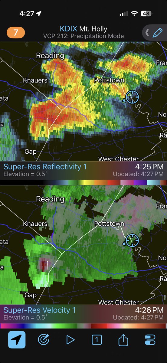
Wall cloud observed near the PHL airport associated with a supercell that moved across Philadelphia this afternoon. View from NJ looking west across the Delaware River. Please take these storms seriously today!
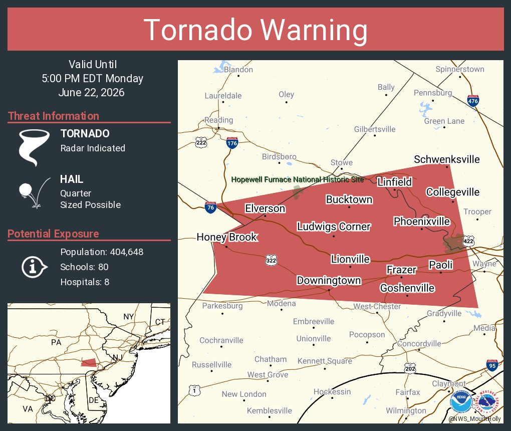
MONDAY, June 22 – portions of southern Pennsylvania, northern Maryland, New Jersey and the northern Delmarva Peninsula are at risk of an isolated tornado today.
Low pressure forming along a frontal boundary will enhance vorticity (spin), and we also have some helicity (twist) along a warm front lifting north.
It's unclear how far north that warm front will get. If it struggles to advance north, a sneaky tornado risk may exist near Washington D.C. or Baltimore too.