Avid Storm Chaser /Spent childhood inside the WLKY Weather Center / Hometown was destroyed by a Tornado /🌪SKYWARN®, SN, & NWSLouisville Spotter Certified 🌩
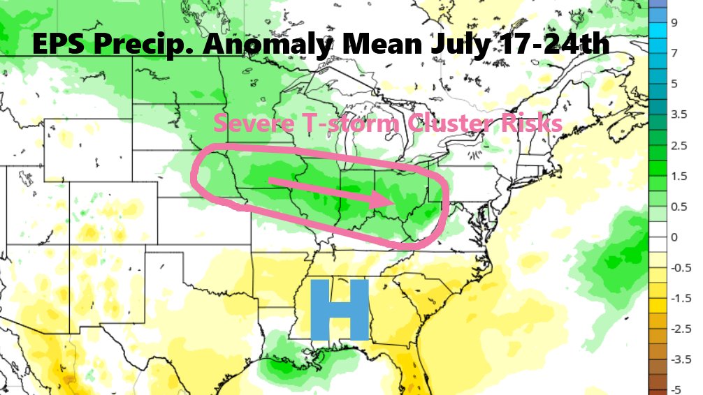
Watching this Weekend into Next Week for a pattern that can be favorable for Severe T-storm Clusters across the Midwest into the OH Valley. Air will be Hot and Very Humid as Dewpoints may reach 80 degrees from time to time which leads to tons of Storm Fuel overlapping the NW Flow
As expected, SPC has expanded the enhanced risk of severe weather to include Louisville on Wednesday. This upgrade is due to increased damaging wind threat as the storms do arrive in peak heating.
Just saw a very bright blue fireball shooting star falling nearly straight down approximately 9:44pm est SSW of Harrodsburg, KY. Light was bright enough to turn to daylight.
#kywx
Just saw a very bright blue fireball shooting star falling nearly straight down approximately 9:44pm est SSW of Harrodsburg, KY. Light was bright enough to turn to daylight.
#kywx