Although Hurricane Isaias will remain well east of our region, rough Gulf seas, gusty Gulf winds, strong rip currents, and minor coastal flooding are possible.
Otherwise, above-normal temperatures will continue through next week.
Out tracking Tropical Storm Isaias. Remember to follow instructions from the local emergency management officials and listen to local weather reports. Keep safe and stay #WeatherReady
🌀Tropical Storm Isaias🌀 is spinning up in the Gulf! While it's steering toward the northern Gulf Coast (leaving SE Texas in the clear), keep an eye out for gusty winds and higher swells later this week. #txwx#houwx
For just the 3rd time on record, three 105+ mph #hurricanes are spinning simultaneously in the eastern North Pacific (to 180°W): #Nolo, #Odalys and #Polo. The only other times were Aug. 16, 1993 (Keoni, Fernanda, Greg) and Aug. 29–31, 2015 (Kilo, Ignacio, Jimena).
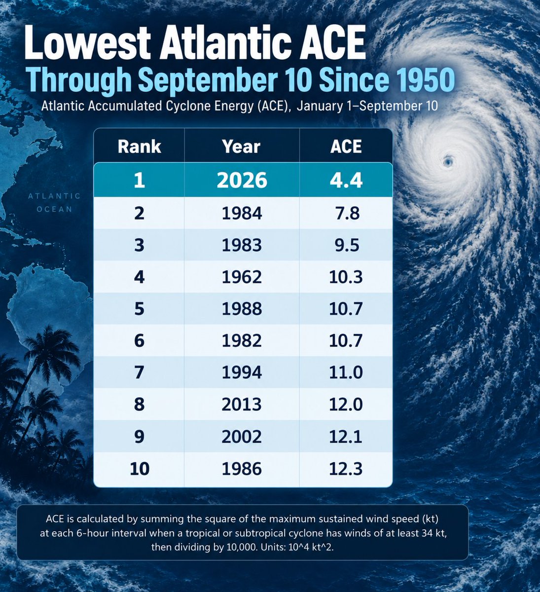
The 2026 Atlantic #hurricane season continues to be remarkably quiet, producing the least Accumulated Cyclone Energy (ACE) to date since 1950. ACE is an integrated metric accounting for storm intensity and duration.
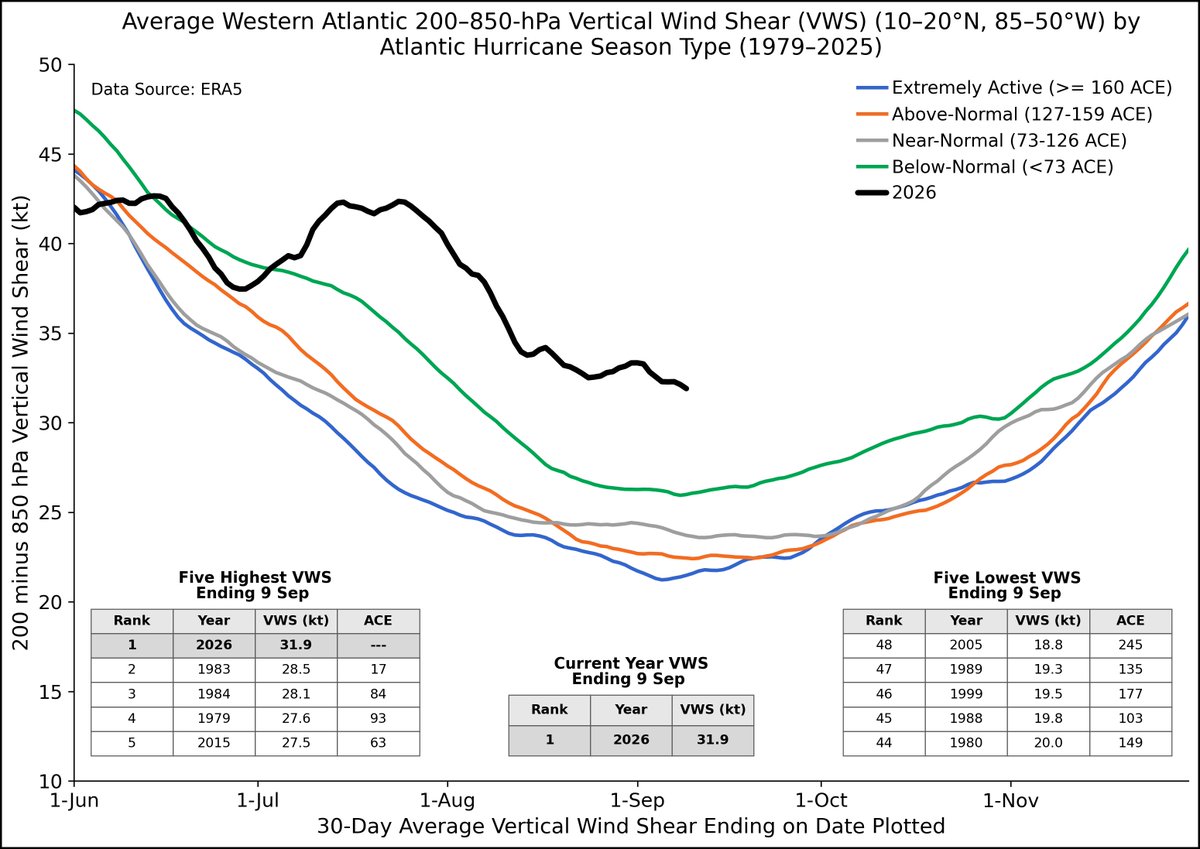
Main Development Region vertical wind shear remains extremely strong, with record high levels of vertical wind shear in the western Atlantic (10-20°N, 85-50°W) for the past 30 days. The 2026 Atlantic #hurricane season continues to be remarkably quiet. #ElNino
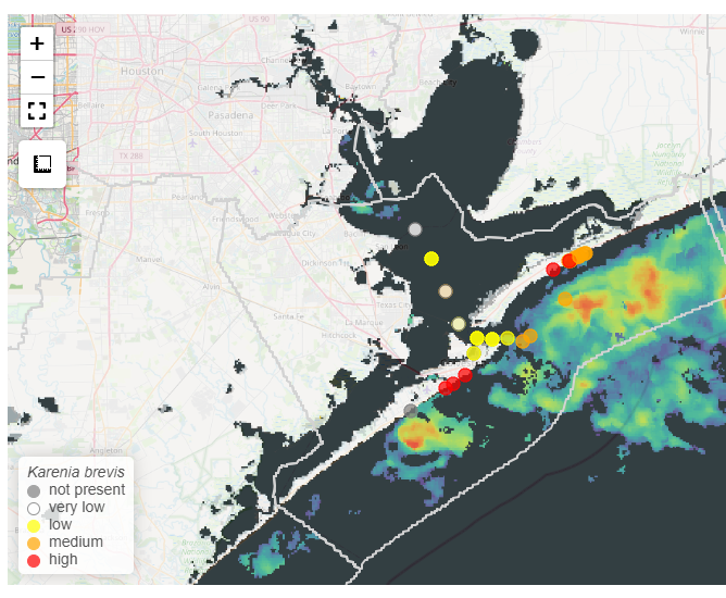
Water samples collected on Bolivar Peninsula, Crystal Beach, and Galveston Island, Texas from Sep 6-13 have detected red tide (caused by Karenia brevis). We are predicting a HIGH risk of respiratory irritation in Galveston County over the next 36 hours. https://t.co/KmqqoFqvIv
The Central North Pacific (140°-180°W) has already generated its 4th highest seasonal Accumulated Cyclone Energy (ACE) value on record, with plenty of #hurricane season left. Hurricane #Lowell has significantly increased Central North Pacific ACE in recent days.
Today is September 10 - the climatological peak of Atlantic #hurricane season. In 2026, the Atlantic has generated the least Accumulated Cyclone Energy (ACE) of any season through Sept. 10 since 1950. ACE is an integrated metric accounting for storm intensity & duration.
Today is the peak of hurricane season, but the Atlantic has been unusually quiet.
Why? Strong wind shear, boosted in part by El Niño, has made it harder for storms to organize. Earlier Saharan dust and dry air also helped.
Quiet so far does not mean we are done.
@CW39Houston
45,000ft up and directly over the center of Hurricane #Lowell@noaa Gulfstream IV-SP #NOAA49 "Gonzo" just wrapped up its missions to Hurricane Lowell. Throughout the series, the crew collected vital data to help improve @NWSNHC forecasts and advance @NOAA_AOML research.
Photo Credit: Ryan Knapp, NOAA #FlyNOAA
🌀 INTO THE STORM | Air Force Reserve #HurricaneHunters with the 53rd WRS are flying Hurricane Lowell, collecting critical data to help forecasters determine the storm’s intensity and track.
Stay weather-aware and follow guidance from local officials.
#53WRS#HurricaneLowell
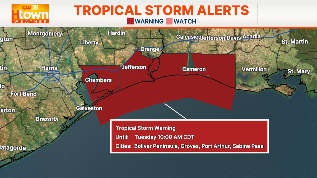
⚠️NEW: Potential Tropical Cyclone Five has formed in the Gulf. Tropical Storm Warning in effect for TX coast.
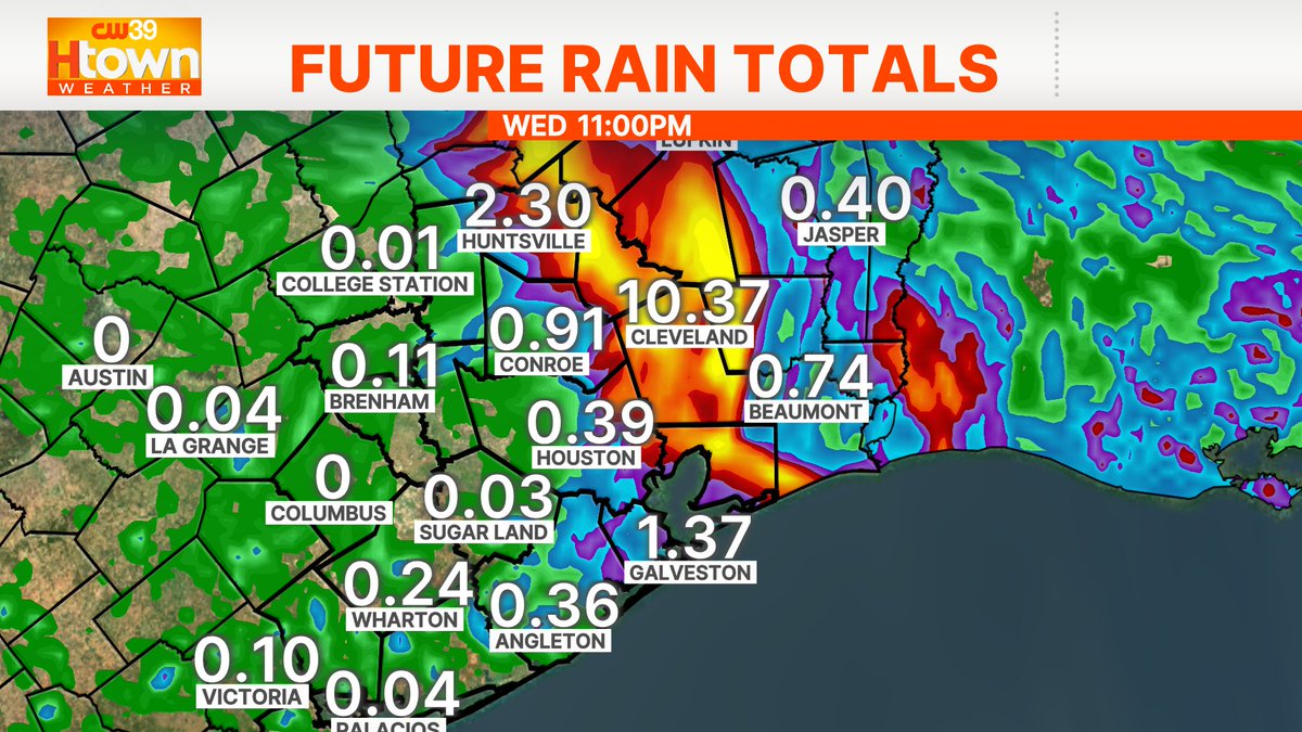
🚨 Flash flooding is possible, especially in urban and low-lying areas Tuesday.
🔌 Power outages are also a concern with strong wind gusts 50 to 60 mph.
@CW39Houston
Dolly is now a remnant low lasting about 24 hours as a tropical storm before dissipating Friday morning.
There will still be impacts, though. Heavy rain is anticipated Saturday into Sunday for Leeward Island where flash flooding is a concern.
@CW39Houston