Happy to share our latest paper in Geomorphology! 🎉
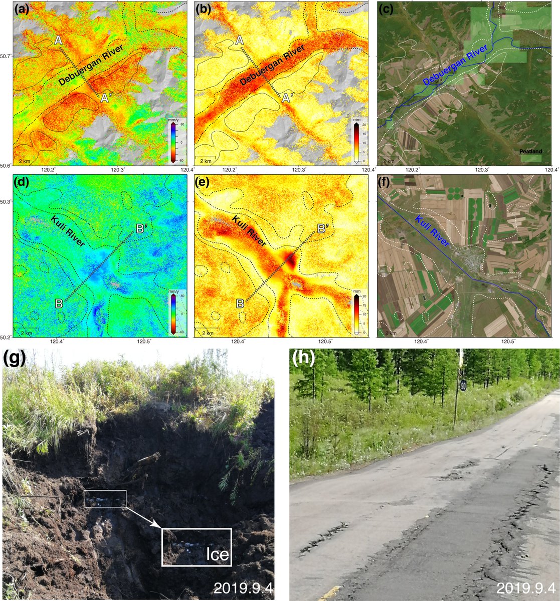
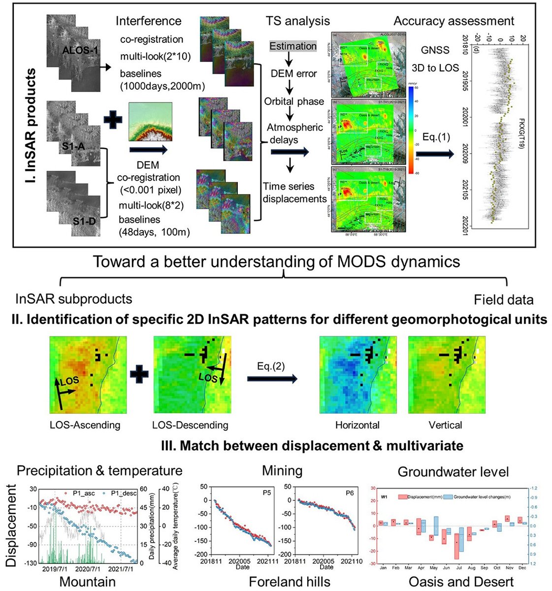
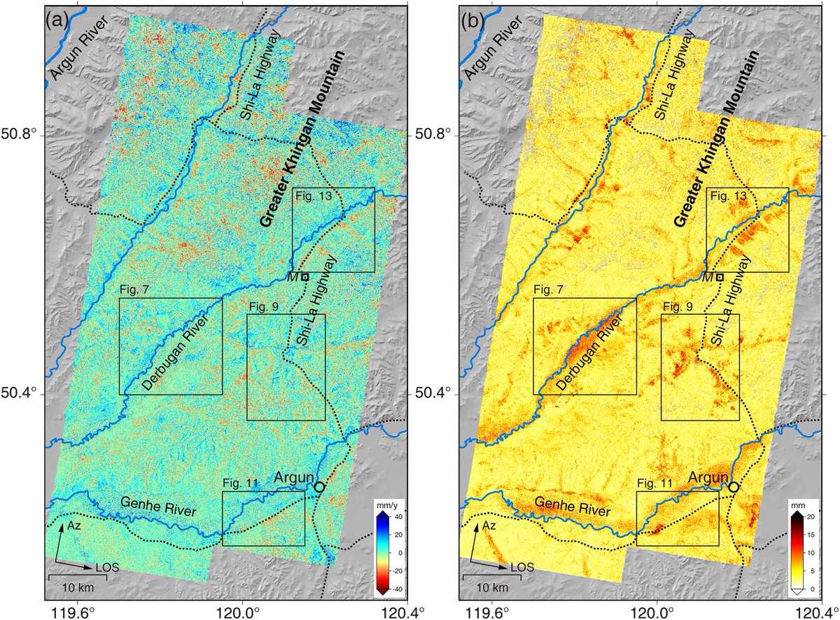
Using #InSAR, we investigated ground deformation in the discontinuous permafrost of the Da Xing’anling Mountains, revealing widespread deformation, strong seasonal signals, and key environmental controls.
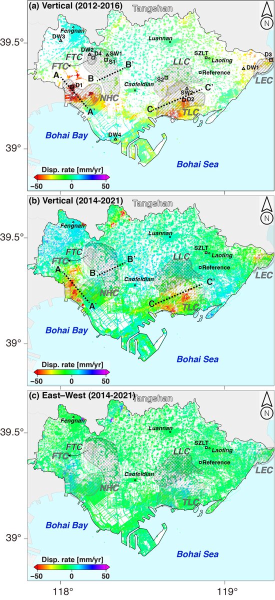
@nueavalanche Not all land subsidence is caused by groundwater loss — InSAR shows surface movement, but the cause could also be soil consolidation, tectonics, mining, or other factors.
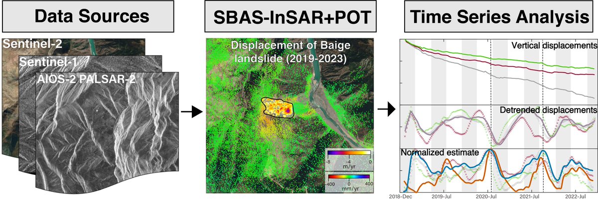
Earth Surface Processes and Landforms | Geomorphology Journal | Wiley Online Library https://t.co/sU9D7GSu19 Our study integrates multi-source remote sensing to reveal the post-2018 kinematics of the Baige landslide
Our new paper Refined landslide inventory and susceptibility of Weining County, China, inferred from machine learning and Sentinel-1 InSAR analysis "https://t.co/Yq2aasCQsG"
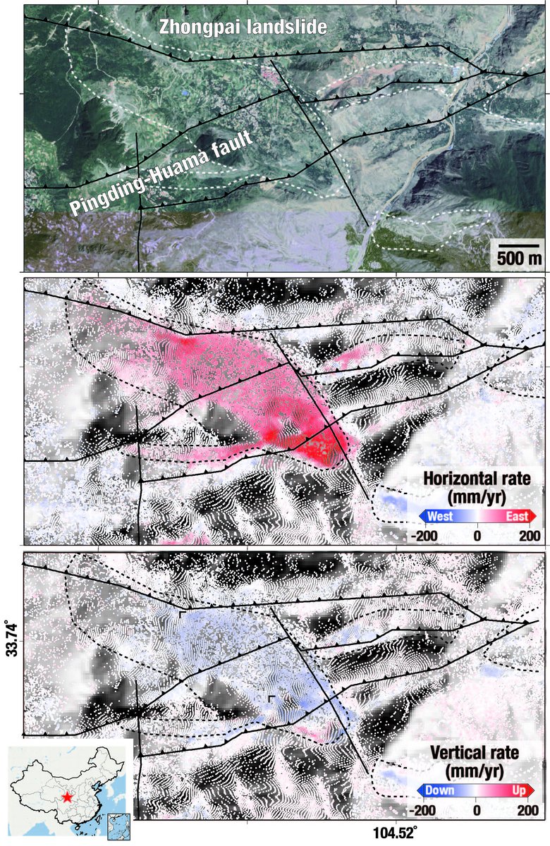
Our new paper "Characterization of landslide displacements in an active fault zone in Northwest China" is out in Earth Surface Processes and Landforms. Here is a full-text, read-only version of our article. https://t.co/bxLv4slXFj
Our new paper "Extreme rainfall-related accelerations in landslides in Danba County, Sichuan Province, as detected by InSAR" published in JAG https://t.co/nJEaICaf9V
Our SI 'Remote Sensing-Based Structural Health Monitoring and Damage Assessment' is open. Related contributions are welcome. https://t.co/X5yVMFc2Z1 #mdpiremotesensing 来自 @RemoteSens_MDPI
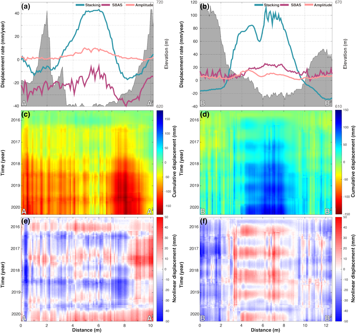
Our paper "Stability analysis of Shiwei-Labudalin Highway in Inner Mongolia, Northeastern China using Sentinel-1 InSAR" just published in Cold Regions Science and Technology. https://t.co/QDXYVKabkH
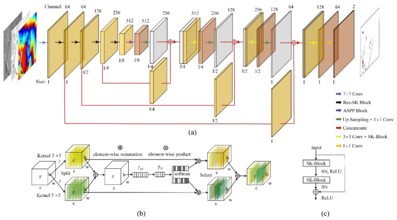
My co-authered paper "Selective Kernel Res-Attention UNet: Deep Learning for Generating Decorrelation Mask With Applications to TanDEM-X Interferograms" just published open acess. https://t.co/x2rRoazBDo
Our recent study of the Guobu slope in China using InSAR published in Remote Sensing of Environment. The personalized URL provides 50 days' free access to the article. https://t.co/2YBA62lLUW
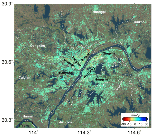
New #EGUhighlights: Spatial and temporal subsidence characteristics in Wuhan (China), during 2015–2019, inferred from Sentinel-1 synthetic aperture radar (SAR) interferometry https://t.co/RkkXoQZGQK
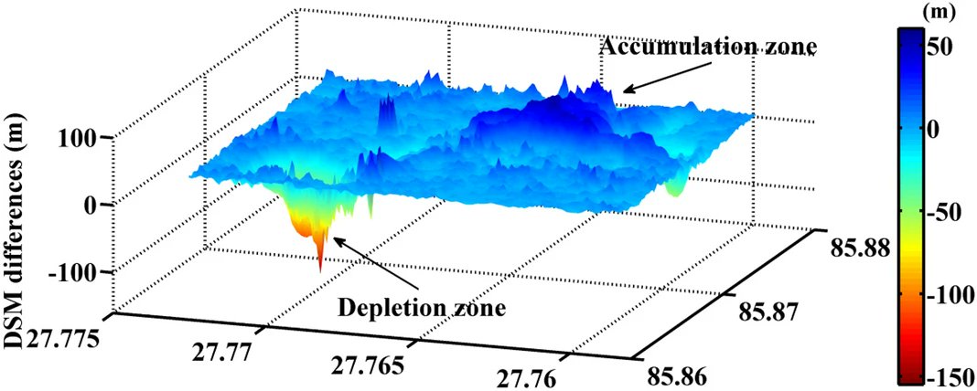
Our new paper "Characterizing the evolution life cycle of the Sunkoshi landslide in Nepal with multi-source SAR data" published in scientific reports https://t.co/gMnr9PD5fe
#mdpiremotesensing Detection and Characterization of Active Slope Deformations with Sentinel-1 InSAR Analyses in the Southwest Area of Shanxi, China @RemoteSens_MDPI