Have you walked through the Storytelling with Maps exhibit at #EsriUC2024?
Take the 9 Tips for Great Storytelling home with you. Explore the ArcGIS #StoryMaps collection.
https://t.co/Hn1W5e6XPj
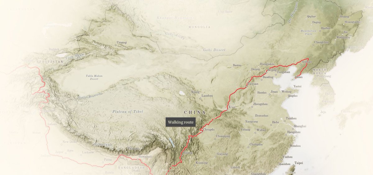
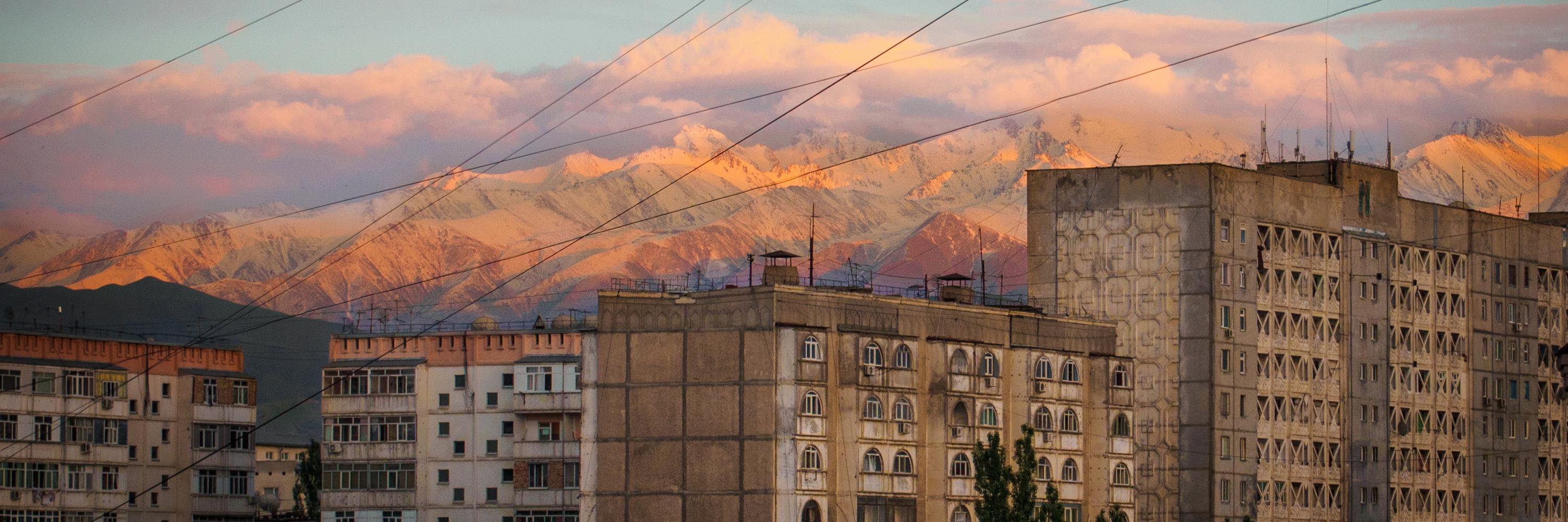
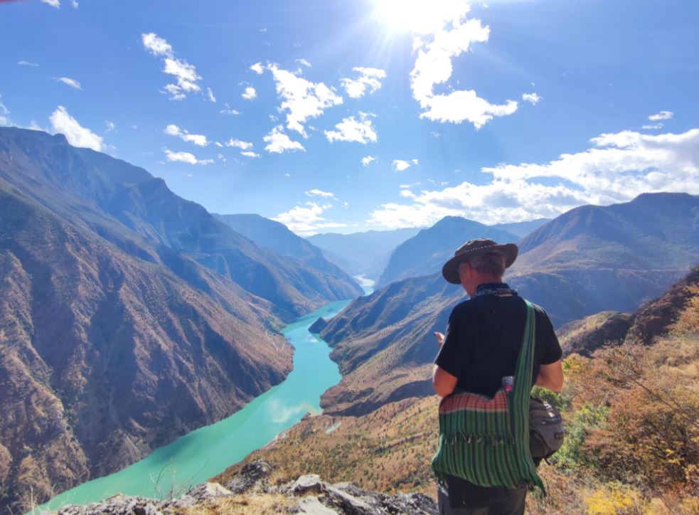
I’ve had the great pleasure of working with Paul on a few map-focused stories chronicling his round-the-world walk — but this latest installment, which explores Paul’s passage across China through the lens of 2,000 years of history, is our most ambitious collaboration to date:
Take a step into China’s rich history as Pulitzer Prize-winning journalist @PaulSalopek recounts his 4,000-mile walk across the country.
Read the latest from his multi-year @outofedenwalk project 🥾 https://t.co/yHQgYtdma3
#StoryScape@InsideNatGeo
Another banger from @puddingviz. The human pictos in this piece are so good—like, I can practically hear the dude on the right mansplaining how to write an insipid radio-friendly single
New Project! @cdallarivamusic analyzes the remarkable trend that most hit songs are written by all men. How often has a top 5 hit been written by *only* women in the last 10 years? It’s likely rarer than you think.
https://t.co/G5QEaxXGqX
ArcGIS #StoryMaps turns 4 y/o next week—just in time for #EsriUC2023. 🥳🎂
We're celebrating with a new digital magazine featuring you, our global storytelling community.
Explore #StoryScape. Read innovative stories, meet storytellers & learn together.
https://t.co/WdIMlJzUL6
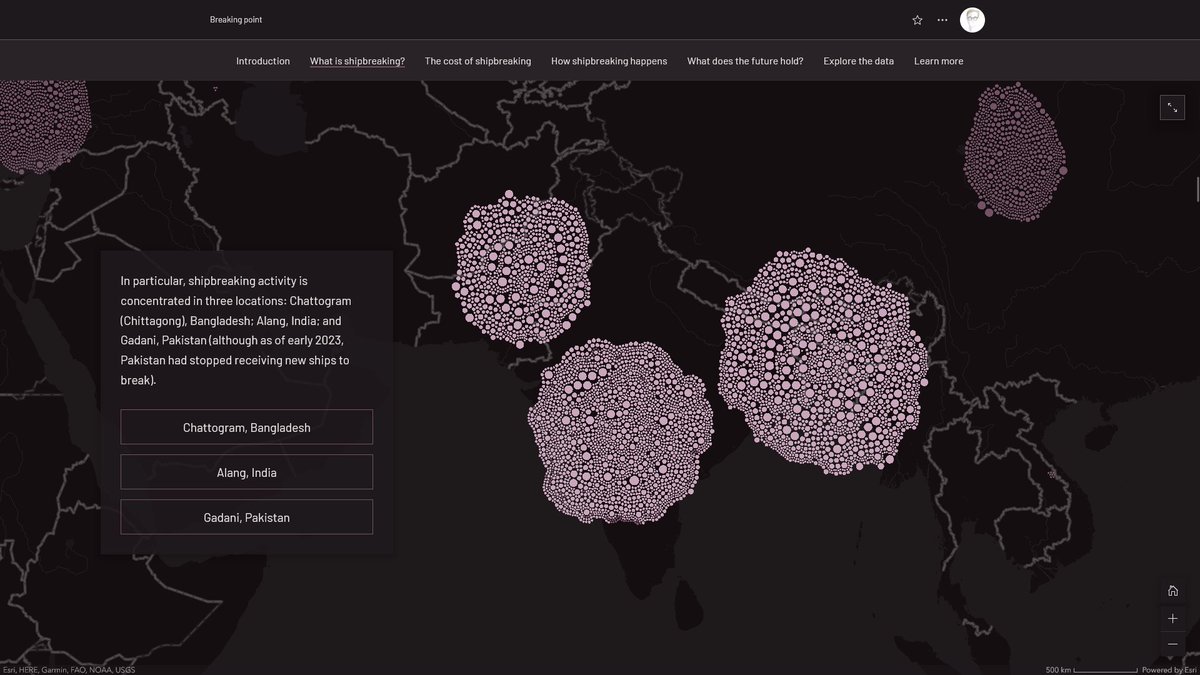
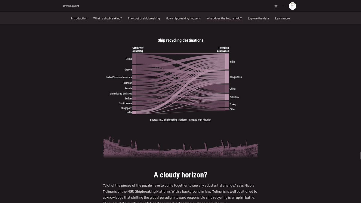
If you thought taking out the recycling was a pain, try dismantling an entire ship. Our latest story explores the shadowy world of the #shipbreaking industry, and why organizations like @NGOShipbreaking are urgently advocating for reform: https://t.co/a9q66DYGn2
What happens when a ship reaches the end of its life?
The latest story from the #StoryMaps team explores the #shipbreaking industry, and why organizations like @NGOShipbreaking are urgently advocating for reform. https://t.co/Tz7KI6IgLa
I had a great time chatting w/ the @ArcGISStoryMaps team & @InfiniteCoop about science communication.
"Truthfully, and maybe tragically, it probably won’t be traditional cartographers creating the first maps of distant planets."
https://t.co/CUbRi8oaYt #maps#scicomm#dataviz
Hey, checkitout!
As exciting as it is to receive recognition for this project, I'm even more thrilled to see multiple stories from the @ArcGISStoryMaps storytelling community receiving plaudits as well🙃
50th Annual CaGIS Map Design Interactive/Animated
Winner: Resurfacing the past by Ross Donihue, Will Hackney, Cooper Thomas, Hannah Wilber: Esri; and Paul Heersink: Esri Canada https://t.co/QkBgTQXFj8
Does the atmospheric pressure feel low in here to you, or is it just #internationaldayofhumanspaceflight? 🚀
If you think air molecules are a waste of time anyway, you’ll feel right at home in the T-Minus 6000 story: https://t.co/HxqfORAfdV
#StoryMaps#maps
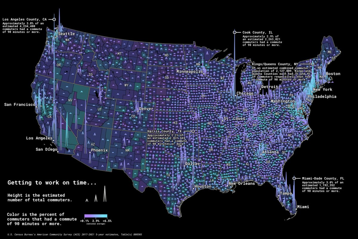
Income inequality in the U.S. is at an all-time high.
Explore the geography of income in this story, which uses the latest @uscensusbureau data in @LivingAtlas to highlight the striking wealth disparities in America’s cities. https://t.co/tzAlrSXLim
#maps#dataviz#StoryMaps
As the war in #Ukraine enters its second year, up-to-date maps of territorial control can help illustrate the evolving geography and complexion of the conflict. Stay informed with our maps, powered by @TheStudyofWar's authoritative, daily-updated data: https://t.co/860fhgNDMq
...memes aside, inset/overview maps can provide useful orientation (especially for large-scale maps). Now you can enable them in #StoryMaps with a single click!
#StoryMaps Update 2: A map inside a map.
Add geographic context for your readers.
Simply toggle the option on to add an overview map to any express map, web map, or web scene. https://t.co/w41yjcyQnt
2/3
Steven and co. at @FT have been doing fantastic work mapping the war in Ukraine (among other topics of global concern). Really looking forward to this AMA tomorrow–I have about 57 questions lined up already
Hoping to do an AMA on Reddit's dataisbeautiful tomorrow. Will post details when I get them. It will primarily be on how we mapped the War in Ukraine, but you can ask me anything about cartography, software/tools used etc
#gistribe#cartography
Today marks the 81st anniversary of Executive Order 9066, which authorized the forced removal and internment of more than 120,000 Japanese Americans living on the West Coast.
Uncover how geography impacted the lives of those affected by this injustice: https://t.co/TAEwrTNRzX
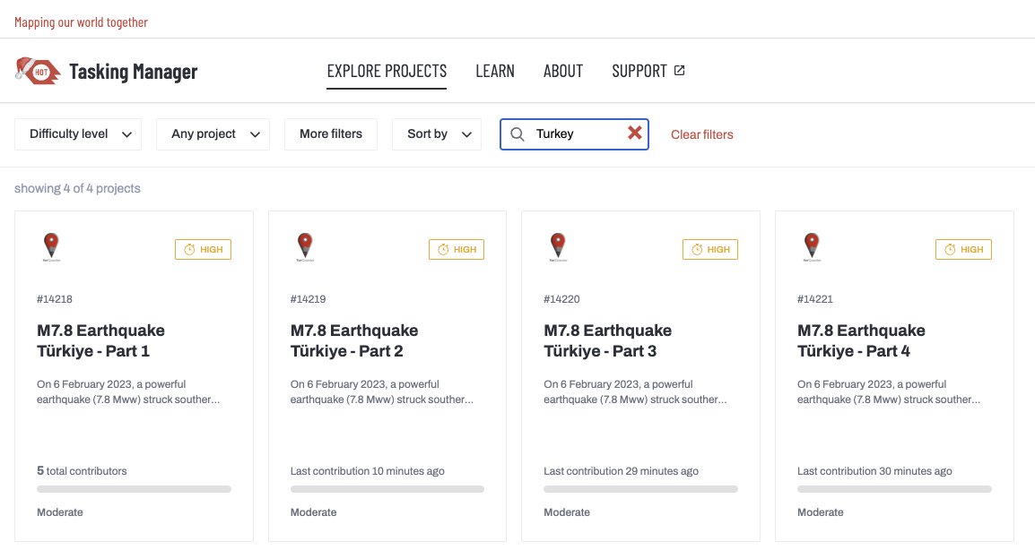
Call to Action: Map Southern Turkey
Dear @openstreetmap community,
We’re asking your help to support mapping the areas which have been terribly affected by the powerful earthquake (7.8 magnitude) in Southern Turkey. #TurkeyEarthquake
Mapping Tasks:
https://t.co/tJAi2r8OCq
@abourasrachel Thanks for the kind words. This basemap isn't in the Living Atlas, but you can access it at the link below. Feel free to use it in your own work, or customize the base/reference layers further! https://t.co/4QXMujJCdK
More than 20,000 ships sank during World War II. One man is on a mission to map them all — and is uncovering untold stories along the way. Explore this story map: https://t.co/iAHKYcXdJI
🟣 Allies
🟢 Axis
⚪ Other
Recently put together this short piece tracking Russia’s invasion of Ukraine. The maps use @TheStudyofWar’s daily-updated territorial control data, so the story should remain relevant (with little upkeep) as the conflict evolves https://t.co/g2a7m4Mb31 #StoryMap