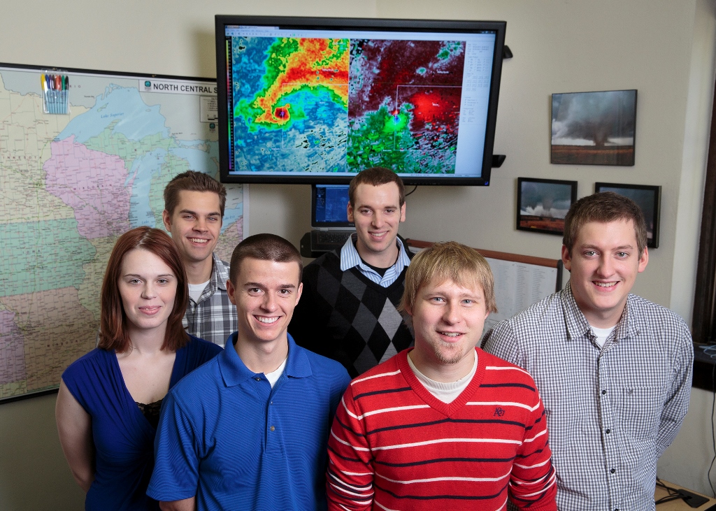
17 years ago Innovative Weather set forth on a mission to bring value to @UWMAtmoSci students, @UWM, our partners, and the community through applied experience in a weather forecast setting.
Tonight we close with that legacy in tact, and over 100 students/alumni. Thank you all!!
Another way that we're preserving IW's legacy is through this Innovative Weather YouTube channel! Here you can find videos documenting IW's impact, interviews with partners/leaders, and some preserved training materials.
https://t.co/PbhbRtOMXY
Continuing stories of IW's legacy, here's a great article telling the student perspective of our closure. Better yet, it's written by one of our closing meteorologists, Mariann Maile, and includes interviews with many others from within our program.
https://t.co/lCqHGEblmZ
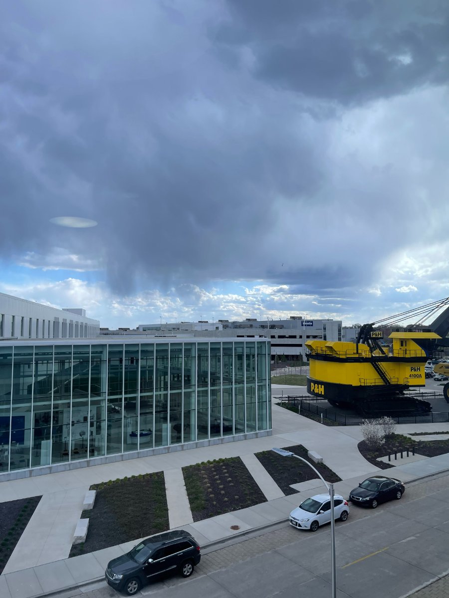
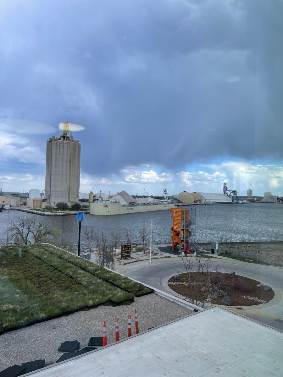
9:45am, 4/30/24: Pleasant weather today with mainly sunny skies and highs in the upper 60s lakeside to lower 70s inland. Rain and weak storms return overnight tonight, with a dry day then Wednesday and more rain Thursday. Temps hold in the mid 60s to low 70s, just above average.
4/29 3pm- Some brief light rain is moving through the area this afternoon, but otherwise pleasant conditions remain as temps approach 70! Winds stay light as well under mostly cloudy skies, and we fully look to dry out later this evening and overnight with lows in the mid 40s.
04/28, 7:30pm - Expect a beautiful spring week ahead, with plenty of spring showers balanced with plentiful sunshine. Highs in the upper 60s and low 70s are expected to start off the month of May.
04/28, 7:30pm - Expect a beautiful spring week ahead, with plenty of spring showers balanced with plentiful sunshine. Highs in the upper 60s and low 70s are expected to start off the month of May.
4/28 7am- Scattered showers are expected to continue all day today with consistent temps near 50, light winds, and some lightning. Around an additional 0.5" of rain is expected for the day, and rain chances continue overnight before finally ending later in the day Monday.
Severe storms are moving through Southern Wisconsin now until just after midnight. Damaging winds, quarter-sized hail, urban flooding and an isolated tornado is possible. Stay indoors and keep your phone near for local severe storm warnings. Storms weaken after midnight tonight!
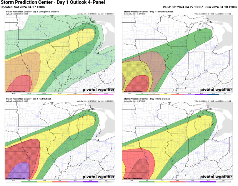
04/27 10:10a- Temps are in the high 60s to low 70s this morning with gusts to 30-40 mph across SE WI. Be on the lookout for strong to severe storms today mainly after 5-7pm where hail, gusts to 45-60 mph, and perhaps an isolated tornado are in the cards. Stay weather aware!
4/26 3pm- Scattered rain showers are now moving into the area as temps reach the mid 50s. Breezy winds with gusts to 25-35 mph continue for the rest of today along with on-and-off showers, and we then turn to much warmer conditions tomorrow with some strong storms possible later.
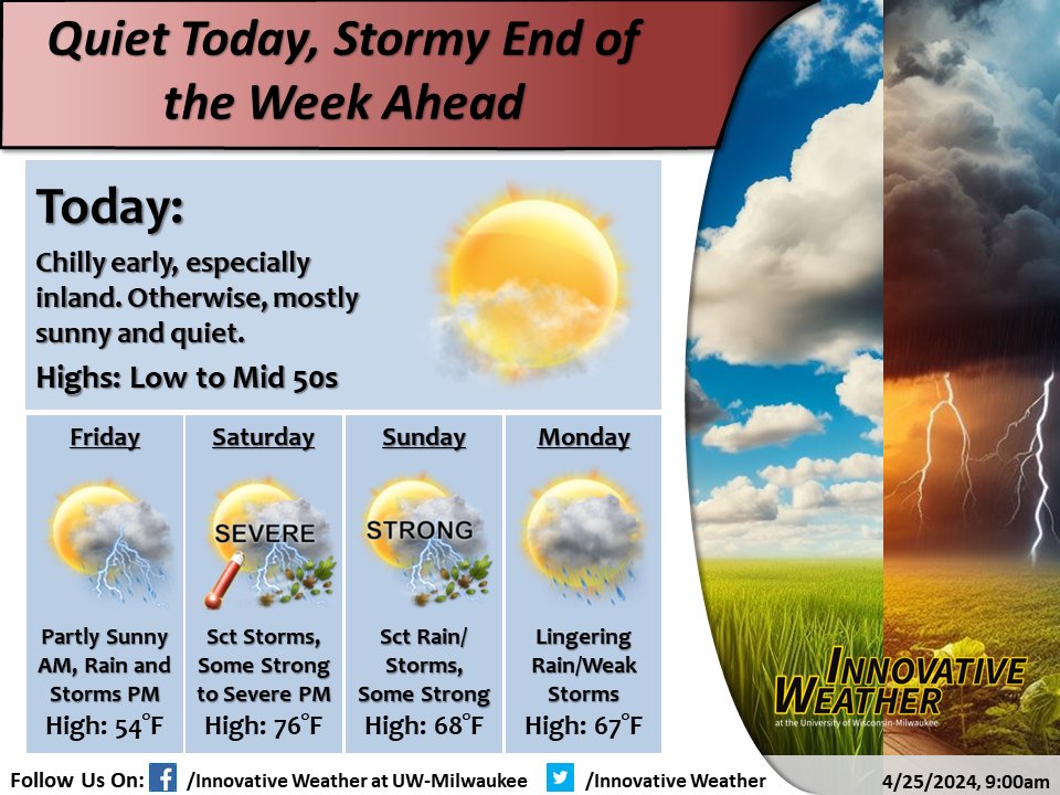
A beautiful and quiet start to our Friday but conditions will change during the afternoon as winds become breezy with chances for rain arriving. Heading into the weekend, we are expecting a warm-up into the 70s with chances for storms moving in, especially Saturday evening.
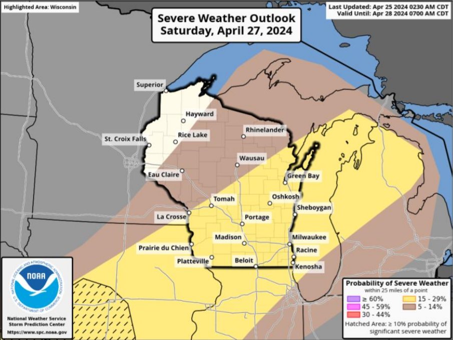
From plain rain on Friday to severe weather on Saturday, plan ahead for a rainy weekend, including the threat for gusty winds, intense lightning at times, and heavy downpours that could cause urban flooding. Here's our severe storm chances from the NWS on Saturday:
9:00am, 4/25/24: There is still a chill in the air this AM, especially inland. Fortunately, we warm today into the low to mid 50s under mainly sunny skies. We then trade the quiet for storms Friday-Sunday, with severe weather possible at times, so stay weather aware this weekend!
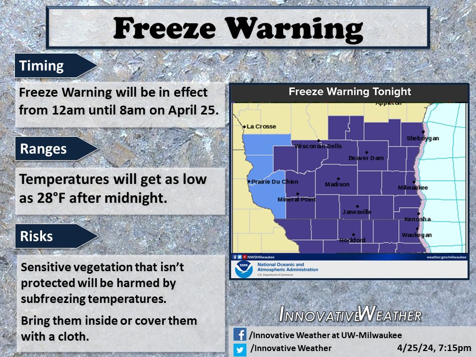
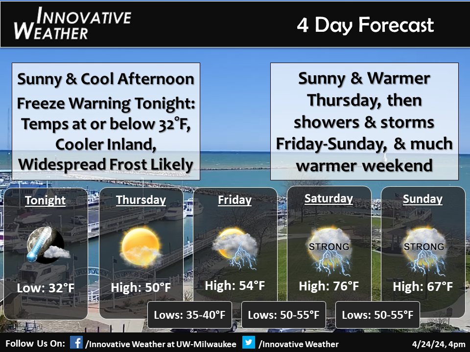
04/24, 7:15pm- Temperatures will cool fast tonight, prompting a freeze warning throughout the area. Lows will be around or slightly below freezing by the morning hours, creating a chilly start to our Thursday. Highs tomorrow will rise back to around 50 degrees by the afternoon.
04/24, 7:15pm- Temperatures will cool fast tonight, prompting a freeze warning throughout the area. Lows will be around or slightly below freezing by the morning hours, creating a chilly start to our Thursday. Highs tomorrow will rise back to around 50 degrees by the afternoon.
4/24/24, 4pm - Keeping cool and sunny for this afternoon, with current temperatures in the low to mid 40s along the lake front. Tonight, we have a Freeze Warning throughout southern WI since we'll see freezing temperatures and widespread frost by dawn.
04/23 7:10pm- This afternoon, virga painted captivating scenes in the sky, as dry air caused most of the raindrops to evaporate before touching the ground. Tonight, expect temperatures to cool rapidly, leaving us in the 30s by morning.
04/22 11:50p- We have some rain and storm chances Tuesday afternoon but be ready for a quick cool down in the evening and into Wednesday with temperatures falling from from the 60s into the 30s in 10-12 hours thanks to a cold front racing down Lake Michigan.