IEMA exists to advance the professional interests of its members and to assist Iowans in preserving life and protecting property in the face of any hazard.
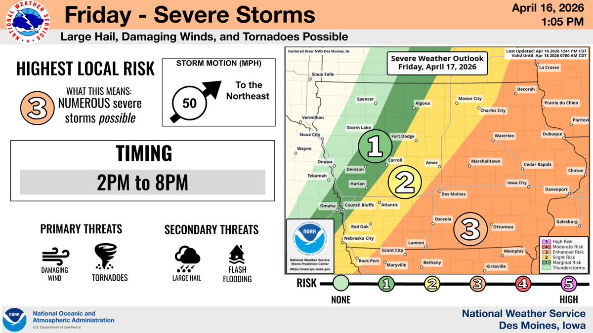
🪡🧵 We have an active stretch of severe weather ahead of us. Starting with today, there is a Level 3 of 5 risk for severe storms across central Iowa. The breakdown on the hazards are in the thread below. ⬇️ #IAwx (1/3)
Good Afternoon,
Severe weather is still on track for Iowa on Friday. Storms fire up early afternoon, moving NE before shifting east as a cold front arrives.
⚠️ Main Threats: Damaging winds & a few tornadoes. ⚠️ Secondary: Large hail & flash flooding.
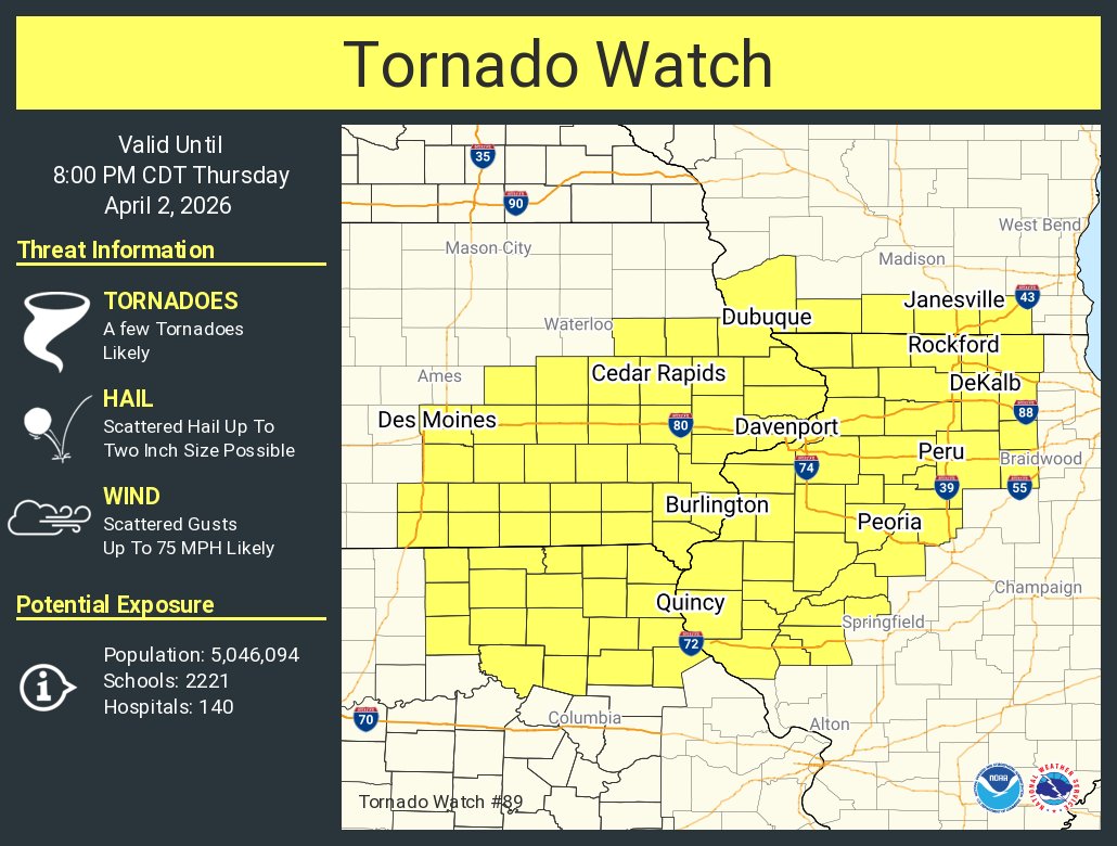
🎉 Congrats to our newest EMPD course grads! 👏 On April 2 in Des Moines, 5 emergency managers completed the 4-part training.
📸 Pictured: Dwayne Brown, Jim Reynolds, Matthew Vogeler, Richard Hall & Aaron Goodenbour.
ℹ️ Info: https://t.co/jKHAZh0a38 #IowaEMA
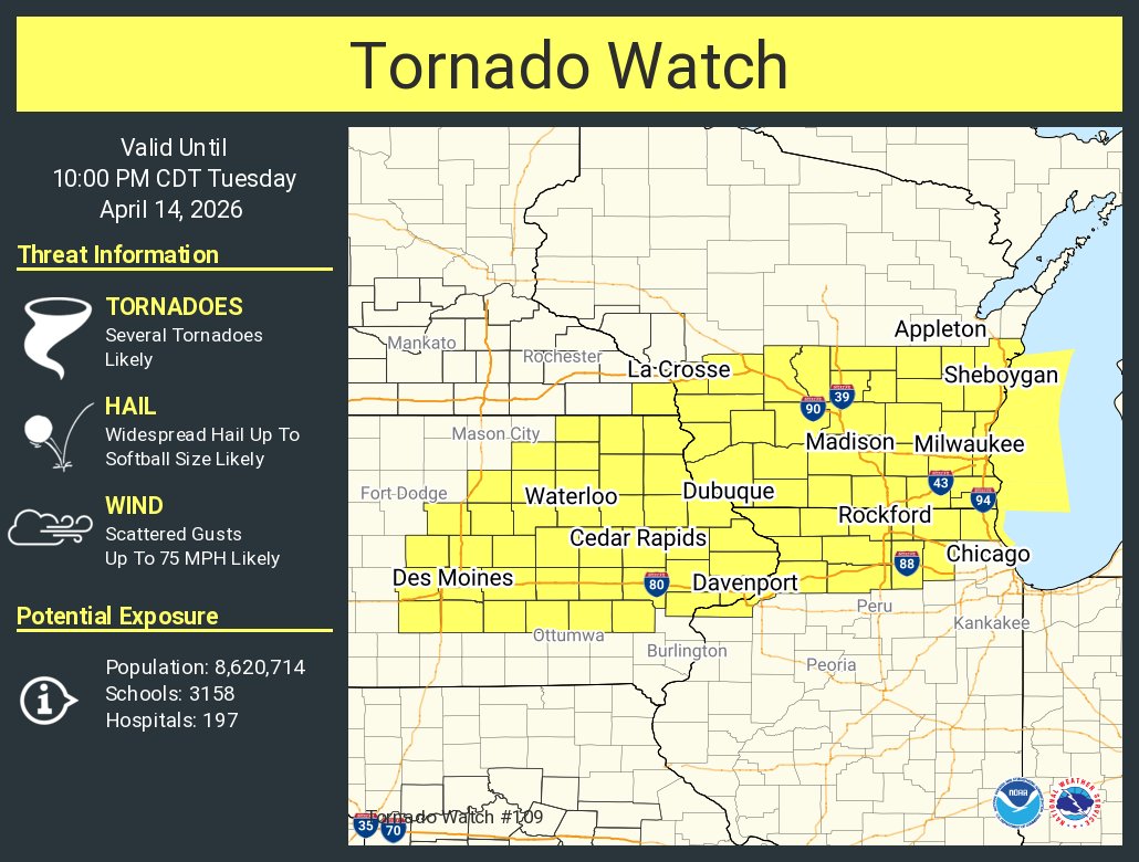
It's an active weather day ahead for Iowa! We expect the main round of severe storms from 2-11 PM with all hazards possible including wind, hail, and tornadoes. Isolated flash flooding is possible today with minor river rises in the coming days. Stay weather aware today!
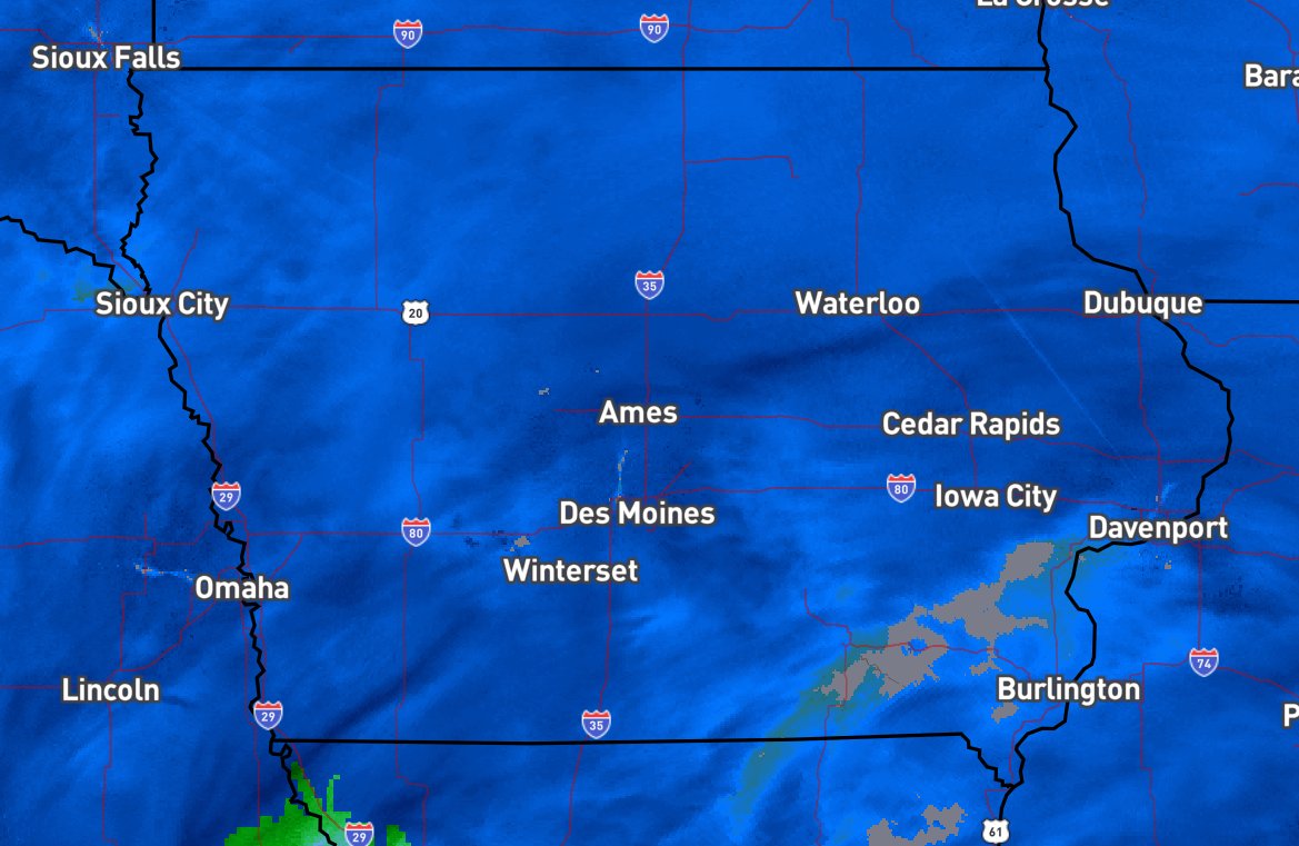
Moderate to heavy snow will spread across northern and central IA this afternoon and tonight. Northern IA will see the heaviest snow, though the band may still shift slightly.
Snow is covering all of Iowa today and making road conditions less than ideal. If you must travel, do so with extreme caution. If you can hold off a day or so, that's an even better idea.
Today, you'll want to hunker down and let snowplow crews have the roads. But if you absolutely must go, do you have your winter emergency kit in the car? Here's what you need. Build or refresh your kit now! #MustDoThis#WhatToStock#DOTISP