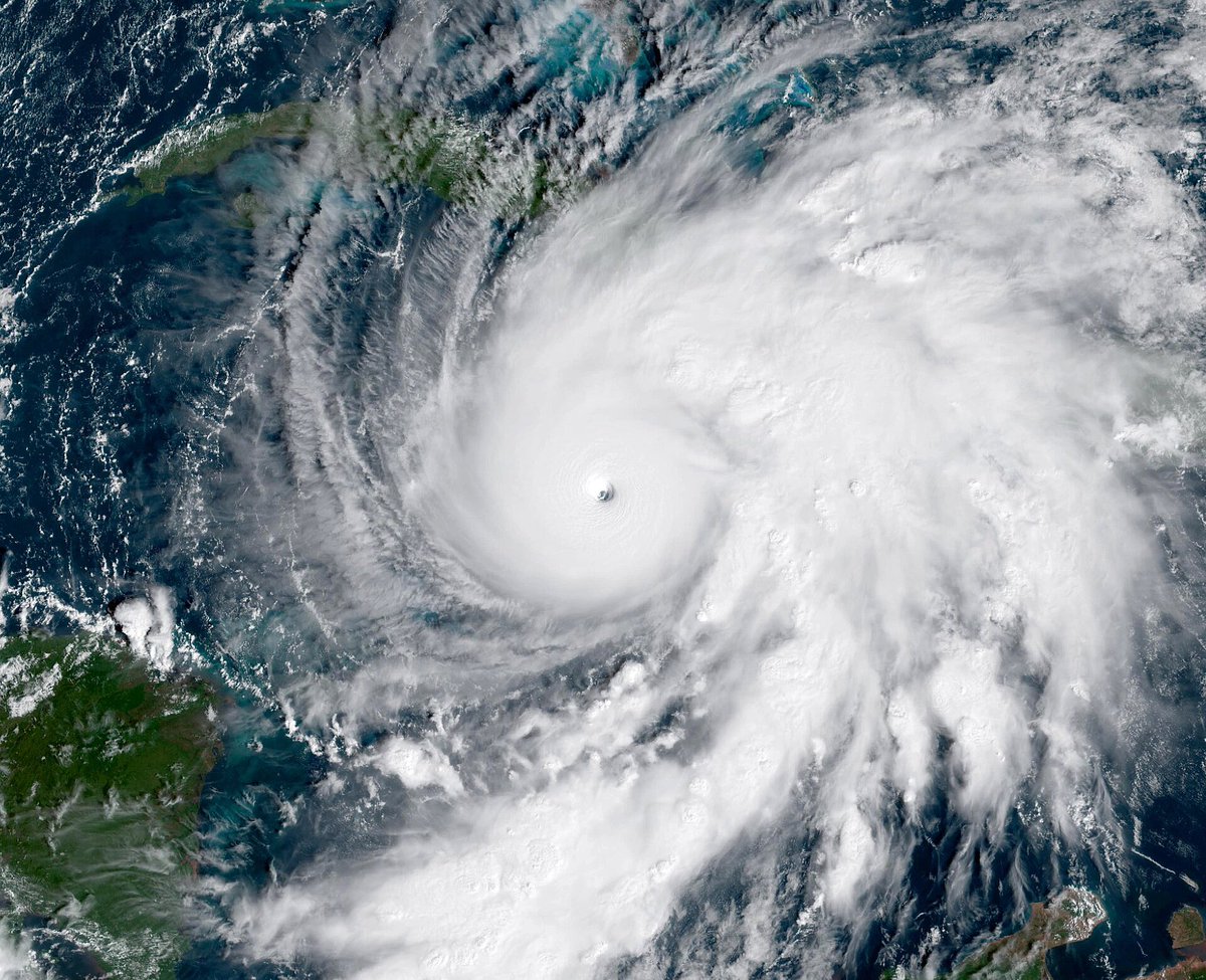
Oh yeah, Hurricane #Melissa was officially upgraded to 190 MPH, tying it with Hurricane Alan as the strongest Atlantic Hurricane on record in terms of windspeed, ever. We witnessed history.
#Melissa has single handedly been one of the most interesting tropical cyclones I’ve ever tracked or witnessed in my life. Can’t believe this all happened just this week.
Post-Tropical Cyclone #Melissa Advisory 41: Melissa Becomes a Powerful Post-Tropical Cyclone Over The Northwest Atlantic. This is the Last Nhc Advisory. https://t.co/tW4KeGdBFb
Thinking, reflecting on #MELISSA tonight as I head to bed. Hurricanes are my passion, have been and will be for the rest of my life — but they are extremely traumatic events for those impacted. Always difficult watching satellite, knowing people are losing everything before your very eyes. The feeling of helplessness is very much real. It makes putting out accurate forecasts/information all the more important to me.
I’ve studied hurricanes for years, and we always read about LABOR DAY 1935, the hallmark of all landfalling hurricanes — I never thought I’d see the day it gets rivaled. I think post-analysis finds an even stronger MELISSA — and it feels so surreal rewriting the history books for something that happened yesterday. Unbelievable. A loss for words, really.
Those that lost everything in #Jamaica are in my thoughts tonight. They endured the most powerful landfalling Atlantic hurricane in recorded history.
HAFS-B shows Melissa hitting Jamaica with 185 MPH winds, but I think this is not realistic
This run doesn’t show any EWRCs occurring which seems highly unlikely
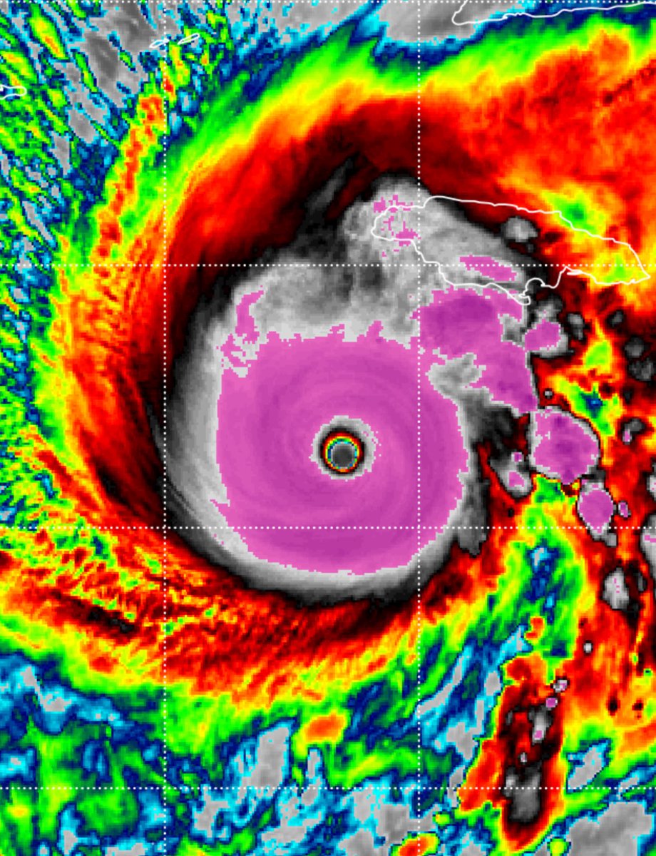
@lisamjohnson Basically they found 195-200 MPH winds sustained at the surface, but ADT is basically the satellite estimates. It set a record for the highest estimate ever, being around 870 Millibars and 215 MPH. Given this, and the RECON data of 892 millibars, an upgrade is highly possible.
Peak intensity recap of Melissa
- Highest ever ADT estimate form any cyclone on record
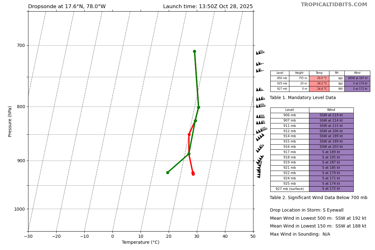
- 252mph wind gust in southern eyewall
- 892mb dropsonde with continued deepening
All that to say, it should be interesting to see the post-season analysis of this storm.
I could see a scenario where this system ends up at 195-200mph with a pressure in the 880's.
The infamous Hurricane Hunters just had one of the wildest flights in history today.
Flying straight into the heart of Category 5 Hurricane Melissa, a Lockheed Martin C-130J Hercules aircraft, call sign TEAL 75, was slammed by violent turbulence
The G-forces were so extreme they may have stressed the aircraft’s frame, forcing the crew to abort the mission and return to base in Curaçao for inspection.
Inside Melissa’s eyewall, the C-130J was thrown hundreds of feet up and down in seconds, nearly 700 feet of vertical motion within a single minute.
The crew also reported that the eyewall had a “sawtooth” appearance, an indicator of the storm’s chaotic and extreme structure.
Yet even amid chaos, the crew captured historic data, a central pressure of 893 mb and astonishing wind gust of 252 mph just above the surface, setting a world record for the highest wind gust ever measured by dropsonde in a hurricane.
The plane then spent more than 35 minutes circling inside the eye of one of the most violent storms ever observed in the Atlantic, searching for a path out of the hurricane that wasn’t filled with lightning and extreme turbulence.
These brave men and women risked their lives, without pay, to gather critical data that helped forecast the track and intensity of Melissa.
A legendary plane ride that will go down in history.
Crazy to believe we are even having the conversation that #Melissa was 200 MPH.. And now it has restrengthened into a Category 4 and is dead-eyeing Cuba next. Impacts in Jamaica are utterly catastrophic. Every image I’ve seen looks like an EF3-4 Tornado ripped through…
BREAKING: Hurricane Melissa is once again a Category 4 Hurricane, and is rapidly intensifying right now...
Eastern Cuba is about to get slammed by this powerful hurricane.