https://t.co/AuODt7qA1Yの記事にて、私が参加しました旧トラック島でのプロジェクトについて紹介して頂きました。Mapping a Wartime Past in Paradise: Interactive Chart Shows Japanese Relics on Tonoas, Chuuk https://t.co/pwO77z8MVz
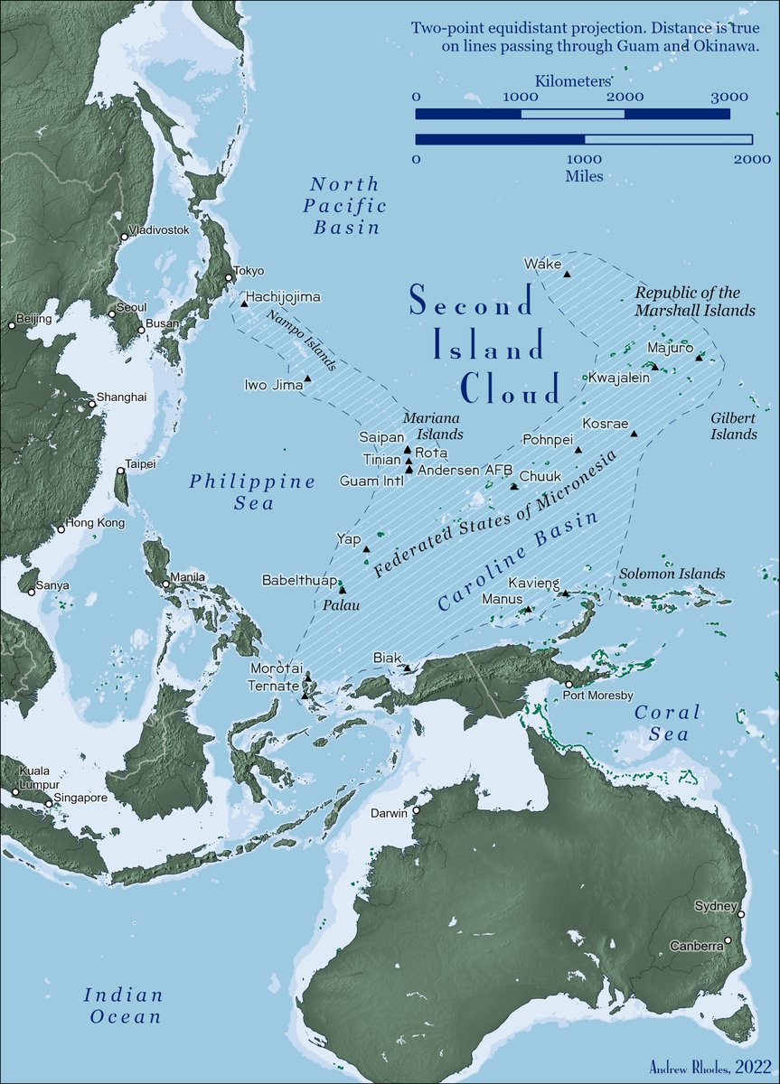
This is a superb map from @RhodesMaps. As @cdrsalamander has pointed out, it allows us a different perspective on how China & the PLA might think about creating a massive, strategic engagement zone in the western Pacific. With Aleutians on its northern flank, and PNG/Bismarks on the southern flank, it allows us to ponder - from a different perspective - what geography is critical in a future conflict. The key terrain and vital ground becomes much clearer with these kinds of maps.
Excellent feedback recently on my "Central Pacific" map, which some are now calling the "funnel map." To the conversation about island geography, I would add my 2019 JFQ piece on the "Second Island Cloud." Download printable maps and get article links at https://t.co/lF7YNA5cGR