The Emergency Notification account for @jwucharlotte. This account will only be used for emergency purposes and testing. This is NOT a monitored account.
Due to winter weather, the Charlotte Campus will have a delayed start on Thursday, February 20. Morning labs will begin at 8:30am. Students with 8am classes should check uLearn for updates. Online classes will continue as scheduled.
So far, Charlotte has some trees down across roads, about 21,000 without power, 2+inches of rain since midnight and more to come. This is your cue to be careful out there...
If your power goes out or there is a tree in the yard, 911 isn't the number you need. Contact your power company if needed or call 311 for non-emergency questions or Duke Energy for power outages.
National Weather Service reports a moderate risk of flash flooding in our area due to Tropical Storm Debby. Only a few inches of rain can be enough to make a driver lose control. If you encounter flooded roads, remember Turn around, Don't drown
Expect rainbands from Debby to begin spreading into the I-77 corridor this afternoon & evening, with heavy rain expected to begin overnight. Rain will continue off & on through the day on Thursday. (Winds will be breezy, but not a significant concern.)
Turn around don't drown!
Isolated Flash Flooding possible today as showers and thunderstorms cross the area. Slow moving storms, or storms repeatedly moving across the same area, could produce excessive rainfall that could lead to localized flooding. Stay weather aware into the evening. #ncwx#scwx#gawx
Another very hot and humid day, with scattered afternoon and evening showers and storms. A Heat Advisory is in effect for the city of Charlotte and surrounding areas. The pattern will become steadily more active and cooler(!) through the end of the week.
Severe Thunderstorm Warning including Charlotte NC, Gastonia NC and Charlotte/Douglas Airport NC until 4:45 PM EDT. This storm will contain wind gusts to 70 MPH!
A dynamic storm system brings rain and embedded t-storms to our area from late tonight through Thur morning. Heavy rainfall is expected which could cause localized flooding. A severe storm or 2 producing damaging wind gusts and perhaps a brief, weak tornado cannot be ruled out.
⚠️ Stay Weather Aware Tonight! ⚠️
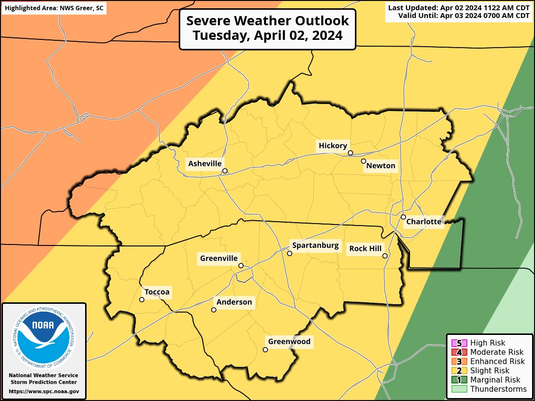
⛈️🌪️ Strong to severe storms are expected this evening into late tonight. Any severe storm will be capable of producing damaging wind gusts, large hail, and isolated tornadoes. Make sure have multiple ways to receive warnings! #scwx#ncwx#gawx
REMINDER: The 2024 Annual Statewide Tornado Drill for South begins in one hour and an hour and a half for North Carolina as part of Severe Weather Preparedness Week.
#scwx#ncwx
Quiet weather abruptly ends today, as very gusty winds are expected to develop, continuing through at least Wed. Much of the area will see frequent 25 to 35 mph gusts. Gusts as high as 50 mph possible across the high elevations. Otherwise, expect showery and warm conditions.
A cold front will approach the region today with rain chances starting this evening into early Friday morning. Totals amounts will range from a 1/4"-1/2+" before the rain pushes out by Friday afternoon. A few rumbles of thunder will be possible Friday morning. #scwx#ncwx#gawx