Another El Niño Record! Watch as heat “back ups” at the end.
The heat building below the surface, which fuels the strength of El Niño, is higher than it’s ever been measured. This animation shows the heat just below the Tropical Pacific Ocean, moving from the West Pacific Warm Pool where it’s stored, to the East Pacific Surface where El Niño forms. Notice how at the end of the movie there’s a “heat backup” - like a traffic jam. That means there’s a lot more heat waiting under the surface to intensify our current El Niño event. It lends more evidence that this will be the strongest El Niño on record, and may end up reaching the high-end model scenarios. We’re already seeing the impacts: from a quiet Atlantic hurricane season, to an already invigorated subtropical jet stream with heavy rain along the #Gulf Coast, to big heat waves around the Globe. Come winter it will mean a very intense subtropical jet stream with a lot of heavy rain in the Southeast & #florida and likely frequent squall lines with severe weather and potential tornadoes 🌪️ #ElNino
Thanks @cyclonicwx for the great subsurface animation!
C'est plus possible d'accepter les épandages aériens la géo ingénierie, chaque fois après la température monte en flèche 🥵🔥🥵🥵 de 10 degrés au-dessus des normales de saison et nous respirons les particules chimiques.
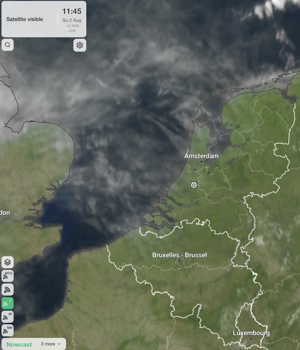
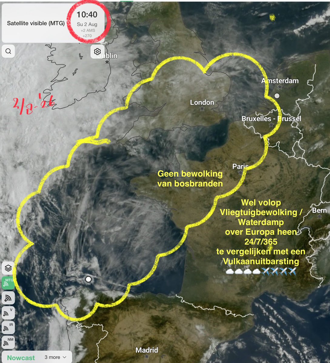
Geen rook van bosbranden!!!
Echter wel volop VLIEGTUIGBEWOLKING wat over Europa trekt
VLIEGTUIGSMOG / WATERDAMP
VERANTWOORDELIJK voor de huidige klimaatverandering met bijkomende extremen
De straalstroom wordt hierdoor verstoord, vergelijkbaar met een vulkaanuitbarsting ☁️☁️✈️✈️
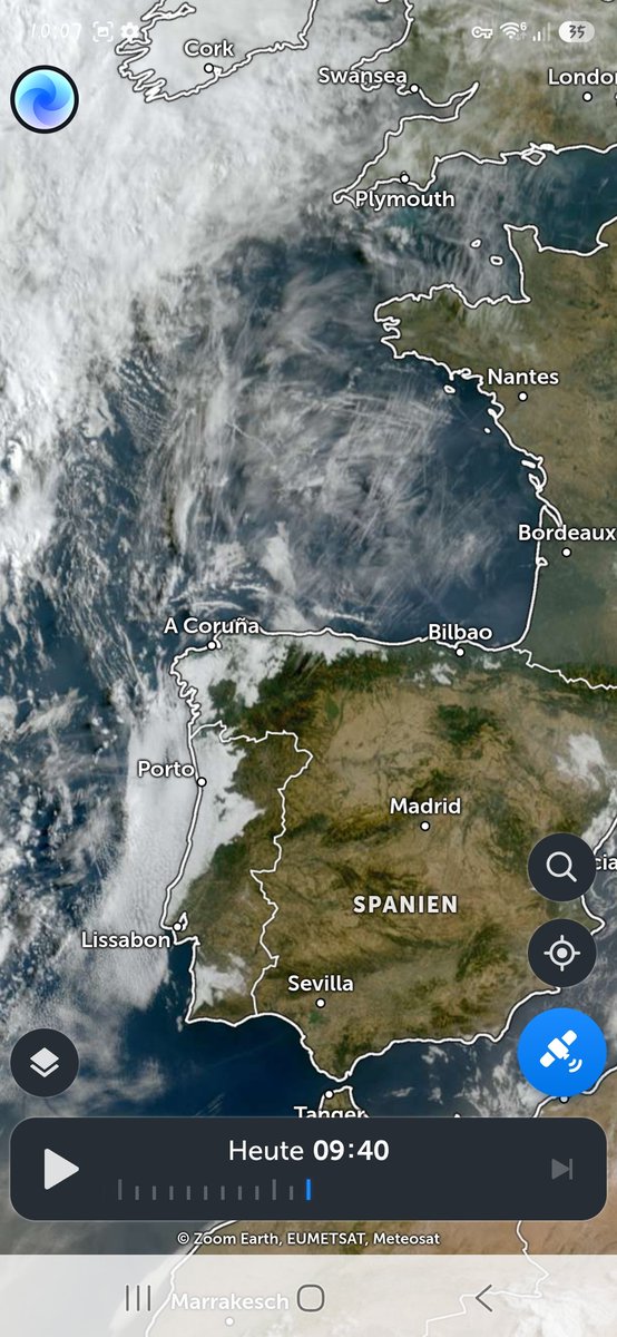
@RobertvanWaning Op de satellietbeelden goed te zien, gaat 24/7/365 door, vaak ook onzichtbaar doordat er geen condensatie plaats vindt.
Wat explosief naar voren komt bij een temperatuurdaling, met celvorming bij een onderliggend lagedrukgebied ☁️☁️✈️✈️
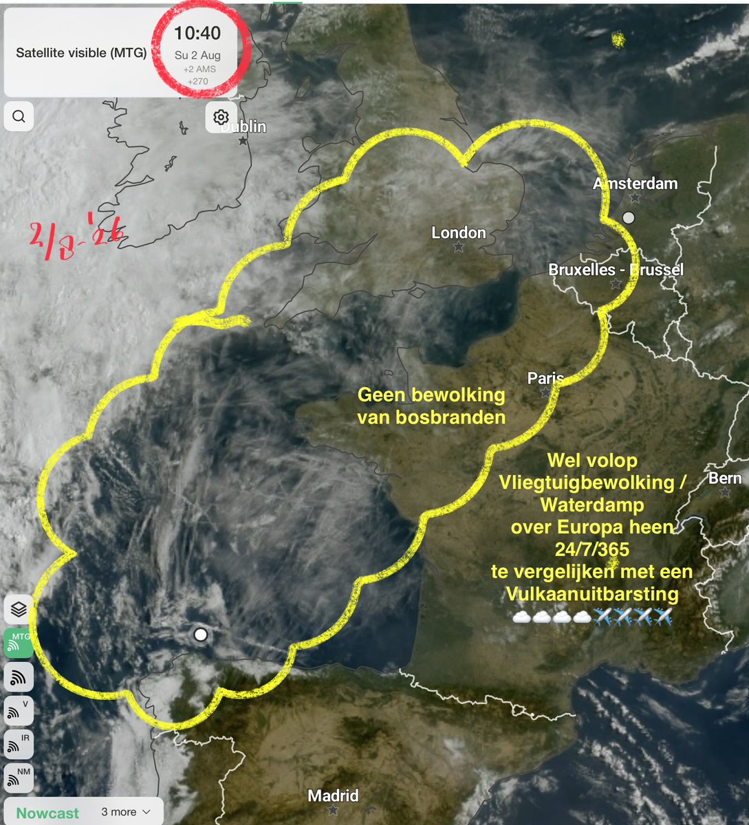
Geen rook van bosbranden!!!
Echter wel volop VLIEGTUIGBEWOLKING wat over Europa trekt
VLIEGTUIGSMOG / WATERDAMP
VERANTWOORDELIJK voor de huidige klimaatverandering met bijkomende extremen
De straalstroom wordt hierdoor verstoord, vergelijkbaar met een vulkaanuitbarsting ☁️☁️✈️✈️
EXTRAORDINARY HEAT IN NORTH AFRICA
Harshest heat wave in history continues and intensifies with >48C in MOROCCO and MINIMUMS >36C at Tata
.
Record hot nights smashed including at Fez with min 29.9C.
In Just 1 day,nearly 200 countries and territories have broken August records.
Early this morning, heavy flooding occurred after the Rehue River overflowed in Villa Arboleda, Angol, Chile. Emergency teams evacuated residents from the affected areas.
Slowakije, Tsjechië, Oostenrijk ook in diverse problemen door watertekort en en lage waterstanden...
Hongarije sluit de kerncentrale 😂 dus het is duidelijk dat kerncentrales geen goed idee zijn..
#klimaatnoodtoestand 🌎🔥🔥💀💀
https://t.co/XXtJEtqqaa