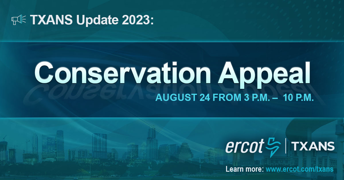
(1/2) TXANS Update—August 24, 2023: ERCOT has issued a Conservation Appeal for today, Aug. 24, from 3 – 10 p.m. due to extreme temperatures, continued near-record demand, and forecasted low wind-power generation. Tight grid conditions are expected this afternoon into the evening.
(2/2) TXANS Update—August 24, 2023: ERCOT is requesting Texans to conserve electricity use, if safe to do so. For more information, energy-saving tips, and to sign up for #TXANS emails, visit: https://t.co/rWMslT4y8Q.
A few light showers are beginning to develop across portions of the southern Edwards Plateau and Hill Country. This activity is generally moving to the northeast around 20 mph. Only light rain is expected at this time.
Several progressives face challenges in their first bids for reelection, while the business groups are once again flexing influence. https://t.co/oWR3E7IyBA
Congratulations to all the candidates who participated in LPBexar's 2023 Candidate Survey, showcasing their dedication to Libertarian principles of limited government intervention and individual freedom. Check out the survey results here: https://t.co/mQ2tFpZZwb
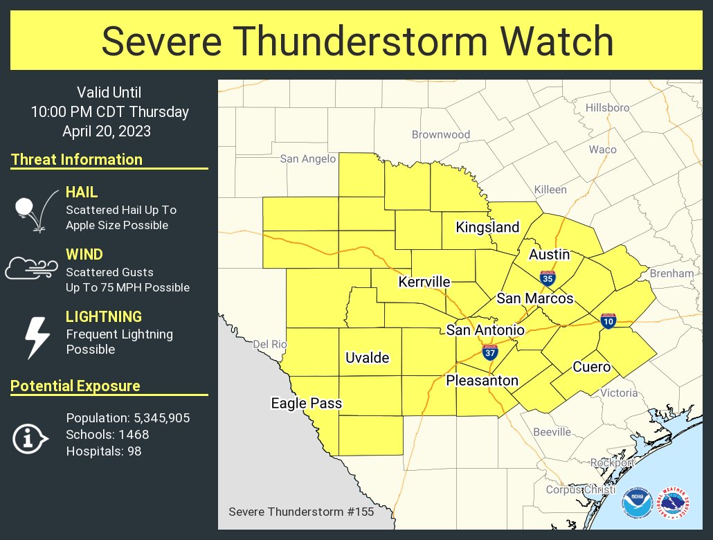
SPC has increased the size of the enhanced risk of severe storms to cover more of the Coastal Plains and I35/I37 corridors for the expected storms late this afternoon and evening. #txwx#ctxwx#severeweather
Showers and storms will be possible this afternoon & evening and once again Wednesday evening. Level 1/5 and 2/5 risks are forecast by @NWSSPC over Hill Country, I-35, and the Coastal Plains each day. Large hail and damaging winds are the primary concerns today and Wednesday.
Tomorrow: Severe thunderstorms with the potential for giant hail, a risk for a couple of tornadoes, and severe gusts will be possible late afternoon into the night across parts of the central states.
Find and follow your local nws office for the latest: https://t.co/GWrG0hTRHN