A High Wind Warning has been issued for Friday as a potent storm system brings strong winds across the region. Southwest winds of 25 to 35 mph Friday morning will become west by the afternoon, with gusts of 50 to 60 mph expected.
Despite the rain across portions of the area this week, drought/abnormally dry conditions persist areawide. Extreme Drought (D3) conditions spread across locations that had very little rainfall. This is the most widespread D3 conditions have been for the local area since 2000.
❄️Many areas will see their first frost of the season tonight and Thursday night. Here are graphics showing the climatology of first frost/freeze at climate sites in our forecast area. Most of the region typically sees their first frost in early to mid October.
FORECAST: Another near-perfect day! ☀️ How much longer will the stretch last? Meteorologist @JennHarcher breaks down the details in the story link below:
https://t.co/lpCyD4sFp1
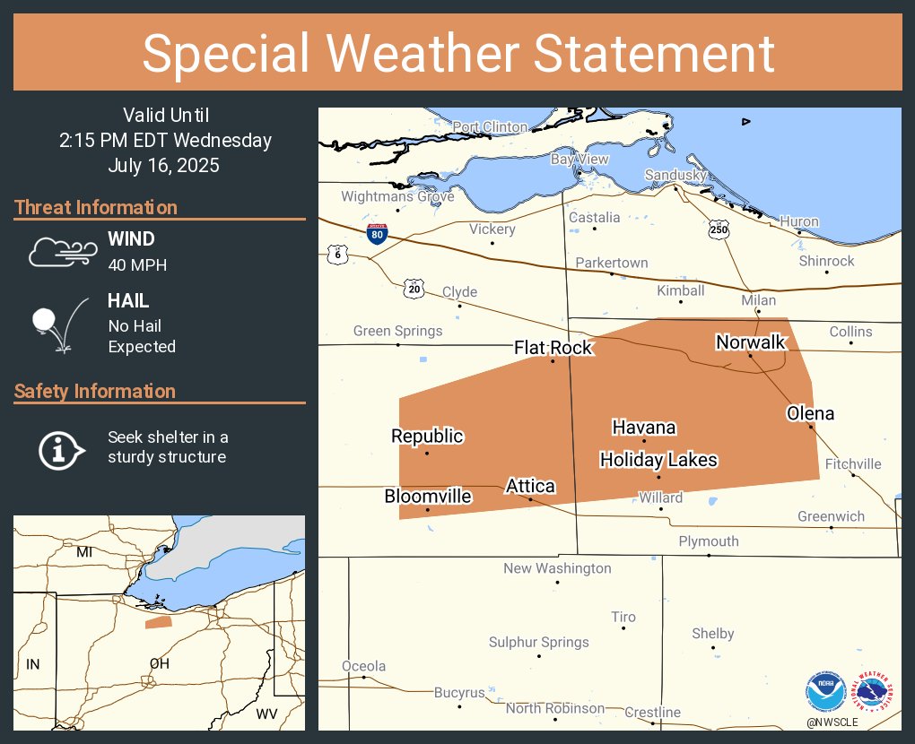
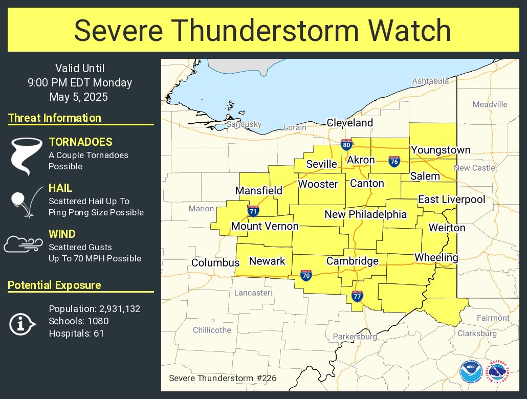
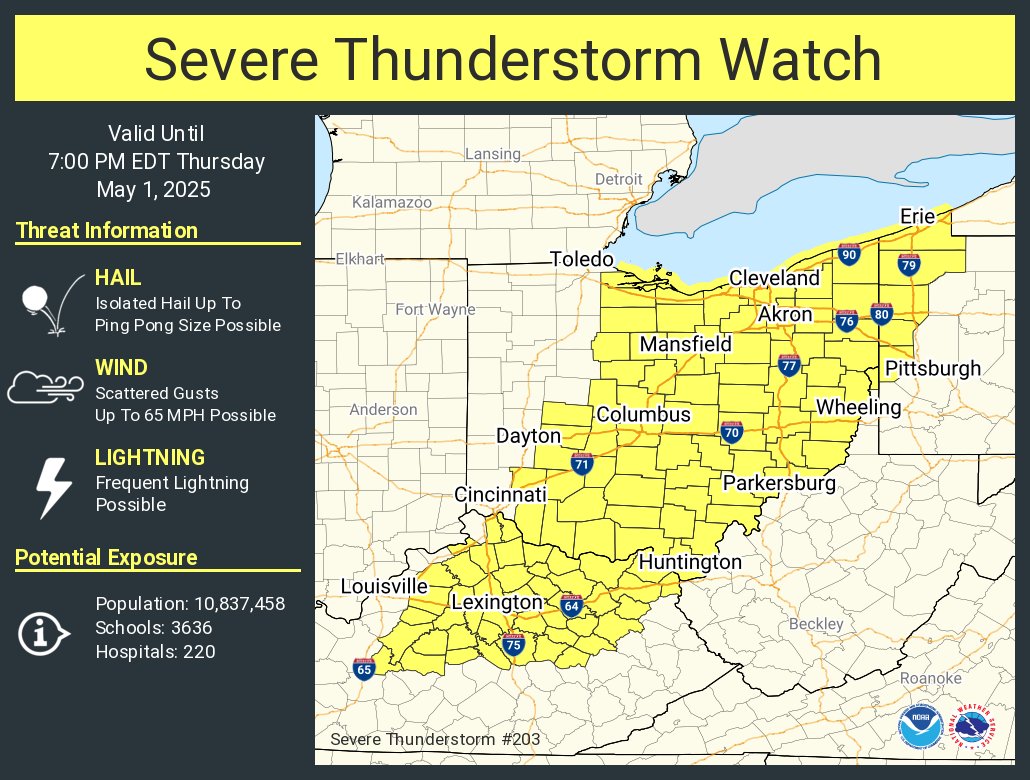
SEVERE THUNDERSTORM WARNING continues until 1:15 (6/27) for Eastern Cuyahoga, Lake and Geauga. The line of storms is moving NE at 40 mph with 60 mph winds.
@fox8news#Friday
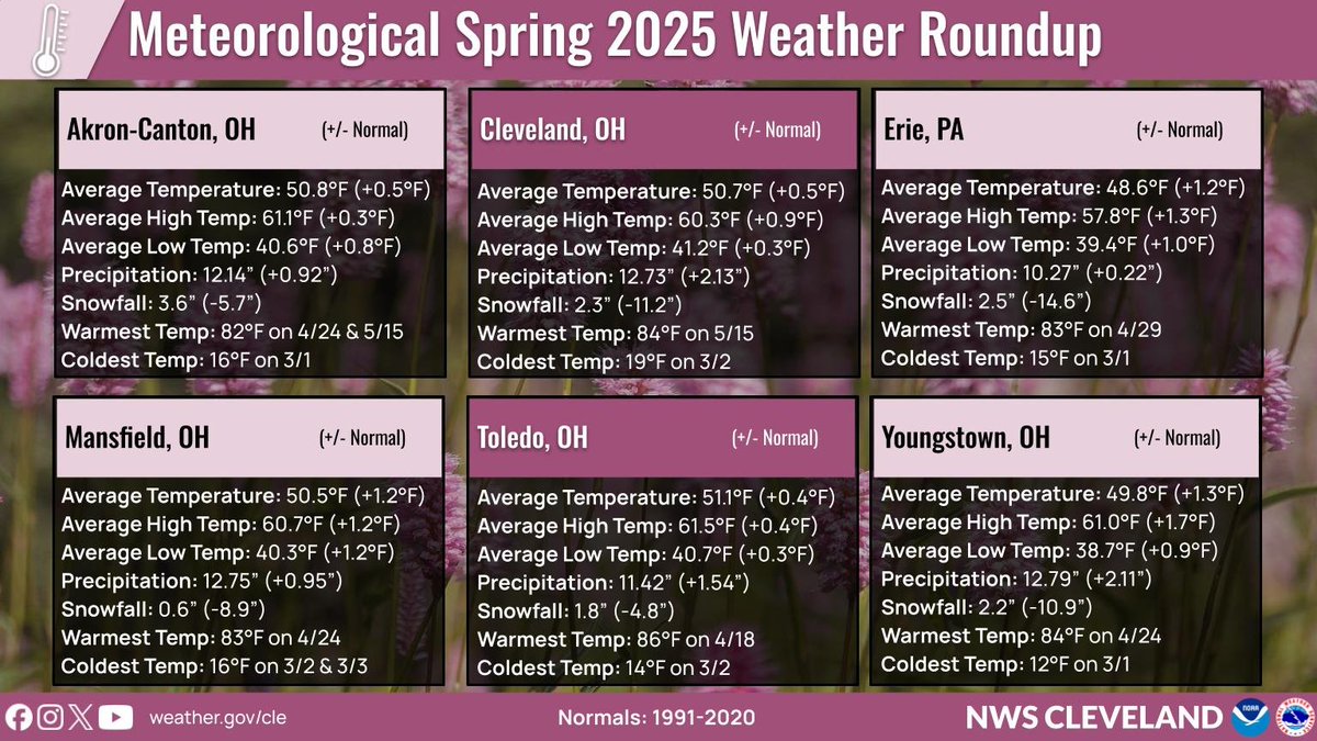
Spring 2025 temperatures averaged a little above normal across Northern Ohio and Northwest Pennsylvania. Precipitation for the March through May time period was above normal but snowfall well below normal. #ohwx#pawx