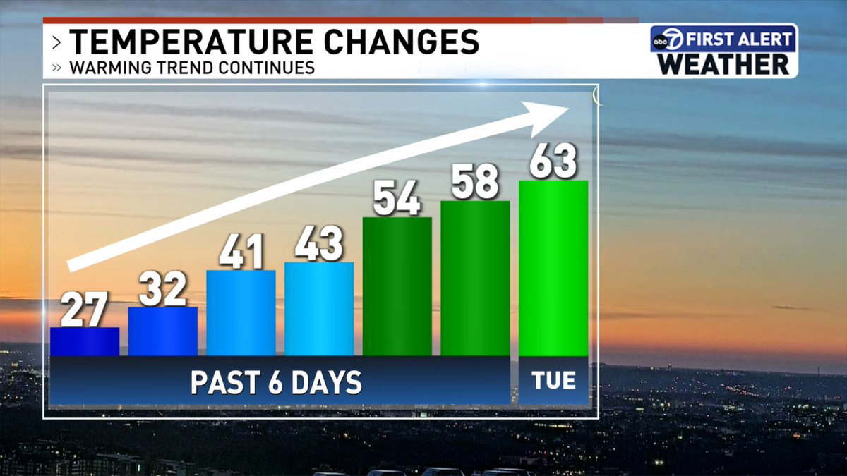
This is the kind of trend I think many of us can get behind. We will have more clouds around today, but the warmer air lingers. There is a slight (20% chance) of a sprinkle but most of us remain dry! @7NewsDC@WTOP
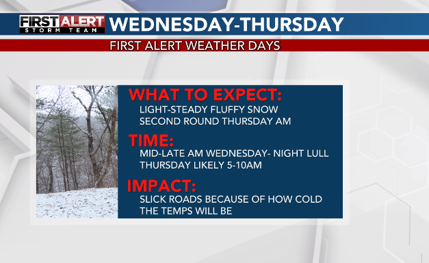
Our snow comes in two parts. Wednesday snow showers all day, lull by late evening and overnight and round 2 Thursday am with some bursts. I think that's when we'll have more road issues honestly is Thursday am.
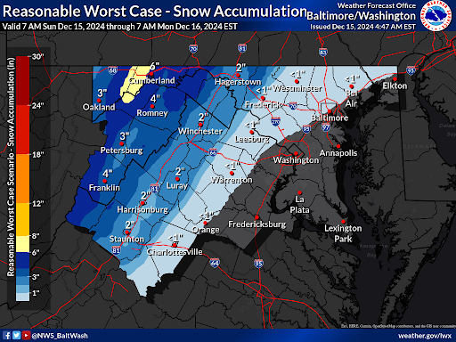
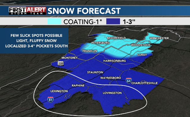
This will take a while to accumulate
⚠️Multiple Hazards Expected Sunday into Monday⚠️
🍃Winds - High Wind Warnings (55-65 mph gusts) & Wind Advisories (up to 50 mph)
⛰️❄️Mountain Snow - Blizzard Warnings for combination of 55-65 mph winds and accumulating snow
Slight increase, biggest reason is the evening round
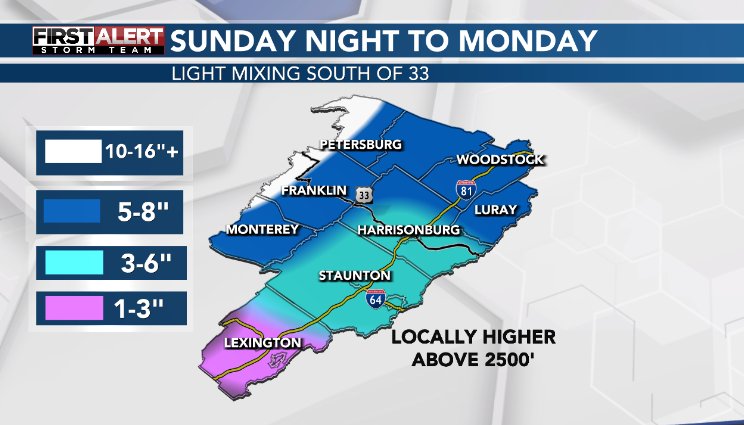
You will not wake up to all Monday am. It will be lighter & lingering thru the day. 2nd round of dry, fluffy snow Monday evening which adds a good 1-3" because of colder temps.
Glaze for most, up to 0.20" icing south of Rt33
There won't be much melting between Monday and then whatever melts next Tuesday with the sun. Clear what you can because we'll drop below freezing Tuesday with sunset and stay below freezing through next weekend.
Short window to clear and for pavement to dry out
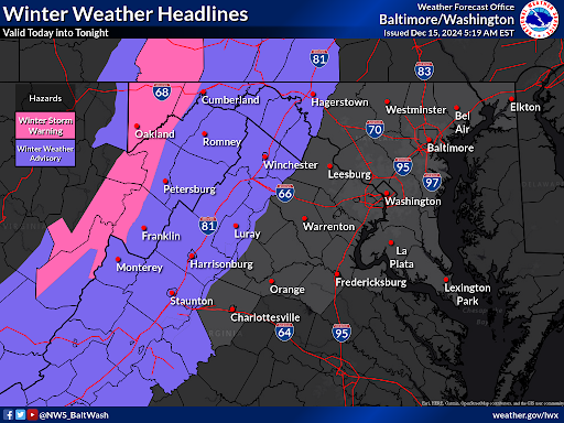
Winter Weather headlines remain in effect for today into tonight along and west of the Blue Ridge. Travel could be hazardous at times today in these areas as snow, sleet, and freezing rain move through.
#Milton is now a Category 5 #hurricane with max winds of 160 mph. Milton joins Michael as the only October Category 5 hurricanes in the Gulf of Mexico in the satellite era (1966-onwards).
The Town of Black Mountain is asking folks to hold off on donations for a few weeks.
We are overwhelmed with supplies. Some churches are even having to turn supplies away. It’s a logistics nightmare.
We’ll need help for MONTHS. It’s a marathon, not a sprint.
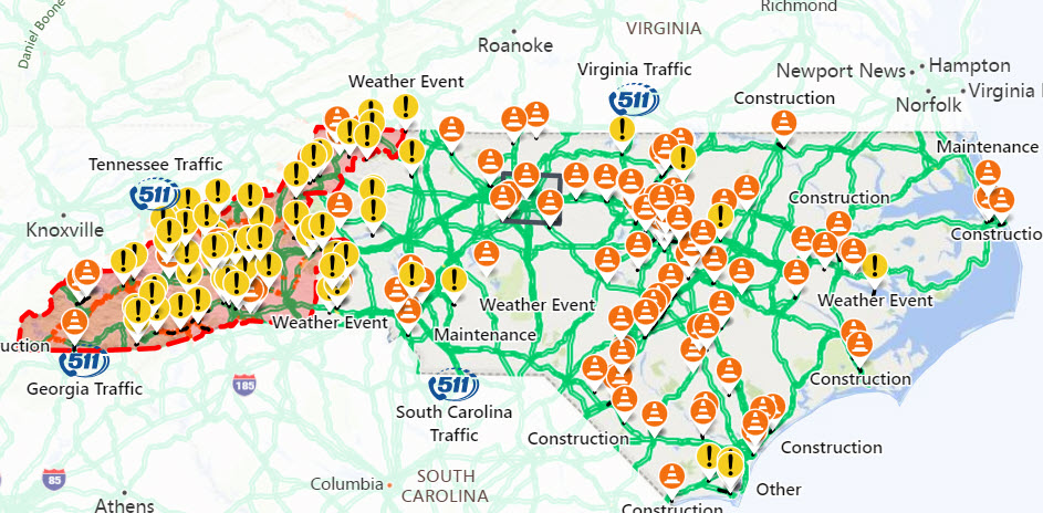
As of this morning, over 400 roads remain closed in NC. All roads in Western NC should be considered closed.
Remember: As crews work to clear and inspect roads and bridges, please give them room.
Go to https://t.co/AGDVnBcrXk for the latest road information.
#Helene has strengthened into a Category 1 Hurricane!
Forecast still has Helene strengthening into a major hurricane before landfall along the Florida coast.
For Central Ohio impacts, we could see a slim chance for a few showers into the weekend.
@nbc4i#ohwx
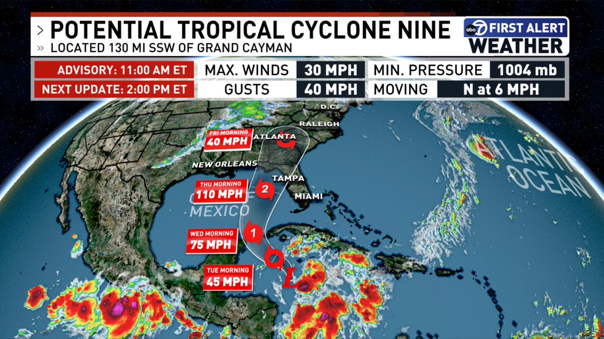
Potential Tropical Cyclone Nine has formed! Forecast to become a hurricane by Wednesday before a gulf coast landfall, we will be tracking the all week long. @7NewsDC@WTOP