[1/2] 5pm EDT: Preliminary post-landfall analysis of storm surge from Hurricane #Milton indicates peak water levels reached 5 to 10 feet above ground level between Siesta Key, FL and Ft. Myers Beach, FL, including Charlotte Harbor.
Preliminary post-landfall modeling of storm surge from Hurricane #Helene indicates areas within the Big Bend region of Florida near Keaton Beach, Steinhatchee, and Horseshoe Beach had water levels reach more than 15 ft above ground level.
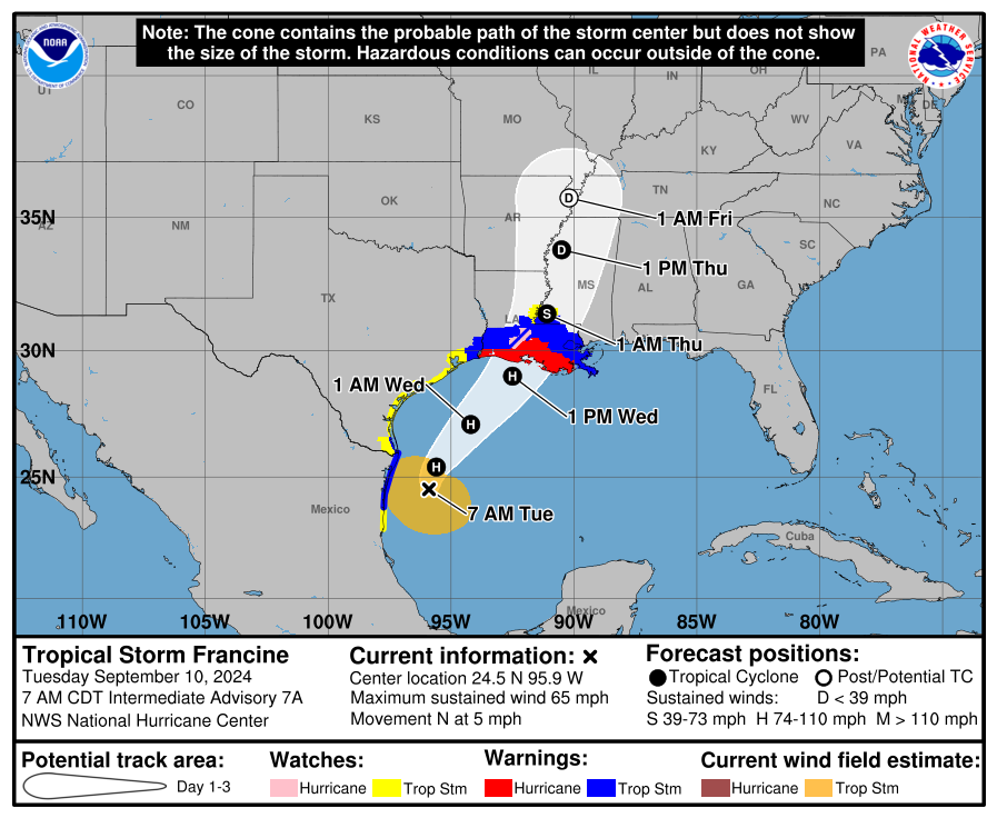
7am CDT Sep 10th Update on Tropical Storm #Francine.
Coastal Hurricane Warnings have been extended eastward to Grand Isle, LA. A Tropical Storm Warning is now in effect to the mouth of the Pearl River, including metropolitan New Orleans.
Latest update: https://t.co/b0277jkLwh
As the threat for rip currents increases across most of the East Coast due to #Ernesto, NHC Meteorologist Cassie Mora explains what a rip current means and some safety tips in case you get caught in a rip current. https://t.co/0mWgQAMGga #NOAA#ripcurrents@noaaocean
NHC Deputy Director Jamie Rhome talks about the importance of staying safe from #ripcurrents from #Tropicalstorm#Ernesto in the East Coast. For the latest forecast visit: https://t.co/4FxamOH94G #NOAA#NHC#FL#GA#SC
In our new blog post "NHC Cone Heads in a New Direction," we discuss NHC's new experimental cone of uncertainty, which will include inland tropical storm and hurricane watches and warnings in effect for the continental United States.
Read more here: https://t.co/wcAmQNuxwn
The National Hurricane Center will begin issuing an experimental Tropical Cyclone Forecast Cone Graphic on our around August 15, 2024, that includes inland tropical storm and hurricane watches and warnings for the continental U.S.
Read more here: https://t.co/zHGVE26Avz
2/1 at 9am: The National Hurricane Center (@NHC_Atlantic) will be implementing a new experimental cone graphic beginning on or around August 15th 2024.
This experimental graphic will help better convey wind hazard risk inland in addition to coastal wind hazards.
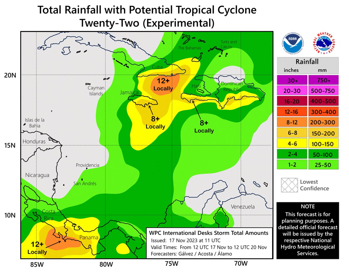
NHC and @NWSWPC are beginning to issue experimental graphics for rainfall associated with tropical cyclones affecting Caribbean and Central American locations.
For more info and to provide comments, refer to the Public Information Statement: https://t.co/xSTcjkk5BC
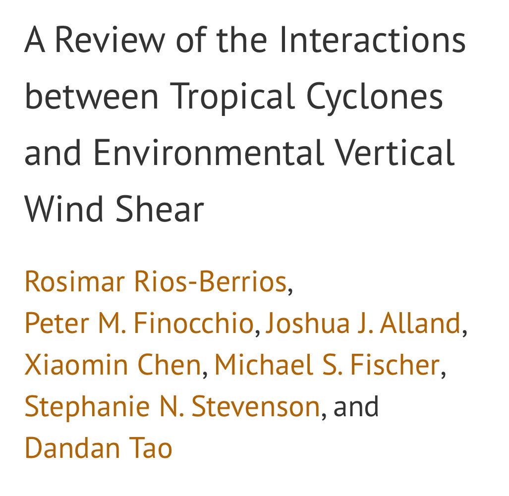
I’m beyond excited to share this manuscript just posted to Early Online Release. This review article took several years from vision to draft to acceptance. It was truly a team effort. We hope it’s going to be helpful to the community!
https://t.co/7cSZvX7xNK
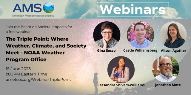
The @ametsoc Board on Societal Impacts is excited to announce a new webinar series bringing together the social, behavioral, and economic sciences and societal impacts within the weather, water, and climate enterprise. See the flyer for our first event and registration link!
Today's Hurricane Preparedness Week theme is Know Your Risk: Water & Wind. This @NOAA@NWS video shows important tips to help keep you and your family safe.
At the @ametsoc AMS Annual Meeting next week, we are organizing a special symposium to honor the remarkable career of Dr. William Hooke. We hope to see you at the William Hooke Symposium on Wednesday! #SocImpacts#AMS2023
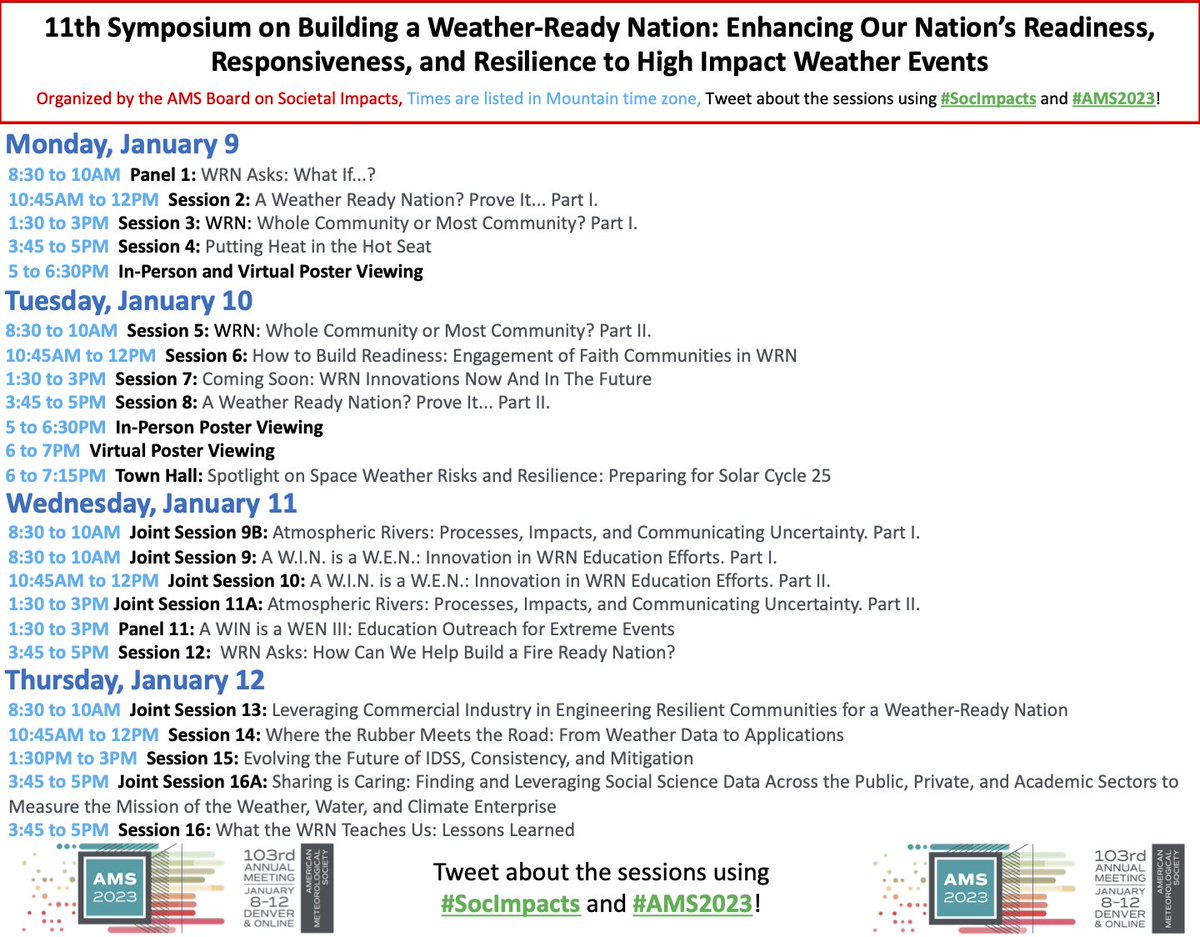
The @ametsoc AMS Annual Meeting is next week! Please see the attached flyers for two fantastic Symposia we are organizing - Societal Applications and Building a Weather-Ready Nation! We hope to see you there! #SocImpacts#AMS2023
Here's a look at temperatures over the last 2 days, as the cold air outbreak spread across the country east of the Rockies. Many locations across the Midwest into Ohio failed to reach 0F during daytime today.
You can see the bomb cyclone deepening over Quebec by the end:
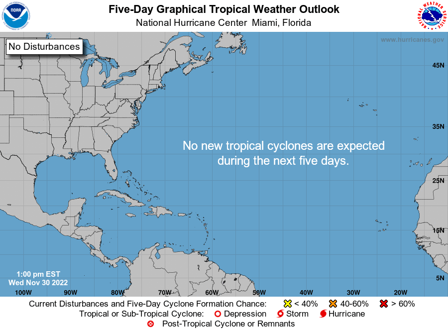
1pm EST 30 Nov -- Today is the Last Day of the 2022 North Atlantic Hurricane Season.
Happy to report it remains quiet in the tropics today with no tropical cyclones expected during the next 5 days.
https://t.co/QnemzPKS0D
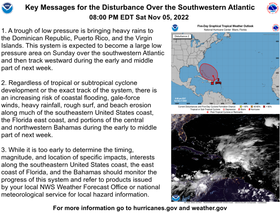
8 PM EDT Saturday November 5: Here are latest Key Messages for the disturbance over the southwestern Atlantic. Regardless of development, there is an increasing risk for impacts along the SE U.S. coast and the east coast of Florida. For the latest info: https://t.co/tW4KeGe9uJ
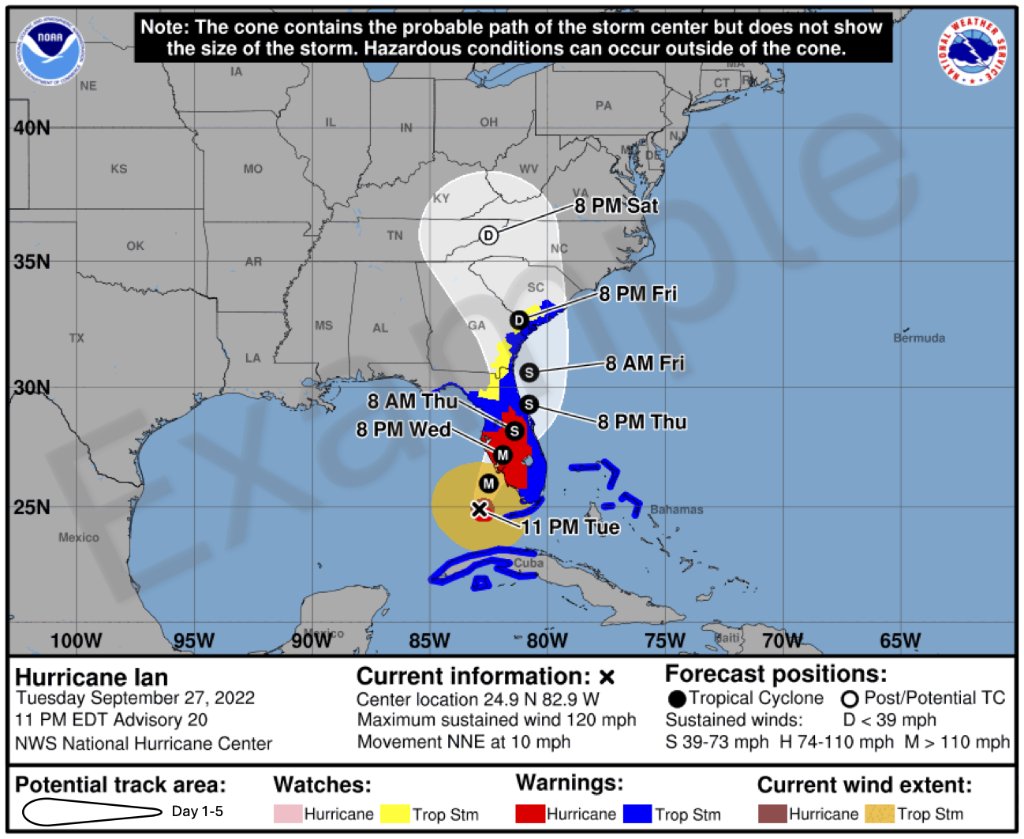
The hurricane cone sparked lively debate in the aftermath of Hurricane #Ian. @NWSNHC Acting Director Jamie Rhome weighs in to dispel myths and answer some of the more pressing questions about the cone’s utility and future.
https://t.co/nnT5J9K7bM