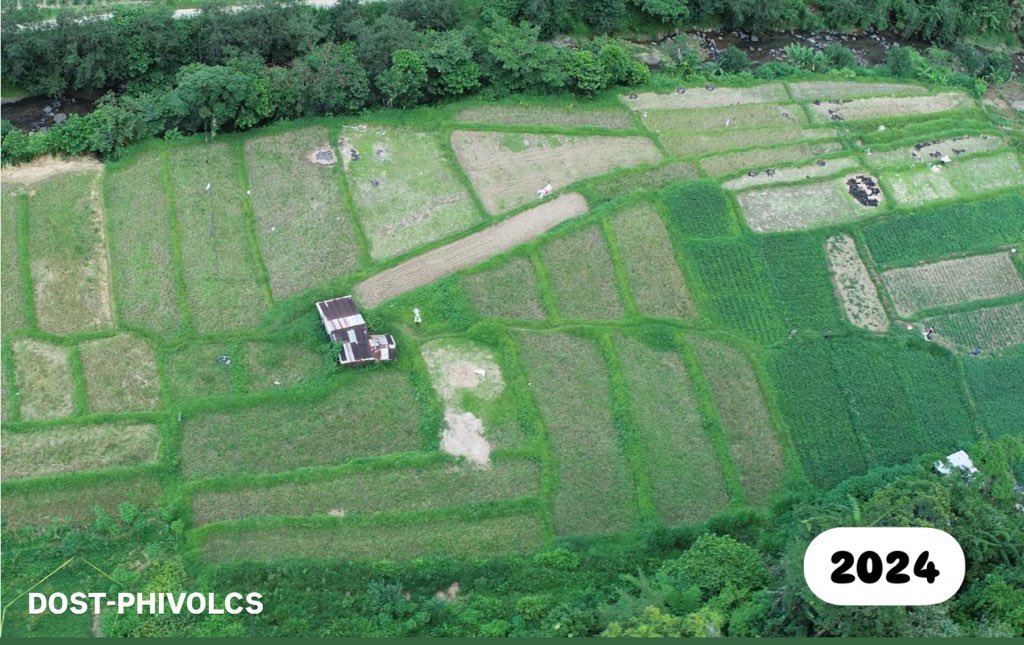
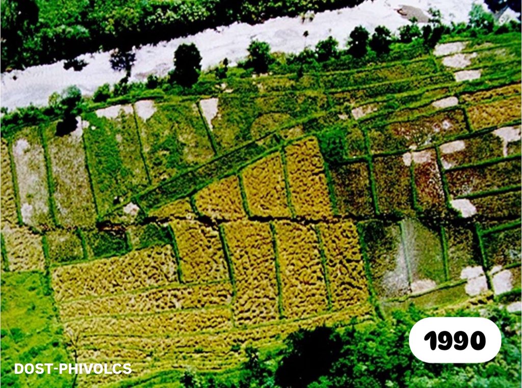
#OnThisDay in 1990, the Digdig segment of the Philippine Fault generated a M7.8 earthquake in Luzon, producing a ~125 km surface rupture with ~6m maximum left-lateral offset.
Thirty-four years later, we revisited a section of the rupture and found the fault offsets still visible
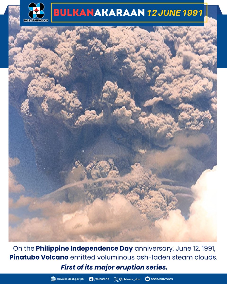
#𝐁𝐮𝐥𝐤𝐚𝐍𝐚𝐤𝐚𝐫𝐚𝐚𝐧 I On June 12, 1991, three days before the Pinatubo’s cataclysmic eruption, a huge cloud of volcanic ash and gas rose up to 20 kilometers above Mt. Pinatubo
Source: FIRE and MUD: Eruptions and Lahars of Mount Pinatubo, Philippines
Scientists from @phivolcs_dost explore a series of earthquakes that struck on or near the island of Mindanao in 2023 and early 2024, in Temblor's latest.
https://t.co/z1prJ96MIZ
🗺 Humans have a lot of scientific achievements to boast about. But we have yet to complete a map of the #ocean.
Why does this matter?
Keep reading to find out why having a complete map of the #oceanfloor is so important for the future of humanity and the #planet 👇
UPDATE: DENR Secretary Toni Yulo-Loyzaga says ALL Manila Bay reclamation projects are suspended and currently under review.
President Marcos said last Monday that one reclamation project was exempted from suspension, but did not specify which. | via @iyagozum
This week @GuidoGianni22 talks about the ghostly fingerprints of a magmatic arc beneath mid ocean ridges (MORs) and how to disentangle the puzzle of ancient subduction zones beneath present-day MORs.
https://t.co/PFGUz2JkxX
Did you know? Only 23.4% of the ocean floor has been mapped in detail 🌊 There's still so much to discover! More #oceanmapping is crucial to fill knowledge gaps & support a sustainable blue economy. 👇
📣New grid figure will be announced on 2 May!
#GEBCO120#UnitedWeDiscover
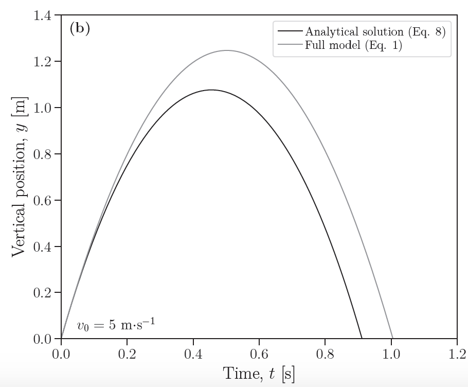
Here's a new analytical solution for projectile motion in the case of a vertical launch (i.e. projectile thrown straight up), including drag forces. I'm excited about this because it could be used to more easily invert for source parameters from volcanic eruption videography.