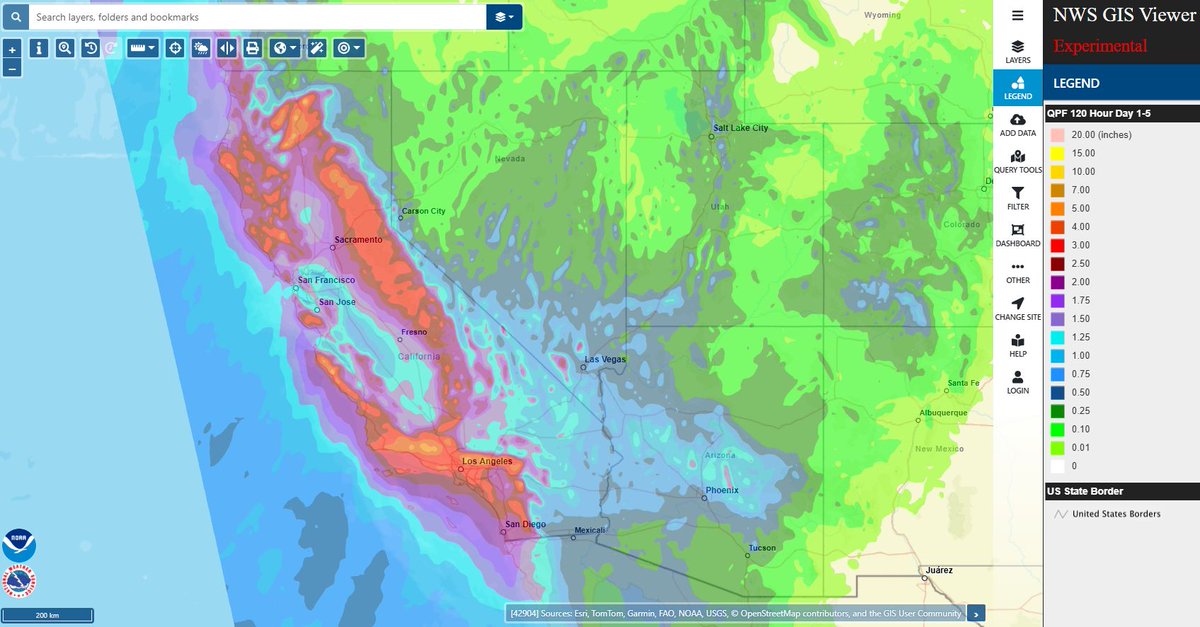
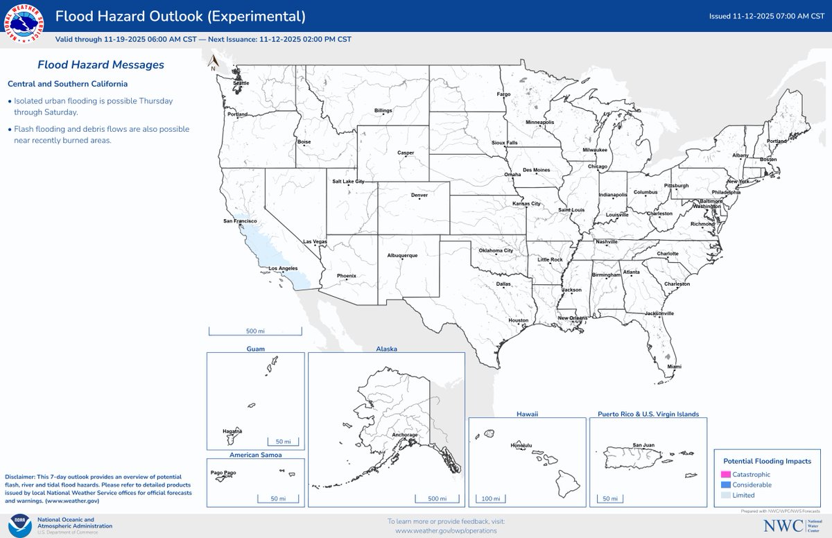
An atmospheric River is once again headed for the California coast, with heavy rain likely to result in some isolated flash and urban flooding into this weekend.
https://t.co/7995b2OMng
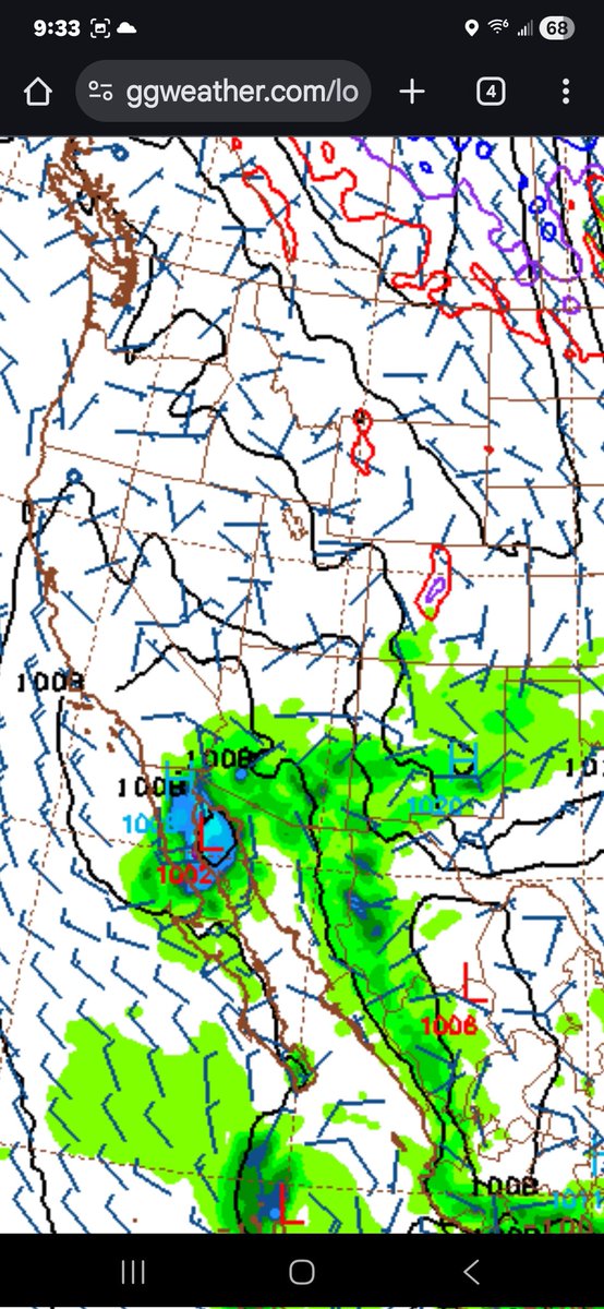
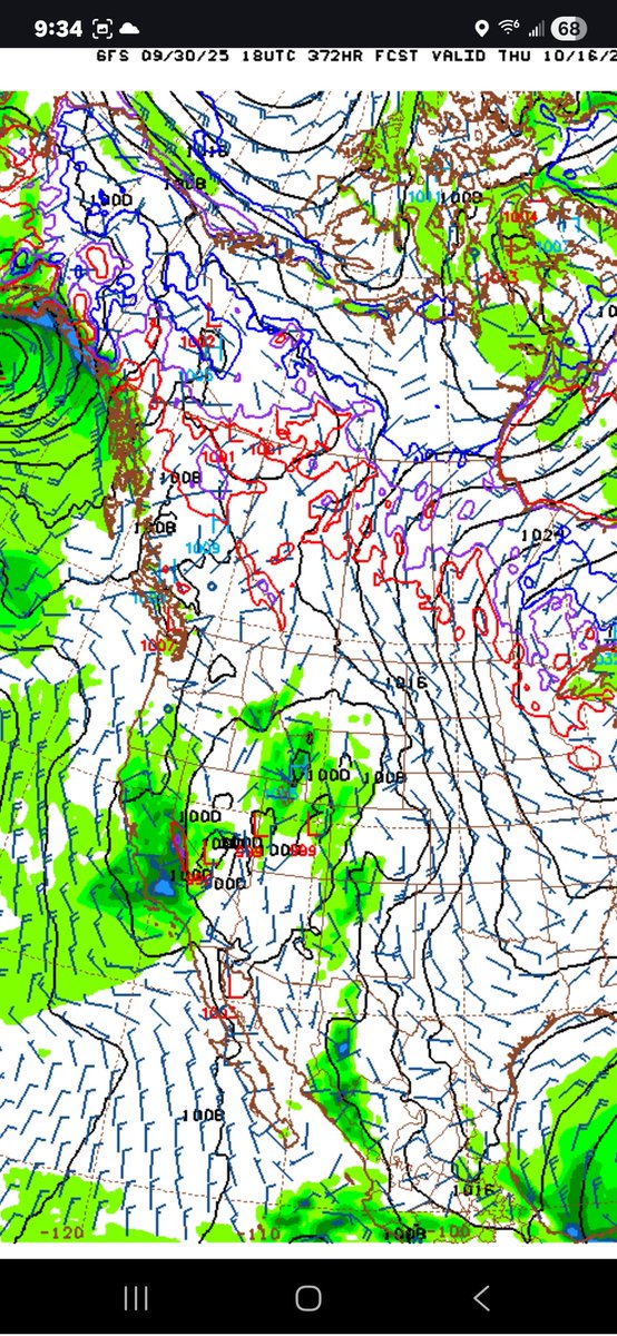
Some interesting stuff happening on some long range computers tonight with some showing our unusually warm waters and incoming troughs of low pressure potentially bringing a full blow tropical storm or Hurricane somewhere between SoCal and Arizona next weekend. Of course chances are slim for that but given the pattern we've been in all of September which has pulled tropical systems from Mexico into our region it bares close watching. If a major hurricane manages to form and move through Baja and over the unusually warm waters would help keep it together longer then usual. With such unusual climate conditions across the pacific I feel chances are higher then normal that we will eventually at some point see an unusual weather system as well, and I think computers will struggle a lot more then usual all month even with short range forecast due to limited climatology data to compute. Any weather outlooks outside 10 days are unreliable and change daily.
The GFS also shows the 1st deep Alaskan trough of season bringing significant rain and mountain snow around the 15th. Of course that is weather fantasy land and will likely change. Overall we've been an unusually long period of cooler and wetter then normal weather with no signs of it changing, further adding to my confidence that we may see a wetter and colder then usual October/official beginning of our wet season.
#CAwx #Rain #LosAngeles #SanDiego #Fallwx #Snow
As rain continues into the evening, roads may be slick. ⚠️🚗💥🚗Make sure to slow down and leave plenty of space between you and the car in front of you on your commute. #CAwx
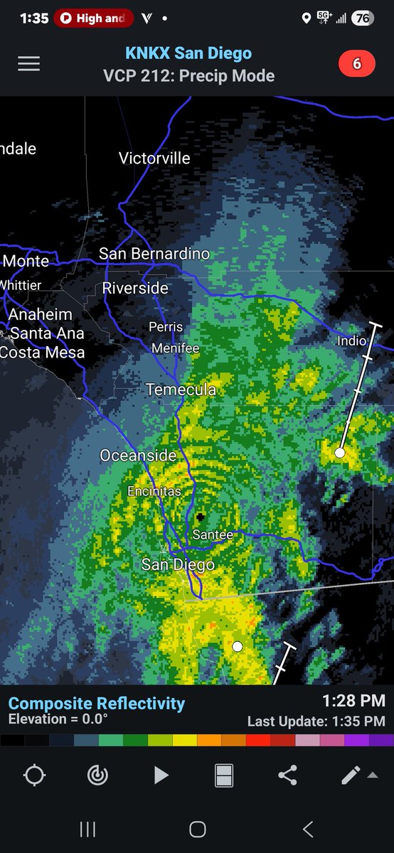
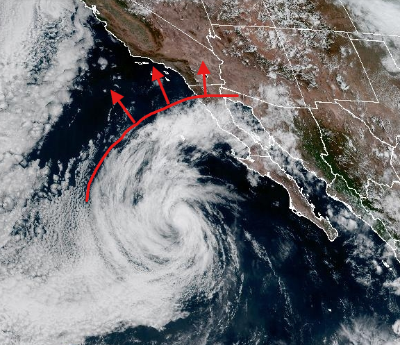
Showers and a few Thunderstorms will increase through this evening for mainly for all areas of San Diego&Riverside counties where some light amounts have already fallen this morning. This swath of moisture wrapping around the outter bounds of Tropical Storm Jullitte looks to briefly shift a bit more west later this afternoon so a few showers are possible in the OC&South Eastern LA as well but not much. Anywhere from .10-.50"+ of rain looks possible in all areas of San Diego county, Riverside and Eastern San Bernardino IE valleys through tomorrow Am.
#CAwx #Rain #SanDiego #PalmSprings #SoCal #TropicaStorm
⚠️ SUNSET ALERT ⚠️ High clouds from Tropical Storm Juliette are moving into So Cal. After a pretty sunset we'll start to see bands of light rain move in overnight and continue into Thursday afternoon, with the best chances in SD and Riverside Counties.
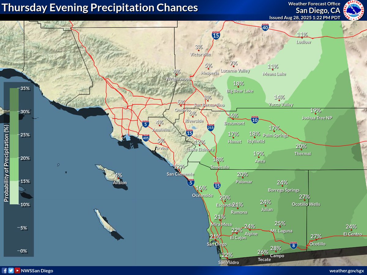
Tropical moisture is headed our way! Rain chances increase over most of the area beginning Thurs am and lasting through the evening. On and off rain showers through much of the day and urban areas could see rain totals of 0.05-0.25" with 0.5" possible in the mountains. #CAwx
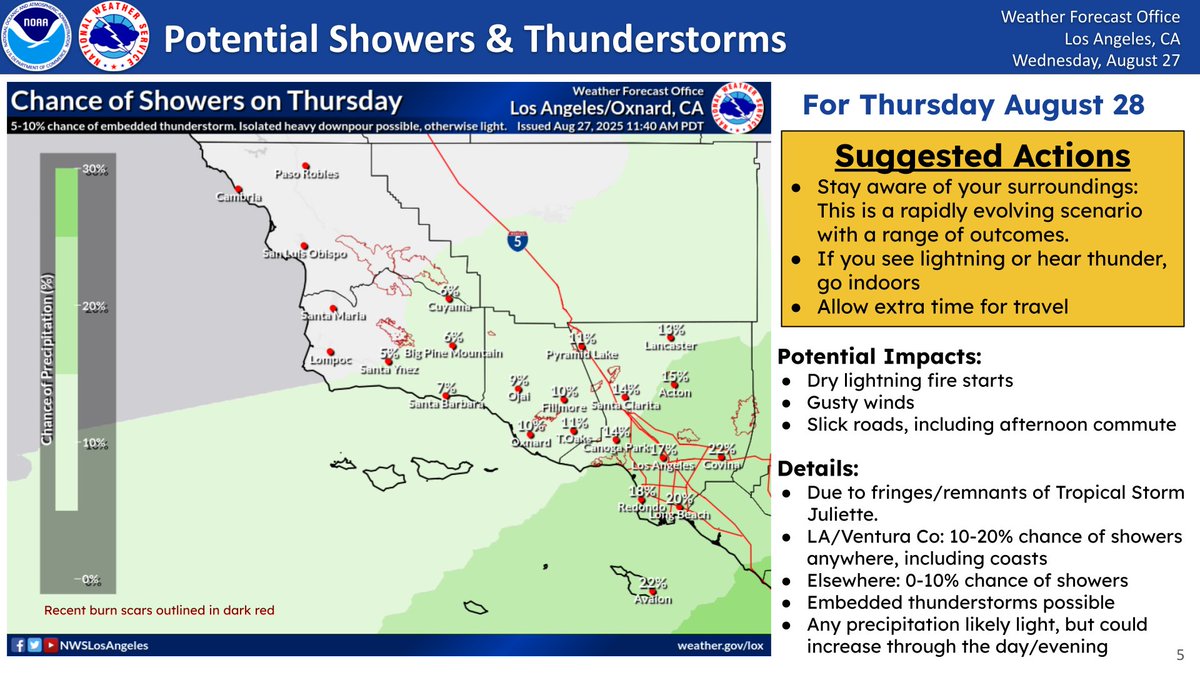
Southern CA is expected to see moisture from the weakening Tropical Storm Juliette starting tonight. There is potential for showers & tstms starting early Thur (poss as soon as tonight) - Fri, & best chances will be for LA/Ventura Co & S coastal waters. #socal#cawx#CArain
On Tuesday, an 8.8 magnitude #earthquake struck off the coast of Russia, triggering multiple #tsunami alerts along the U.S. west coast. Learn how @NOAA scientists monitor, detect, and research tsunamis: https://t.co/KtnlXygUYG
@NWS @noaapmel @noaaocean
The first tsunami waves have reached La Jolla shores as of 1:45 AM, registering around 0.36 feet. For areas upstream, the first waves haven't been the biggest with arrival of additional waves for 6 or more hours after the initial wave.
Great info by our friends at @NWSLosAngeles! While we still expect lesser conditions here in SoCal, a Tsunami Advisory remains in effect. Please avoid the beaches & continue to monitor the situation on https://t.co/lHEuTPzV51. Local tide gages found here: https://t.co/f1M7YcCQIt
TSUNAMI ALERT: An 8.7 magnitude earthquake that struck off Russia’s Kamchatka Peninsula triggers tsunami warnings in the entire United States West Coast. NWS issues a tsunami advisory for San Diego County beaches. Waves anticipated for Wednesday, 1:15 a.m. (PST).
Tsunami Advisory is in effect for the west coast as a result of an 8.8 magnitude earthquake off the coast of Kamchatka, Russia. Tsunami waves are capable of producing strong currents and dangerous waves. Stay away from beaches and waterways until officials deem it safe to return.
One of the most widespread June Thunderstorm outbreaks in Several years, especially in LA county, will continue tonight across SoCal with activity gradually shifting South and East into San Diego county, and our lowers deserts. Frequent lightning, hail, strong winds, and flooding rains will continue at times across the evening with a lot of awesome lightning shows tonight!
#CAwx #SoCal #Thunderstorms #LosAngeles #SanDiego #PalmSprings
**Drizzle this morning with below normal temperatures , Another trough with slight rain chances this weekend **
A trough of low pressure moved through the region last night and has resulted in a deep marine layer west of the mountains with some drizzle this morning. Highs today will be 10-20degrees below normal with 60s&70s west of the mountains and 50s in the mountains. Wibds should begin to die down in the Deserts.
Weak high pressure will build Wednesday-Friday gradually warming temperatures back to near normal with partly cloudy skies overall. Computers continue to hint at another unusually deep trough of low pressure moving over the region Saturday with highs falling back to well below normal with some computers even showing some showers over and west of the mountains with an area of low pressure moving over head. Given the time of year confidence in any rain remains low this far out, but will increase the next couple days if current trends continue. Stay tuned!
#CAwx #spring #Drizzle #Rain #SoCal