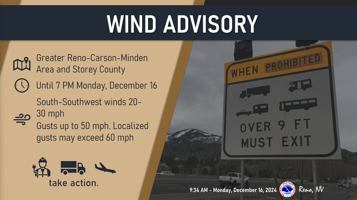
A Wind Advisory is in effect until 7 PM for the Greater Reno-Carson-Minden Area and StoreyCounty. South-southwest winds 20-30 mph with gusts up to 50 mph. Localized gusts may exceed 60 mph.
More records have been broken as today's high of 57 degrees at Reno-Tahoe Airport is the all-time lowest high temperature during the month of August!🥶
#nvwx#cawx
We're tracking the development of bands of high intensity snowfall later this afternoon into the evening. Here's what the latest simulations are showing for timing of the 1"/hr or higher bands of snow. Keep an eye out in Fallon-Yerington-Hawthorne, where chances are highest.
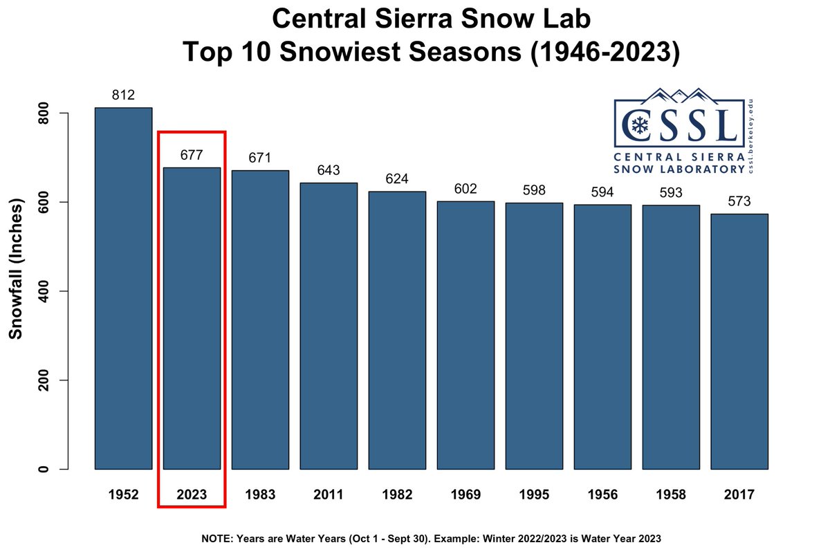
With 7.7" (19.5 cm) of #snow over the last day, '22/'23 has passed '82/'83 as the 2nd snowiest season (Oct 1 - Sept 30) since the CSSL was built in 1946! We now have a season total of 677" (56.4 feet, 17.2 m).
Still far from #1 but we'll get closer over the next week.
#CAwx
Snowfall will continue areawide along with blowing & drifting snow, esp. in Mono/Mineral/S. Lyon Counties. Major travel impacts for I-80, US-50, US-95, US-395, and US-6 with periods of near-zero visibility. Amounts taper off north of I-80 (outside of NE CA west of Hwy 89).
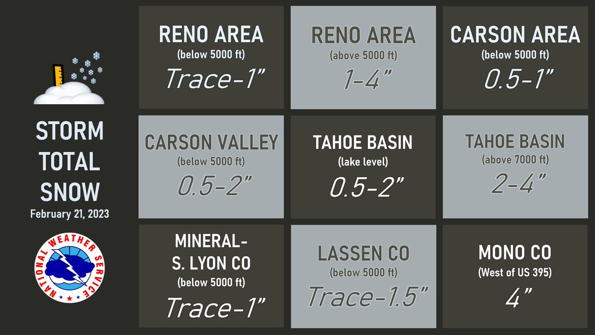
❄️ Here are the snowfall amounts from yesterday’s storm. ❄️
For a more detailed map to see how much it snowed in your area, visit: https://t.co/vMpIXipbLO
Whoa, it's cold out there this morning 🥶(https://t.co/6fItMKFKQM) Here's a snapshot of the temperatures as of 6 AM around the region.
Watch out for icy patches on the roads too ❄🚗
Widespread heavy rain is producing urban and small stream flooding along standing water on many roadways in western NV and CA.
⚠ Slow down & don't drive through flooded roads!
Flood Advisory - https://t.co/x2Vcy9OJt6
9:00am... Conditions look terrible across I-80 as a heavy snow shower persists from Soda Springs to Truckee. Hold off on traveling if at all possible until conditions improve. #cawx
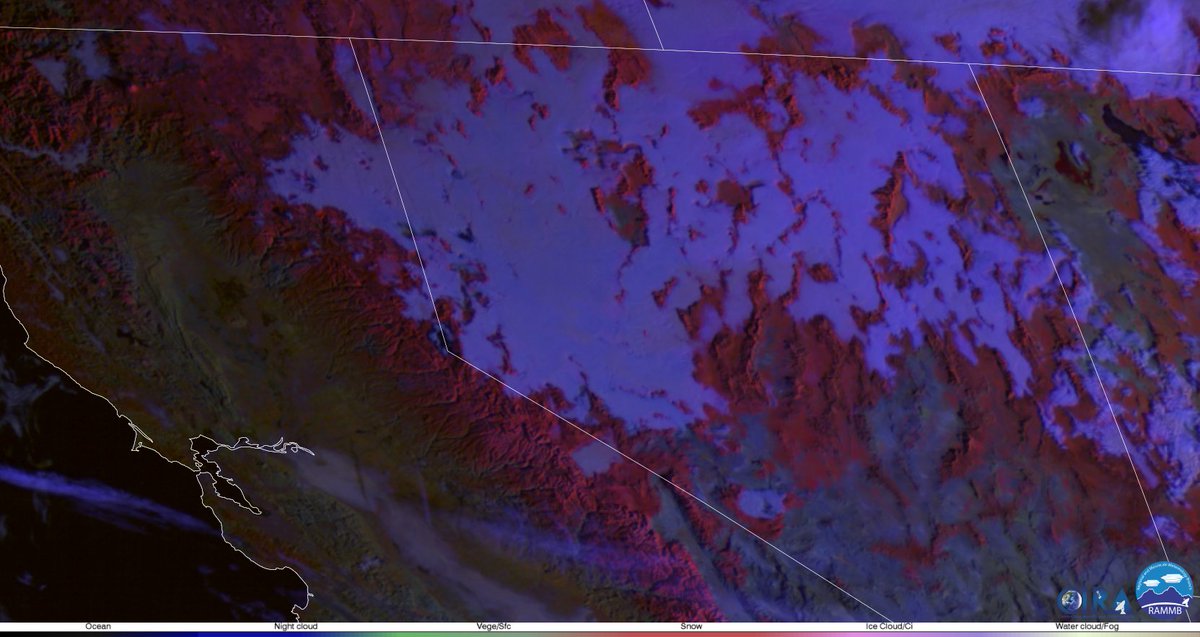
Wondering about those clouds? Inversions and melting snow adding moisture to lower elevations are causing low stratus and in some places freezing fog. Above the inversion, the sun is shining! For cams: @ALERTWildfire (https://t.co/dGOjunoBQ9).
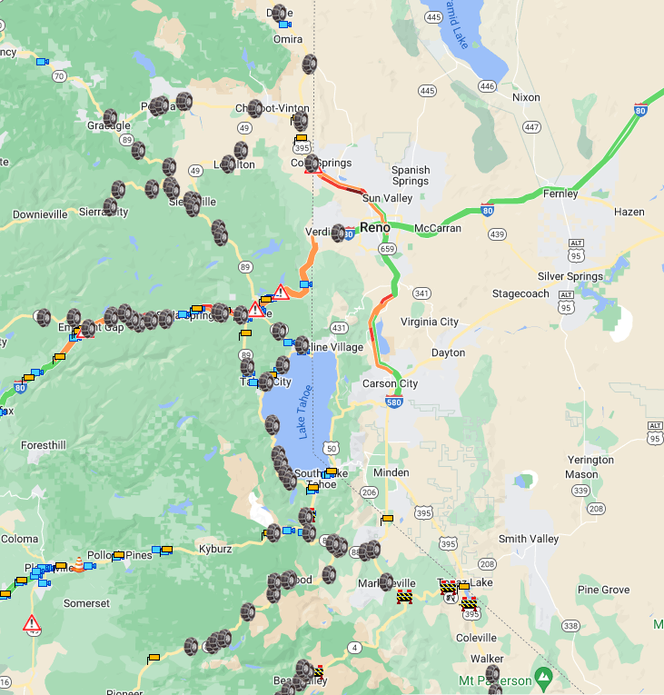
Snow covered roads and chain controls are present across the Sierra, with some roads in western Nevada and northeast CA as well. Be safe out there this morning!
Check https://t.co/9qzK0DzQCG and https://t.co/wtpcmwMAPT for the latest on road conditions, including cameras!
❄️☃️ Slide Mountain this morning ☃️❄️
Snow levels will be a bit lower today, around 8000-8500' with potential for small hail accumulation at any elevation in thunderstorms.
Be prepared if you have travel plans today, esp in the high Sierra.
***FLASH FLOOD WATCH***
Flash flooding caused by excessive rainfall is possible this afternoon-Thurs evening.
Where: The Caldor, Numbers, Tamarack, Mountain View, Slink, and Boot burn scars & areas in steep terrain/poor drainage mainly south of US-50.
https://t.co/X5vy3NXKFn
How do you top Thursday's heat? Reno Airport did just that today, briefly touching 104 degrees shortly before 4 PM. (For the metric fans, that's 40 degrees Celsius!). This sets a new record high for July 29, surpassing the old record of 103 which occurred in 1943 & 2016.
Widespread areas of smoke and haze for the Sierra and western Nevada this morning from the Oak Fire.
Latest Air Quality - https://t.co/BTyHvOL67e
Smoke resources via @WashoeCountyAQ https://t.co/HDyg5efbwe
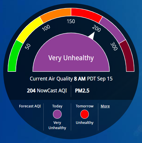
Forecast models have indicated wildfire smoke from the #RicesFire will impact Washoe County today and tomorrow. With this in mind, pay attention to https://t.co/tUgeSAWPR3 and https://t.co/pcDg1zIvUU when wildfire smoke hits for the latest AQI near you. #BeSmokeSmart