@PollidiGomaro@DrKeithLTaylor We have a tool that will return an AI-generated report with flight/satellite data using the date/time/location of the sighting. 🙂
Send us a message if you’d like to check it out!
Webb provided the first direct measurements of the potential for moon-formation in a carbon-rich disk encircling a giant exoplanet, which is itself orbiting a young red dwarf star. https://t.co/fXRuo1mhns
What happened in KairoSphera this week and last?
- Created custom emoji pack
- Flightradar24 subscription updated (searchable for previous 2 years)
- Secured on-site datacenter physical servers now storing data and ready for sensitive information reports
Have you thought about how else your expertise might apply to phenomenology? We're developing a formalized ontology and classification schema for experiential and observational data. Some of your questions are a bit early but we are definitely thinking about them.
If collected correctly, and reported firsthand, "seeing a mantid-like being while sleeping" may still be a "good" record. We encourage direct reporting though. Historical or publicly reported events are categorized accordingly. We look for larger patterns in that data and help provide insight via ontology-driven data modeling (or other research methodologies.)
We are prepared to ingest the criteria you mentioned. PII concerns require redaction/data anonymization, unless there is explicit consent to release to an expert, like the taxonomic experts you mention. This is still an emerging domain, so we're not sure who exactly that expert is yet, but we are preparing a data pipeline for them. Much of the data is still experience-based but that shouldn't be ignored. We're building tools for the community to ethically organize and analyze that data. By providing community members these tools, and teaching them how to better collect and analyze anomalous data, we hope to empower them to collectively drive discovery without narrative control.
@SafeAerospace Our organizational vision aligns. We would love to have a conversation with your leadership team.
Would you be interested in working with us to improve reporting tools for the community?
Hey there! Thanks for sharing your sighting!
I wish we could provide you with more insight about what you saw. Right now, our SkyScraper tool is still in beta and only supports 30 days of ADS‑B history. Unfortunately, global ADS‑B data wasn’t generally archived back in 2012, and flight history was rarely retained beyond 45 days. The FAA didn’t require ADS‑B Out until January 1, 2020. That means most aircraft (90-97%) from that era never broadcast ADS‑B, so even with satellite coverage, there isn’t much to pull up for 2012. That said, if you can pinpoint the precise location, we can still look into satellite-based observations for that event. We’re also working on expanding ADS‑B archives with partner datasets, but for sightings from 2012, the satellite records are likely the best we can do right now.
SkyScraper is designed to help identify prosaic objects so you can focus on collecting better data on those truly anomalous events. Though we may not have the hard data to conclusively prove this, what you're describing doesn't sound like a prosaic object. We are working on releasing a more extensive tool that will allow you to report any anomalous experience anonymously. Over time, those anonymized reports will collectively empower experiencers to discover unique insight about those events and how they may have impacted us. Until then, if you'd still like us to pull the available satellite data using our SkyScraper tool just send us a DM and we'll be happy to assist you. We do not store, retain, or charge for the reports generated by our SkyScraper tool.
-Your friends, @Kairosphera
(@Nov3L, we appreciate you spreading the word!)
There's a private and safe space hosting discussions like this. We have built it and will be opening up for folks of all kinds to join a truly positive movement. Please stay tuned in the next few weeks and stop by our website in the meantime to learn more. Our sole focus is to protect our members.
At Kairosphera, we like to GOFast.
Our CI/CD process definitely goes fast. That means everything you are about to see will likely be obsolete by end of week. We want to share a little about how to use our smallest tool though.
So, let's show you how we use it. The information generated allowed us to arrive at the conclusion in our QT. It all starts with entering the date, time, and location of the sighting to generate a report. It's not just finding answers that matter, it's also how and why you are finding them.
#ufotwitter #ufox #uaptwitter #uapx
Check it out. This is the lightest tool in our toolbelt. You should see the stuff we're not ready to show you.
We were made for this.
https://t.co/WjQFgJZDtC
👀
No airplanes overhead. Quite a few satellites.
Very cool.
I dropped a pin on Banbury Cross for the coordinates. Without specific coordinates, this is the best we can offer. If you make contact with the individual and have more information about the sighting then we may be able to narrow it down further.
We just need the Date, Time, and Location.
Also, we have an API Key if you would like to attempt integrating reporting into your website.
-Kairosphera Observation Report-
Visible Satellites (Top 5 by Elevation, then by Range for similarity)
Given the large number of satellites, the summary focuses on the top 5 by elevation (higher elevation generally means easier visibility) and then highlights a few notable ones by other criteria (lower altitude, unique direction, or specific interest). No aircraft data available.
Top 5 by Elevation
1. STARLINK-32211
Elevation: 67.59°
Azimuth: 136.54°
Range: 516.75 km
Path Direction: SW → E
Cardinal Direction: Southwest to East
2. STARLINK-32159
Elevation: 67.86°
Azimuth: 183.19°
Range: 515.53 km
Path Direction: SW → E
Cardinal Direction: Southwest to East
3. STARLINK-30713
Elevation: 66.05°
Azimuth: 315.36°
Range: 522.60 km
Path Direction: W → NW
Cardinal Direction: West to Northwest
4. STARLINK-31997
Elevation: 66.36°
Azimuth: 151.58°
Range: 520.78 km
Path Direction: SW → E
Cardinal Direction: Southwest to East
5. STARLINK-30936
Elevation: 59.85°
Azimuth: 133.28°
Range: 517.41 km
Path Direction: SW → E
Cardinal Direction: Southwest to East
Notable Mentions
-Lowest Altitude (not in top elevation): STARLINK-11372 (368.42 km, but very high elevation of 82.35°, making it potentially very visible)
Elevation: 82.35°
Azimuth: 103.58°
Range: 368.42 km
Path Direction: W → E
Cardinal Direction: West to East
-Unique Path Direction: PRSS 1 (NE → NE, one of the few with a consistent direction)
Elevation: 29.12°
Azimuth: 29.18°
Range: 1154.56 km
Path Direction: NE → NE
Cardinal Direction: Northeast to Northeast
-Specific Interest - Low Orbit: SPACEMOBILE-004 (low range, 533.58 km, though not exceptionally low elevation)
Elevation: 70.75°
Azimuth: 55.22°
Range: 533.58 km
Path Direction: NE → E
Cardinal Direction: Northeast to East
Analysis and Likely Observations
-Time of Day (Evening): Favorable for satellite spotting as the sky is darker, making satellites more visible, especially those with higher elevations.
-Satellite Properties and Orbital Dynamics: The majority of visible satellites are part of the Starlink constellation, known for its low Earth orbit, which makes them more visible from the ground due to their proximity. Higher elevation satellites are more likely to be observed.
-Previous Documented Sightings and Data Points: Given the dominance of Starlink satellites in the list and their known visibility from Earth due to their design and low orbit, it's likely that most observed satellites, if any, were from this constellation, especially those with higher elevations.
Most Likely Observed
Based on elevation, range, and the specifics of the Starlink constellation's visibility:
1. STARLINK-32211
2. STARLINK-32159
3. STARLINK-11372 (despite not being in the top 5 by elevation, its very high elevation makes it a strong candidate for visibility)
Sources and Usage Policies
-Data Source: U.S. Space Force, 18th Space Defense Squadron, https://t.co/pcEZYi2P3b
-Usage: Data used with permission, subject to https://t.co/pcEZYi2P3b User Agreement.
-Disclaimer: Not suitable for conjunction assessment. Provided as-is without warranties of accuracy or completeness by the U.S. Government.
(Detailed raw data is attached as a CSV file.)
Data Query Parameters Used:
Satellite visibility minimum elevation degrees = 25.0
Satellite visibility maximum range km = 2000.0
Satellite visibility time window +/- minutes = 10
Aircraft bounding box +/- miles = 15.0
At Kairosphera, we like to GOFast.
Our CI/CD process definitely goes fast. That means everything you are about to see will likely be obsolete by end of week. We want to share a little about how to use our smallest tool though.
So, let's show you how we use it. The information generated allowed us to arrive at the conclusion in our QT. It all starts with entering the date, time, and location of the sighting to generate a report. It's not just finding answers that matter, it's also how and why you are finding them.
#ufotwitter #ufox #uaptwitter #uapx
Check it out. This is the lightest tool in our toolbelt. You should see the stuff we're not ready to show you.
We were made for this.
https://t.co/WjQFgJZDtC
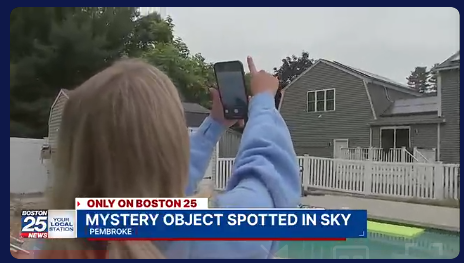
@TheUfoJoe Based on the report generated with our tool, it's most likely an EC-145 Helicopter. Callsign N144NE.
No reptilians for dinner tonight. Sorry Joe.
🫡
https://t.co/Av10reyK2C