Kansas Division of Emergency Management, responsible for emergency management statewide & coordination of state & federal response to disasters & emergencies.
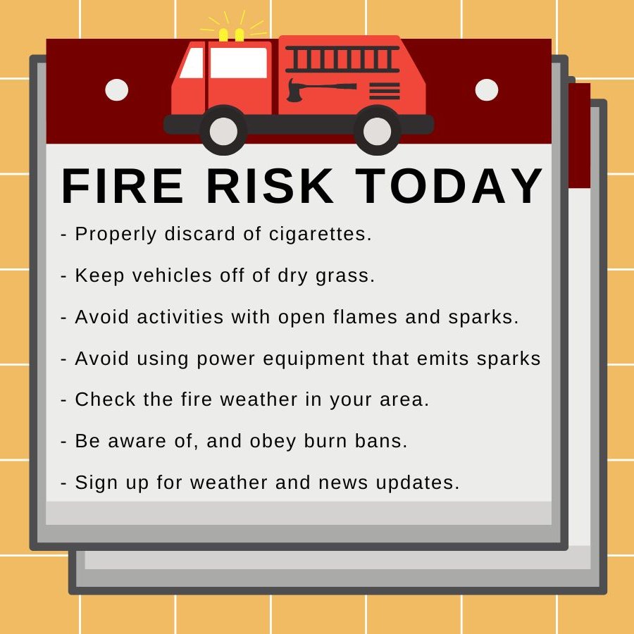
Wildfire danger threatens most of Kansas today with strong winds. It only takes a spark to start a fire that can quickly get out of control. Make sure you follow all precautions listed below!
@GovLauraKelly | @KSForestService | @ksfiremarshal
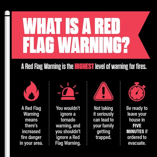
Fire weather watches and red flag warnings, along with high wind warnings, are in effect! There should be NO outdoor burning of any kind until this event is over, as the slightest ember could become tomorrow's inferno.
@GovLauraKelly | @ksfiremarshal | @KSForestService
🔥Wildfire Update
The Ranger Road Fire, in Beaver County, Oklahoma, crossed into Kansas this afternoon. The Johnson County Task Force is engaged in Ashland, Kansas, and Assistant Fire Management Officer Dennis Carlson is engaged in Englewood, Kansas.
🔥 Fire Weather Alert🔥
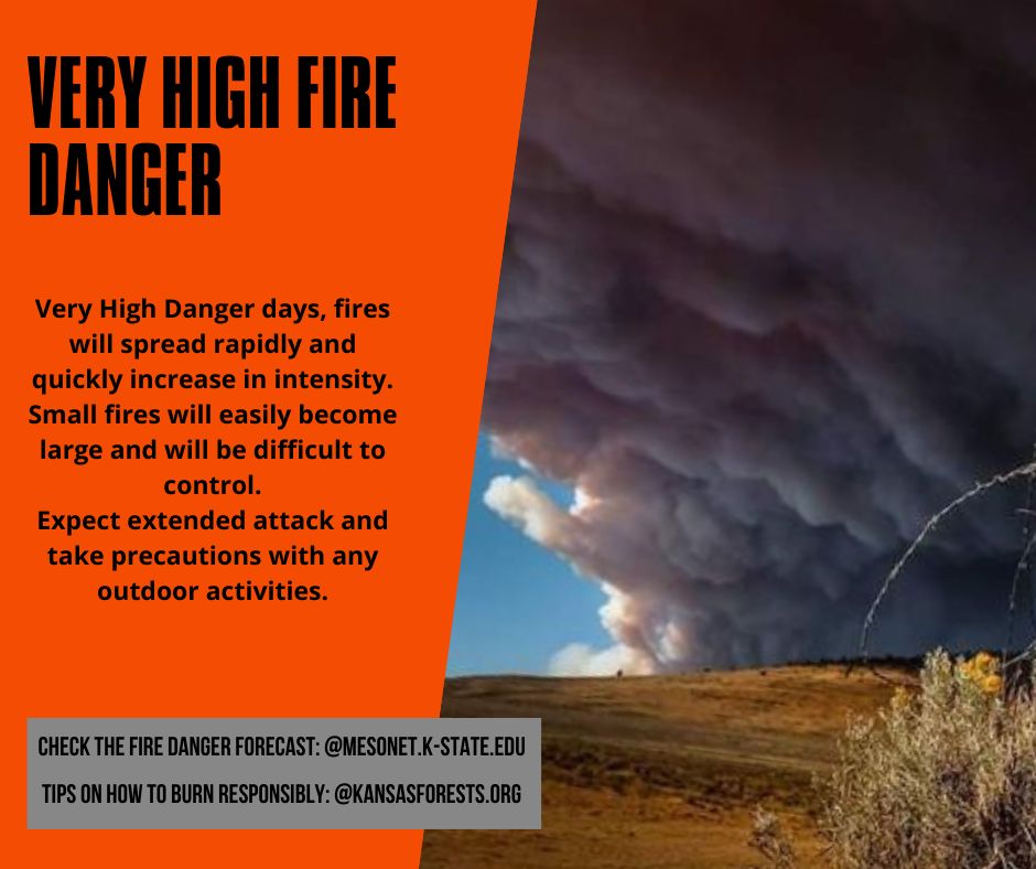
Weather conditions are deteriorating earlier than expected across western Kansas. Humidity levels are dropping, winds are increasing, and fire danger will escalate from Very High to Extreme as these conditions continue.
#kswildfire#FireSeason2026
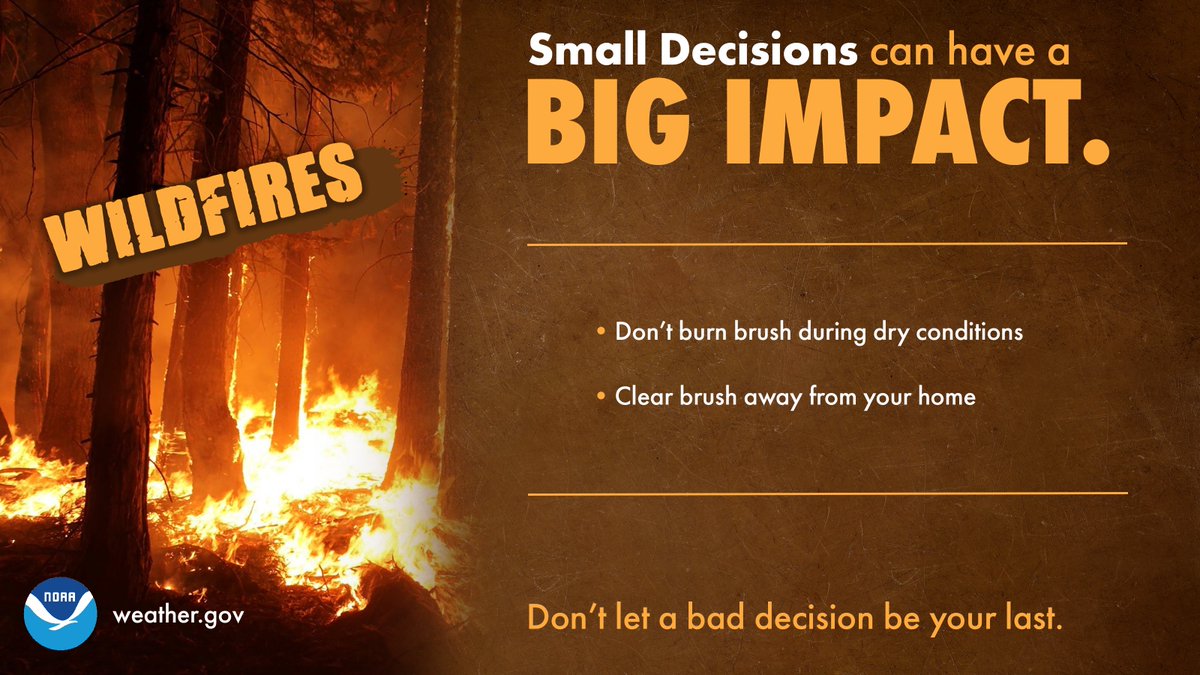
Dangerous fire weather! One small decision can have a BIG impact!
When? Today - Thursday
Where? Across Kansas
Why? Strong 30–40 mph winds, humidity as low as 10%, rapidly drying grass, blowing dust, and shifting winds.
@GovLauraKelly | @KSForestService | @ksfiremarshal
Wildfire Weather Update with Chip Redmond
Fuels in KS are drying quickly with warm temps and strong wind and vegetation will become more receptive to fire. We are transitioning into the typical spring fire season pattern — when fires can start easily and spread quickly.
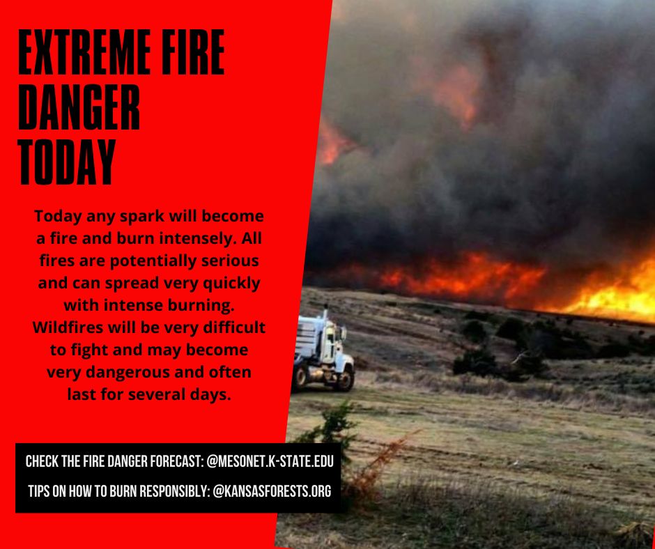
Dangerous fire weather with Red Flag Warnings and Fire Watch is in effect for most of Kansas. Extreme fire danger means that fires can start and spread quickly and burn intensely. All fires are potentially serious.
@GovLauraKelly | @KSForestService | @ksfiremarshal
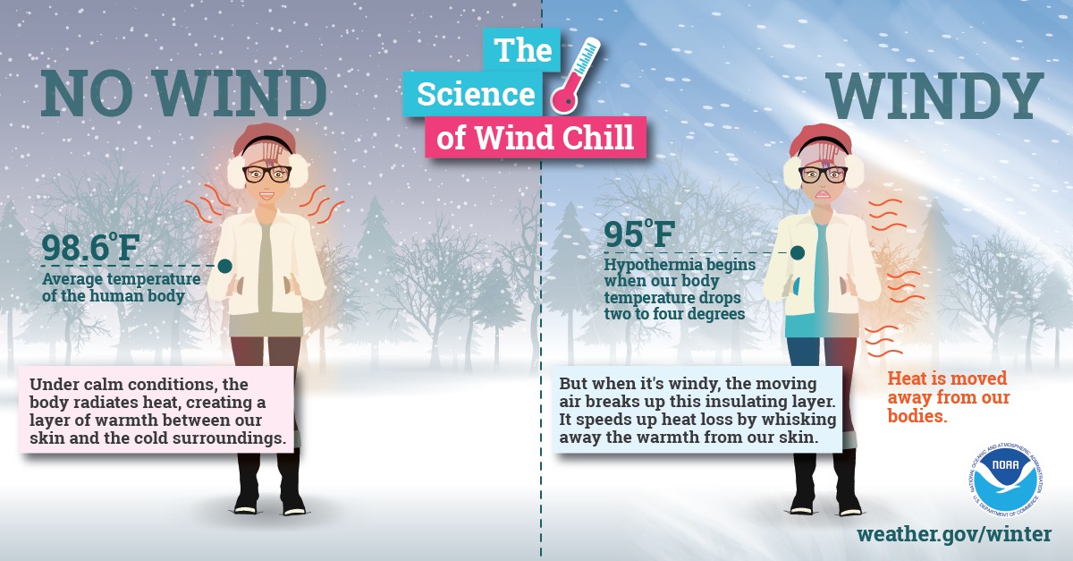
Extremely cold air comes every winter, make sure you are prepared before stepping outside. The arctic air, together with brisk winds, can lead to dangerously cold wind chill values.
#kswx | @GovLauraKelly | @KDOTHQ | @NOAA
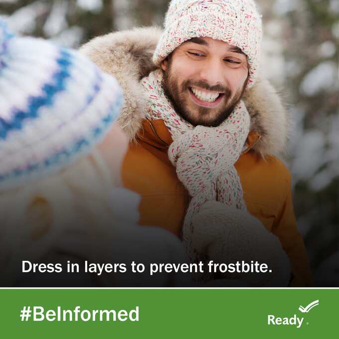
While snow can be exciting, remember to protect yourself from the cold.
- Frostbite: fingers, ears, or any exposed skin is affected.
- Hypothermia: when body temp sinks below 96°F.
If effected by either of these move to a heated location and get medical help immediately!
#kswx
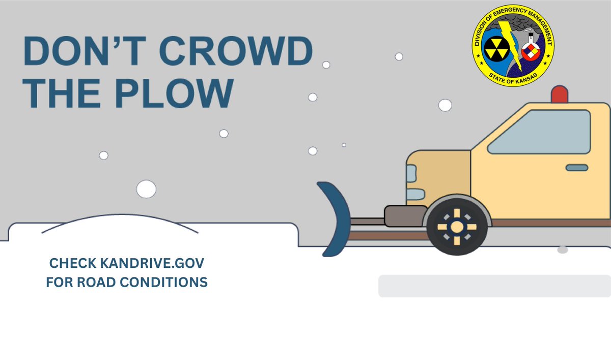
Winter driving can be hazardous. One simple way to keep yourself and everyone on the road safe is to slow down. Remember, ice and snow, take it slow.
Learn about road conditions in your area at https://t.co/8Q5cdREWHg
#kswx | @KDOTHQ | @GovLauraKelly | @kshighwaypatrol#winterwx
Kansans snowfall is expected to begin Friday afternoon and taper off early Sunday. Widespread 3-7 inches of accumulation south of I-70 is possible with 1-4 inches possible north of I-70.
#kswx | @GovLauraKelly | @KDOTHQ | #winterweather
Extreme Fire Weather Risk 🔥 for much of Kansas this week with gusty winds over 50-60 mph, extreme fire load, little to no precipitation in the last 50 days and low relative humidity.
@GovLauraKelly | @ksfiremarshal | @KSForestService
🔥 Fire Weather Update with Chip Redmond, meteorologist for K-State and KFS
High winds will combine with low RH to increase the potential for large fire growth Friday - Sunday. The biggest threat is in areas in the far NW that have not received recent moisture.
#kswildfire