Human exploration of the Solar System began on the Moon during the mid-20th century. To facilitate documentation and study of the human influence on the Moon, a Comment article in @NatureGeosci argues it is time to designate a ‘Lunar Anthropocene.’ 🔒 https://t.co/oeGj5yYoBp
“Islands are some of the most imperiled, highly disturbed ecosystems in the world, and are home to roughly 20% of Earth’s biodiversity”
Amazing coverage in @Nature of our expedition to sample fungi on world's most remote island @VirginiaGewin
https://t.co/ktpZAaukUr
#NCWRRI Graduate fellow Chris Norcross is a PhD student at @ncstatemeas who is studying the impact of beavers on #stormwater storage, water quality, and diversion in urban wetlands.
Learn more about his project below! [🧵thread]
Interested in following the beavers in the #WalnutCreekWatershed? Check out the Rocky Branch Greenway Beaver Cam to see them in action! https://t.co/hmc1MuolzM
Special thanks to Chris’ advisor, @KarlWegmann for capturing this footage!
@ncstatefan757@ncstatemeas@NCStateSciences@GeologyClubNCSU Yes, exact same spot. Rock-drop structure likely favorable to beavers for anchoring their dam as are two upstream adjacent constructed wetlands that the have modified and connected to the main-stem pond… just like in 2016-17 😊
I am SO excited to announce that one my PhD chapters is finally published in ESPL!!! We found that Piedmont channels are migrating up-valley and estimate the amount of future erosion and nutrient contributions to piedmont streams. Check it out:
https://t.co/vJP8XDMVoZ
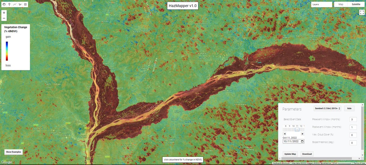
October flood woes along the #Niger and #Benue Rivers is clearly visible using #Sentinel2 imagery and the @HazMapper#rdNDVI algorithm. Contiguous red areas = loss of vegetation during #NigeriaFloods inundation. Explore yourself with the direct URL at https://t.co/4ndauu4vDv;
So nice to see the #geomorphology efforts of @RockDocRach and @drbohnen out in print. Channel head response to anthropogenic landscape modification: A case study from the North Carolina Piedmont, USA, with implications for water quality https://t.co/Yg6oL7MxNb
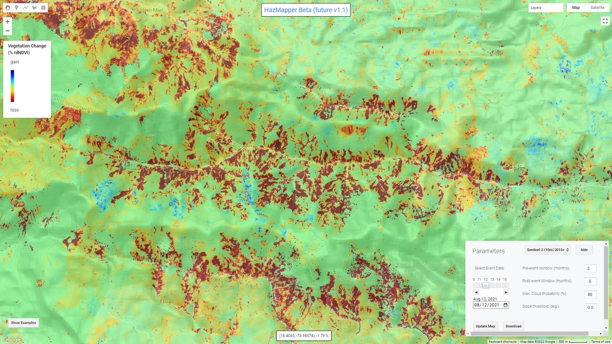
A quick comparison of mapping landslides (August 2021 Nippes EQ in #Haiti) in the original HazMapper compared to the beta v1.1 which includes moving from TOA to SR Sentinel data and some additional cloud filtering techniques.
#googleearthengine#gee#bigdata#naturalhazards
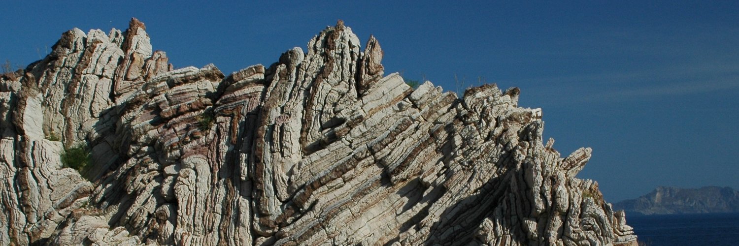
Intraplate fault zone with seismic recurrence are real. Sometimes (frequently) hard to identify. Here, weathered bedrock (neoproterozoic ?) thrusting Pleistocene (?) colluvium.
I *really* wish I could find funding and time to develop the 2nd version of @HazMapper. I have a bunch of code toward incorporating surface reflectance data, trend tracking, and cloud prob filtering....but alas, very cool to see v1 being useful for folks!!!
#gee#opendata
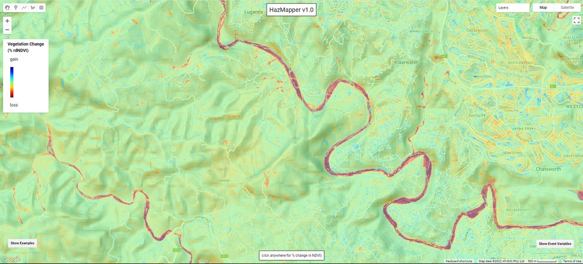
HazMapper Weekly Update #22 - April 2022 flooding and minor landsliding along the Mlazi (uMalzi) River, on the suburban fringe of Durban, South Africa.
#Yellowstone#Flooding damage starting to become visible with #openaccess data. Somewhat cloudy image from #Sentinel2 is up in the @sentinel_hub EO Browser from yesterday.
Waiting for the imagery to populate in #EarthEngine but for now this will do! See what else you can find.
Here is a more distant view of the 2020 western NC debris flow image from the NCSU News service, compliments of @playingwithdata
https://t.co/oAh1goh1kq
Digging through the PC and came across this beaut. Easter storms, 2020, Macon County NC. Thankfully no injuries when this monster came down the hill. Def flirting with the cloud ceiling on this response...
#landslide#debrisflow#drone#uas#em
@drrocktagon


![NC_WRRI's tweet photo. #NCWRRI Graduate fellow Chris Norcross is a PhD student at @ncstatemeas who is studying the impact of beavers on #stormwater storage, water quality, and diversion in urban wetlands.
Learn more about his project below! [🧵thread] https://t.co/0Iga3n9pGd](https://pbs.twimg.com/media/FxkkFVNX0AQ-nV-.png)