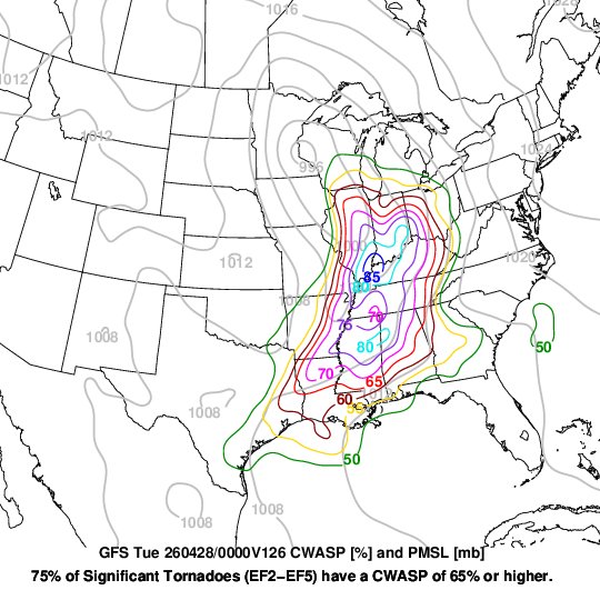
Significant severe storms likely Monday next week (April 27) -- details of storm mode are tricky but could be two zones of higher end risk. CWASP ran on the GFS tonight indicates two areas (light blue, 80+) where significant damaging winds/tornadoes are possible. Been a quiet spring so far in parts of these areas. That should change Monday.
Here are my latest thoughts on how Tonight's event could go. We are still talking about an QLCS that can produce Widespread Damaging Winds + QLCS🌪️'s. Discrete Supercells may develop ahead of QLCS in the Jackson Purchase Region which can increase potential for Strong🌪️'s. #kywx
🧵
THIS is the latest Hi-Res HRRR run. This is what the Radar *Could* look like at 4pm through the Overnight hours.
This model likes to overconvect at times but almost every other model shows the same setup. 🌪️ want to form ahead of line in West KY/TN but a line will slowly…
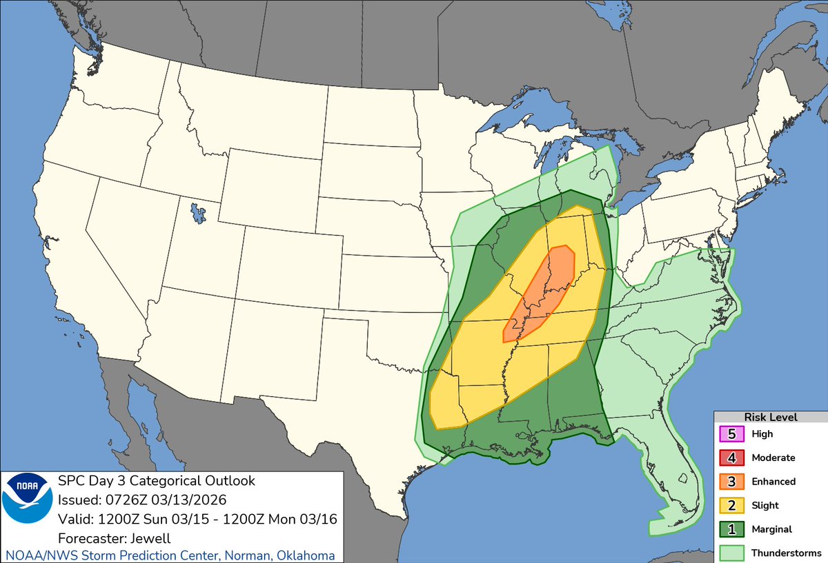
Here we go again. An enhanced risk of severe weather is now posted for Sunday. This one looks like a good candidate for a line of strong to severe moving across our area Sunday night. Damaging winds as the primary threat with isolated tornadoes embedded in the line.
(1/3) What makes things a little interesting for the Severe Weather Setup Tomorrow Night is that we'll have some Dry Air Mixing from the Surface up to the LLJ. This can increase the Damaging Wind Threat as this helps Winds Aloft get transported towards the surface. #kywx
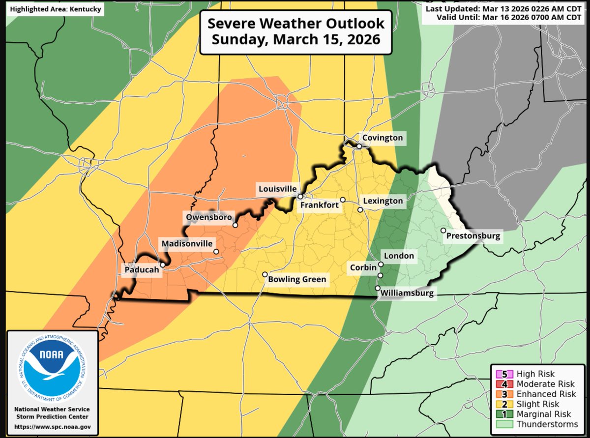
(1/2) Big changes on the SPC Outlook for Sunday as the Slight Risk now includes all of Central KY and an Enhanced Risk is issued for a large chunk of Western KY. The main threat is Damaging Winds, but a Few Tornadoes are Possible. This is going to be a QLCS Event. #kywx