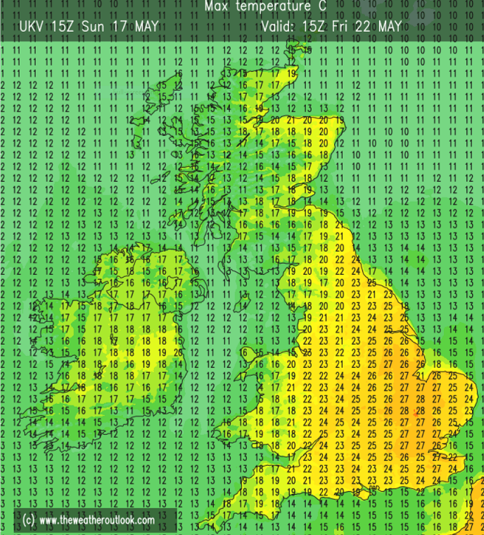
Bank holiday Monday on 00z ECM 🥵
Too far to be taken seriously but it’s likely to be very warm. At London Heathrow from 1948 we’ve seen 30C in May on only two occasions in 1953 and 2005.
St James’s Park, central London site has existed for longer since 1912 it happened in 1922, 1944, 1947, 1953 & 2005.
With unsettled weather coming over the weekend there's a chance we could see some thunderstorms, but what makes a thunderstorm? ⛈️
Alex Deakin explains in this video 👇
https://t.co/mrhpOJ1kcn
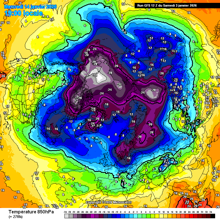
Certainly been an increase on confidence for another cold spell end of January early Febuary.
All eyes on this potential currently as one plausible outcome is where there is a surface high located over Scandinavia pulling an arctic air mass down while u have the Atlantic trying to fight it, resulting in perhaps some significant snow accumulations parts of Scotland, Northern England, Midlands and maybe the south as it will likely cause frontal snow events.
I think we are extremely close to a scenario where some parts of the UK end up seeing a genuinely severe (1980's esq) amount of snowfall here.
There is very little signal to properly blast the cold air away, run after run, across models the cold air remains quite close to the UK, despite the uptick in Atlantic energy this isn't your typical very mild southwesterlies regime and there's little appetite for that within ensemble suites.
Instead, we have a rather weak Atlantic disrupting lows just to the north of the UK and a potential new trend for a Scandinavian surface high to develop 10th-15th.
All it would take is for a slight shift south of those disrupting lows and we're back into air cold enough for band after band of significant snowfall.
Uncertainty in the mid-extended range is extremely high. But.. I'm seeing something.
Blimey, tonight's EC 12z run going for a classic 1980s style channel low and major snow event for much of lowland, southern England on Thursday night and Friday morning... #OneToWatch 👀