Incredible wind reports already coming from Long Beach Island on the Jersey shore. All these have occurred between 10:40PM and 11:45PM
74 mph - Surf City
66 mph - Harvey Cedars
67 mph - Ship Bottom
61 mph - Barnegat Lighthouse
Makes sense that this area is seeing major coastal flooding
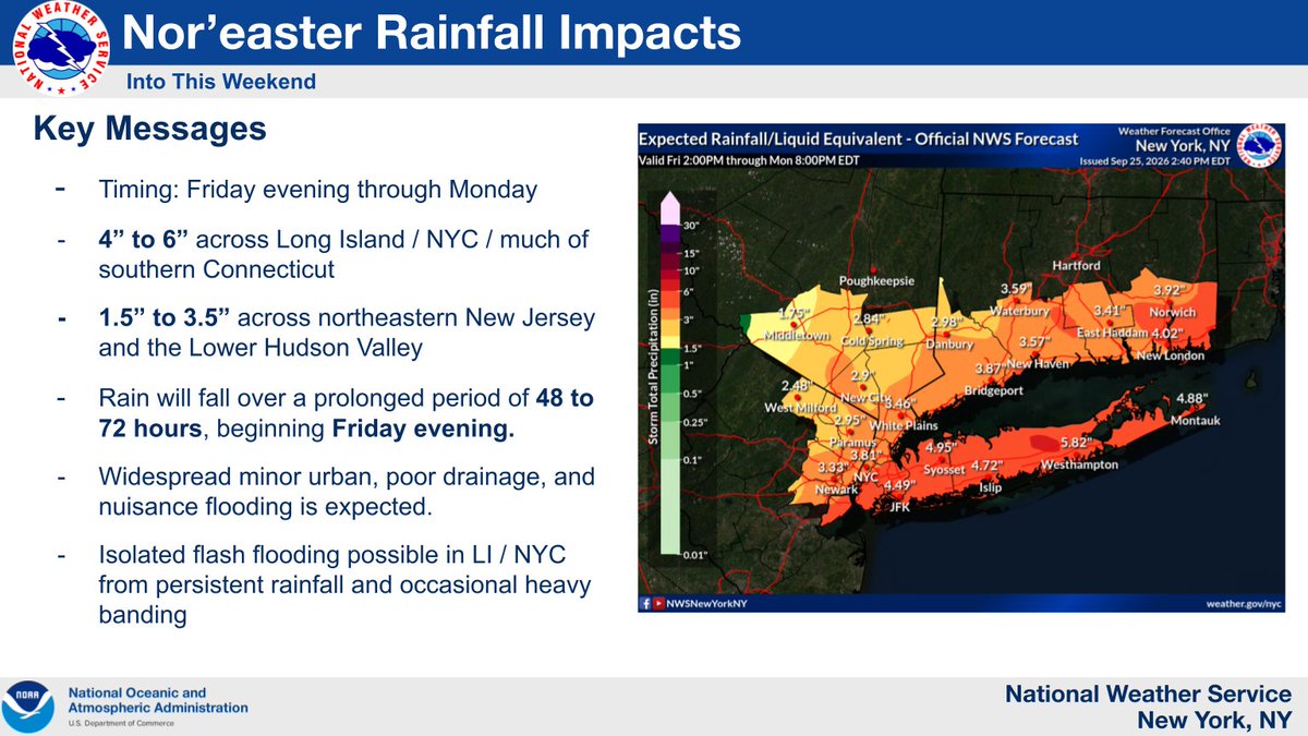
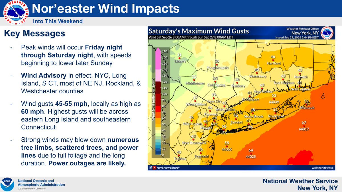
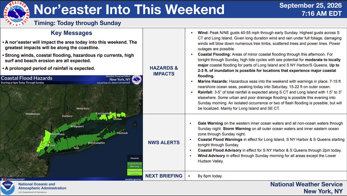
A nor'easter impacts our area through the weekend, with the greatest impacts along the coast.
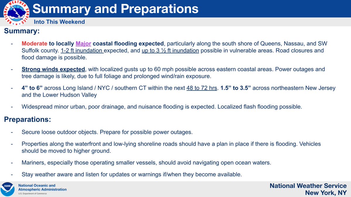
Moderate to locally major coastal flooding, wind gusts up to 60 mph, and a prolonged rainfall is expected.
💻 Forecast: https://t.co/K4slLrwi4g
📄 Briefing: https://t.co/UV3Rpna98Q
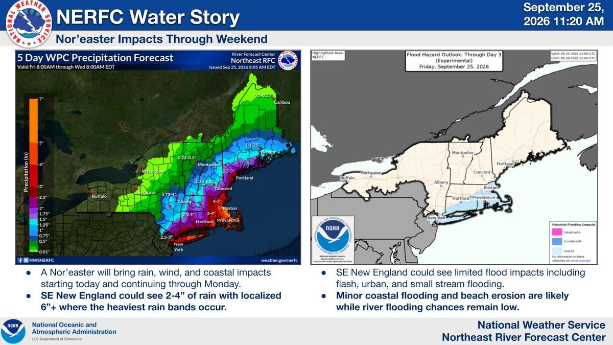
A Nor'easter will bring rain, wind, and coastal impacts today through Monday. 2-4" of rain with localized amounts of 6"+ are possible, leading to limited flash, urban, and small stream flooding. Minor coastal flooding is likely while river flooding chances remain low. #noreaster
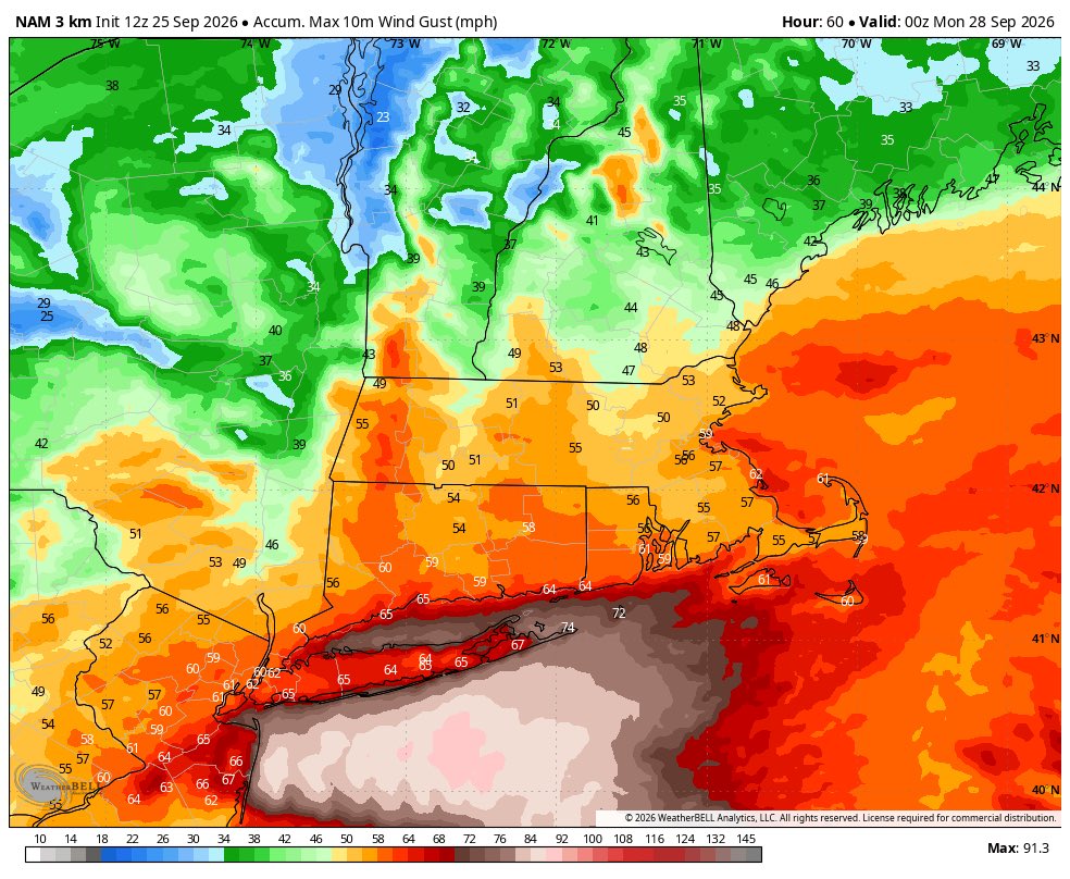
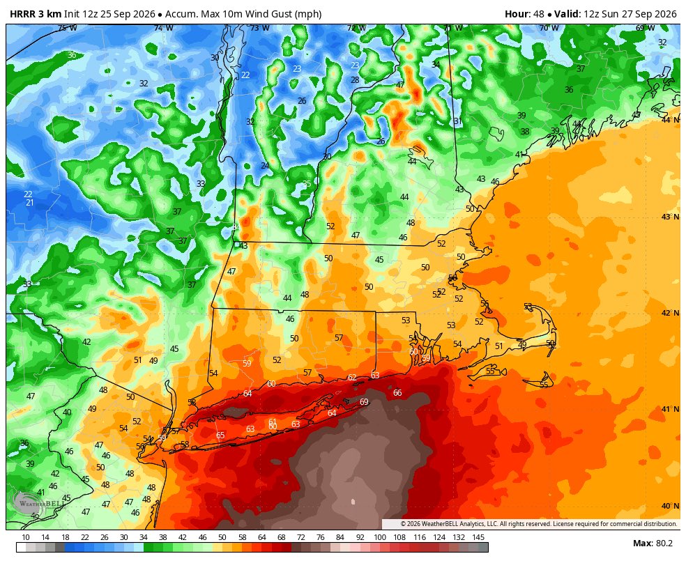
Here’s the rest of the midday hi res guidance. They are all impactful. The NAM with the strongest storm. I know it is typically well overstated, but in this situation it should not completely be dismissed.
Extremely strong winds, heavy rains, and coastal flooding WILL happen starting tonight. Tropical storm conditions will be widespread Saturday night into Sunday. Please heed ALL local warnings.
Everyone loves to rip on the 3km NAM. But in rapid feedback situations, it can not be dismissed. I would certainly be running hurricane models on this. If this tightens completely, some places from N Jersey to SNE will see coastal surges second only to Sandy. There is that kind of potential IMO
This is beyond unprecedented.
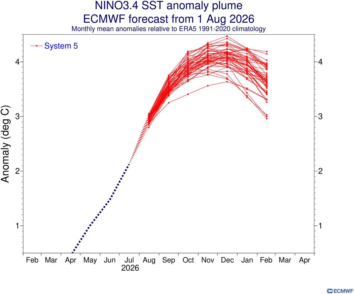
El Niño forecasts are now approaching 5°C above average in the Nino3 region.
Average global temperatures in 2027 could potentially exceed 2.0°C above the pre-industry baseline.
I’m very confident this yr’s El Nino will be the strongest in the entire instrumental record (1850-present), even besting historic events like 1877-78
This will probably be the strongest El Nino in at least ~250 yrs, or since the Great El Nino of 1789-93
https://t.co/n8fVv6XLtY
I’ve never seen the mean Warm Pool displaced this far east before.
30C temperatures down to 100m at 150W is absolutely ludicrous.
This El Nino event is putting the “El Nino of the Century” (1997-98) to shame.
Breaking: El Niño strength forecasts have just taken another step higher.
The new ECMWF outlook shows the event peaking near +4.0˚C in December — obliterating the previous record.
This will have sweeping implications on global climate patterns from late this year into 2027.
Having spent most of my life in Fairfax County, Virginia, I cannot ever recall going from 84 degrees with tornado warnings and severe thunderstorms to accumulating snow in the mid-30s ~12 hours apart. Wild stuff for the Mid-Atlantic! #vawx#dcwx
After our first 50s since January 14th, winter returns tomorrow with some morning/midday snow and flurries. Expect no more than a slushy coating in and around the city with mainly wet roads, but upwards of an inch to the north. Monday may be the coldest day until next winter.
*Providence, RI Update*
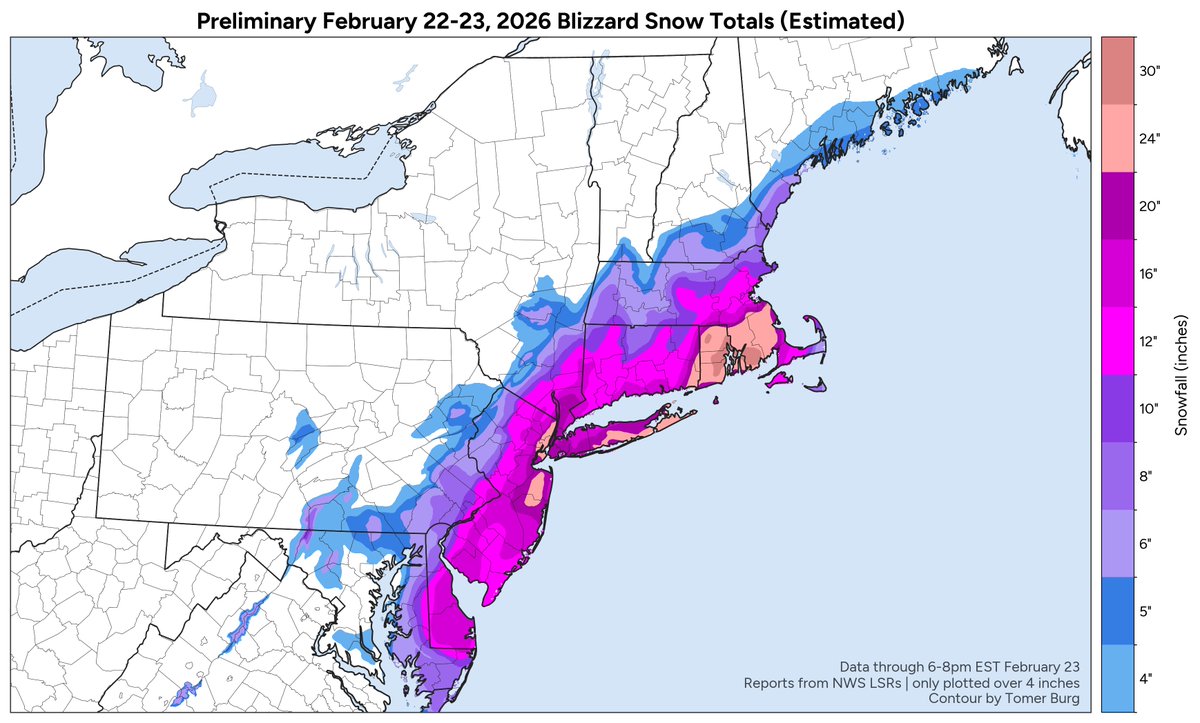
37.9" of snow. Top all-time snowstorm and the 24-hour state record for snowfall was possibly broken today
This is more snow than the ENTIRETY of 6 of the past 7 winters. The only one with more was 2022, and it was barely more than this (43.5"). #wbz
Using all public storm reports from the NWS so far, I contoured a preliminary estimated snow accumulation map for today's blizzard (through 6-8pm EST tonight).
Truly a historic storm - both in terms of impacts, and the forecast challenges leading up to it.
Here's a loop of the 2026 Historic Major Blizzard. This Blizzard smashed the Rhode Island Statewide snow total record set nearly 50 years ago. This Blizzard dropped over 36 Inches of snow in an area in Rhode Island...
Fascinating evolution of two quasi-stationary snow bands today:
- fires of moisture targeted at SE MA & Rhode Island producing heavy snow since 2-3am - *still* ongoing 16 hours later
- near-stationary band over eastern NJ this morning produced a narrow swath of 24-28 inches