🌪️ Why just watch the weather when you can wear it? Our Supercell Slide-ons are perfect for every storm chaser and weather enthusiast. Take a step into style and comfort now! 🚀👍 Explore here: https://t.co/P7qxx5dSiU #MeteorologyFashion#ChaseIt#WeatherStyle#Supercell
Hi friends! A quick message from the weather center for my followers who have YouTubeTV. If you want to keep getting my forecast, log on to https://t.co/SYOr5X74Lx and I hope to see you soon!
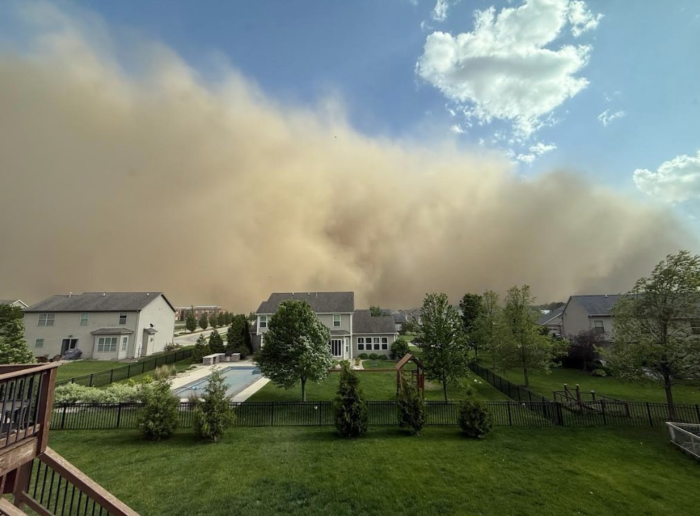
For reference here is what the Dust Storm moving through the Bloomington, IL area looks like. This dust storm is heading towards southern Ford and Iroquois counties! Use caution if traveling! #ILwx#INwx
Starlink 5693 appears to have reentered over the southern Wisconsin/Michigan area at about 0303 to 0305 UTC Jan 29 (9.03 to 9.05pm CST) and was widely observed from neighbouring regions including Chicago
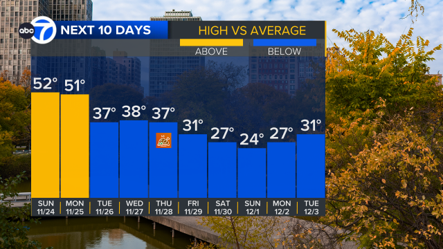
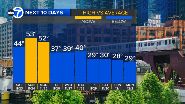
Bitter cold coming! Mild Sunday and Monday, but turning colder leading up to Thanksgiving. Then bitter cold Friday and the weekend.
I'm watching for some snow possibilities Tuesday night, Wednesday and on Thursday. It will all come down to the track of the system. TBD
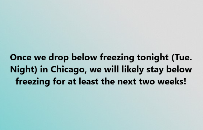
Ready for some winter cold?
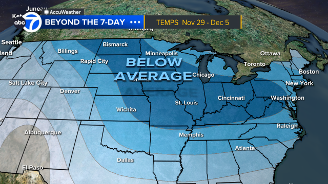
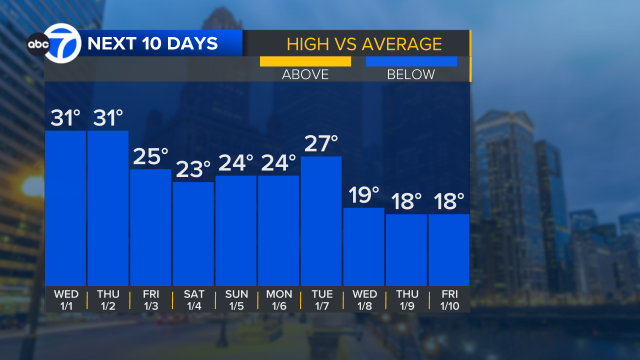
Late next week into next weekend, cold take hold with highs not going above freezing for several days. See high temp bar graph below. Bitter cold may lock in for the first full week of December too.
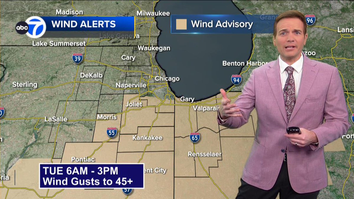
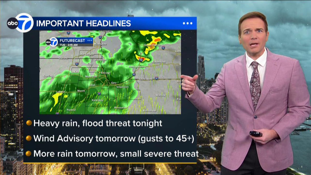
➡️GUSTY WINDS - Wind Advisory for part of the area tomorrow from TUE 6am to 3pm. Gusts to 45+ mph possible.
➡️LOW SEVERE THREAT - small risk of a severe storm tonight. Another small threat of a severe storm tomorrow afternoon. Chance is low, but wanted to mention the chance.
ACTIVE WEATHER TONIGHT AND TOMORROW
Key Points...
➡️HEAVY RAIN TONIGHT - swath of heavy rain and storms tonight could produce some isolated totals of 3+" of rain leading to a flood threat. Heaviest rain threat will be between 9pm and 3am. (1/2)