From our dear friend and NashSevereWx founder, David.
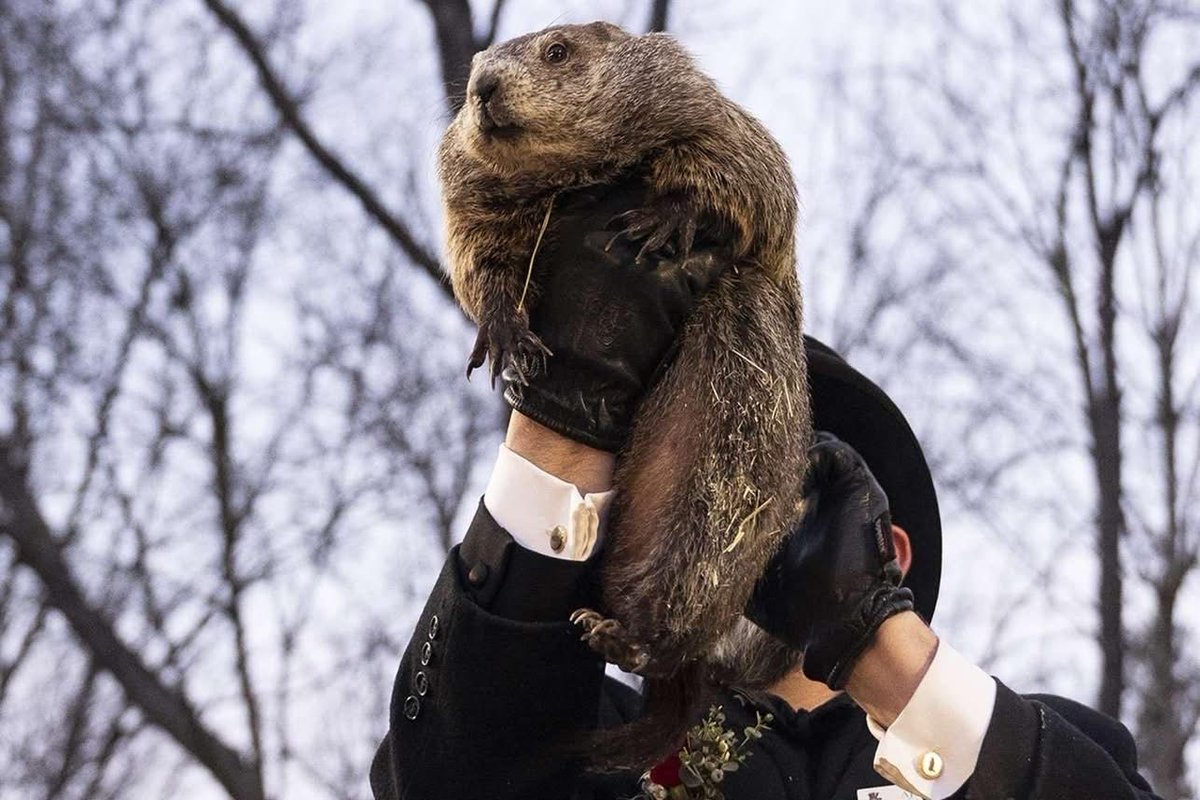
Well they did it again. Tophats pulled that giant rat from its cage and thrust him in front of gathered media.
Conclusion 6 more weeks of winter. That poor rathog doesn’t even know what a shadow is. Did the tophat see his shadow? Same effect. Now media all over the USA will tell people the key to forecasting a meteorological constant is a Pennsylvanian rodent. other states have their own Phil.
I hope one day the rodents take over and each Feb 2 they gather and pull a scientist out of his or her house and thrust them in front of a computer to do forecasting. This has been my annual Groundhog Day rant. Justice for Phil.
@HeatherMorozov From the blog: "Besides an outside chance of some flurries, maybe some light snow, on Friday – we will remain dry throughout the forecast. Any talk of another winter storm headed for our area is completely and entirely false."
Cold and lots of Sun today. High today is 18°. Worse, single digit lows for the few nights. Warming shelters remain open in both counties. Don't be afraid to use them. Power slowly coming back as crews work tirelessly. Give tree and power crews some room and check in friends and loved ones.
- Potential Ice Storm To Unfold Later Today and Sunday
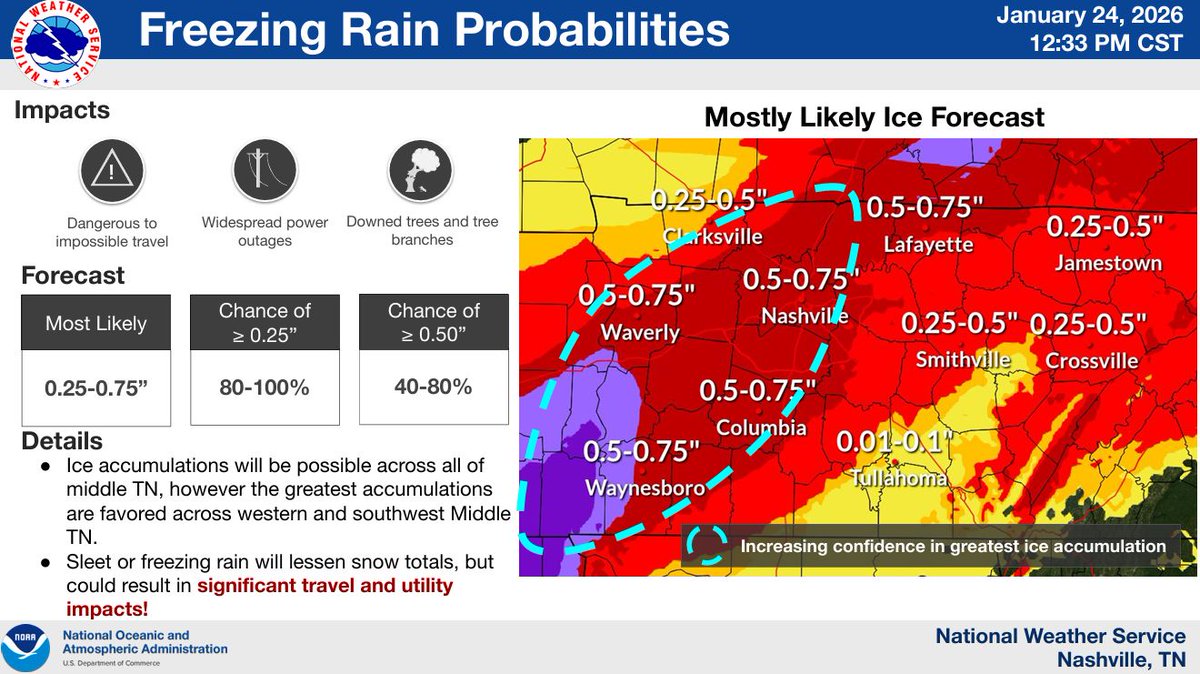
- Ice Accumulations of 0.5 - 0.75" To Cause Possible Power Outages/Tree Damage
- Prolonged Dangerous Cold To Follow, Wind Chills Values Near -10° Early Next Week
New blog here https://t.co/SuJFW9ofQm
Current expectations: Snow north of 840. Sleet S of 840. Sleet line will creep north for the next 3-4 hours. Transition to liquid freezing rain this evening (booo) for all of us. This is where real trouble begins for trees/electrical infrastructure. Surface temps *may* warm just above freezing in S and SE Williamson 4-10 am Sunday, other wise freezing rain continues until early afternoon Sunday. These expectations are *current expectations*. We'll see how things evolve.
We'll be live at 5:00 pm with the latest for Davidson and Williamson Counties as well as talk about ways to prepare for the impacts we face over the course of this storm. Link: https://t.co/RH4XoLzEsN
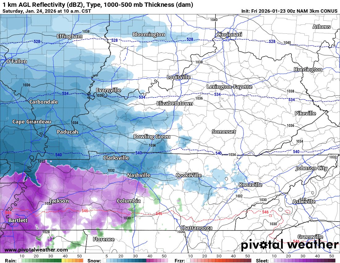
So as we wrap things up for the night i want to dive in to some forecast notes. We continue to have high confidence in a winter storm. Warning lasts through the weekend. Do weather models agree on anything? Some form of frozen precip very likely to fall. Here are snapshots from the NAM and HRRR models at 10am and 6pm on Saturday. Remember, guidance not gospel.
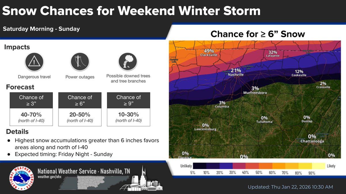
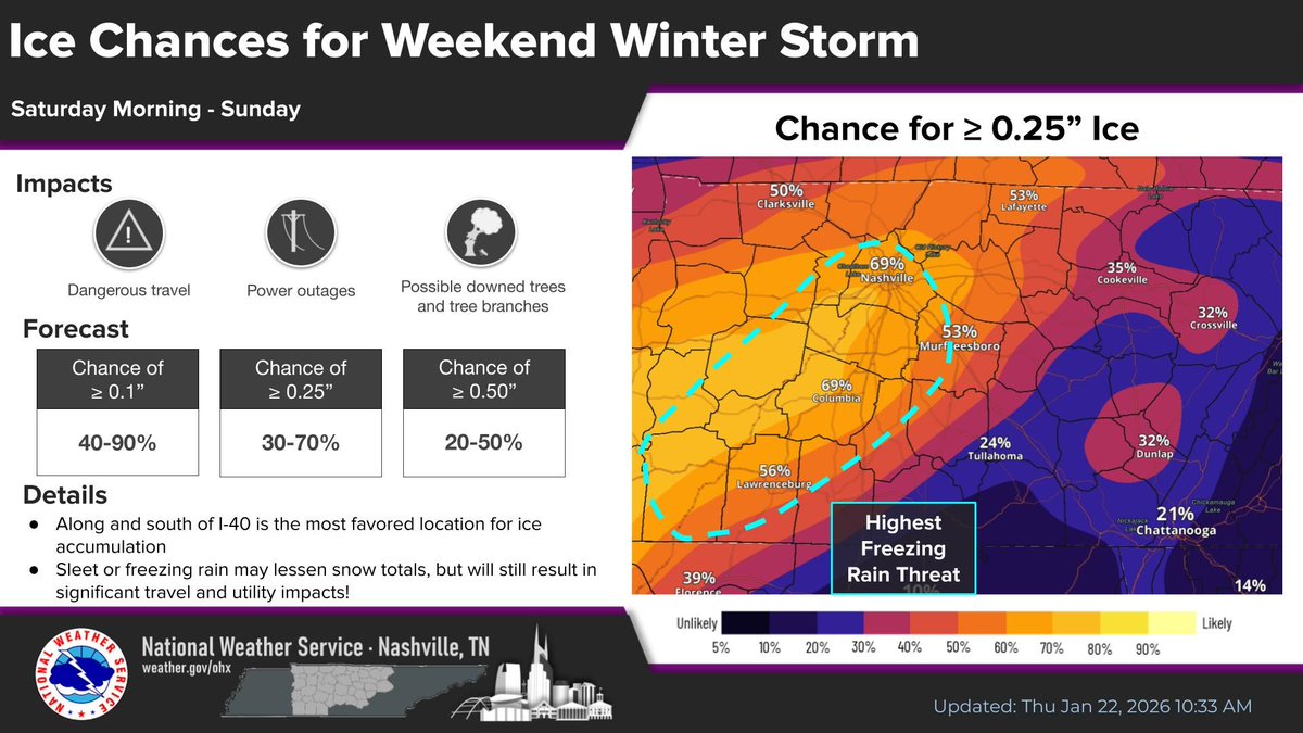
To continue what we talked about in the thread this morning...a couple of new visuals from NWS Nashville. One graphic shows the drop in chances of snow accumulations over 6 inches. The other is much more concerning and highlights our two counties as the highest freezing rain threat, currently. We're entering that phase where details are beginning to emerge and things happen fast. Stay connected to this forecast as changes take place.
Let me clear the air on something that has come up more than once in the past hour. It has been suggested by some that we're stringing you along on lack of forecast details and/or clearly concerned about ad revenue/clicks on the website. To have to address this implies a clear misunderstanding of how this organization works, and maybe you'r new here. Welcome! Never once in my 11 years have I or anyone else at NSW left out details to string you along. Ever. And we never will. We will tell you what we know and what we don't, full stop. Secondly, we are 100% supported by donations, using two methods Patreon and Paypal. The website costs us money every single month and has never generated a penny. Now that that's behind us, back to regularly scheduled programming. And, thanks for being here. Really.
Our friends at @Nike absolutely got us outfitted right with the new Nike Mind 001 🙌
Their new neuroscience-based mule is built to strengthen the mind-body connection and help the Dukes feel calm, focused and present!
#GoDukes
Open Table Nashville is in full-on winter mode taking care of vulnerable fellow Nashvillians. With a few clicks, you and I can be part of their efforts! They'll be busy every night this week. Let's make this happen, fam! https://t.co/GqbSpdDYmX
@NashSevereWx You’re the only reason I still have X.
I push only your notifications to my watch so that I always know whether updates severe or not. Excited to watch the evolution of your platform.
GOOD NEWS! Northern Lights are slowly but surely dropping further south right now.
This map is based on the latest reports across the United States. Keep in mind, we are still very early into tonight. They could drop even further south, or stall. We'll have to wait and see. Get your cameras ready!
during commercials of @911nashville (a TV maxidrama featuring attractive people rescuing folks while managing complex family sitches and base amorous urges), consider helping our most vulnerable Nashvillians by donating food, shelter and warmth that will go directly to those in need through Open Table Nashville. Winter is coming. https://t.co/SLA44FcOqC?
Full-circle moment! @Coach_Lea is coming back to where it all began. We’re thrilled to welcome @VandyFootball head coach and MBA class of 2000 alum Clark Lea as our 2025 commencement speaker.🎓#RollRed