While rare, looks like this Meteotsunami nowcast ended up verifying with the South shore of Lake Winninago being impacted after the tornado occluded. Last instance of this I can recall one video is from the Canton Lake 2011 tornado.
Casual flex that I was able to identify the potential for this. Don’t think anything will ever top the 2011 video tho
https://t.co/Ng9fjmLe67
I anticipate the Appleton, Wisconsin tornado to be rated in the ballpark of EF3.
Intense tornado that was probably on the surface for 30 minutes (between being on land and as an intense tornadic waterspout on Lake Winnebago):
A result from my M.S. work: in idealized simulations of a rear-flank storm interaction, the "parent" supercell in an "interaction simulation" produced *substantially* more surface vert. vorticity than a discrete control storm, for a much larger period of time (34min!).
Hot take: These plots right here are the most overrated thing in the forecast toolbag. I almost never use them.
It’s not that what they show is wrong, they’re just only useful in post analysis IMO.
I can’t think of a single day in my career i owe to picking a target based on one of these. You don’t need em.
A tornado-supercell perspective like none captured before. Almost three days later we are still wrapping our minds around the wonder of the Tulliby Lake, Alberta tornado.
With this speed-ramped clip from our 360, you see large oil tanks (4-8 tons empty) being knocked over and a grove of trees demolished as the twister moves onto the lake surface, illuminating the subvortices near ground level. At the same time we can see the entire tornadic structure, wall cloud, RFD cut, billowing updraft and fanning out anvil cloud 12 miles above - complete with a double rainbow.
Sadly, just downwind a house was swept clean from its foundation and vehicles launched into shredded forest, but fortunately, the home was unoccupied at the time.
We have a lot of data analysis to do, but we will share both findings and amazing video perspectives like this over time on our socials!
- Nelson Tucker
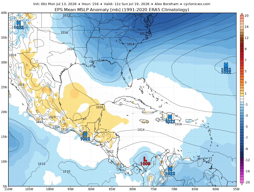
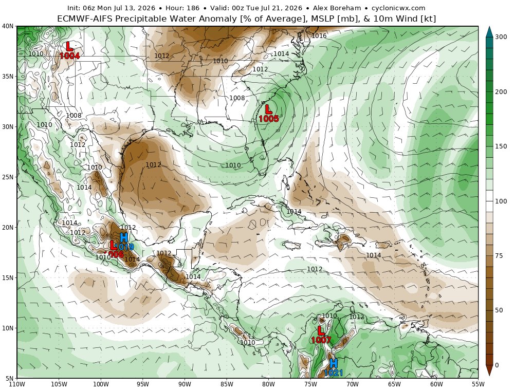
Despite what some have advertised on here, TC development in the northern Gulf currently looks unlikely.
By the time a disturbance moves into the gulf, a trough over the northeastern US will limit time over water whilst deforming the low-level flow, making it difficult to aggregate and stretch vorticity into a TC. Regardless of development, this synoptic setup will transport abundant tropical moisture up the East Coast, generating a flood threat.
No words. Here is a peak at one of our most incredible drone flights around a #tornado to date near Tulliby Lake, AB.
The odds were completely stacked against us on this one, but thanks to some determination to make the 18 hour drive up here pulling an all-nighter, and brilliant forecasting by Nelson Tucker we were able to see this beauty.
This will likely be one of our last intercepts of the season, thank you so much to everyone for following along as we press on to properly measure tornadoes to push weather science forward!
#stormchasing #nature #weather
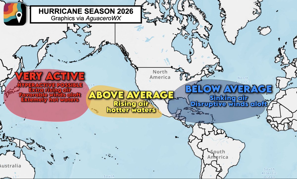
GREAT NEWS! Colorado State University is now predicting the quietest hurricane season in 13 years – if not longer!
We're expecting well below-average activity across the Atlantic thanks to sinking air and near-average water temperatures. Harsh upper-level winds will also tear apart storms as they try to develop, meaning fewer will form.
Colorado State University updated its seasonal forecast on Wednesday, now calling for only 9 named storms compared to an average of 14.4. They only expect 4 to become hurricanes across the entire Atlantic, and just 1 to reach major hurricane strength (Category 3+).
While this doesn't guarantee the U.S. will be free from concern, it dramatically reduces the chance of major impacts or hurricane landfalls.
The North Pacific, meanwhile, will be active or hyperactive.
It's all thanks to an intensifying El Niño, which begins with hot waters in the eastern tropical Pacific. This could be the strongest El Niño on record, meaning red-hot waters in the eastern Pacific. That warms the air above, causing rising motion – and more tropical cyclones there!
But what goes up must come down. That's why we expect subsidence, or sinking, over the Atlantic, squashing many attempts at tropical cyclone formation.
Moreover, El Niños tend to induce greater wind shear, or disruptive changing winds with height, in the Atlantic. Some storms will be shredded or "sheared apart" before they can ever mature.
Finally, we DESERVE a break!
There was apparently a tornado in Alaska on July 4th, and it was fully condensed, too! That's incredibly, and I mean incredibly, rare. I honestly can't recall seeing a fully condensed tornado documented in Alaska before. This footage was captured near the Alpine Creek Lodge outside of Cantwell, Alaska.