Botanist/Forester/Arborist/Ecologist/Environmentalist/Animal Rights Advocate/Cat Mom/Snowboarder/CSU Chico Geosciences & Yale School of the Environment Alumna
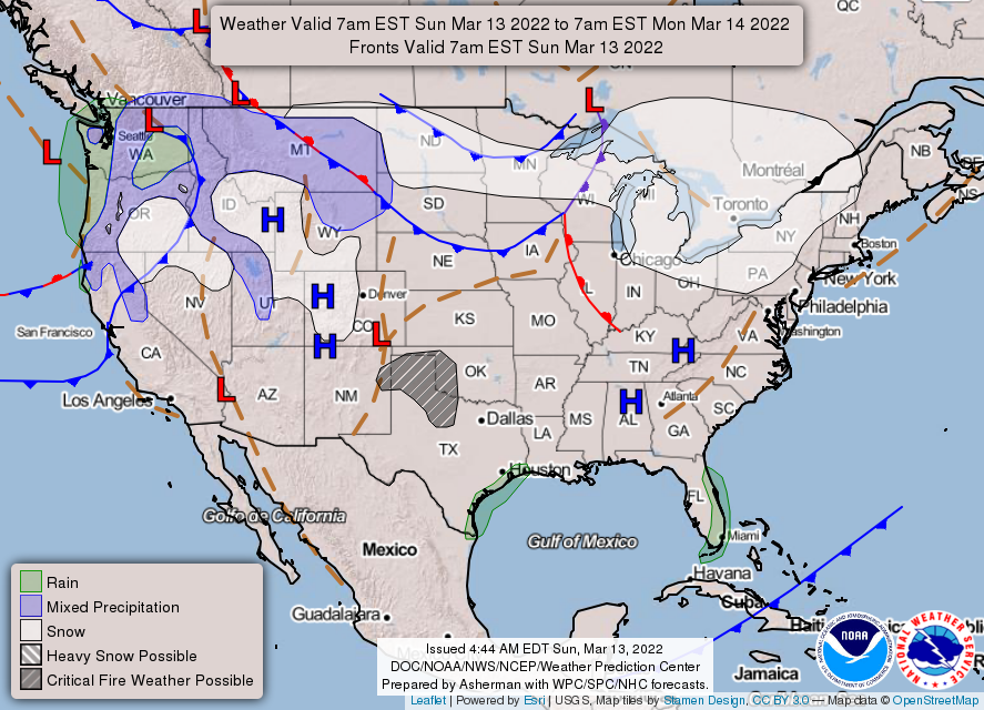
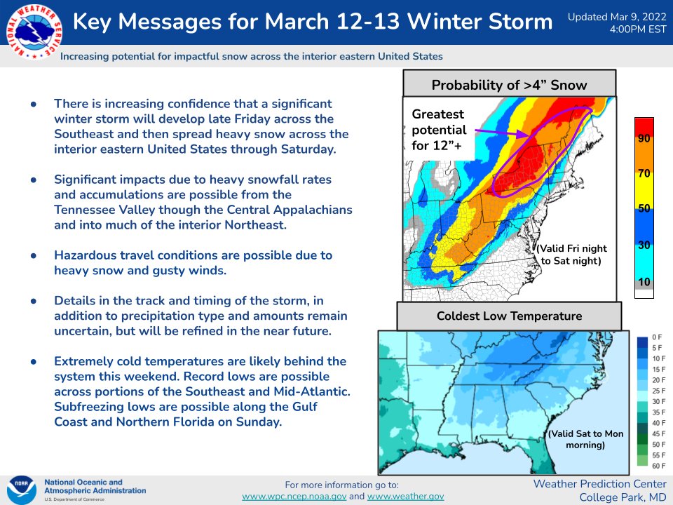
This morning, record low temperatures are forecast for the Southeast into the Mid-Atlantic. A storm will bring some heavy precipitation and gusty winds throughout the Pacific Northwest. Critical fire weather conditions will impact the Southern High Plains.
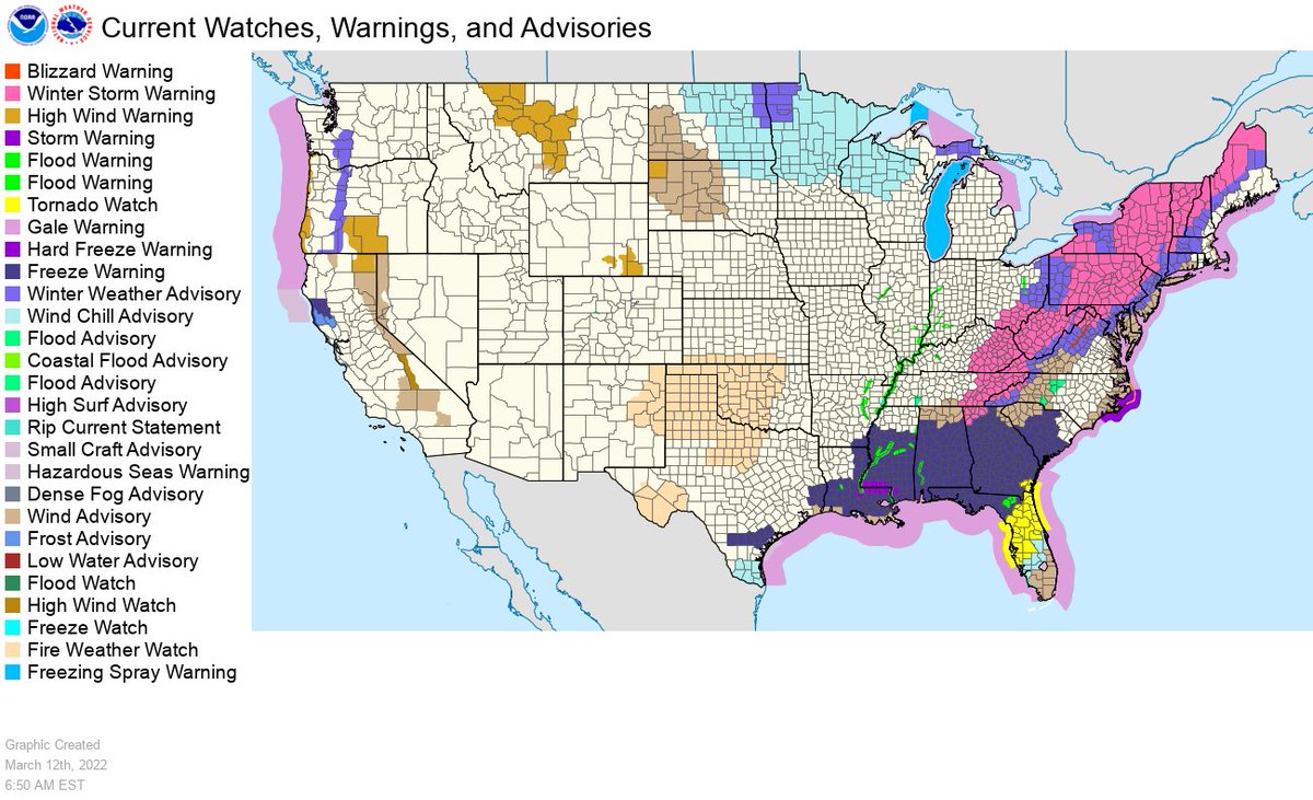
Widespread hazards are in effect today across the Eastern U.S. as a powerful cold front and low pressure system plow through the region. The hazards include winter storm warnings, widespread wind advisories and currently a tornado watch in effect across Florida until 11am ET.
Though showers and storms are ongoing across much of the area with the highest threat for severe weather today, the period of greatest concern appears to be late tonight into Saturday morning, when damaging wind and a few tornadoes are possible. https://t.co/VyWINDk3xP
Thunderstorms capable of damaging wind, isolated hail, and a few tornadoes are possible across parts of the Southeast and Carolinas. The greatest threat appears to be late Friday night into Saturday morning.
https://t.co/VyWINDk3xP for more.
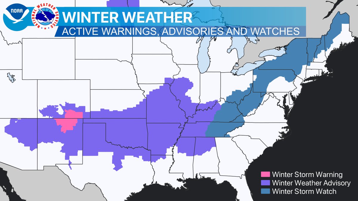
A wide swath of winter weather products are in effect, stretching from Arizona in the west, to Maine in New England. Find and follow your local NWS office at https://t.co/GWrG0hTRHN for details on what to expect in your area.
Thunderstorms with damaging wind gusts are possible along the southeast coast this afternoon. Follow your local NWS forecast office on social media for the latest forecasts and warnings.
https://t.co/GWrG0hTRHN
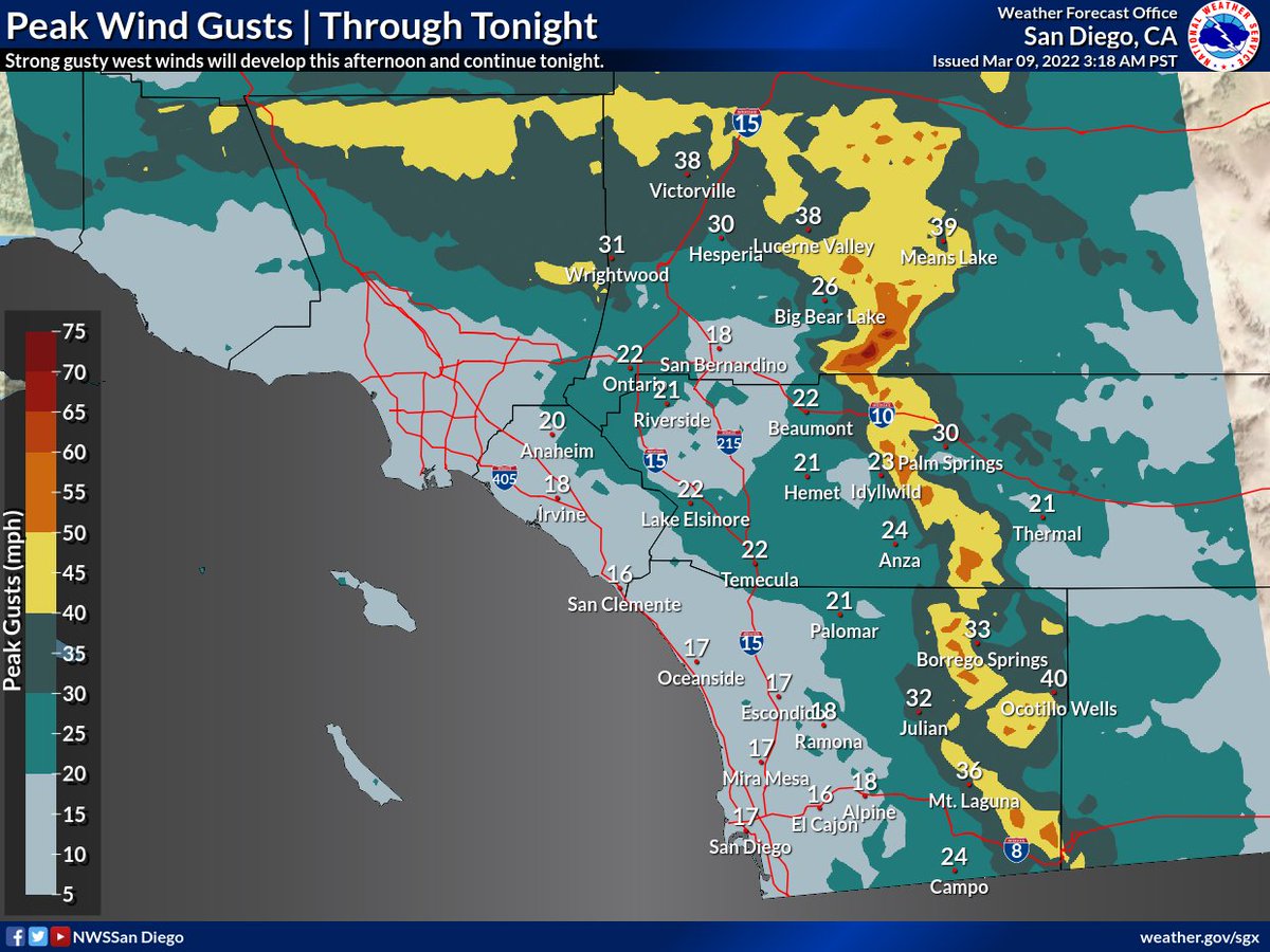
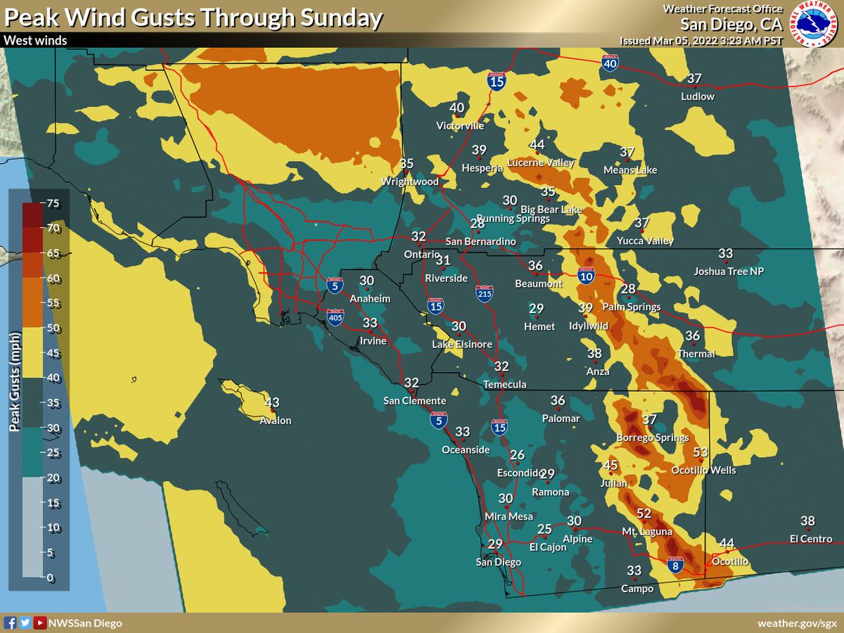
Winds will be the biggest weather story today and Thursday. Onshore winds will pick up today and offshore winds will take over Thursday. Here are the maps showing peak gusts each day.
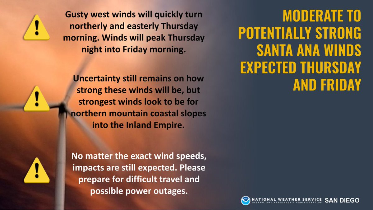
Gusty west winds are expected across the High Desert on Wednesday, where a Wind Advisory is in effect 🍃 Winds will quickly turn offshore by Thursday morning. Uncertainty still remains how windy it will be in SoCal Thursday & Friday, but stay tuned for details! #CAwx
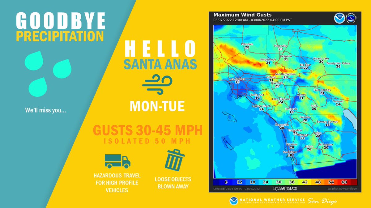
Back to our regularly scheduled winter 2022 weather... Santa Ana winds 🍃
Northeast winds will continue to increase this morning, peaking midday, then decrease somewhat late this afternoon and evening. Another uptick in winds is expected Tue morning. #cawx
Here come the winds (and maybe even a light shower? 🤭) as we head through the week. Give our latest forecast video a watch to see what we got goin' on over the next few days 🍃 https://t.co/M934cSgcn8
#CAwx
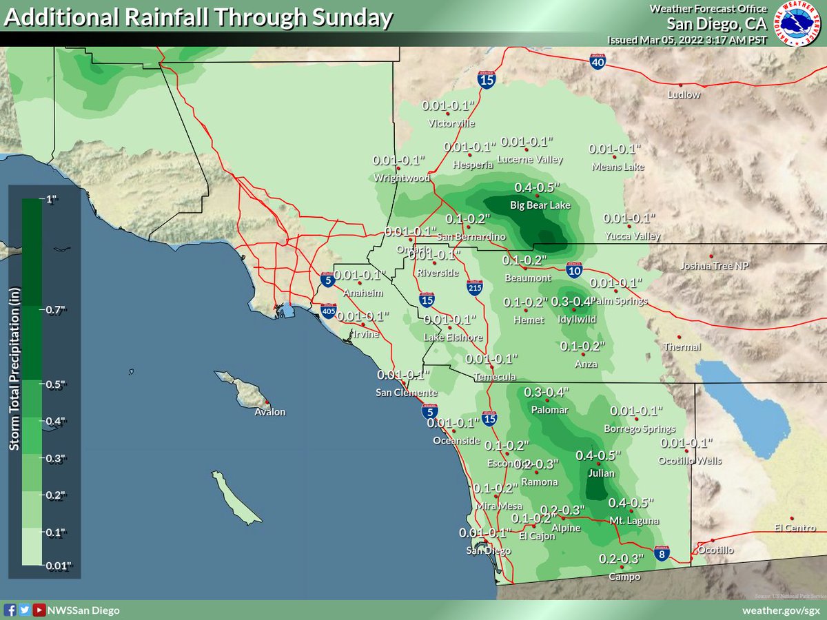
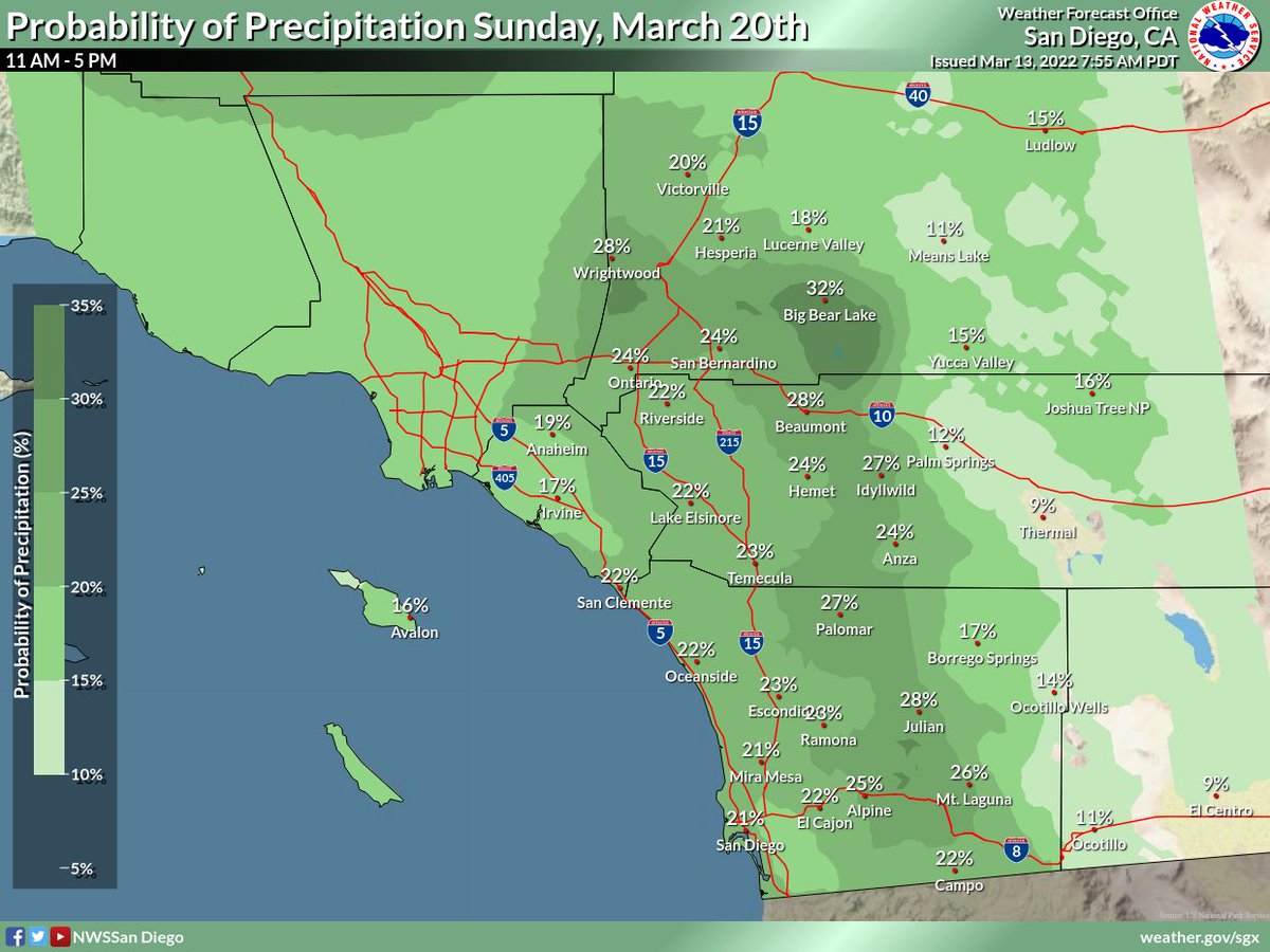
Wind, snow, and rain, oh my! 🌬❄🌧 Here's a look at what's still to come with this storm. Sunday will be a little warmer and drier if you're looking for some outdoor weekend activities.
Showers are slowly coming to an end this morning. Tomorrow we return to your regularly scheduled weather, which this winter appears to be *checks notes* Santa Ana Winds 😒
[9 AM Radar Update]: After a big push of rain and isolated thunderstorms this morning, the coverage and intensity of the rain is diminishing across San Diego County. What did you see where you are?
#CAwx
1030 pm radar update - the initial band seen on radar didn't reach the ground. The main band extending south from Ventura County should intensify and move into Orange/San Diego Counties around 2 AM. Lightning has been detected with the cell SW of San Clemente Island🌩️ #CAwx
Along with winter storm conditions in the mtns, rain and gusty winds will impact SoCal. Locally heavy rain and thunderstorms possible midnight through mid-morning Friday. Friday afternoon-Sunday morning breezy, and cool conditions with periods of isolated showers will prevail!