Shout out to @CIRA_CSU for finding one of the cooler satellite animations I've seen in a minute.
Outflows and gravity waves gliding over Lake Superior.
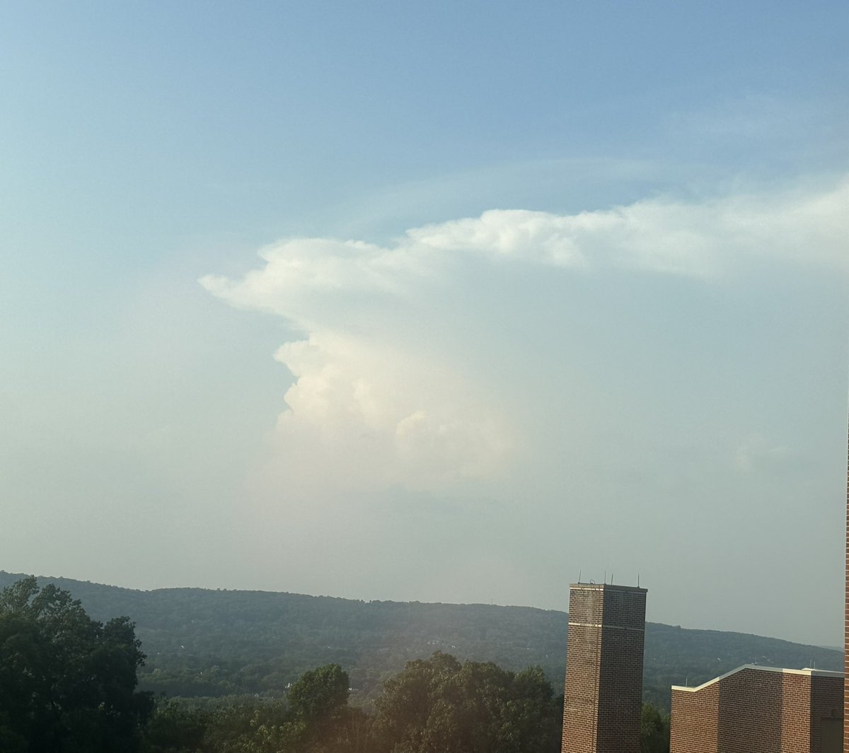
@EasternChaser Cool photos! I was near Bensalem where I saw the furthest parts of the cloud top meander to and fade off back into blue sky. Amazing that it bubbled up from so far up county and reached out so far away, and without precipitation
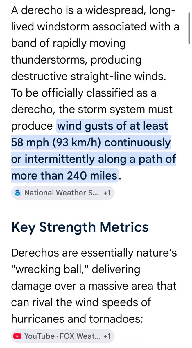
@Allyslayernl@spann It’s a unique and fortunately rare type of thunderstorm that’s very wide and travels hundreds of miles while maintaining its strength. Gusts can exceed 100mph/160kph. The top post in this thread shows how strong and deadly. Not a typical thunderstorm by any means, scary stuff
@Allyslayernl@spann We do indeed have a solid power network, though it differs some from region to region. The pressures and damage they face from even our average thunderstorms is significant and greater than in Europe by scientific data. Had a t-storm last summer with nearly 100kph winds!
@Allyslayernl@spann Even low-end derechos at their minimum 58mph, or 93kph required for classification are immense and dangerous. Europe does have them occasionally and they’re horribly damaging just as in the US. I love my European friends and don’t see it as a competition. Derechos are bad news.
@Chasaru3@MatthewCappucci Now THIS is the play. Bet he could spot some real interesting stuff with six eyes instead of two (I had to google how many a recluse has)