A few spotty showers are possible across North Alabama tonight... then we will experience the coldest air so far this season by Friday and the weekend. Forecast details are on today's afternoon briefing: https://t.co/a7cQmoPgTH
🇺🇸 Veterans Day 🇺🇸 We are flying yellow flags in Orange Beach today - Wednesday, November 11th. Yellow Flags represent a medium hazard and urge caution to anyone entering the Gulf. 🎥: Romar Beach. @spann#alwx
The Heart & Soul Nebulae (IC 1805 & IC 1848), approximately 7,500 light-years away in Cassiopeia.
These enormous clouds of glowing gas are stellar nurseries where new stars are born
This photo was taken in Pike Road and took over 8.5 hours to capture.
@spann@amanduh_curran
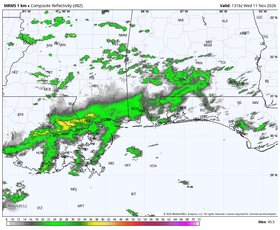
A FEW DROPS: We have a little scattered light rain over South Alabama this morning. It will move out of the state by midday.
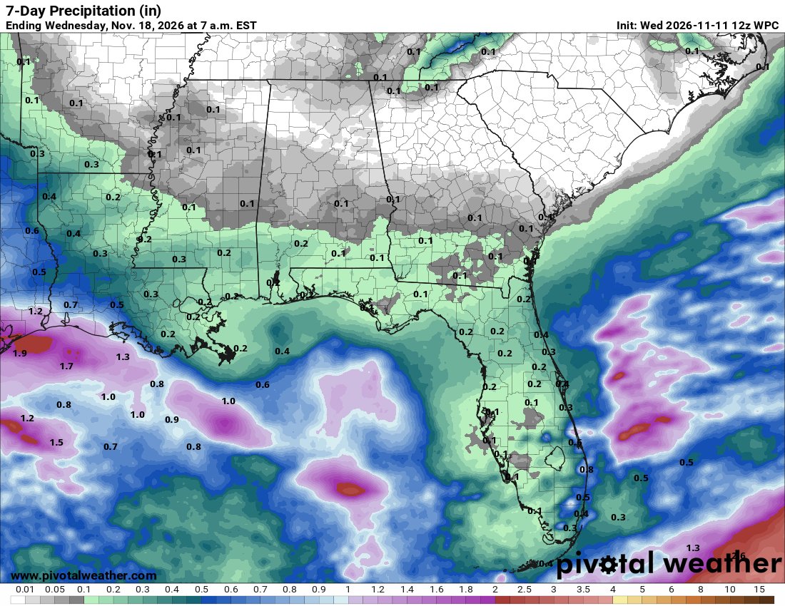
The overall pattern is unusually dry for November, which is typically a wet, stormy month. Some light rain is possible Monday (November 16), but it looks like the next really significant rain event will be at some point over Thanksgiving week.
Drought conditions continue over much of North and West Alabama... the new weekly drought monitor will be released tomorrow morning.
A little light rain for South Alabama this morning, then get ready for the coldest air so far this season by Friday and the weekend. Forecast details are on today's morning briefing: https://t.co/7CxqAy1DdP
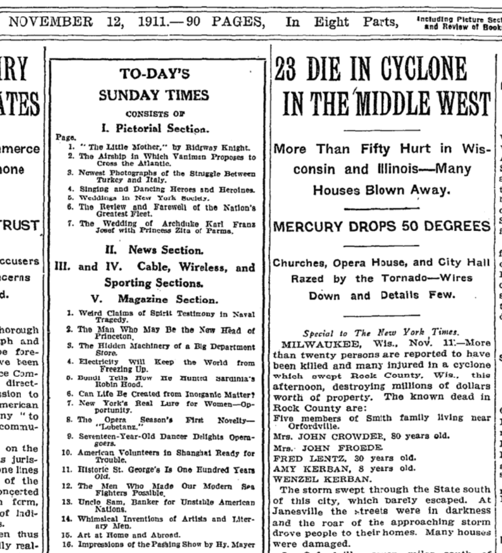
ON THIS DATE IN 1911: 115 years ago today — November 11, 1911 — the central United States lived through the wildest 24 hours of weather in American records: the Great Blue Norther.
The day began like spring. Oklahoma City hit a record high of 83°, Springfield, Missouri reached a record 80°, Kansas City a record 76°. Then the front arrived — a wall of Arctic air behind a dark, blue-black bank of clouds, which is where "blue norther" gets its name.
At Springfield the temperature fell from 80° to 40° in fifteen minutes, with a 74 mph wind gust, and rain, hail, sleet, and snow all fell within two hours. By midnight Oklahoma City was at a record low of 17° and Springfield a record low of 13°.
Both cities set their record high AND record low for November 11 on the very same day — and both records still stand.
Ahead of the front, tornadoes tore across the Midwest — an F4 killed nine people near Janesville, Wisconsin — and within an hour of the tornado, blizzard conditions had set in over the wreckage.
Shorts at noon, parkas by supper, tornadoes and a blizzard on the same afternoon. That's 11/11/11. Listen to this week's WeatherBrains podcast for more on this remarkable event.
@spann We are ready for everyone at Christmas at the Falls in Gadsden!!! Visit https://t.co/C4W79GMJ3O for tickets and info!!! We can't wait to see everyone!!