We Are Iowa's Most Accurate Forecast: Weather updates for central Iowa from Chief Meteorologist Brad Edwards, Chris Kuball, Bree Sullivan and Hannah Dennis.
A beauty of a sunrise this morning over central Iowa as a few weakening showers rolled in. You can see a couple rain shafts towards the end of this video. Great color to start the day! #IAWX#DSM#Sunrise
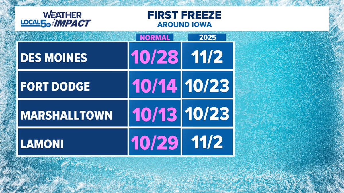
Still a few communities across the southern part of Iowa waiting on their first freeze of the season. But is it actually late? Signs point to no. We've run well into November without a freeze before.
Blustery and cool in the stands for tonight's Friday Night Football games!
Our Friday Night Blitz Game of the Week is a crosstown rivalry between Waukee and NW!
Stay warm!
Our first freeze is possible tonight (10/17) With our mild start to Fall this may seem late but it's actually pretty typical, if not a bit early to be seeing temperatures hit 32°. Last year our first freezes in central Iowa came later.
Wind is just now starting to ramp up. Strongest is expected Friday morning, especially across northern Iowa where wind gusts could touch 50 mph. Difficult crosswind driving is expected for high profiled vehicles as gusts reach 40-50 mph across the state.
Not only windy! But chilly too! Wind gusts run up to the 40-50 mph range from the northwest on Friday morning and early afternoon. This will make for some difficult crosswind driving.
Also look for wind chills in the 30s and 40s through the day! #IAWX#Windy
Persistent rain on the way for Thursday morning through the afternoon. Rain totals up around 1/2" will be common across most of Iowa. Rumbles of thunder will accentuate rain rates at times. Most of the rain falls between midnight and 6 PM and will come in a couple waves. #IAWX
A few storms streaking over southern Iowa early this morning, a few localized places saw 1/4" to 1/2" of rain. More rain storms return overnight in this same area. #IAWX#WeAreIowa#Iowa
Not only cool air arriving on Friday, but a stout wind will mean wind chills will be at play for the first time this season. It'll feel like the 30s out the door on Friday morning with wind gusts reaching 30-40 mph from the northwest. #IAWX
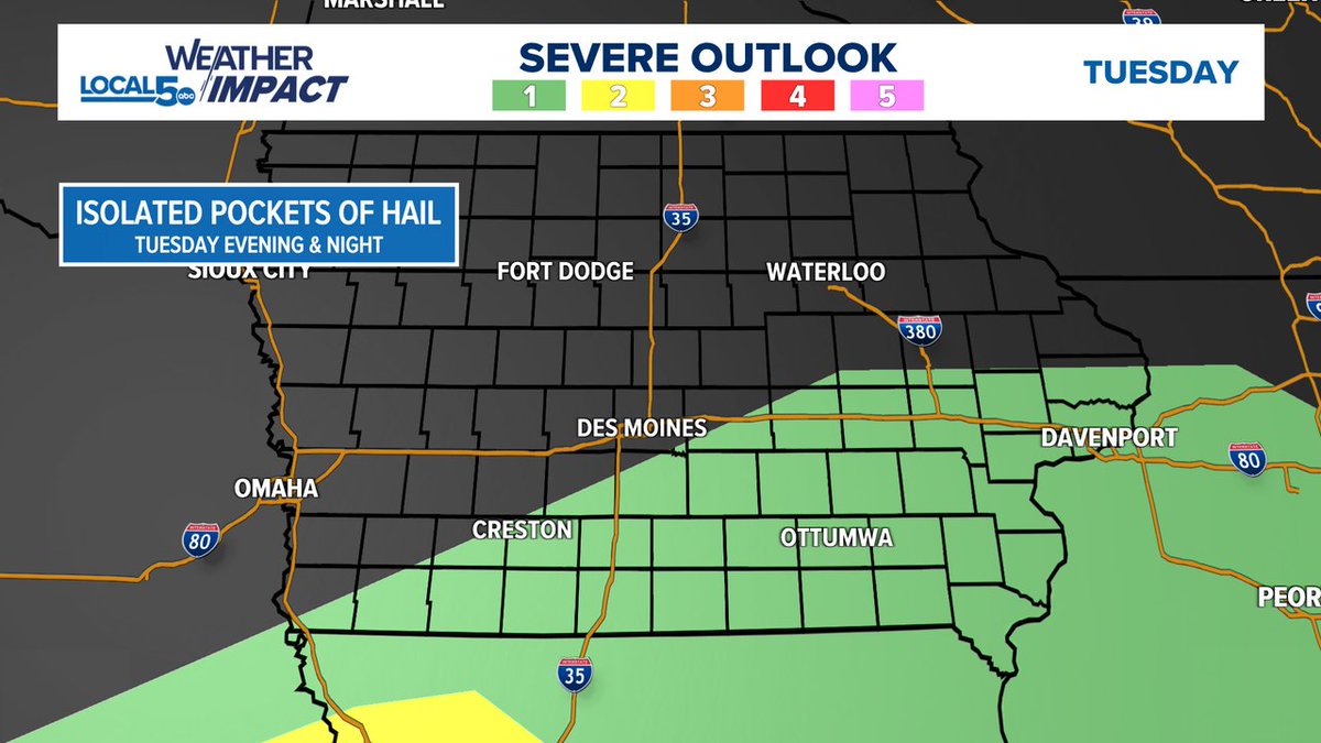
Level 1 risk of severe weather for Tuesday, mainly evening and overnight as a few storms bubble over southern Iowa. The setup would favor a few pockets of hail being possible. Not looking at a big time setup or anything, any impacts felt would be fairly localized.
On record watch for Monday in Des Moines. So far the low temperature is 70°. Should it hold, it would blast a 147° record high low temperature out of the water. The record high of 91° is a bit more safe, but worthy of watching the mercury this afternoon. #IAWX#Iowa