A lab for geospatial computing dedicated to the study of ancient culture and environment at the Middle American Research Institute, Tulane University. Inaugura
Lidar technology allows @MARI_Tulane to peel back the layers of time and reveal lost cities and structures.
Thanks to a $1.5 million grant from the Hitz Foundation, @MARI_Tulane's ability to conduct this work is being greatly expanded.
Learn more ⤵️ https://t.co/bw7lxdwzjv
1. We analyzed 110,000 structures over 2500 km2 of #lidar maps. 2 We found a way to detect #Maya vaulted buildings on lidar maps. And 3. that gave us a key to unlock the structure of Maya urbanism . #mayaarchaeology#Guatemala#Mexico https://t.co/oAKMMopyvZ
That's an impressive growth rate!
And we are ready for it! @MARI_GISLAB#lidar#mayaarchaeology
Light Detection and Ranging (LiDAR) Market to Worth USD 6.71 Billion by 2026 | At a CAGR of 22.7% https://t.co/p2ayQP23Cu
Announcing a new post for the Ancient Maya Settlement blog titled “Becan, a beacon of things to come” discussing the importance of Becan to lowland Maya scholarship. Access to digitized survey data from the MARI project is provided. Hope you enjoy! https://t.co/lUVIftVDND
Hi everyone, I toyed with the Kontur population dataset and created this 2022 population map of Europe for you. It looks like a traffic jam at the heart of the continent 😂😂😂
#population#RStats#DataScience#dataviz#maps#GeoSpatial
Check out this new post by Drs. Mary Pohl and Kevin Pope on the Ancient Maya Settlement blog! All about how, when, and where the ancient Maya made use of wetlands for agriculture! https://t.co/UxeX4b6s1v
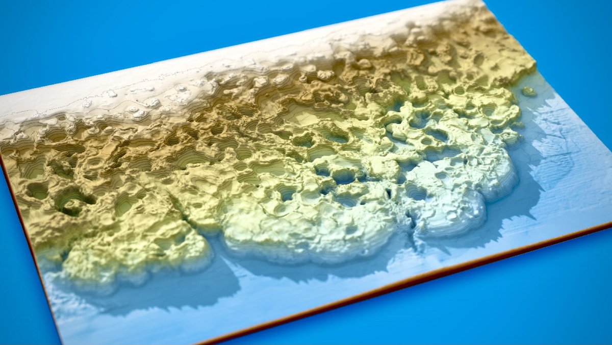
GEBCO bathymetric data from the Gulf of Mexico illustrating a seafloor morphology produced by salt tectonics. Image covers roughly 450 km x 300 km https://t.co/rCZC4BVxmc @gebcobathymetry#rayshader#QGIS#rstats
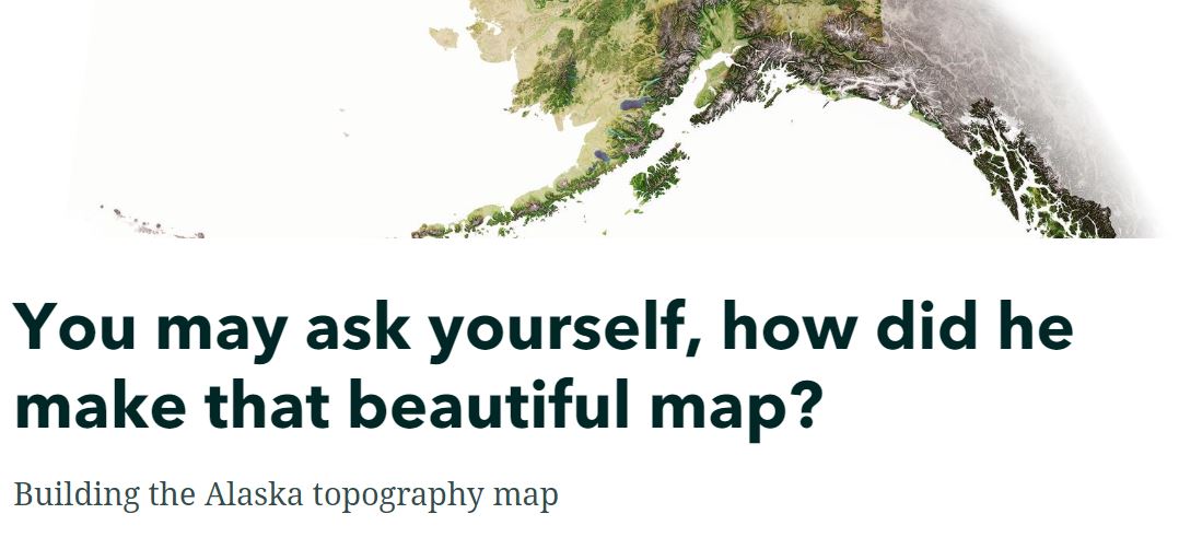
You may ask yourself, how did he make that beautiful map?
Lots of questions regarding my Alaska topography map, so I pulled together a quick #StoryMap in response. Happy reading: https://t.co/wyuBq78Hzd @ArcGISStoryMaps
Article on Pulltrouser Swamp, Belize and maps digitized by our capable team of graduate students at @MARI_Tulane published by Marcello Canuto https://t.co/QppvMUdYul
#MAYA#mayaGIS#mayaarchaeology#Belize
With the latest version of qgis2threejs in QGIS you can set your 3D scenes to autoplay in the browser, following any path you like (as you can see I need to work on this!) - here's the live web page example shown in the video #QGIS
https://t.co/UYMLzqpPBD
The archaeological maps of La Milpa, Belize have a new online home here at the GISLAB at @MARI_Tulane
Free to download.
#mayaarchaeology#Belize#gis
https://t.co/nwqDOoxitn
MARI's interactive map. In 2024, MARI will celebrate 100 years of mapping Maya settlement.
Send us your sites info if you would like them to be included.
https://t.co/4sNePvGRhx
ESA's #Biomass mission, set to launch in 2024, will monitor the world's forests along with #GEDI and upcoming @NASA-@isro#NISAR mission. We've only just begun to understand the intricacies of Earth's forest structure...
@ArmstonJohn@NASAJPL@esa
https://t.co/ErexTm0l1P