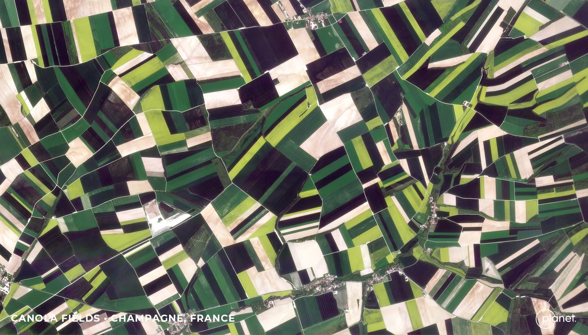
We're excited to announce our partnership with @planet to provide our AI-powered analytics on top of Planet’s high-frequency, high-resolution satellite data. 15+ Land cover categories at PlanetScope resolution can help you understand our changing world: https://t.co/iYOTsQJiQK
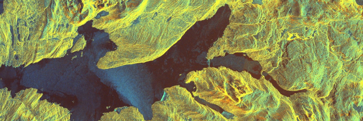
These SkySat images capture water spilling over the Nova Kakhovka dam in southern Ukraine. The dam cuts through Ukraine’s Dnipro River, holding back a huge reservoir of water. The dam’s failure poses a humanitarian and ecological catastrophe.
📸 (1): 6/4/2023
📸 (2): 6/6/2023
Today, through the #RapidAi4EO consortium, we released one of the largest Earth observation training datasets for #ML applications via @OurRadiantEarth.
The data covers 500,000 locations across Europe, captured every five days over two years. Learn more: https://t.co/wqaqtwsesB
Thanks for having me @BBCyaldahakim!
Critical advancements are happening in tech today – be it sat data or AI – that are bringing transparency & accountability, helping both security & sustainability.
We believe we've only scratched the surface of what's possible with our data. 🚀
@Planet's North Star for the next decade is to build an #earthdata platform that empowers action for govts, businesses and leaders around the world.
First light images from last week's launch of 36 SuperDoves are here, and aren't they spectacular? 🤩
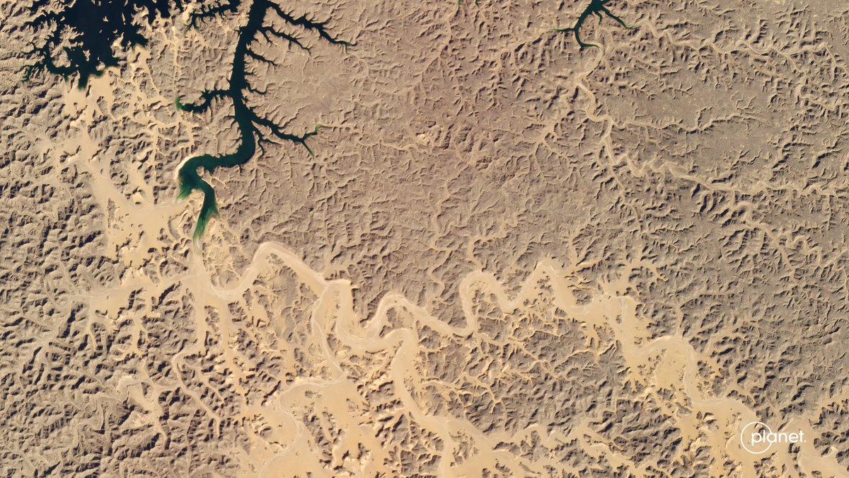
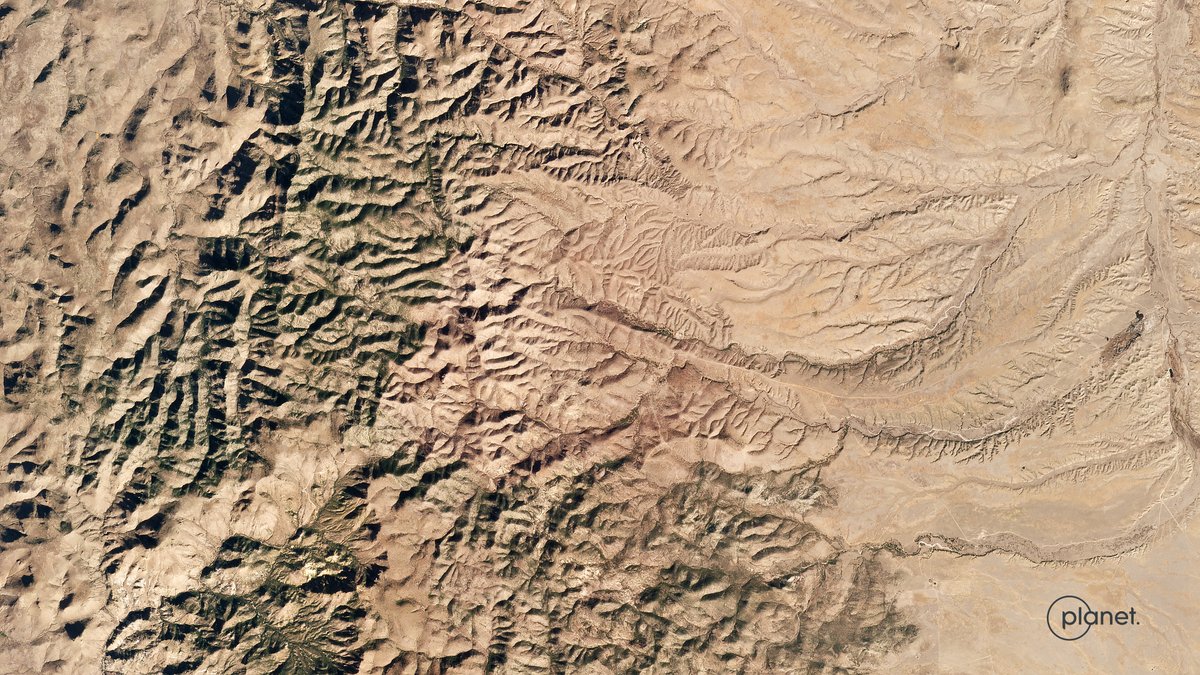
Our sats have already gotten to work scanning our Earth. 📸 here: Budiganga River in Nepal, Lake Nasser in Egypt, Wexford Harbor in Ireland & Whitmire Canyon in New Mexico.
Boldly going…where no dove has gone before! 🛰️
Select Planet SuperDoves on the upcoming @SpaceX Transporter-6 mission will feature art from our collaboration w/ @RoddenberryFdn's #BoldlyGo100 campaign to memorialize our collective hopes for our future. https://t.co/aBFasgJuUT
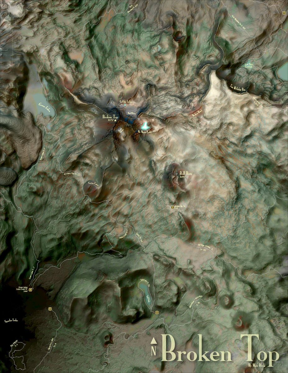
Little map action! Broken Top - Three Sisters Wilderness - Bend, Oregon.
Hillshade help from @John_M_Nelson and typefaces (High Alpine & Belltoposans) created by @sarahbellmaps!
#maps#adobe#geospatial#gis#ESRICommunity
Meet the four-person @NASA_DEVELOP team working with partners at @USDAForeignAg and @USDA World Agricultural Outlook Board to support agricultural policy development in the #MatoGrosso region of #Brazil: https://t.co/WiUbrwyNbM
Save the date: @NASA_DEVELOP Spring 2022 Virtual Closeout Presentations on March 30
Learn how teams of early career scientists used @NASA Earth observations for societal benefit – like studying seasonal water variability in the Midwest. #drought
https://t.co/seWxSVXb6d
I encourage all to join the North Carolina team and I as we present our findings on #evapotranspiration in the Midwest! We have spent a great deal of time using NASA Earth observations to support our findings; who doesn’t love satellites!?
#NASADEVELOP#noaa#geospatial#climate