@weathertrackus Good agreement this morning.
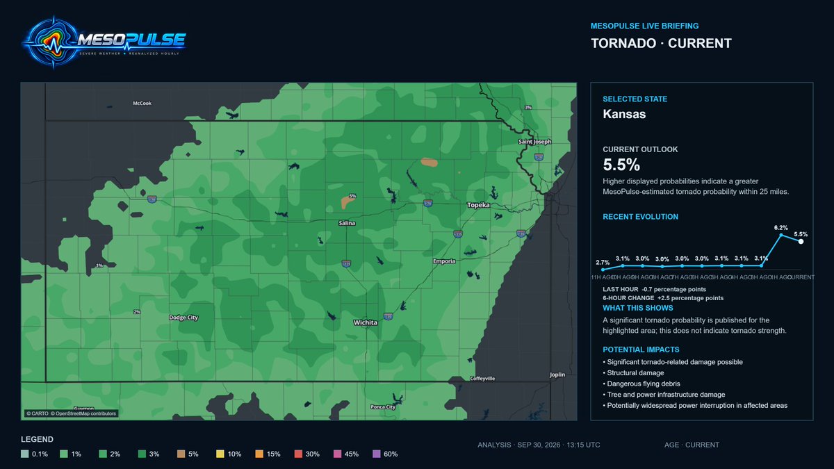
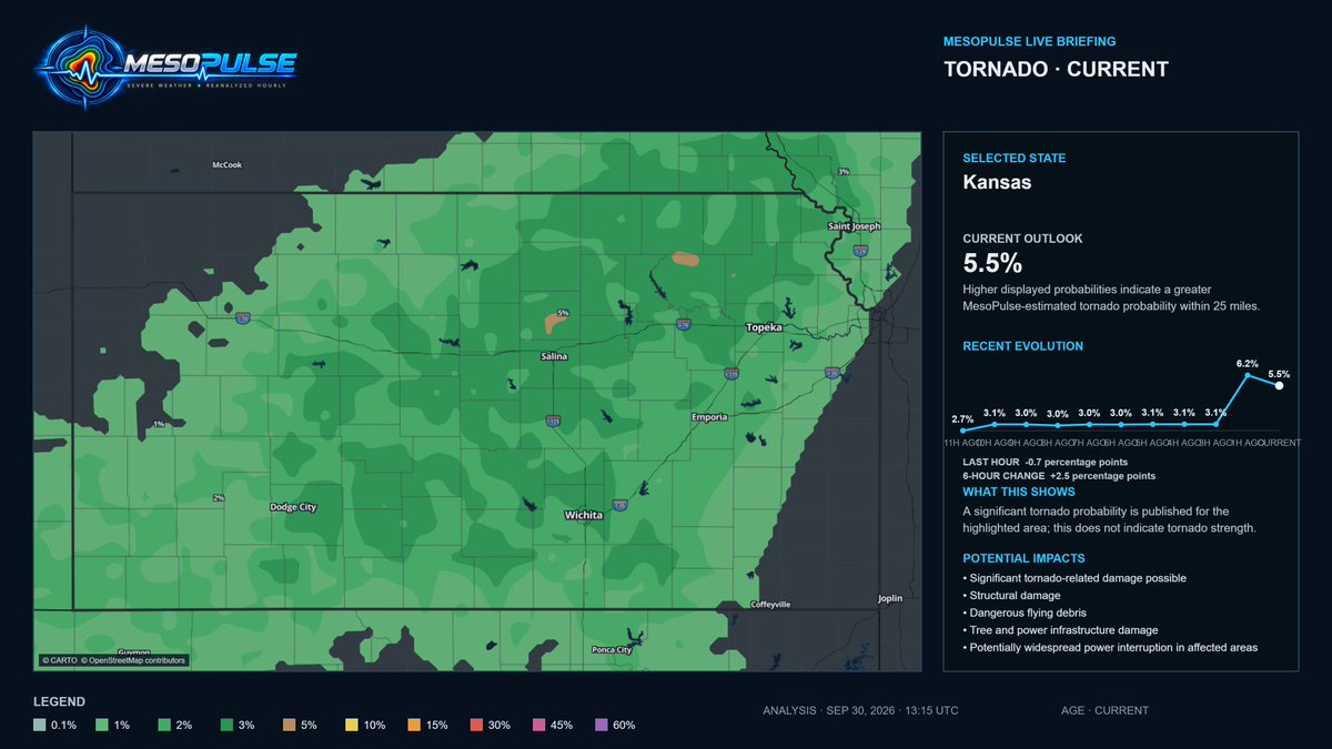
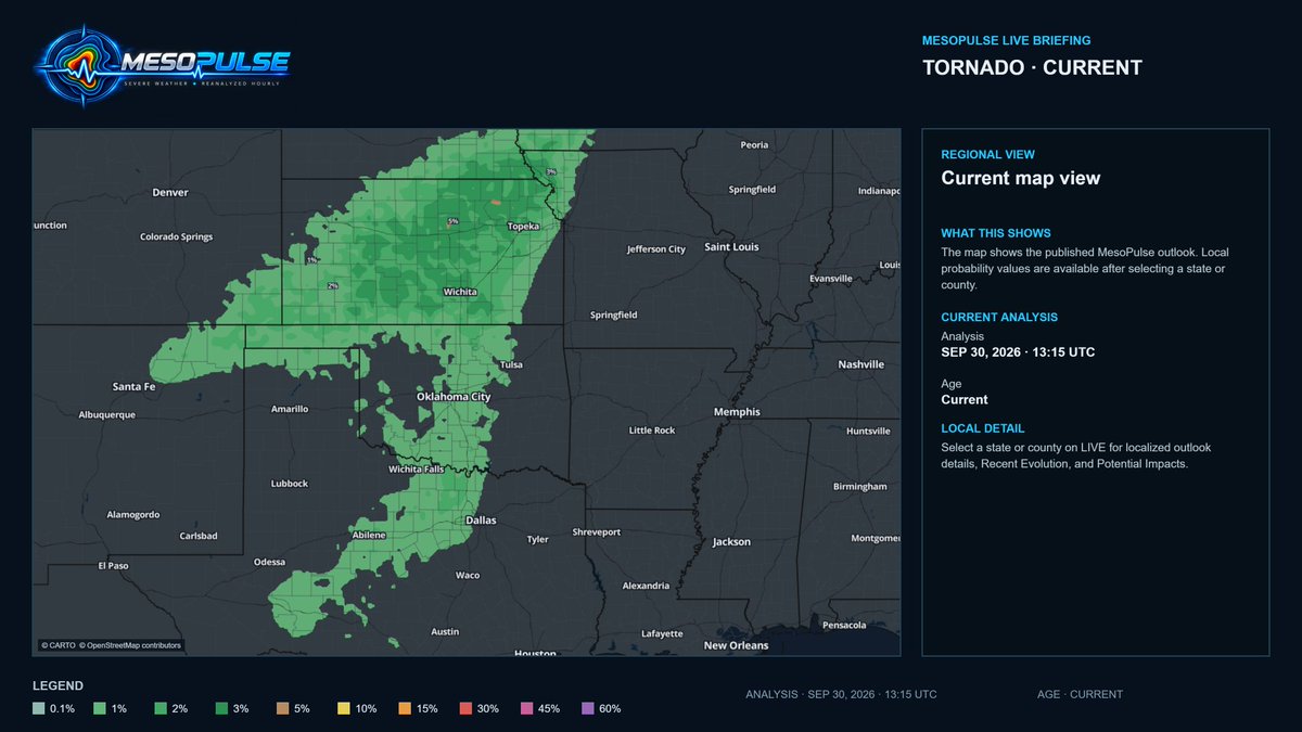
MesoPulse’s 12:15 UTC cycle placed Kansas at 6.2% before the new SPC outlook was issued. The 13:15 update remains elevated at 5.5%, with a focused 5% pocket in north-central Kansas.
Updated hourly: https://t.co/J4anfDHK9O #KSwx#NEwx
⚠️ OUTLOOKS CONVERGE ON KANSAS
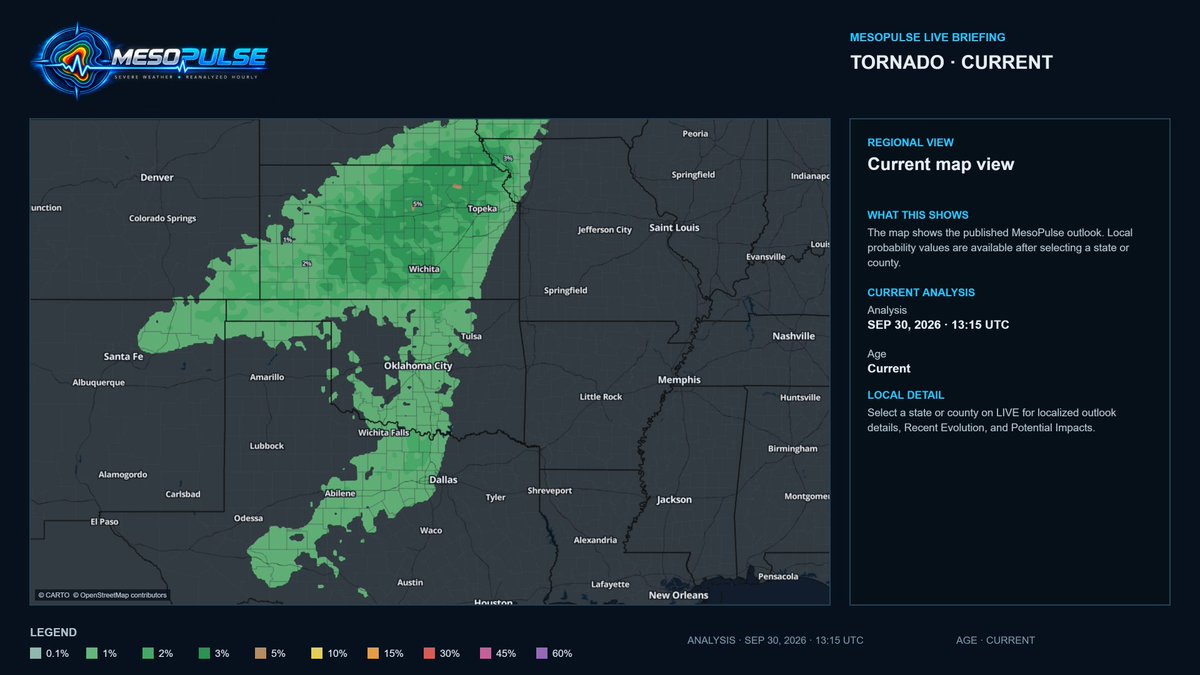
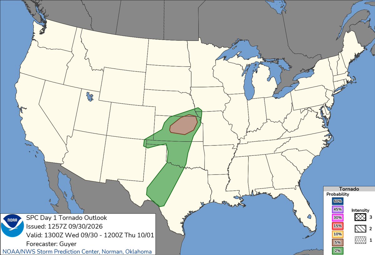
SPC raised today’s tornado outlook to 5% across parts of Kansas and southern Nebraska matching the focused 5% corridor MesoPulse highlights this morning.
A few tornadoes are possible later today.
Reanalyzed hourly: https://t.co/USN4yAezMs #KSwx #NEwx
Lower tornado probabilities extend southwest through Oklahoma and Texas, with additional low-end potential across northern New Mexico and southeastern Colorado.
MesoPulse probabilities are within 25 miles and do not indicate tornado strength. #OKwx#TXwx
⚠️ TORNADO CORRIDOR SHIFTS NORTHEAST
A 5% focus sits over north central Kansas within a broader 1 to 3% corridor. Later today, risk shifts toward SE Nebraska, SW Iowa and NW Missouri.
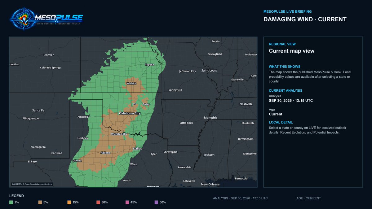
A few tornadoes and damaging winds are possible.
Reanalyzed hourly: https://t.co/USN4yAezMs #KSwx #NEwx
@therobdale Cleaning up the 0.1% from the outlooks yet when when the numbers are increasing, yes some noise, yet that is where we are seeing tornadoes occur greater than 80%. Anything below 3% is definitely more noisier that the larger percentages. Thanks for the feedback
⚠️ MESOPULSE UPDATE
This is why hourly MesoPulse outlooks matter...
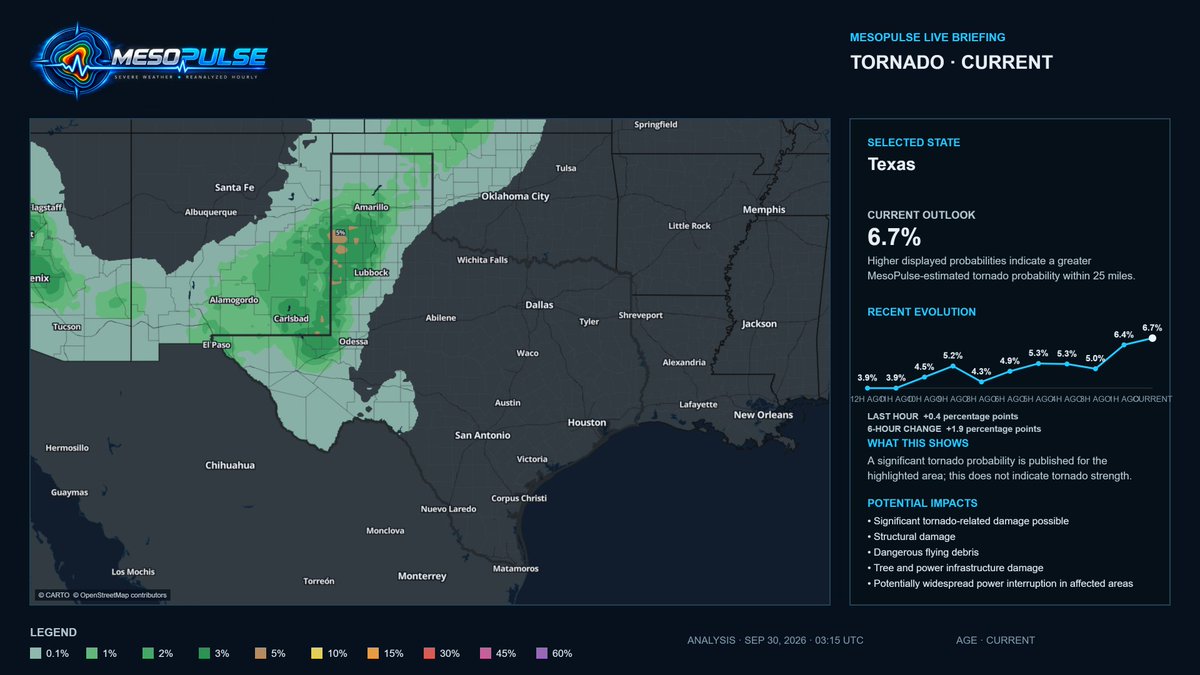
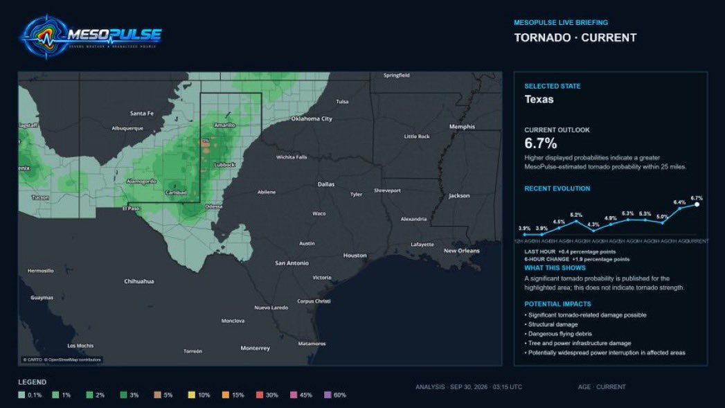
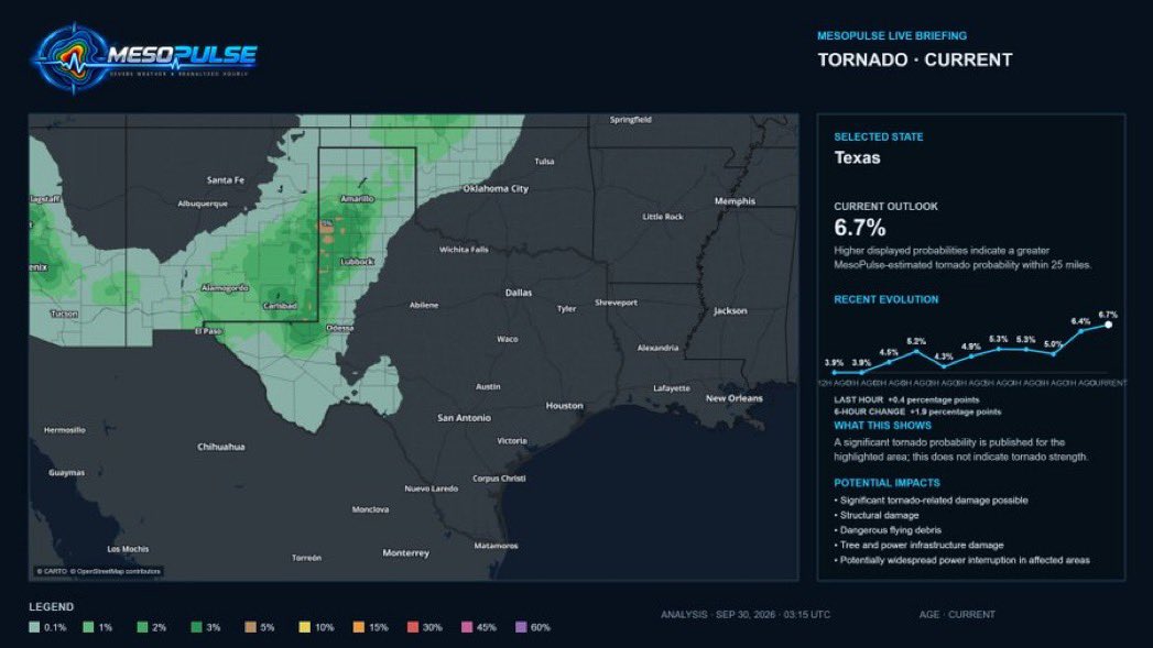
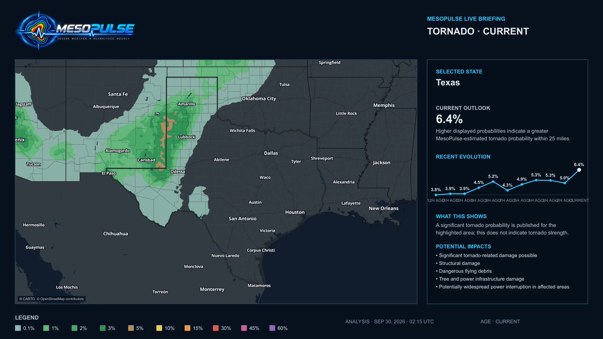
The tornado threat has shifted ENE into the Texas Panhandle.
10:15 PM CDT analysis: Texas 6.7%, up 0.4 points in one hour and 1.9 in six hours. Greatest focus: Lubbock to Amarillo.
Probability is within 25 miles not tornado strength. Follow warnings. #TXwx
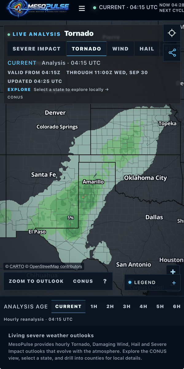
A 5% tornado risk region remains active across parts of the Texas Panhandle (near Amarillo), eastern New Mexico, western Oklahoma, eastern Colorado, and western Kansas.
Track living severe weather outlooks hourly at https://t.co/ueU32QXpsu
Stay weather aware through early Wednesday morning!
#MesoPulse #SevereWx #Tornado #TXwx #OKwx #NMwx #COwx #KSwx
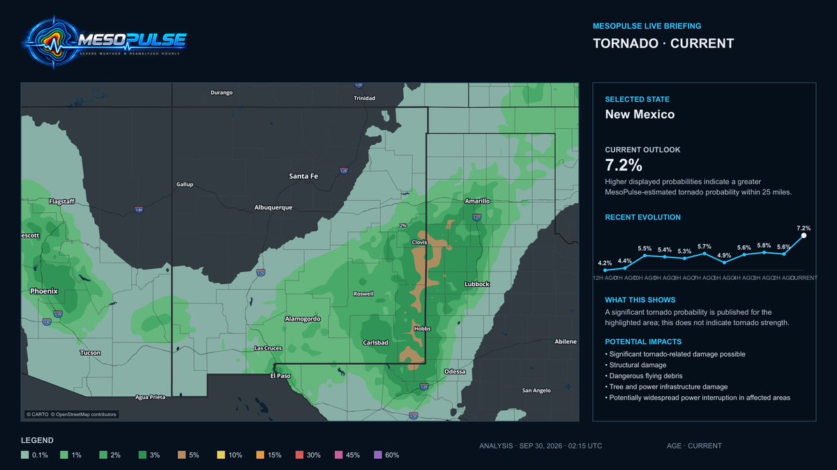
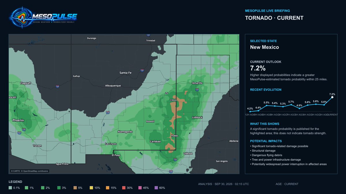
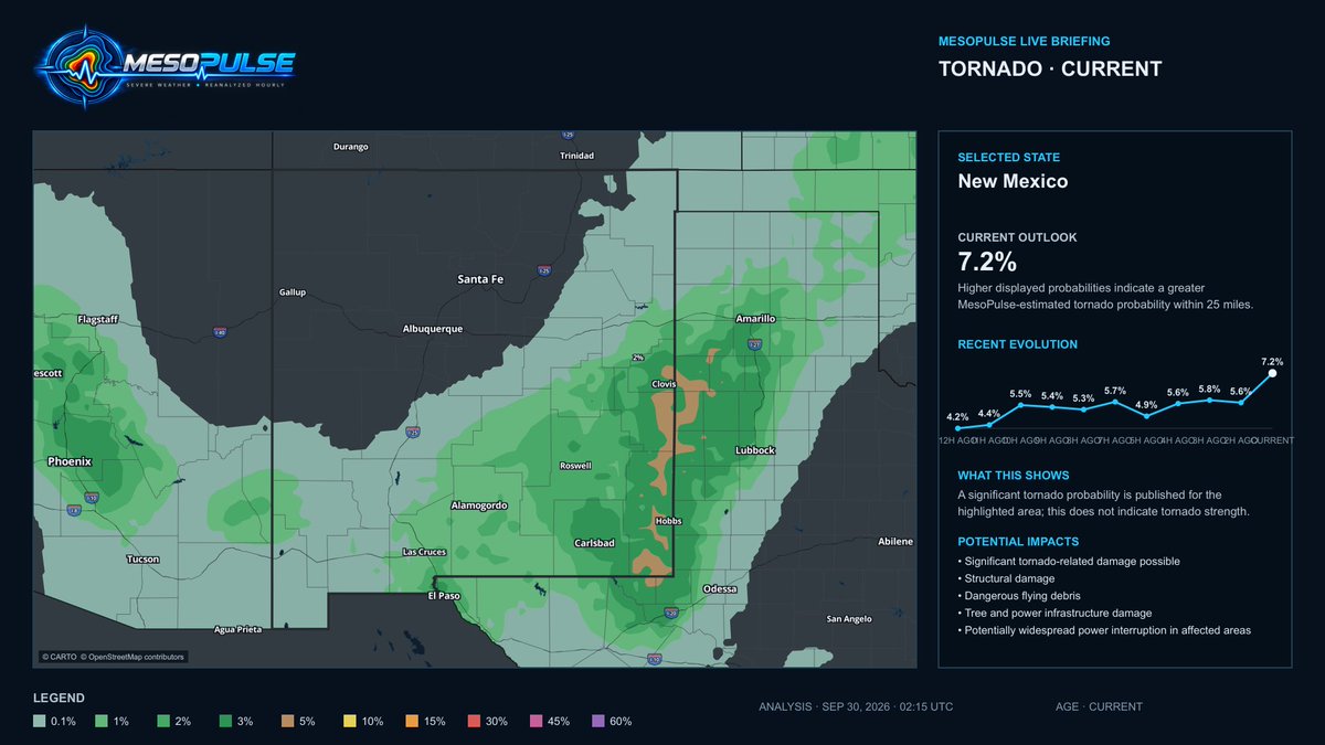
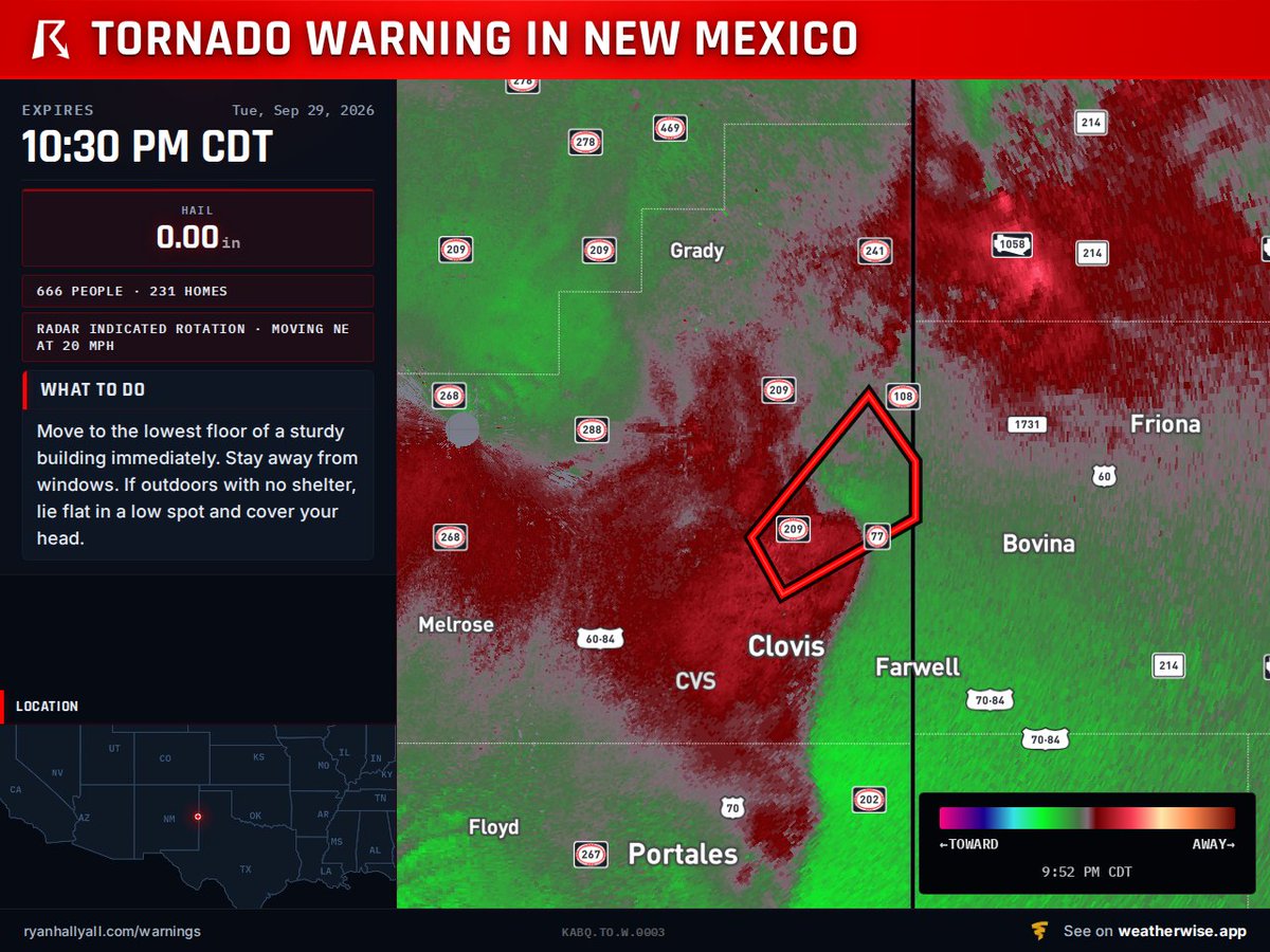
MesoPulse highlighted the Clovis corridor throughout the day.
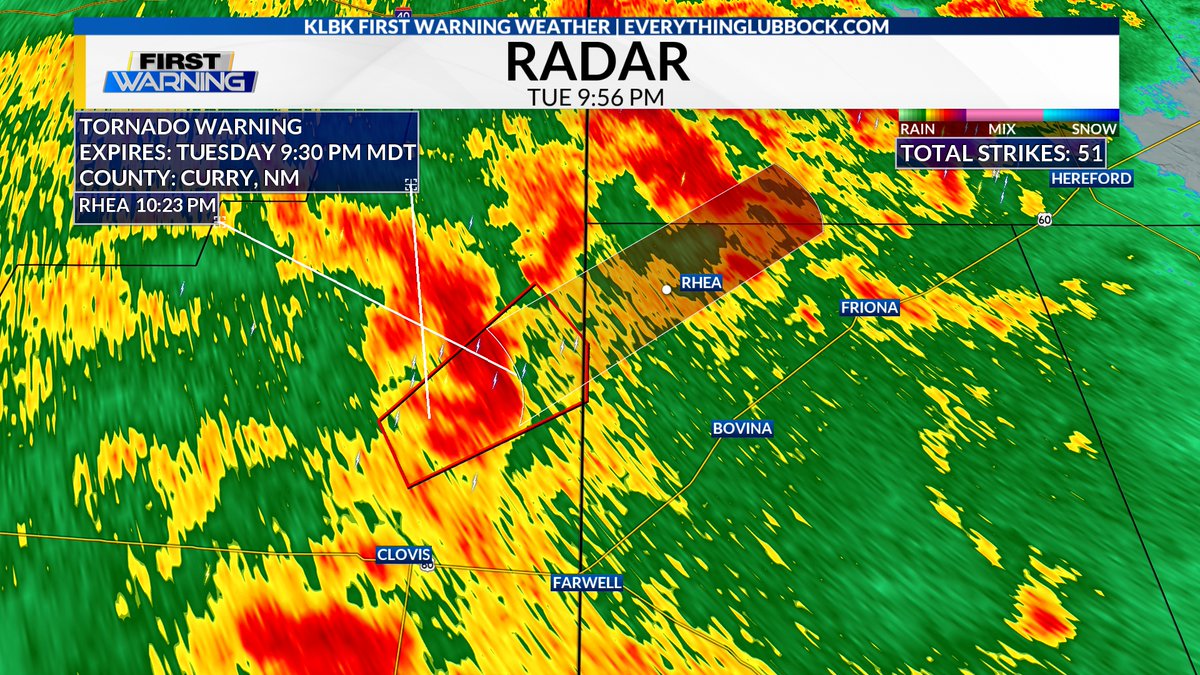
Tonight, a tornado warning was issued after a potential tornado was identified 7 miles north of Clovis, moving NE.
This is what a living, hourly outlook is built to do, tracking the environment as it evolves. #NMwx
8:56 PM MDT 09/29/2026 - A Tornado Warning has been issued for portions of Curry County, NM until 9:30 PM MDT. A potential tornado was located 7 miles north of Clovis, tracking NE @ 25 MPH. Seek shelter if you are in the path of this storm. #KLBK#NMwx#SevereWeather#Tornado
@MatthewCappucci@MyRadarWX 👀 NEXT UP: KANSAS
Attention turns to Kansas Wednesday, where the environment may support a few tornadoes—especially near the I-70 corridor.
MesoPulse will reanalyze the setup hourly as the potential corridor and timing become clearer.
https://t.co/J4anfDIhZm #KSwx
@JayLesykWX We’ve been highlighting Clovis all day.
The signal remained persistent across eastern New Mexico, and tonight the tornado threat materialized near the city.
This is why MesoPulse updates hourly to track the evolving environment before storms arrive. #NMwx
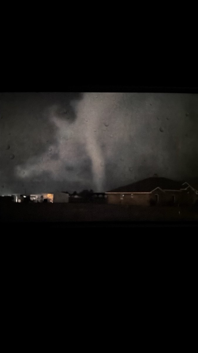
@F5Video@StrmchsrHunterF@NWSAmarillo Another clear visual of the tornado near Amarillo earlier tonight.
The 10:15 PM MesoPulse analysis now shows the broader tornado corridor shifting ENE across the Texas Panhandle.
The threat continues follow warnings and shelter immediately if alerted. #TXwx
This is the tornado southwest of Amarillo around 9:37 PM CDT.
Since then, the 10:15 PM MesoPulse analysis shows the tornado threat shifting ENE through the Texas Panhandle, with the statewide peak increasing to 6.7%.
Stay alert and follow all warnings tonight. #TXwx
⚠️ BOTH MESOPULSE MAXIMA ARE NOW ACTIVE
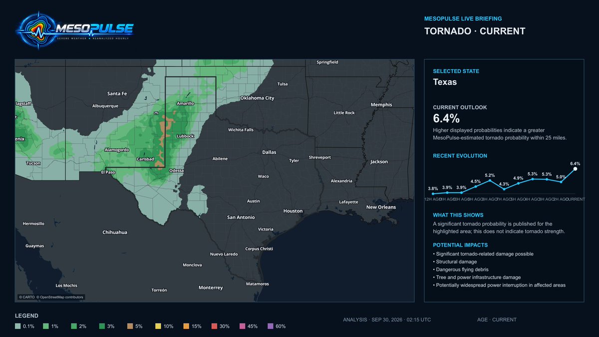
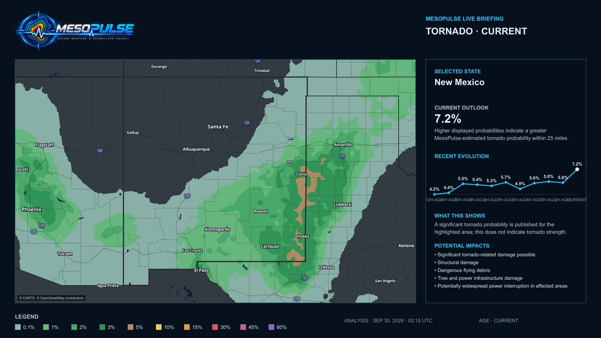
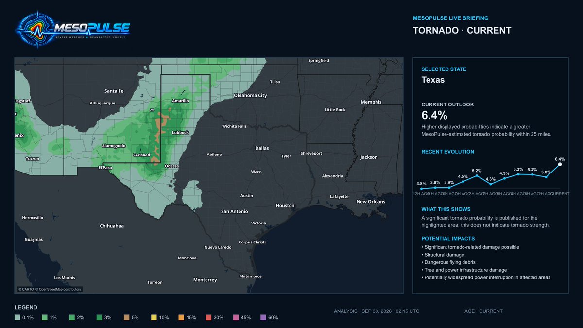
At 9:15 PM CDT, New Mexico was at 7.2% and Texas at 6.4%.
Tornadoes have since been reported near Clovis, NM, and Canyon/Amarillo, TX—within the highlighted corridor.
Remain sheltered when warned. #NMwx#TXwx
Flying debris and destroyed mobile homes threaten East Central Curry County, NM. Twister-producing storm sits 7 mi north of Clovis, pushing NE at 25 mph. Warning till 9:30 PM MDT. Heavy rain hides it, take cover now. https://t.co/IJvaCVSyzZ
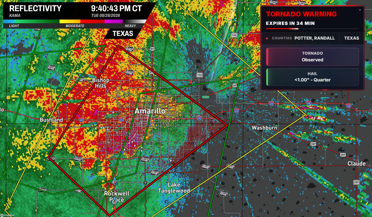
🚨 OBSERVED TORNADO WARNING — AMARILLO, TX
MesoPulse raised Texas’ tornado probability to 6.4% at 9:15 PM CDT. A debris signature appeared near Canyon around 9:27, and the Amarillo warning was marked OBSERVED by 9:40.
Take shelter immediately if warned. #TXwx
⚠️ TORNADO REPORTED NEAR CANYON, TEXAS
At 9:15 PM CDT, MesoPulse increased Texas’ tornado probability to 6.4%, highlighting the eastern NM/West TX corridor.
About 12 minutes later, a tornado was reported near Canyon, south of Amarillo.
Take warnings seriously. #TXwx