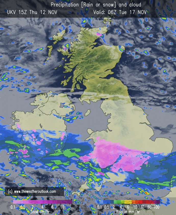
More models are joining in on the idea of a potential snow event early next week, as a sliding low pressure collides with the cold air mass in place
Very precarious with the placement of these lows, especially this early, but i suspect this will be a mainly hill event
@Julian766987 Depends on your elevation and how far north the low goes, if your elevation is favourable, the air will likely be cold enough for snow provided you stay north of the boundary
Fuck it, cant be calm anywhere it doesn't work. WIDEPREAD HEAVY FUCKNI TWATTING SNOW SHOWERS (also organised bands of snow) WANKING IN FROM THE EAST. ACCUMULATIONS EASY OVER A FOOT FROM THIS RUN EASY
Later this week the freezing level will be below 100m for many across the country, if there was precipitation it would fall as snow across these areas
Of course, high pressure firmly in charge so there's nothing to fall as snow...typical