Monday 1st June:
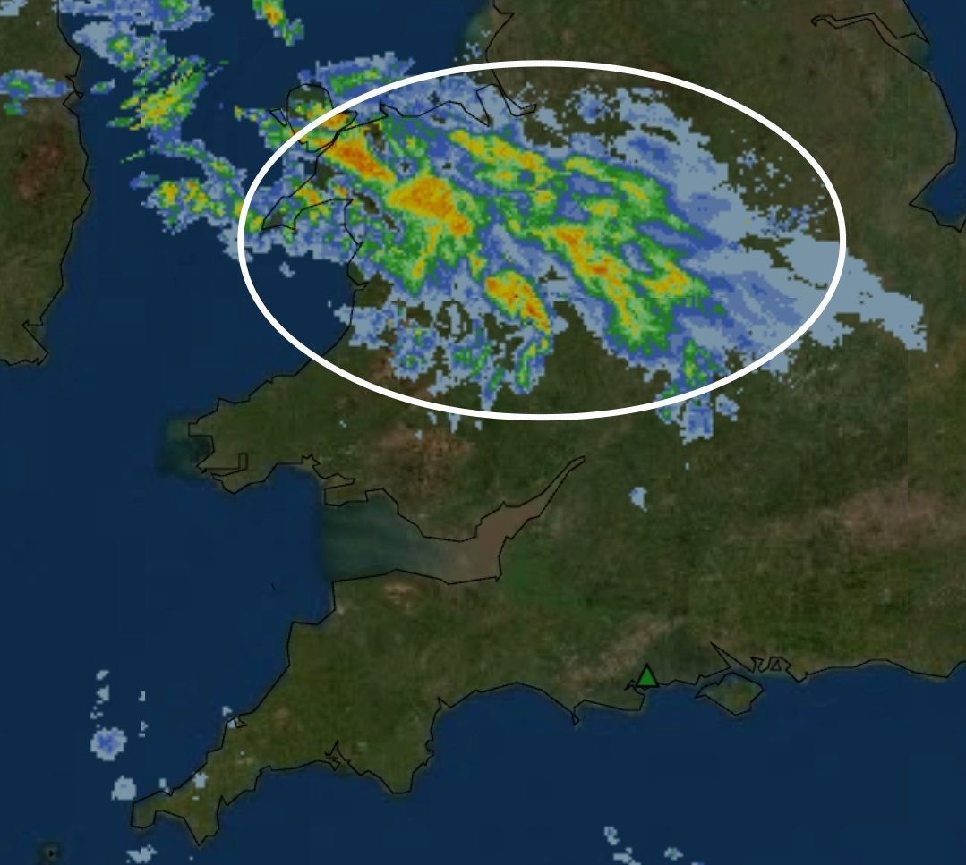
Scattered showers and T-storms will develop through the afternoon and evening, particularly across S England where instability is expected to be greatest.
Storms may become organised for a time bringing frequent lightning, these storms will mostly be sporadic.
Models are suggesting daytime heating combined with colder air aloft will allow showers to develop, with some becoming thundery during the afternoon. Frequent lightning, torrential downpours, localised flooding and small hail may accompany the strongest cells.
Eyes On Tuesday!
Saturday 30th May:
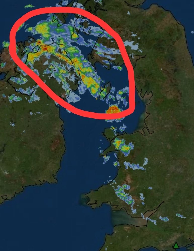
Heavy showers are expected to spread NE through the day, with scattered T-storms possible, particularly across N / NE Ireland. The strongest cells may produce frequent lightning, torrential downpours, small hail and gusty winds.
Update following...
@SkiesOfTheUK Correct yeah, if the cap can erode later throughout the day around 2pm - 9pm then we could see some pretty potent storms.
Did mention the uncertainty in the comments on this post, nothing is guranteed today, very low risk.
Latest high-resolution guidance show a very unstable airmass developing across parts of central and eastern England this afternoon, with CAPE values exceeding *2000–3000+ J/kg*
Any strong T-storm could evolve into a Supercell today... ⚡️
However, due to uncertainty surrounding storm initiation, overall thunderstorm coverage is expected to remain local at best. Any storm that does form may strengthen rapidly and become locally severe.
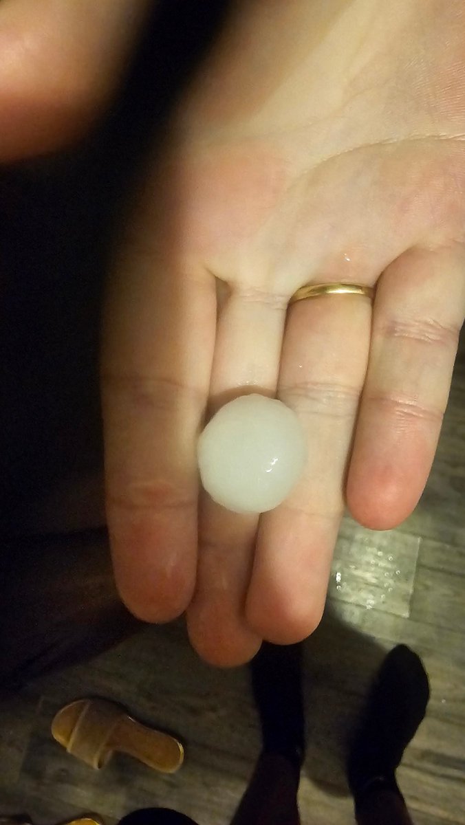
This could be one of the severest storms ive seen in my life, not so much in the way of lightning but rain rates / hail size...
• Frequent Sheet Lightning
• Explosive Development All Under 30 Minutes
• Large Hail
• 150/200mm/hr rates
Insane stuff.
@HAMPWEATHER History tells us this could go much further south then we think.
Ive ran through all ensembles last 48 hours and there is a chance that this could end up in France.
Higher liklihood of it being centred anywhere between channel / Midlands
This feature comparing to the models at 2100 looks more extensive and definitely more intenser then previously anticipated from the models.
This has increased the chances of snow for lowland areas of south / se areas.
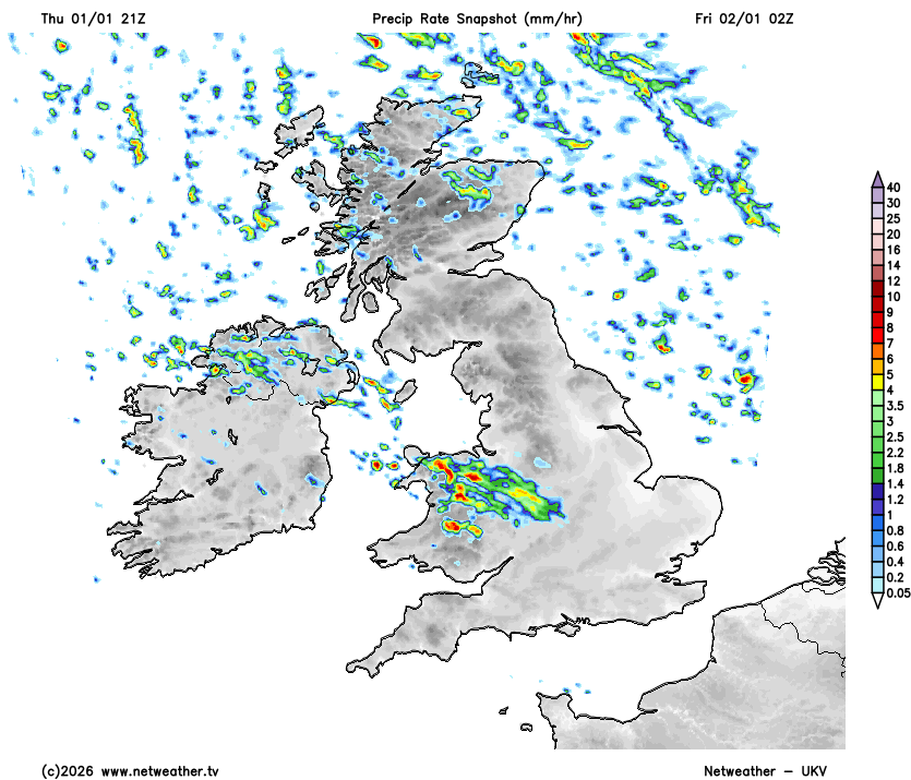
UKV 21z is now in a similar scenario for whats currently ongoing across Wales / Midlands.
Still seeing the precipitation being much extensive and stronger, however the UKV has this dieing out slowly as it heads S.
Eyes on whether this dies or continues!
@notkindofokay Alot of uncertainty on exactly the length / track / intensity on this feature. So they are covering all areas as of a just incase im guessing.
A very active rare cold front is going to be tracking from NW Wales down CS/SW England early hours of Friday bringing a mixture of sleet & snow.
Snow will likely accumulate on higher levels with potentially a dusting on lower levels depending on how fast the cold air undercuts.